Precision Agriculture
Drone Agricultural Survey Services
Precision farm mapping, crop health analysis, and agricultural data collection to optimise yields and reduce costs.
Response within 2 hours • Or call 020 4634 0456
What Is a Drone Agricultural Survey?
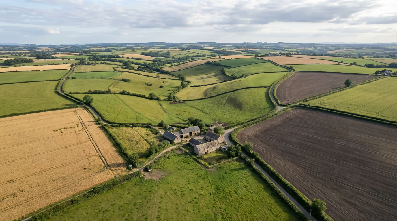
A drone agricultural survey uses unmanned aerial vehicles equipped with specialist sensors to capture detailed data about your farmland, crops, and agricultural assets. Unlike traditional field walking or satellite imagery, our drones fly at low altitude to deliver centimetre-level precision across your entire holding.
At Drone Survey Services, we deploy advanced multispectral and RGB sensors to create comprehensive farm maps, identify crop stress before it becomes visible, analyse drainage patterns, and generate accurate boundary surveys. This data empowers you to make informed decisions that directly improve yields and reduce input costs.

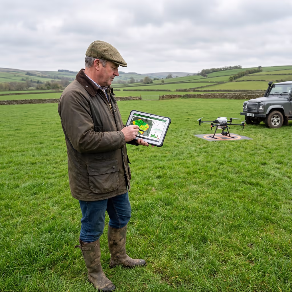
James Leslie
Owner, Engineer & Drone Pilot
"Got questions? Call me directly - I'm happy to talk through your project."
Call NowPrecision Farm Data,Delivered Fast
What You'll Receive
- High-resolution farm orthomosaic
- NDVI crop health maps
- Drainage pattern analysis
- Accurate boundary mapping
Delivered in 5-7 working days
Why Choose Us
- CAA approved & fully insured
- Agricultural survey specialists
- Latest multispectral technology
- UK-wide coverage
Trusted by farmers, agronomists & land agents across the UK.
Trusted by leading organisations
How Much Does a Drone Agricultural Survey Cost?
Pricing depends on your farm size and required outputs. Here's a guide to help you budget:
| Farm Size | Guide Price |
|---|---|
| Small FarmUnder 20 ha | £500+ |
| Medium Farm20–100 ha | £1,000+ |
| Large Farm100–500 ha | £2,500+ |
| Estate500+ ha | POA |
| Seasonal PackageMultiple visits | POA |
*Guide prices include standard deliverables. Final quote based on farm complexity, access, and specific requirements.
What affects your quote?
- Farm size & terrain
- Required deliverables
- Turnaround time
- Number of visits
Our drone agricultural surveys typically cost 50-70% less than traditional ground-based surveying methods while delivering more comprehensive data. Contact us with your farm details and we'll provide a tailored quote within 24 hours.
Ready to get a quote for your farm?
Free, no-obligation quotes within 24 hours
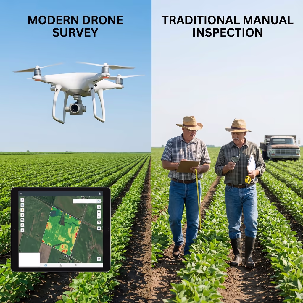
What Is the Difference Between Drone Agricultural Survey and Traditional Methods?
Traditional farm surveying relies on manual field walking, sample-based assessments, and occasional satellite imagery. While these methods have served farmers for decades, they're time-consuming, limited in coverage, and often miss emerging problems until they're visible to the naked eye.
Drone agricultural surveys capture complete coverage of your entire holding in a single flight session. Our sensors detect crop stress, nutrient deficiencies, and pest damage days or weeks before symptoms become visible—giving you crucial time to intervene and protect your yield.
When to Choose Each Approach
Choose Drone Agricultural Survey
Complete coverage & early detection
Traditional Methods
Manual inspection & sampling
Not sure which approach suits your farm?
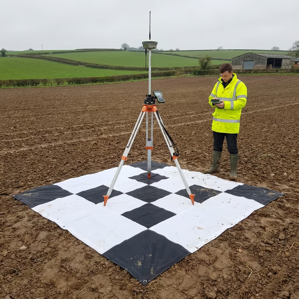
What Accuracy Can a Drone Agricultural Survey Achieve?
Our drone agricultural surveys achieve ground sample distances (GSD) as fine as 1-2cm per pixel—that's detailed enough to count individual plants or identify small weed patches. For mapping and boundary work, we deliver positional accuracy of ±2-5cm using RTK/PPK GPS technology and ground control points.
This level of precision far exceeds satellite imagery (typically 30cm-10m resolution) and enables variable rate application maps that your sprayer or spreader can use directly. Our NDVI crop health maps can detect stress in individual zones as small as a few square metres, allowing truly targeted interventions.
What Are the Applications of Drone Agricultural Survey?
Drone agricultural surveys support precision farming across all sectors of UK agriculture. Here are the key applications where our clients see the greatest return on investment:
Crop Health Monitoring
NDVI and multispectral analysis to identify stress, disease, and nutrient deficiencies before visible symptoms appear.
Drainage Assessment
Identify waterlogging patterns, blocked drains, and areas requiring remedial work to improve field productivity.
Boundary & Field Mapping
Accurate field boundaries for BPS claims, tenancy agreements, and farm management software integration.
Variable Rate Application
Generate prescription maps for precision application of fertiliser, seed, and crop protection products.
Livestock & Infrastructure
Monitor livestock, assess building conditions, plan new infrastructure, and survey tracks and yards.
Environmental Schemes
Document habitat areas, woodland, hedgerows, and watercourses for Countryside Stewardship and SFI applications.
Have a farm project that needs aerial survey?
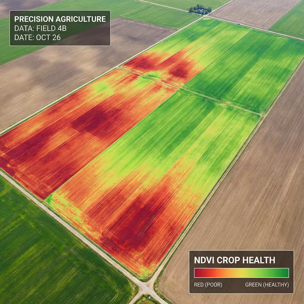
Can Drones Assess Crop Health?
Yes—this is one of the most powerful applications of drone agricultural surveys. Our multispectral sensors capture light beyond the visible spectrum to calculate the Normalised Difference Vegetation Index (NDVI). This scientifically-proven measure reveals plant vigour and chlorophyll content that's invisible to the human eye.
Healthy, actively-growing crops reflect more near-infrared light and less red light. By measuring this ratio across your entire farm, we create detailed maps showing exactly where crops are thriving and where they're struggling. You'll see the results as colour-coded maps—green zones indicate healthy growth, while red and yellow areas highlight stress that needs investigation.
What NDVI Mapping Reveals
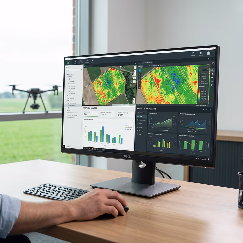
What Deliverables Do You Get From a Drone Agricultural Survey?
We tailor deliverables to your farm requirements, but our standard agricultural survey outputs include:
Farm Orthomosaic Map
High-resolution, georeferenced aerial imagery of your entire holding. Perfect for planning, record-keeping, and as a base layer for farm management systems.
NDVI Crop Health Maps
Colour-coded vegetation index maps showing crop vigour across every field. Identify problem areas and track changes through the growing season.
Drainage Analysis
Digital terrain models and surface water flow analysis to identify drainage issues, ponding areas, and optimal locations for new drains.
Boundary Mapping & CAD Files
Accurate field boundaries in DXF/DWG format for farm software, BPS claims, and professional record-keeping.
Crop Assessment Reports
Written analysis with recommendations highlighting areas requiring attention and suggested actions to optimise your operation.
Need specific deliverables for your farm?
How Long Does a Drone Agricultural Survey Take?
On-site data capture is remarkably fast. We can survey 100-200 hectares per day depending on the required resolution and weather conditions. A typical 50-hectare mixed farm takes just 2-3 hours of flight time, plus setup and ground control establishment.
Processing and delivery depends on your required outputs. Standard deliverables are typically ready within 5-7 working days. For time-critical decisions during the growing season, we offer expedited 48-72 hour turnaround at additional cost. We'll confirm realistic timescales when we quote your project.
| Phase | Duration |
|---|---|
| Planning & Weather | 1-3 days |
| On-Farm Data Capture | ½-1 day |
| Image Processing | 2-3 days |
| Analysis & QC | 1-2 days |
| Report & Delivery | 1 day |
| Total (Standard) | 5-7 working days |
Express Processing Available
Need it faster? 48-72 hour turnaround available for urgent crop decisions.
How Do I Choose a Drone Agricultural Survey Provider?
Not all drone survey services understand farming. When evaluating providers, we recommend checking these key factors:
- CAA authorisation – Ensure they hold valid GVC or legacy PfCO permissions for commercial operations
- Agricultural experience – Ask about their understanding of farming systems and crop production
- Multispectral capability – RGB cameras alone can't deliver NDVI crop health mapping
- Actionable outputs – Data should work with your sprayer, spreader, and farm software
- Farm references – Request examples of agricultural projects they've completed
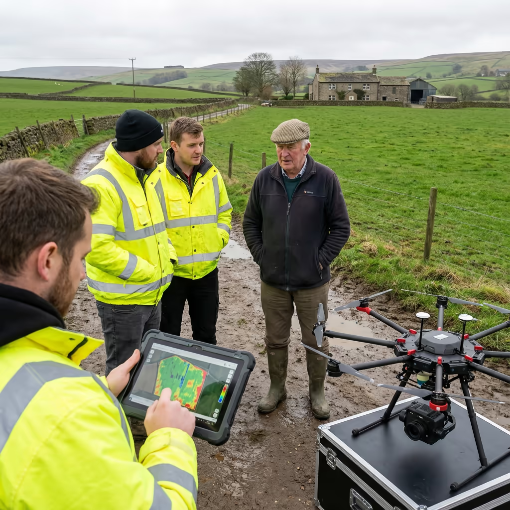
At Drone Survey Services, we tick every box. We're CAA approved, fully insured, and have delivered agricultural surveys for arable farms, dairy operations, mixed holdings, and estate clients throughout the UK.
Ready to work with a trusted agricultural survey provider?
Is Drone Agricultural Survey Cheaper Than Traditional Methods?
In most scenarios, yes—and you get far more data for your investment. Traditional crop walking and manual sampling can only ever cover a fraction of your fields. Satellite imagery subscriptions cost hundreds of pounds per month and deliver far lower resolution than drone surveys.
Our drone agricultural surveys capture complete coverage of your entire holding in a single visit. The return on investment comes from targeted interventions—applying inputs only where needed rather than blanket treating whole fields. Most clients see payback within the first season through reduced input costs and protected yields.
Ready to Discuss Your Farm Survey?
Expert advice • Tailored pricing • Response within 2 hours
James Leslie
Owner, Engineer & Drone Pilot
With extensive experience in surveying and UAV operations, James personally oversees every agricultural project to ensure accurate, actionable data for your farm.
TLDR: Drone Agricultural Surveys Explained
Agricultural Deliverables
- Farm orthomosaic map
- NDVI crop health mapping
- Drainage analysis
- Boundary mapping
- CAD files (DXF/DWG)
- Crop assessment reports
Discuss Your Farm Project
Get expert advice and tailored pricing.
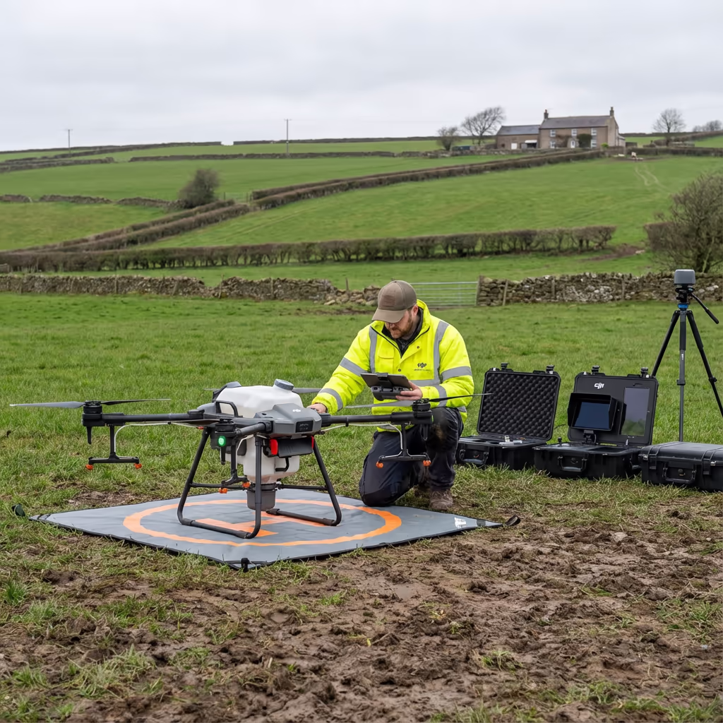
Enterprise Equipment
Survey-Grade Drone Fleet
We don't use consumer mini drones like other providers. Our fleet consists of industrial, survey-grade aircraft purpose-built for capturing detailed, accurate datasets.

AgEagle eBee X
Professional fixed-wing for rapid terrain coverage

DJI Matrice 400
Engineered for excellence, designed for versatility

WingtraOne GEN II
Best-in-class surveying efficiency for large projects

DJI Matrice 350 RTK
Professional multi-payload platform for precision surveying

DJI Mavic 4E
Portable surveying powerhouse with RTK precision
DJI Matrice 300 RTK
Industry-leading inspection and mapping platform

DJI Matrice 4E
Precision survey drone with oblique capture
1 of 7
← Swipe to explore fleet →
Sensor Technology
Specialised Sensors for All Aerial Surveys
Our aircraft carry professional-grade sensors matched to your project requirements, from high-resolution photogrammetry to terrain-penetrating LiDAR.
LiDAR Sensors
Penetrate vegetation and capture precise terrain data with laser scanning technology.
Applications
- Forestry & vegetation mapping
- Terrain modelling under canopy
- Flood risk assessment
- Archaeological surveys
- Power line corridor mapping
Thermal Imaging
Detect heat signatures for building diagnostics, energy audits, and industrial inspections.
Applications
- Building thermal surveys
- Solar panel inspections
- Electrical fault detection
- Search and rescue
- Livestock monitoring
RGB & Photogrammetry
High-resolution imagery for detailed 3D models, orthomosaics, and visual inspections.
Applications
- Topographic surveys
- 3D model generation
- Progress monitoring
- Asset inspection
- Marketing photography
Need a specific sensor or payload?
Client Testimonials
Why Clients Rate Our Drone Survey Service 5 Stars
Don't just take our word for it. Here's what industry professionals say about working with us.
“By far the best drone surveying company I've used. Responsive, helpful and report quality is spot on. Extremely diligent in highlighting defects outside of scope. 10+ projects completed and never disappointed.”
Mark Reynolds
Building Surveyor
“DSS's drone roof survey was brilliant. James showed me everything wrong with my roof in about 30 minutes. Quick, professional and easy to understand.”
Helen Parker
Homeowner
“Fantastic company to do business with. Been working with the DSS team since 2021 and it's been an absolute pleasure. Highly recommended.”
Robert Hughes
Property Developer
Related Services
Drone Topographic Survey
Detailed terrain mapping for drainage design, earthworks, and farm infrastructure planning.
LiDAR Mapping
Precision terrain models that penetrate vegetation for woodland and complex terrain.
Drone Survey
Comprehensive aerial surveys for land assessment, planning, and record keeping.