Surveying & Mapping
Drone Boundary Survey Services
Accurate property boundary mapping, area calculations, and legal plans delivered fast using professional drone survey technology.
Response within 2 hours • Or call 020 4634 0456
What Is a Drone Boundary Survey?
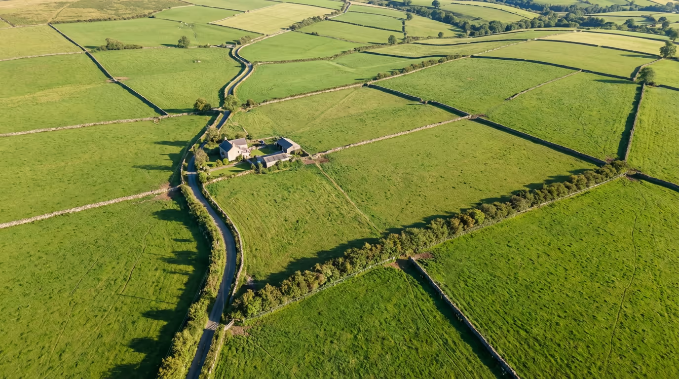
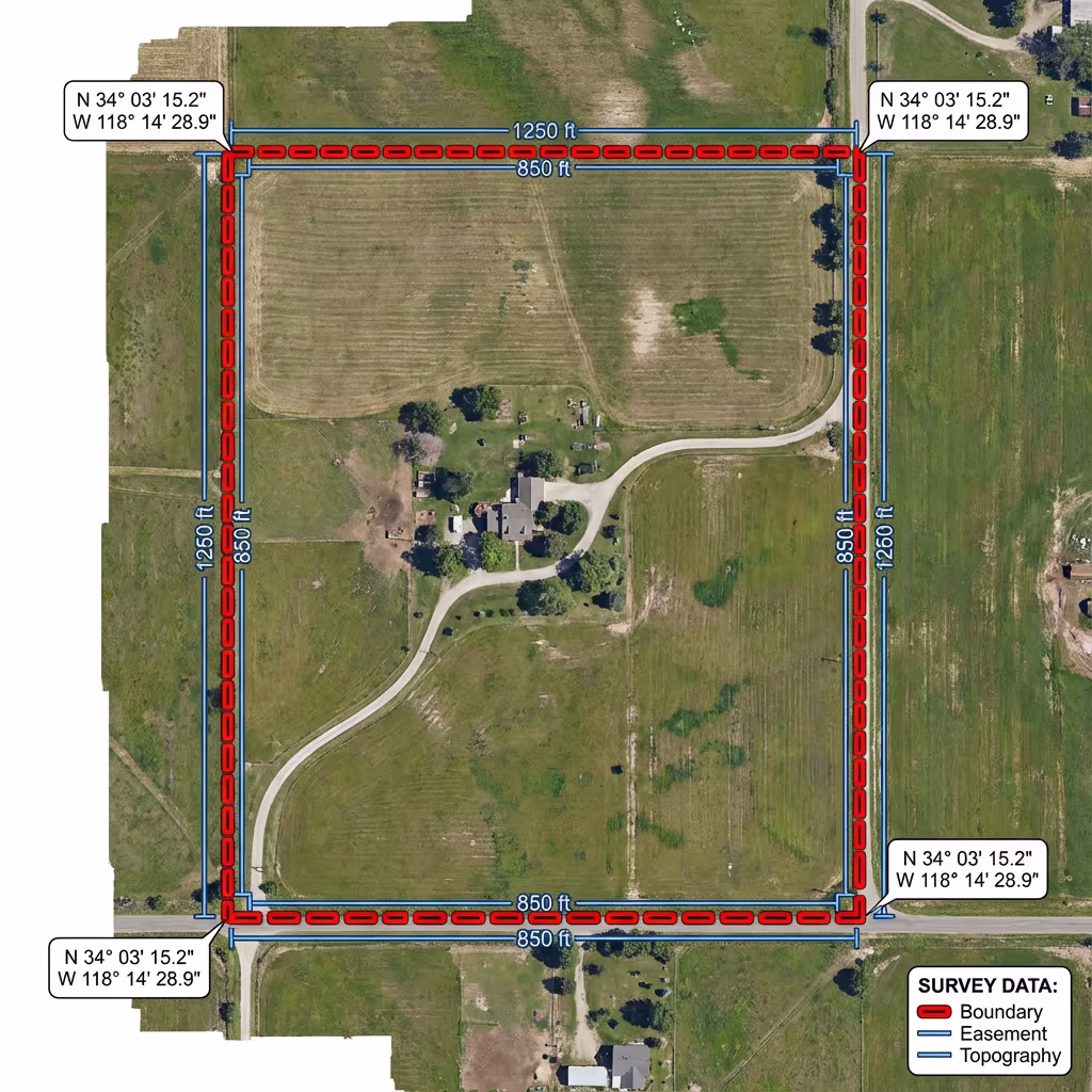
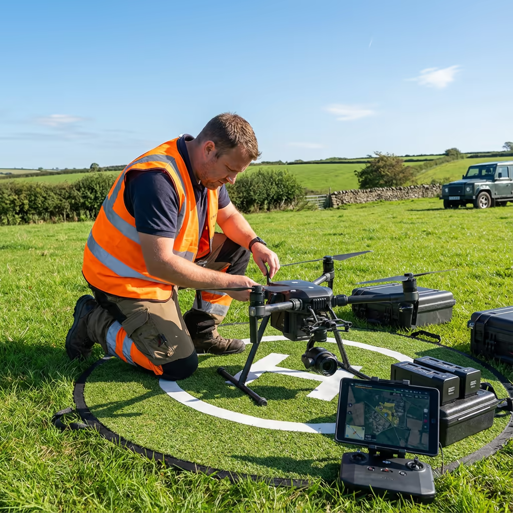
A drone boundary survey uses aerial photography and GPS technology to accurately map the boundaries of land parcels, properties, and estates. Unlike traditional methods that require surveyors to physically walk every boundary line, our drones capture high-resolution imagery from above, creating precise orthomosaic maps that show exactly where your boundaries lie.
At Drone Survey Services, we combine RTK-GPS positioning with professional photogrammetry to deliver boundary surveys that are accurate to within centimetres. Whether you need to verify your property extent, resolve a boundary dispute, or calculate land areas for legal or planning purposes, our drone surveys provide the evidence you need.

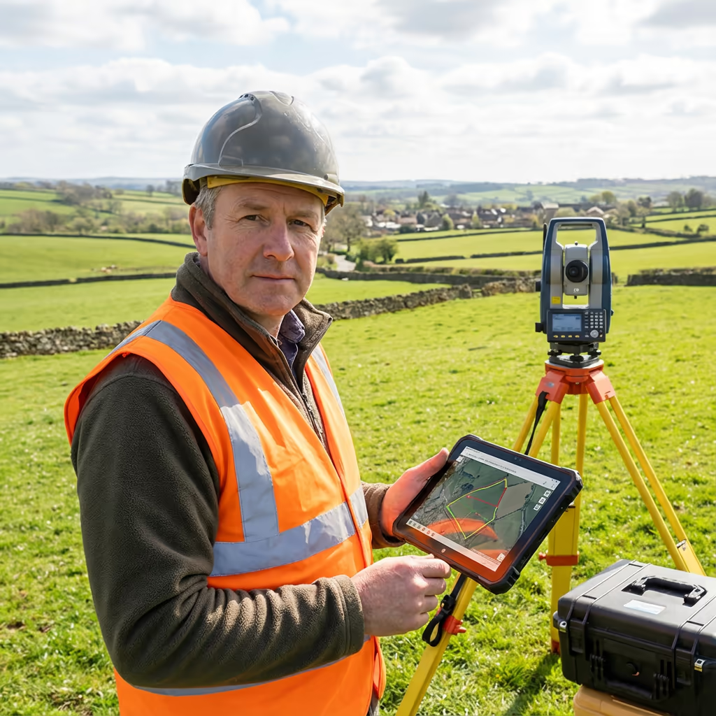
James Leslie
Owner, Engineer & Drone Pilot
"Got a boundary question? Call me directly - I'm happy to talk through your situation."
Call NowAccurate Boundary Data,Delivered Fast
What You'll Receive
- Detailed boundary mapping
- Accurate area calculations
- Coordinate schedules
- Survey-grade accuracy (±2-5cm)
Delivered in 3-5 working days
Why Choose Us
- CAA approved & fully insured
- RTK-GPS precision equipment
- Experience in boundary disputes
- UK-wide coverage
Trusted by solicitors, landowners & estate agents across the UK.
Trusted by leading organisations
How Much Does a Drone Boundary Survey Cost?
Pricing depends on your site size and specific requirements. Here's a guide to help you budget:
| Project Size | Guide Price |
|---|---|
| Small ParcelUnder 1 ha | £400+ |
| Medium1–5 ha | £600+ |
| Large5–20 ha | £1,000+ |
| Estate20+ ha | £1,800+ |
| Dispute ResolutionAdd-on | +£200 |
*Guide prices include standard deliverables. Final quote based on site complexity, access, and specific requirements.
What affects your quote?
- Site size & shape
- Boundary complexity
- Required deliverables
- Turnaround time
Our drone boundary surveys typically save 30-50% compared to traditional ground surveys, while delivering faster results and comprehensive visual evidence. Contact us with your project details for a tailored quote within 24 hours.
Ready to get a quote for your boundary survey?
Free, no-obligation quotes within 24 hours
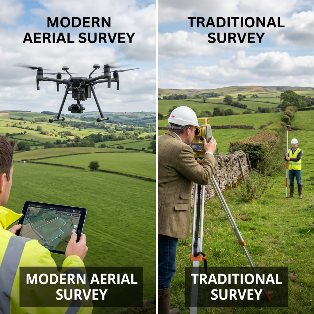
What Is the Difference Between Drone Boundary Survey and Traditional Methods?
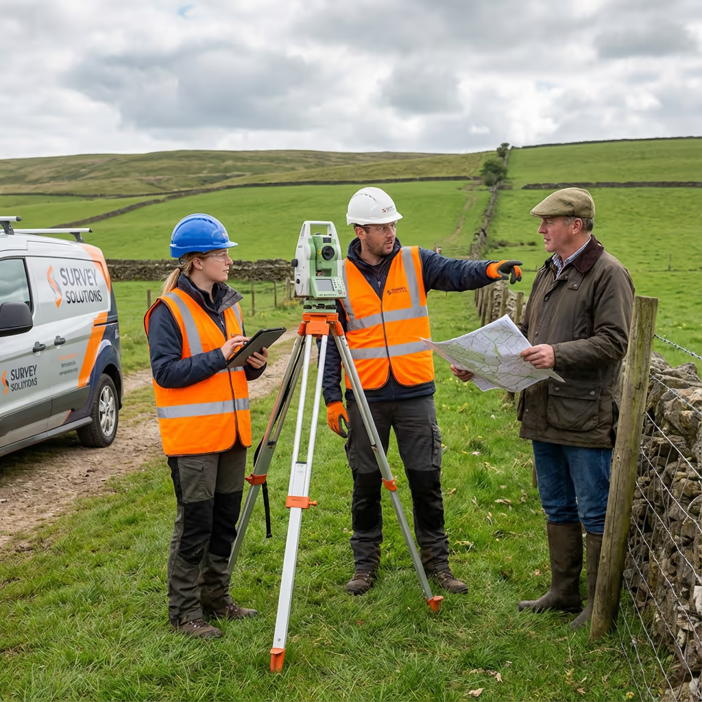
Traditional boundary surveys require surveyors to physically walk the perimeter of your land, taking measurements at regular intervals with theodolites or total stations. While accurate, this process is time-consuming and labour-intensive—especially for larger or difficult-to-access sites.
Drone boundary surveys capture the entire site from above in a single flight, creating a complete photographic record alongside precise positional data. This approach is faster, more comprehensive, and often more cost-effective for medium to large sites. The aerial imagery also provides invaluable visual evidence that traditional surveys simply cannot match.
When to Choose Each Approach
Choose Drone Survey
Fast & comprehensive
Choose Traditional
Detailed ground-level
Not sure which approach suits your project?
What Accuracy Can a Drone Boundary Survey Achieve?
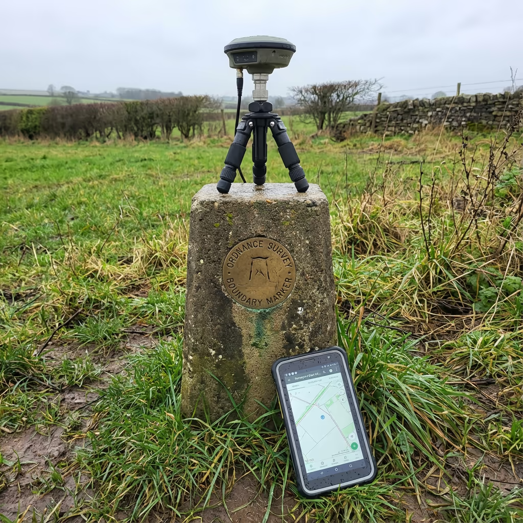
Our drone boundary surveys routinely achieve positional accuracy of ±2-5cm when using RTK-GPS and ground control points. This level of precision exceeds the requirements for most boundary verification, land registration, and legal purposes.
We use RTK (Real-Time Kinematic) enabled drones that receive correction signals from the OS Net network, ensuring centimetre-level positioning during flight. For projects requiring the highest accuracy, we establish ground control points surveyed with dual-frequency GPS receivers. The result is boundary data you can confidently rely on for legal documentation and dispute resolution.
What Are the Applications of Drone Boundary Survey?
Drone boundary surveys serve a wide range of clients and purposes. Here are the key applications where our clients see the greatest value:
Property Purchase & Sale
Verify land extent before buying or selling, confirm advertised areas, and provide buyers with accurate boundary documentation.
Land Registration
Support first registration or update registered boundaries with HM Land Registry using accurate survey data and plans.
Estate Management
Map entire estates, calculate field areas, and maintain accurate records of land holdings and tenanted boundaries.
Development Sites
Define site boundaries for planning applications, verify site areas, and establish development extents.
Agricultural Schemes
Accurate field measurements for BPS, stewardship schemes, and compliance with agricultural regulations.
Boundary Disputes
Provide impartial evidence and accurate measurements to support dispute resolution between neighbours.
Have a boundary project in mind?
Can Drone Surveys Resolve Boundary Disputes?
Yes—drone surveys provide powerful evidence for boundary disputes. The combination of accurate positional data and comprehensive aerial photography creates an objective record that can help resolve disagreements between neighbours without the need for costly legal proceedings.
Our drone boundary surveys can identify where physical boundaries (fences, hedges, walls) currently exist and compare this to registered title plans or historical records. We provide clear measurements showing any discrepancies, along with high-resolution imagery that documents the current situation on the ground.
For disputes that do proceed to mediation or litigation, we can provide expert reports and legal-quality plans suitable for court proceedings. Our surveys have helped numerous clients resolve boundary issues efficiently, often avoiding the need for expensive solicitor involvement.
What Deliverables Do You Get From a Drone Boundary Survey?
We tailor deliverables to your specific needs, but our standard boundary survey outputs include:
Boundary Mapping
Detailed plan showing all boundary features including fences, hedges, walls, and ditches with accurate positions.
Area Calculations
Precise area measurements in hectares, acres, or square metres. Individual field or parcel areas where required.
Coordinate Schedules
Full list of boundary point coordinates in OSGB36 (British National Grid) for integration with Land Registry data.
Legal Plans
Plans suitable for HM Land Registry applications, solicitor requirements, and legal documentation.
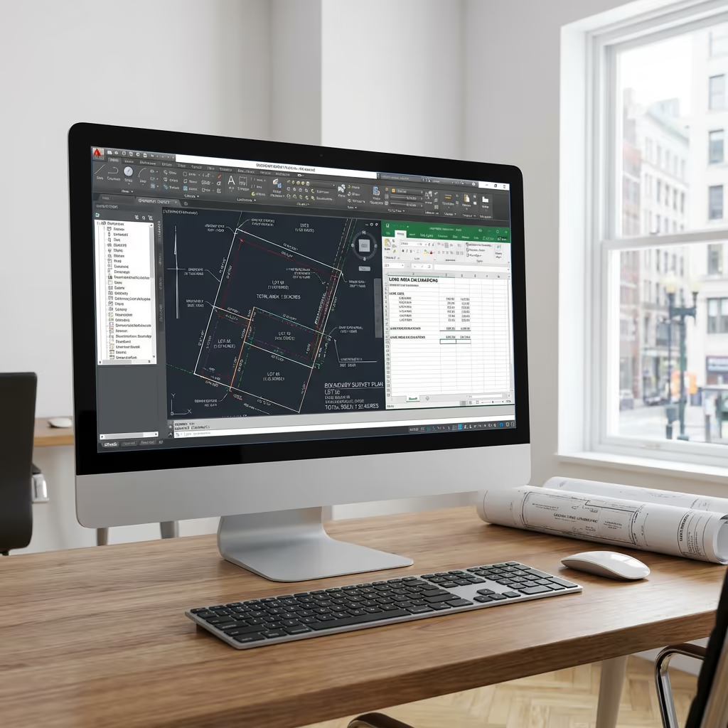
CAD Files & Orthomosaic
DWG/DXF files for use in design software, plus georeferenced aerial imagery showing the complete site.
Need specific deliverables for your boundary survey?
How Long Does a Drone Boundary Survey Take?
On-site data capture is remarkably quick. A typical boundary survey of 5-10 hectares takes just 1-2 hours of flight time, plus setup and ground control establishment. Larger estates may require a full day.
Processing and delivery depends on project complexity. Standard deliverables are typically ready within 3-5 working days. For urgent projects, we offer expedited processing with 48-hour turnaround available at additional cost. We'll confirm realistic timescales when we quote your project.
| Phase | Duration |
|---|---|
| Planning & Permissions | 1-2 days |
| On-Site Data Capture | 2-4 hours |
| Data Processing | 1-2 days |
| Deliverable Generation | 1-2 days |
| Total (Standard) | 3-5 working days |
Express Processing Available
Need it faster? 48-hour turnaround available for urgent projects.
How Do I Choose a Drone Boundary Survey Provider?
Not all drone survey providers have the expertise for boundary work. When evaluating providers, we recommend checking these key factors:
- CAA authorisation – Ensure they hold valid GVC or legacy PfCO permissions for commercial operations
- Professional insurance – Public liability and professional indemnity cover appropriate to your project
- Survey-grade equipment – RTK-GPS positioning and professional photogrammetry software
- Land Registry experience – Understanding of legal requirements for boundary documentation
- Dispute experience – Track record of providing evidence for boundary disputes
At Drone Survey Services, we tick every box. We're CAA approved, fully insured, and have delivered boundary surveys for landowners, solicitors, and estate agents throughout the UK.
Ready to work with a trusted boundary survey provider?
Is Drone Boundary Survey Cheaper Than Traditional Surveying?
For most sites over 1 hectare, yes—significantly cheaper. Traditional boundary surveys require surveyors to physically walk every boundary line, setting up equipment multiple times and spending hours or days on site. Labour costs accumulate quickly, especially for larger or irregularly-shaped parcels.
Our drone approach captures complete site coverage in a fraction of the time. A site that might take a ground surveyor two days can be flown in under two hours. The cost savings typically range from 30-50% compared to traditional methods, while also delivering comprehensive aerial photography that traditional surveys cannot provide. For large estates or multiple parcels, the economics become even more favourable.
Ready to Discuss Your Boundary Survey?
Expert advice • Tailored pricing • Response within 2 hours
James Leslie
Owner, Engineer & Drone Pilot
With extensive experience in surveying and UAV operations, James personally oversees every boundary project to ensure accurate data and professional delivery.
TLDR: Drone Boundary Surveys Explained
Boundary Survey Deliverables
- Detailed boundary mapping
- Area calculations (ha/acres/m²)
- Coordinate schedules (OSGB36)
- Legal plans for Land Registry
- CAD files (DWG/DXF)
- Georeferenced orthomosaic
Discuss Your Project
Get expert advice and tailored pricing.
Enterprise Equipment
Survey-Grade Drone Fleet
We don't use consumer mini drones like other providers. Our fleet consists of industrial, survey-grade aircraft purpose-built for capturing detailed, accurate datasets.

AgEagle eBee X
Professional fixed-wing for rapid terrain coverage

DJI Matrice 400
Engineered for excellence, designed for versatility

WingtraOne GEN II
Best-in-class surveying efficiency for large projects

DJI Matrice 350 RTK
Professional multi-payload platform for precision surveying

DJI Mavic 4E
Portable surveying powerhouse with RTK precision
DJI Matrice 300 RTK
Industry-leading inspection and mapping platform

DJI Matrice 4E
Precision survey drone with oblique capture
1 of 7
← Swipe to explore fleet →
Sensor Technology
Specialised Sensors for All Aerial Surveys
Our aircraft carry professional-grade sensors matched to your project requirements, from high-resolution photogrammetry to terrain-penetrating LiDAR.
LiDAR Sensors
Penetrate vegetation and capture precise terrain data with laser scanning technology.
Applications
- Forestry & vegetation mapping
- Terrain modelling under canopy
- Flood risk assessment
- Archaeological surveys
- Power line corridor mapping
Thermal Imaging
Detect heat signatures for building diagnostics, energy audits, and industrial inspections.
Applications
- Building thermal surveys
- Solar panel inspections
- Electrical fault detection
- Search and rescue
- Livestock monitoring
RGB & Photogrammetry
High-resolution imagery for detailed 3D models, orthomosaics, and visual inspections.
Applications
- Topographic surveys
- 3D model generation
- Progress monitoring
- Asset inspection
- Marketing photography
Need a specific sensor or payload?
Client Testimonials
Why Clients Rate Our Drone Survey Service 5 Stars
Don't just take our word for it. Here's what industry professionals say about working with us.
“By far the best drone surveying company I've used. Responsive, helpful and report quality is spot on. Extremely diligent in highlighting defects outside of scope. 10+ projects completed and never disappointed.”
Mark Reynolds
Building Surveyor
“DSS's drone roof survey was brilliant. James showed me everything wrong with my roof in about 30 minutes. Quick, professional and easy to understand.”
Helen Parker
Homeowner
“Fantastic company to do business with. Been working with the DSS team since 2021 and it's been an absolute pleasure. Highly recommended.”
Robert Hughes
Property Developer