Surveying & Mapping
Drone Coastal Survey Services
Precision drone surveys for coastal erosion monitoring, cliff mapping, and shoreline change detection across the UK.
Response within 2 hours • Or call 020 4634 0456
What Is a Drone Coastal Survey?
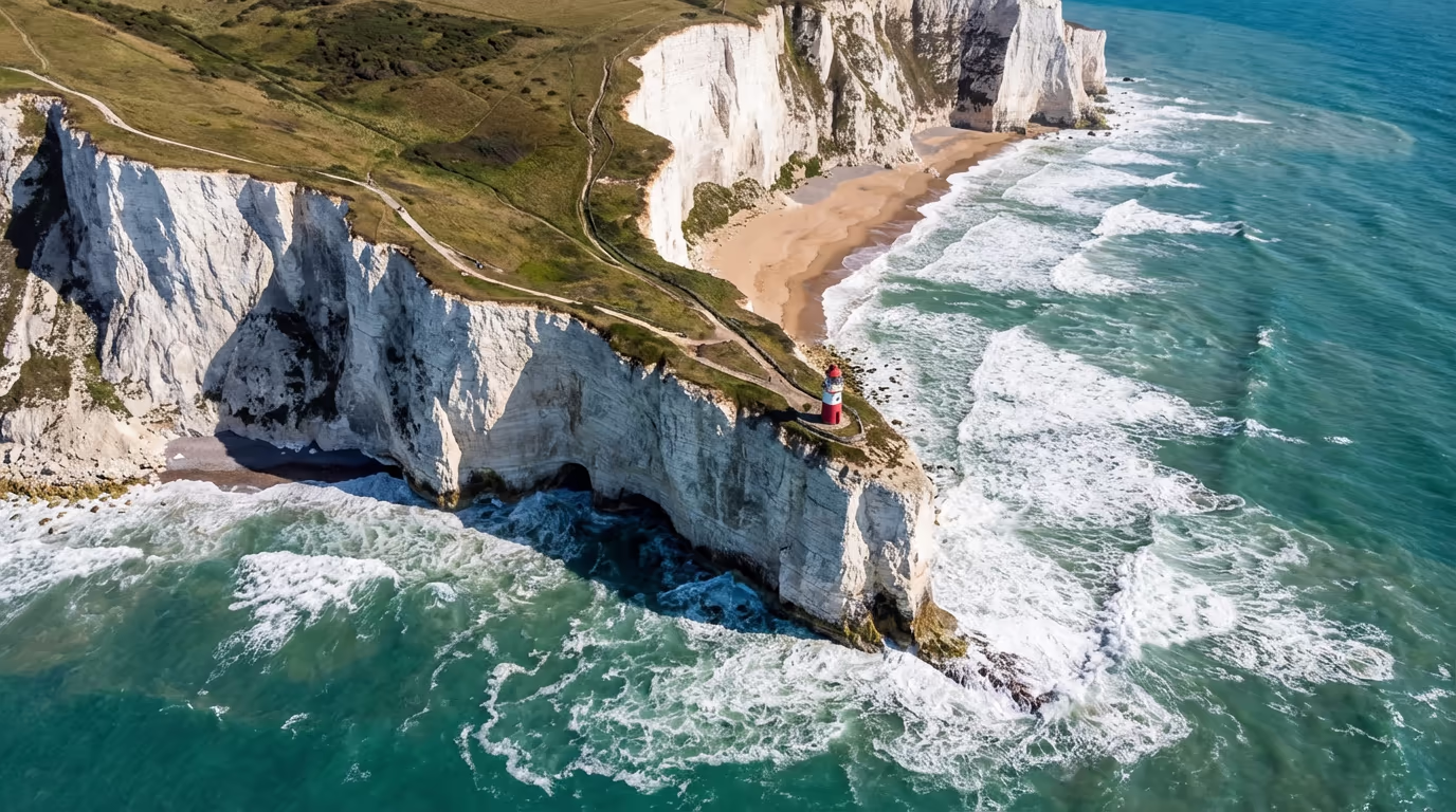
A drone coastal survey uses UAV-mounted cameras and sensors to capture high-resolution aerial data of coastlines, cliffs, beaches, and sea defences. This technology allows us to create detailed maps, 3D models, and change detection analyses that reveal erosion patterns, structural conditions, and environmental changes along the UK's shores.
At Drone Survey Services, we deploy specialist coastal survey equipment capable of capturing centimetre-accurate data across challenging coastal environments. Our surveys provide coastal authorities, engineers, and environmental consultants with the precise information they need to monitor erosion, plan interventions, and protect valuable coastal assets.

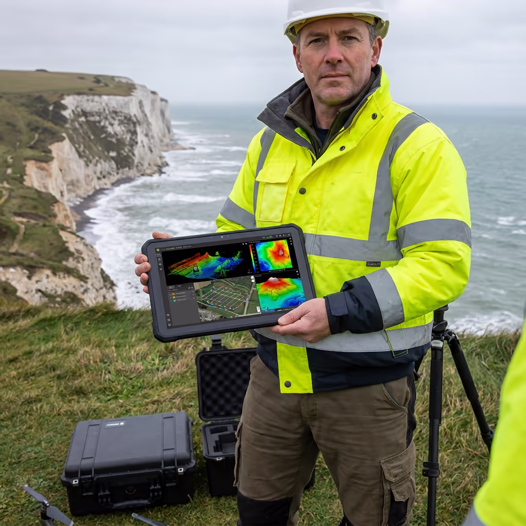
James Leslie
Owner, Engineer & Drone Pilot
"Got questions? Call me directly - I'm happy to talk through your project."
Call NowSurvey-Grade Coastal Data,Delivered Fast
What You'll Receive
- High-resolution coastal orthomosaic
- Erosion analysis & change detection
- Cliff profiles & cross-sections
- Survey-grade accuracy (±2-5cm)
Delivered in 5-7 working days
Why Choose Us
- CAA approved & fully insured
- Specialist coastal survey experience
- Latest DJI & sensor technology
- UK-wide coverage
Trusted by coastal authorities, engineers & environmental consultants across the UK.
Trusted by leading organisations
How Much Does a Drone Coastal Survey Cost?
Pricing depends on the length of coastline and complexity of your project. Here's a guide to help you budget:
| Coastal Length | Guide Price |
|---|---|
| Short SectionUnder 1km | £600+ |
| Medium1–5km | £1,200+ |
| Long5–10km | £2,000+ |
| Major Stretch10+ km | POA |
| Recurring MonitoringAnnual/Bi-annual | POA |
*Guide prices include standard deliverables. Final quote based on site complexity, access, and specific requirements.
What affects your quote?
- Coastline length & terrain
- Required deliverables
- Turnaround time
- Access & permissions
Our drone-based approach typically saves 50–70% compared to traditional coastal survey methods. Contact us with your project details and we'll provide a tailored quote within 24 hours.
Ready to get a quote for your coastal project?
Free, no-obligation quotes within 24 hours
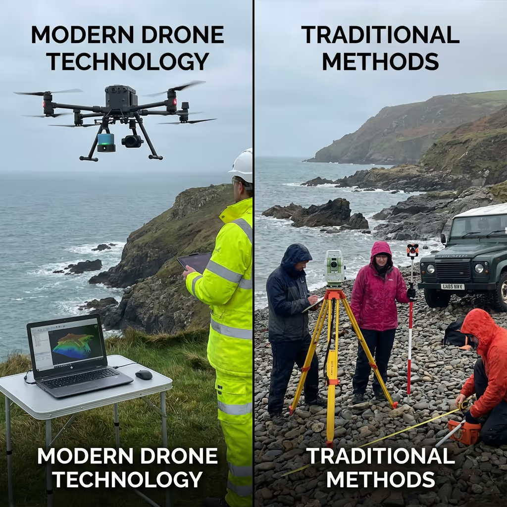
What Is the Difference Between Drone Coastal Survey and Traditional Methods?
Traditional coastal surveys typically rely on ground-based GPS measurements, theodolite stations, or manned aircraft. While effective, these methods are often time-consuming, expensive, and limited in the data they can capture—particularly on hazardous cliff faces or dynamic beach environments.
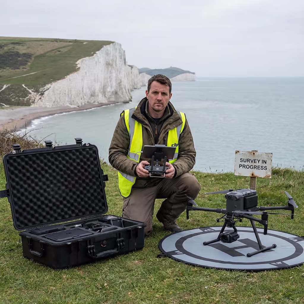
Drone coastal surveys transform this approach entirely. Our UAVs can safely access cliff tops, vertical faces, and remote sections of coastline that would be dangerous or impossible for ground teams. We capture thousands of high-resolution images that produce detailed orthomosaics and 3D models, enabling precise volumetric analysis of erosion and accretion.
When to Choose Each Approach
Choose Drone Coastal Survey
Fast, safe & comprehensive
Choose Traditional Survey
Specific point measurements
Not sure which approach suits your coastal project?
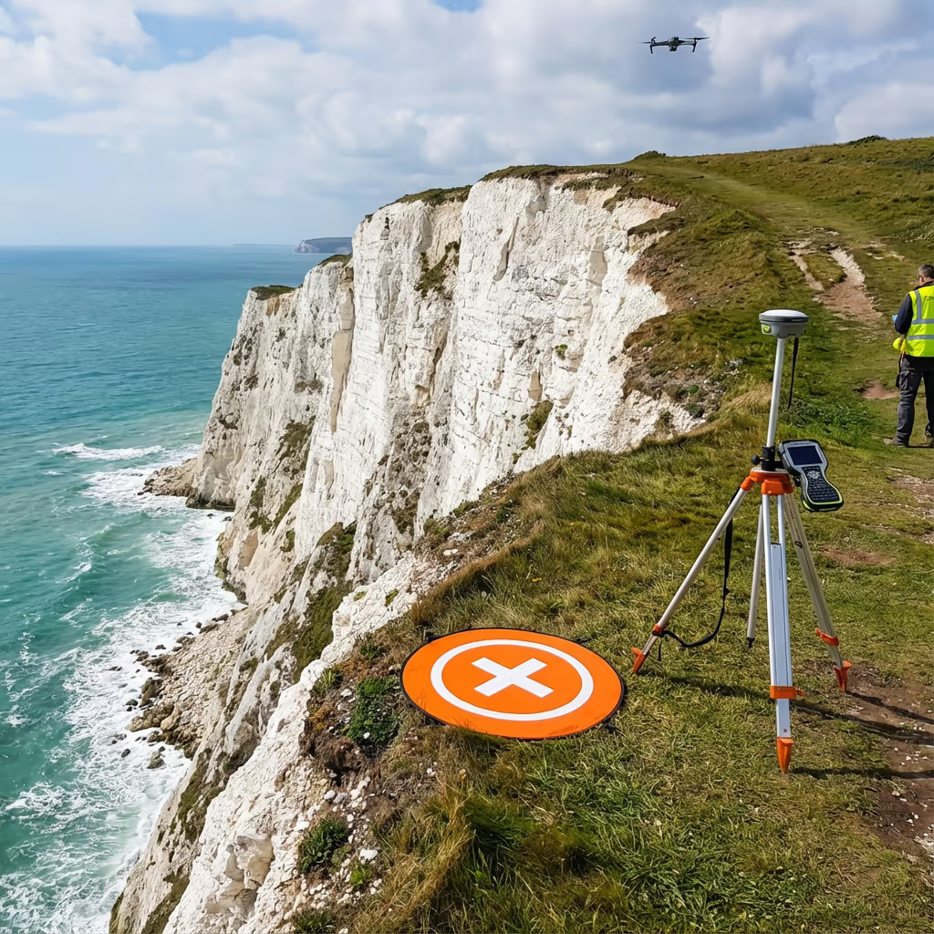
What Accuracy Can a Drone Coastal Survey Achieve?
Our drone coastal surveys routinely achieve vertical accuracy of ±2-5cm and horizontal accuracy of ±3-5cm when using ground control points. This precision is essential for detecting subtle erosion patterns, measuring cliff recession rates, and quantifying sediment movement along beaches.
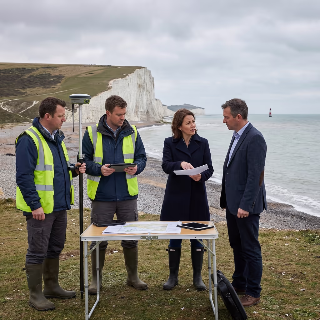
We deploy RTK/PPK-enabled drones combined with strategically placed ground control points to ensure every measurement meets survey-grade standards. For repeat monitoring surveys, we maintain consistent control networks to ensure accurate change detection between epochs. The result is data you can trust for engineering decisions, planning applications, and scientific research.
What Are the Applications of Drone Coastal Survey?
Drone coastal surveys serve a wide range of industries and applications across the UK. Here are the key areas where our clients see the greatest value:
Coastal Erosion Monitoring
Track cliff recession rates, beach profiles, and sediment movement over time with precise change detection analysis.
Sea Defence Inspection
Assess the condition of groynes, sea walls, revetments, and breakwaters without dangerous manual access.
Cliff Stability Assessment
Create detailed 3D models of cliff faces to identify fractures, overhangs, and areas at risk of collapse.
Beach Nourishment Projects
Pre and post-nourishment surveys to calculate volumes and track sediment distribution effectiveness.
Environmental Impact Studies
Baseline surveys and monitoring for coastal development projects, habitat assessments, and marine protected areas.
Flood Risk Assessment
Detailed elevation data for coastal flood modelling, drainage design, and sea level rise impact analysis.
Have a coastal project that needs surveying?
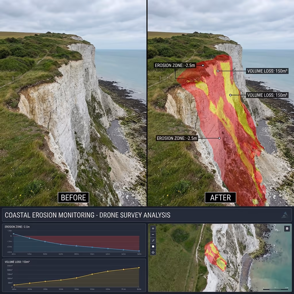
Can Drones Monitor Coastal Erosion?
Absolutely—this is one of the most powerful applications of drone coastal survey technology. By conducting repeat surveys at regular intervals, we can precisely measure how coastlines are changing over time. Our change detection analysis reveals erosion rates, identifies vulnerable sections, and quantifies sediment loss or gain with centimetre accuracy.
We overlay survey data from different epochs to create visual change maps that clearly show where erosion is occurring and at what rate. This information is invaluable for coastal authorities planning protective measures, property owners understanding cliff recession risks, and engineers designing sea defences.
Our monitoring programmes can be scheduled annually, bi-annually, or after significant storm events to track both gradual erosion and sudden cliff failures. Each survey builds a comprehensive time-series dataset that reveals trends and helps predict future coastal change.
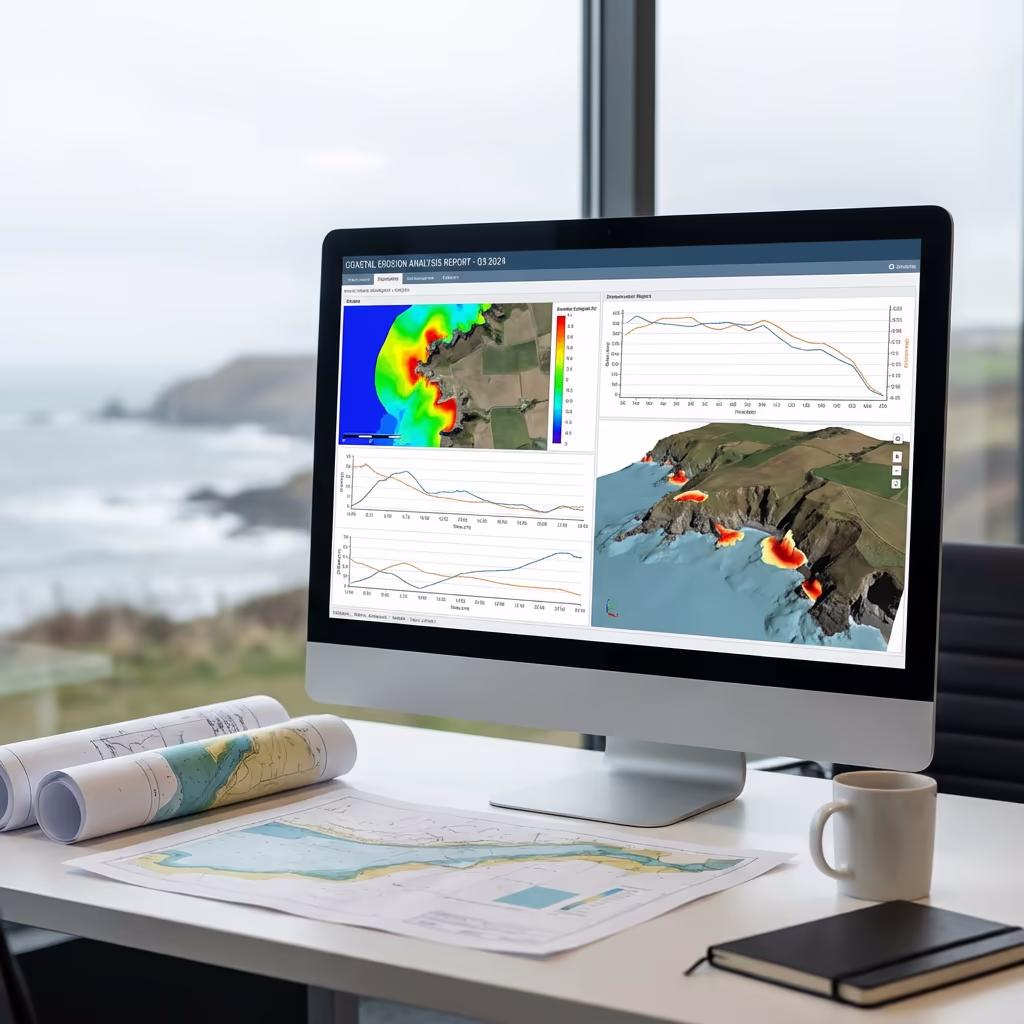
What Deliverables Do You Get From a Drone Coastal Survey?
We tailor deliverables to your project requirements, but our standard drone coastal survey outputs include:
High-Resolution Coastal Orthomosaic
Georeferenced aerial imagery of your coastline at 2-3cm/pixel resolution. Perfect for visual documentation and GIS analysis.
Erosion Analysis & Change Detection
Quantified volumetric changes, recession rates, and visual comparison maps when comparing to previous surveys.
Cliff Profiles & Cross-Sections
Detailed elevation profiles at specified intervals along cliff faces, showing geometry and highlighting instability risks.
CAD Files & 3D Models
DWG/DXF files for engineering use, plus detailed 3D mesh models for visualisation and analysis.
Digital Surface Model (DSM)
Elevation model of the coastal surface for contour generation, slope analysis, and flood risk assessment.
Need specific deliverables for your coastal project?
How Long Does a Drone Coastal Survey Take?
On-site data capture is remarkably fast compared to traditional methods. We can survey 5-10km of coastline per day depending on conditions and site complexity. A typical 1-2km cliff section takes just 2-3 hours of flight time, including setup and ground control establishment.
Processing and delivery depends on project complexity and your required outputs. Standard deliverables are typically ready within 5-7 working days. For urgent projects, we offer expedited processing with 48-72 hour turnaround available at additional cost. We'll confirm realistic timescales when we quote your project.
| Phase | Duration |
|---|---|
| Planning & Permissions | 1-3 days |
| On-Site Data Capture | ½-1 day |
| Data Processing | 2-3 days |
| Analysis & QC | 1-2 days |
| Deliverable Generation | 1-2 days |
| Total (Standard) | 5-7 working days |
Express Processing Available
Need it faster? 48-72 hour turnaround available for urgent coastal projects.
How Do I Choose a Drone Coastal Survey Provider?
Not all drone survey providers have experience with the unique challenges of coastal environments. When evaluating providers, we recommend checking these key factors:
- CAA authorisation – Ensure they hold valid GVC or legacy PfCO permissions for commercial operations
- Coastal survey experience – Coastal environments require understanding of tides, wind conditions, and salt exposure
- Professional insurance – Public liability and professional indemnity cover appropriate to your project
- Change detection capability – Ask about their software and workflows for erosion monitoring
- Relevant case studies – Request examples of similar coastal projects they've completed
At Drone Survey Services, we tick every box. We're CAA approved, fully insured, and have delivered drone coastal survey projects for councils, engineering consultancies, and environmental organisations throughout the UK.
Ready to work with a trusted coastal survey provider?
Is Drone Coastal Survey Cheaper Than Traditional Methods?
In most scenarios, significantly so. Traditional coastal surveys often require expensive boat-based access, rope access teams for cliff faces, or manned aircraft flights. These methods are not only costly but also time-consuming and weather-dependent.
Our drone coastal surveys capture equivalent or superior data in a fraction of the time and cost. A cliff section that might take a rope access team several days can be surveyed by drone in hours. The cost savings typically range from 50-70% compared to traditional methods, while delivering faster turnaround, higher resolution data, and safer operations. For long-term monitoring programmes, the economics become even more favourable with repeat surveys.
Ready to Discuss Your Coastal Survey Project?
Expert advice • Tailored pricing • Response within 2 hours
James Leslie
Owner, Engineer & Drone Pilot
With extensive experience in surveying and UAV operations, James personally oversees every coastal project to ensure survey-grade accuracy and professional delivery.
TLDR: Drone Coastal Surveys Explained
Coastal Survey Deliverables
- Coastal orthomosaic
- Erosion analysis
- Cliff profiles
- Change detection
- CAD files
- 3D models
Discuss Your Project
Get expert advice and tailored pricing.
Enterprise Equipment
Survey-Grade Drone Fleet
We don't use consumer mini drones like other providers. Our fleet consists of industrial, survey-grade aircraft purpose-built for capturing detailed, accurate datasets.

AgEagle eBee X
Professional fixed-wing for rapid terrain coverage

DJI Matrice 400
Engineered for excellence, designed for versatility

WingtraOne GEN II
Best-in-class surveying efficiency for large projects

DJI Matrice 350 RTK
Professional multi-payload platform for precision surveying

DJI Mavic 4E
Portable surveying powerhouse with RTK precision
DJI Matrice 300 RTK
Industry-leading inspection and mapping platform

DJI Matrice 4E
Precision survey drone with oblique capture
1 of 7
← Swipe to explore fleet →
Sensor Technology
Specialised Sensors for All Aerial Surveys
Our aircraft carry professional-grade sensors matched to your project requirements, from high-resolution photogrammetry to terrain-penetrating LiDAR.
LiDAR Sensors
Penetrate vegetation and capture precise terrain data with laser scanning technology.
Applications
- Forestry & vegetation mapping
- Terrain modelling under canopy
- Flood risk assessment
- Archaeological surveys
- Power line corridor mapping
Thermal Imaging
Detect heat signatures for building diagnostics, energy audits, and industrial inspections.
Applications
- Building thermal surveys
- Solar panel inspections
- Electrical fault detection
- Search and rescue
- Livestock monitoring
RGB & Photogrammetry
High-resolution imagery for detailed 3D models, orthomosaics, and visual inspections.
Applications
- Topographic surveys
- 3D model generation
- Progress monitoring
- Asset inspection
- Marketing photography
Need a specific sensor or payload?
Client Testimonials
Why Clients Rate Our Drone Survey Service 5 Stars
Don't just take our word for it. Here's what industry professionals say about working with us.
“By far the best drone surveying company I've used. Responsive, helpful and report quality is spot on. Extremely diligent in highlighting defects outside of scope. 10+ projects completed and never disappointed.”
Mark Reynolds
Building Surveyor
“DSS's drone roof survey was brilliant. James showed me everything wrong with my roof in about 30 minutes. Quick, professional and easy to understand.”
Helen Parker
Homeowner
“Fantastic company to do business with. Been working with the DSS team since 2021 and it's been an absolute pleasure. Highly recommended.”
Robert Hughes
Property Developer