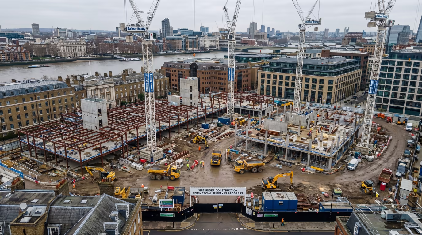
Progress Documentation
Drone Construction Monitoring Services
Regular aerial documentation of your construction project. Track progress, verify milestones, and communicate effectively with stakeholders.
Response within 2 hours • Or call 020 4634 0456
What Is Drone Construction Monitoring?
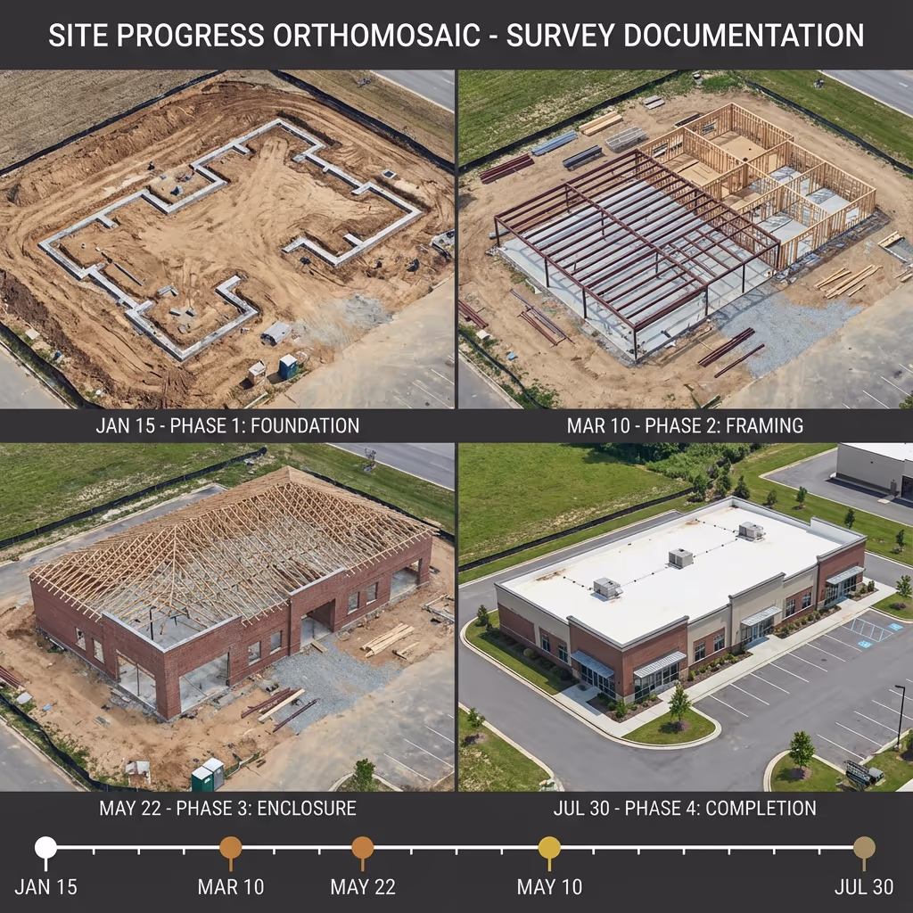
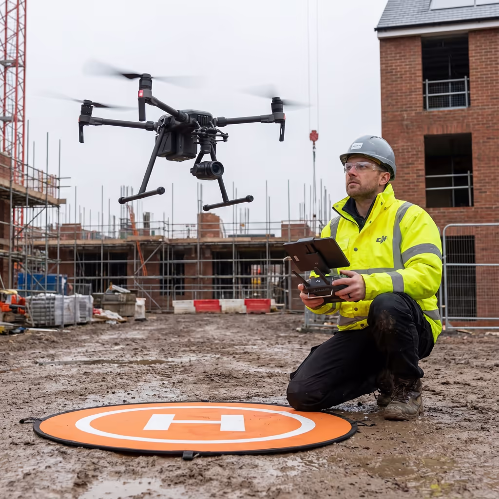
Drone construction monitoring provides regular aerial documentation of your building project from start to finish. Using professional-grade UAVs, we capture high-resolution imagery, video, and mapping data at scheduled intervals—weekly, fortnightly, or monthly—to create a comprehensive visual record of your construction progress.
At Drone Survey Services, we deliver more than just photographs. Our monitoring packages include orthomosaic maps, 3D models, progress comparison imagery, and time-lapse videos that help project managers track milestones, identify delays, and communicate effectively with clients, investors, and stakeholders.

James Leslie
Owner, Engineer & Drone Pilot
"Got questions? Call me directly - I'm happy to talk through your project."
Call NowTrack Every Phase,Document Every Milestone
What You'll Receive
- Regular progress orthomosaics
- Side-by-side comparison imagery
- HD time-lapse video compilation
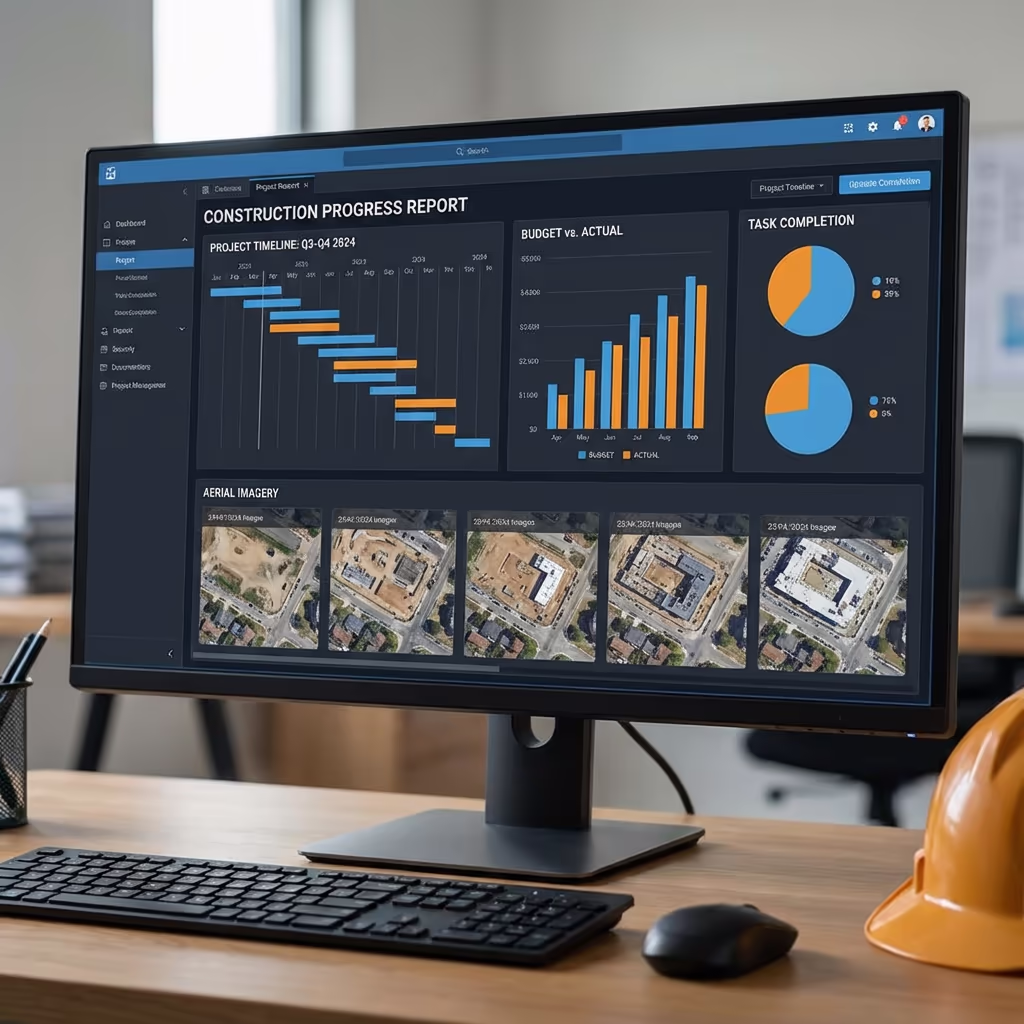
- Progress dashboards & reports
Delivered within 48 hours of each visit
Why Choose Us
- CAA approved & fully insured
- Flexible scheduling to suit your project
- Same pilot throughout for consistency
- UK-wide coverage
Trusted by contractors, developers & project managers across the UK.
Trusted by leading organisations
How Much Does Drone Construction Monitoring Cost?
Pricing depends on visit frequency and project duration. Here's a guide to help you budget:
| Package | Guide Price |
|---|---|
| Single VisitOne-off documentation | £500+ |
| WeeklyPer visit | £350+ |
| FortnightlyPer visit | £400+ |
| MonthlyPer visit | £450+ |
| Project Package10+ visits | POA |
| EnterpriseMultiple sites | POA |
*Guide prices for standard sites. Final quote based on site size, complexity, and specific requirements.
What affects your quote?
- Site size & complexity
- Visit frequency
- Required deliverables
- Project duration
Longer-term monitoring packages offer significant savings—up to 30% discount on per-visit rates. Contact us with your project timeline and we'll provide a tailored quote within 24 hours.
Ready to get a quote for your project?
Free, no-obligation quotes within 24 hours
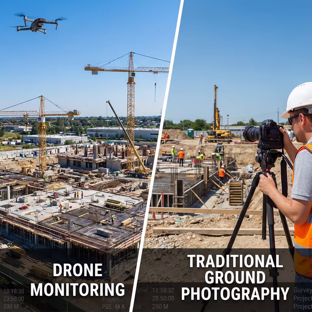
What Is the Difference Between Drone Monitoring and Traditional Progress Photography?
Traditional progress photography captures ground-level images from fixed viewpoints—useful but limited. You see parts of the site, but never the complete picture. Critical progress in areas hidden from view goes undocumented.
Drone construction monitoring captures your entire site from above, creating georeferenced orthomosaics that show exactly what's happening across every square metre. You can measure areas, compare phases precisely, and create accurate 3D models that integrate with your BIM workflows.
When to Choose Each Approach
Choose Drone Monitoring
Complete site visibility
Traditional Photography
Ground-level detail
Not sure which approach suits your project?
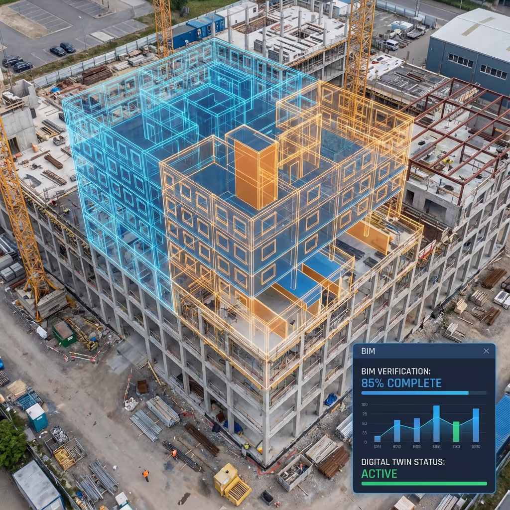
What Accuracy Can Drone Construction Monitoring Achieve?
Our drone construction monitoring delivers orthomosaics with ground sample distances (GSD) as low as 1cm per pixel, allowing you to see fine detail across your entire site. With ground control points, we achieve positional accuracy of ±2-3cm—sufficient for progress verification and BIM comparison.
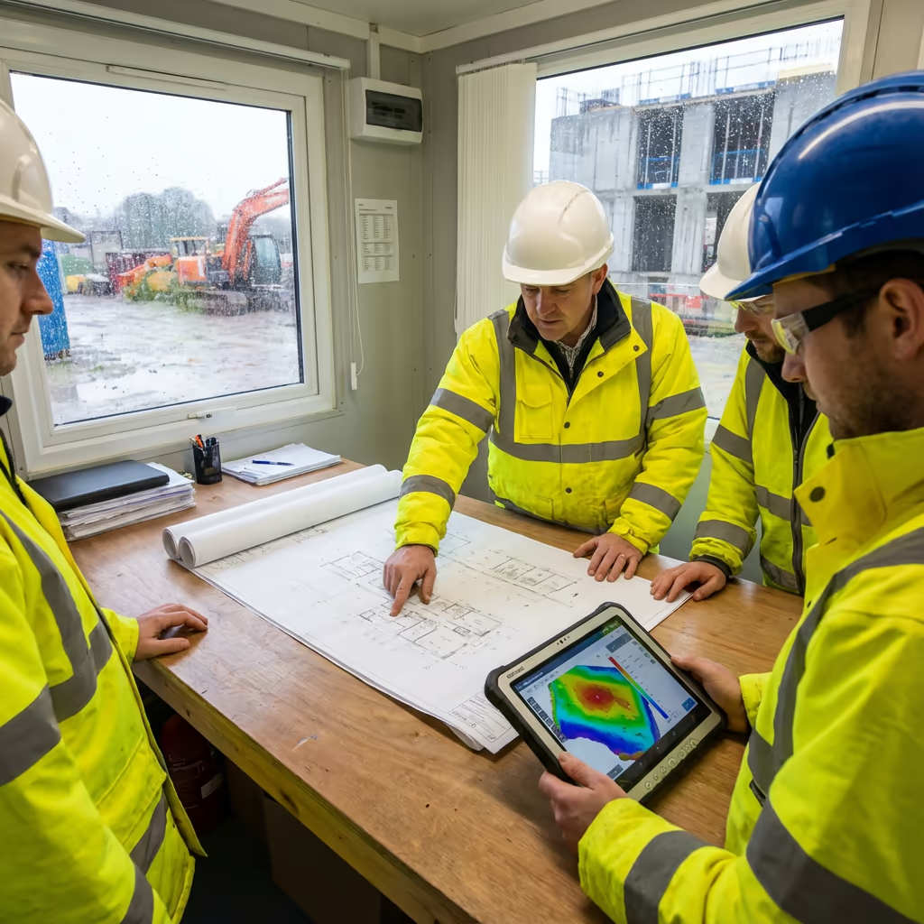
This accuracy means you can overlay drone imagery directly onto your design drawings, compare actual construction against planned positions, and identify deviations before they become costly problems. For projects requiring even higher precision, we can integrate our monitoring with full topographic surveys at key milestones.
What Are the Applications of Drone Construction Monitoring?
Drone construction monitoring adds value across diverse project types. Here are the key sectors where our clients see the greatest benefits:
Residential Developments
Housing estates, apartment blocks, and phased residential schemes. Track plot progress, road infrastructure, and landscaping completion.
Commercial Buildings
Office developments, retail parks, and industrial units. Document structural progress, cladding installation, and external works.
Infrastructure Projects
Roads, bridges, railways, and utilities. Monitor linear progress, earthworks volumes, and coordination between multiple contractors.
Education & Healthcare
Schools, universities, and hospital developments. Document progress for public sector clients and funding bodies.
Renewable Energy
Solar farms, wind turbine foundations, and battery storage facilities. Track installation progress across large sites.
Mixed-Use Developments
Complex schemes combining residential, commercial, and public realm. Coordinate documentation across multiple phases and contractors.
Have a construction project that needs monitoring?
How Often Should Construction Sites Be Monitored?
The ideal monitoring frequency depends on your project pace, stakeholder requirements, and budget. We help clients find the right balance between comprehensive documentation and cost-effectiveness.
Here's our guidance based on project characteristics:
Weekly Monitoring
Ideal for fast-track projects, critical construction phases, or when detailed progress evidence is required for payment milestones. Captures rapid change and provides maximum accountability.
Fortnightly Monitoring
The most popular choice for commercial developments. Balances comprehensive documentation with budget efficiency. Perfect for investor reporting and regular progress updates.
Monthly Monitoring
Suitable for longer-duration projects with steady progress, or when budget is constrained. Still provides valuable documentation for dispute avoidance and project records.
Many clients vary their monitoring frequency throughout a project—weekly during groundworks and structural phases, then fortnightly during fit-out. We're flexible and can adjust your schedule as the project evolves.
What Deliverables Do You Get From Drone Construction Monitoring?
We tailor deliverables to your project requirements, but our standard monitoring outputs include:
Progress Orthomosaics
Georeferenced aerial maps of your entire site at each visit. Zoomable to see fine detail, measurable for area and distance calculations.
Comparison Imagery
Side-by-side and slider comparisons showing progress between visits. Perfect for presentations and stakeholder communications.
Volume Change Reports
Track earthworks progress with cut/fill calculations between surveys. Verify quantities for payment applications.
Time-Lapse Videos
Compiled at project completion or key milestones. Compelling content for marketing, case studies, and handover presentations.
3D Models
Photorealistic 3D models of your site at each visit. View from any angle, share via web link, or integrate with BIM software.
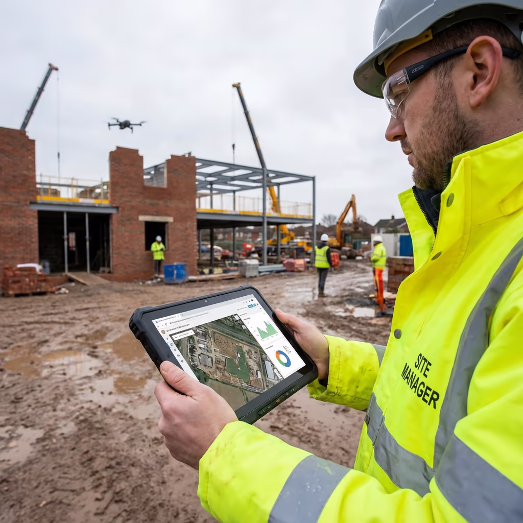
Progress Dashboards
Online portal with all your project imagery, organised by date. Share access with team members and stakeholders.
Need specific deliverables for your project?
How Long Does Drone Construction Monitoring Take?
Each monitoring visit is quick and minimally disruptive. For a typical site of 2-5 hectares, expect 1-2 hours on site for flight operations. Larger sites or more complex requirements take proportionally longer.
We coordinate our visits to minimize disruption—flying during quiet periods, outside critical crane operations, and respecting site access restrictions. Our regular presence means we become familiar with your site operations and can adapt accordingly.
| Phase | Duration |
|---|---|
| Site Arrival & Setup | 15-30 mins |
| Flight Operations | 30-90 mins |
| Data Processing | 24-48 hours |
| Quality Review | 2-4 hours |
| Delivery | Same day |
| Total Turnaround | 48 hours |
Same-Day Processing Available
Urgent deadline? We can deliver orthomosaics within hours of capture for time-critical projects.
How Do I Choose a Drone Construction Monitoring Provider?
Not all drone operators are equal when it comes to construction monitoring. When evaluating providers, we recommend checking these key factors:
- CAA authorisation – Ensure they hold valid GVC permissions for commercial operations on construction sites
- Construction site experience – Working on active sites requires understanding of safety protocols and coordination
- Professional insurance – Public liability cover appropriate for active construction environments
- Consistent pilot – The same pilot throughout your project ensures familiarity with your site
- Quality deliverables – Request sample outputs from previous monitoring projects
At Drone Survey Services, we tick every box. We're CAA approved, fully insured, CSCS certified, and have delivered monitoring projects for residential developers, commercial contractors, and infrastructure clients throughout the UK.
Ready to work with a trusted monitoring provider?
Is Drone Construction Monitoring Cheaper Than Traditional Methods?
Drone construction monitoring delivers significantly more data and insight than traditional progress photography—often at comparable or lower cost. A single drone flight captures thousands of images, creating complete site documentation that would take a ground-based photographer hours to approximate.
The real value comes from what you can do with the data. Orthomosaics enable precise measurements, 3D models support BIM verification, and comprehensive documentation helps prevent disputes. Many clients report that drone monitoring pays for itself through improved project management and reduced claims.
Ready to Discuss Your Construction Project?
Expert advice • Tailored pricing • Response within 2 hours
James Leslie
Owner, Engineer & Drone Pilot
With extensive experience in construction monitoring, James personally manages every project to ensure consistent, professional documentation throughout your build.
TLDR: Drone Construction Monitoring Explained
Monitoring Deliverables
- Progress orthomosaics
- Comparison imagery
- Volume change reports
- Time-lapse videos
- 3D models
- Progress dashboards
Discuss Your Project
Get expert advice and tailored pricing.
Enterprise Equipment
Survey-Grade Drone Fleet
We don't use consumer mini drones like other providers. Our fleet consists of industrial, survey-grade aircraft purpose-built for capturing detailed, accurate datasets.

AgEagle eBee X
Professional fixed-wing for rapid terrain coverage

DJI Matrice 400
Engineered for excellence, designed for versatility

WingtraOne GEN II
Best-in-class surveying efficiency for large projects

DJI Matrice 350 RTK
Professional multi-payload platform for precision surveying

DJI Mavic 4E
Portable surveying powerhouse with RTK precision
DJI Matrice 300 RTK
Industry-leading inspection and mapping platform

DJI Matrice 4E
Precision survey drone with oblique capture
1 of 7
← Swipe to explore fleet →
Sensor Technology
Specialised Sensors for All Aerial Surveys
Our aircraft carry professional-grade sensors matched to your project requirements, from high-resolution photogrammetry to terrain-penetrating LiDAR.
LiDAR Sensors
Penetrate vegetation and capture precise terrain data with laser scanning technology.
Applications
- Forestry & vegetation mapping
- Terrain modelling under canopy
- Flood risk assessment
- Archaeological surveys
- Power line corridor mapping
Thermal Imaging
Detect heat signatures for building diagnostics, energy audits, and industrial inspections.
Applications
- Building thermal surveys
- Solar panel inspections
- Electrical fault detection
- Search and rescue
- Livestock monitoring
RGB & Photogrammetry
High-resolution imagery for detailed 3D models, orthomosaics, and visual inspections.
Applications
- Topographic surveys
- 3D model generation
- Progress monitoring
- Asset inspection
- Marketing photography
Need a specific sensor or payload?
Client Testimonials
Why Clients Rate Our Drone Survey Service 5 Stars
Don't just take our word for it. Here's what industry professionals say about working with us.
“By far the best drone surveying company I've used. Responsive, helpful and report quality is spot on. Extremely diligent in highlighting defects outside of scope. 10+ projects completed and never disappointed.”
Mark Reynolds
Building Surveyor
“DSS's drone roof survey was brilliant. James showed me everything wrong with my roof in about 30 minutes. Quick, professional and easy to understand.”
Helen Parker
Homeowner
“Fantastic company to do business with. Been working with the DSS team since 2021 and it's been an absolute pleasure. Highly recommended.”
Robert Hughes
Property Developer