Surveying & Mapping
Drone Corridor Mapping Services
Precision aerial surveys for pipelines, power lines, railways, and road schemes. Capture kilometres of linear infrastructure in a single day.
Response within 2 hours • Or call 020 4634 0456
What Is Drone Corridor Mapping?
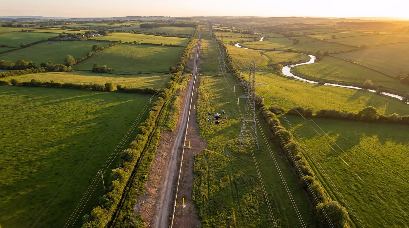
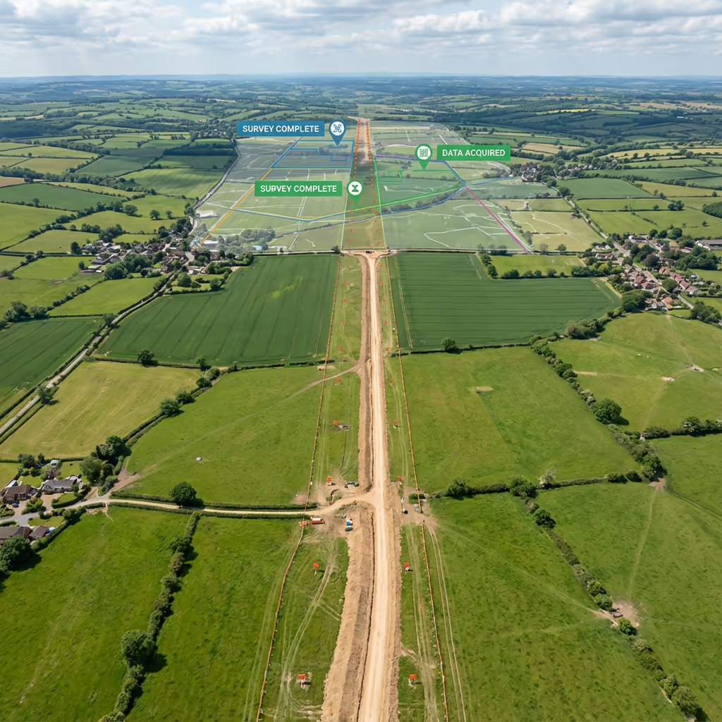
Drone corridor mapping is a specialist aerial surveying technique designed for linear infrastructure such as pipelines, power lines, railways, roads, and waterways. Using advanced UAV technology, we capture continuous, high-resolution data along extended routes that would take traditional survey teams weeks to cover on foot.
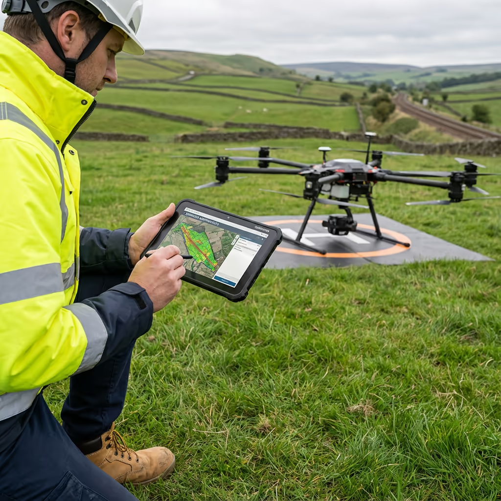
At Drone Survey Services, our corridor mapping missions combine photogrammetry and LiDAR sensors to deliver precise orthomosaics, digital terrain models, and cross-sectional profiles. We can survey corridors of 20km or more in a single day, providing infrastructure operators with the detailed spatial data they need for planning, maintenance, and compliance.

James Leslie
Owner, Engineer & Drone Pilot
"Got questions about corridor surveys? Call me directly - I'm happy to talk through your project."
Call NowSurvey-Grade Corridor Data,Delivered Fast
What You'll Receive
- Continuous corridor orthomosaic
- Cross-sections at specified intervals
- Longitudinal profiles
- Survey-grade accuracy (±2-5cm)
Delivered in 5-7 working days
Why Choose Us
- CAA approved & fully insured
- Extended BVLOS capabilities
- Latest DJI & sensor technology
- UK-wide coverage
Trusted by utility companies, Network Rail contractors & infrastructure developers.
Trusted by leading organisations
How Much Does Drone Corridor Mapping Cost?
Corridor mapping pricing depends on route length, terrain complexity, and required deliverables. Here's a guide to help you budget:
| Corridor Length | Guide Price |
|---|---|
| ShortUnder 5km | £1,000+ |
| Medium5–20km | £2,500+ |
| Long20–50km | £5,000+ |
| Major Route50+km | POA |
| With LiDARAny length | +50% |
*Guide prices include standard deliverables. Final quote based on corridor complexity, access, airspace restrictions, and specific requirements.
What affects your quote?
- Corridor length & width
- Terrain complexity
- Airspace restrictions
- Deliverable requirements
Our drone corridor mapping typically saves 50–70% compared to traditional ground-based corridor surveys. Contact us with your route details and we'll provide a tailored quote within 24 hours.
Ready to get a quote for your corridor project?
Free, no-obligation quotes within 24 hours

What Is the Difference Between Drone Corridor Mapping and Traditional Methods?
Traditional corridor surveys require ground teams to walk the entire route, setting up equipment at regular intervals and physically accessing every section. This is time-consuming, expensive, and often impossible in difficult terrain or where access is restricted.
Drone corridor mapping captures the same data—and often more—by flying along the route at speeds of 10-15 metres per second. A 20km corridor that might take a ground team two weeks can be surveyed in a single day. The aerial perspective also captures features that ground surveyors might miss, such as vegetation encroachment and structural defects.
When to Choose Each Approach
Choose Drone Corridor Mapping
Speed & efficiency
Traditional Methods Better For
Specific applications
Not sure which approach suits your corridor project?
What Accuracy Can Drone Corridor Mapping Achieve?
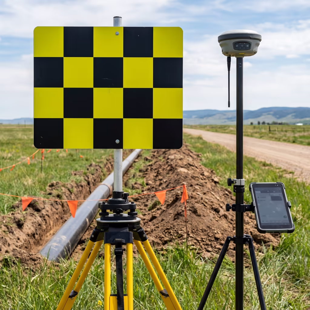
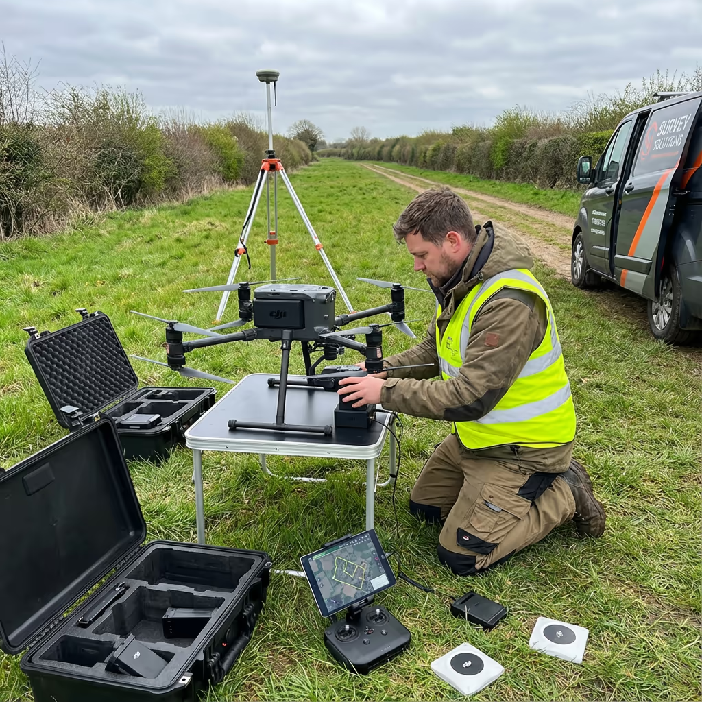
Our drone corridor mapping routinely achieves vertical accuracy of ±2-5cm and horizontal accuracy of ±3-5cm when using ground control points. This level of precision meets the requirements for engineering design, construction planning, and regulatory compliance across the utility and infrastructure sectors.
We use RTK/PPK-enabled drones with high-resolution cameras and optional LiDAR sensors to ensure precise positioning along the entire corridor. For extended routes, we establish ground control networks at regular intervals and use rigorous adjustment workflows. The result is seamless, survey-grade data across the full corridor length.
What Are the Applications of Drone Corridor Mapping?
Drone corridor mapping serves infrastructure operators across multiple sectors. Here are the key applications where our clients see the greatest value:
Power Line Surveys
Vegetation clearance analysis, conductor sag measurement, tower inspection, and right-of-way monitoring for electricity transmission networks.
Pipeline Route Surveys
Route planning for new pipelines, condition monitoring of existing infrastructure, and wayleave documentation for gas, oil, and water utilities.
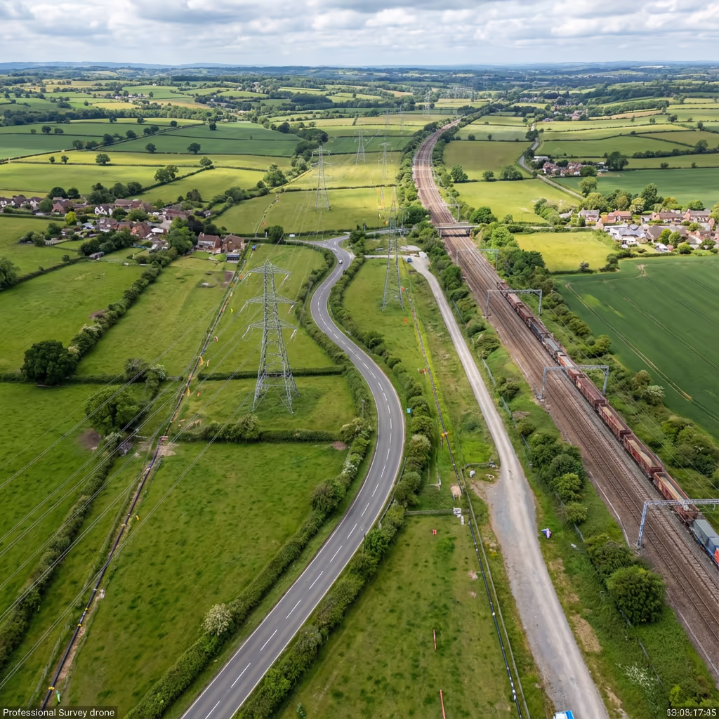
Railway Corridor Mapping
Track geometry surveys, vegetation management, embankment monitoring, and level crossing assessments for Network Rail projects.
Road & Highway Schemes
Route corridor surveys for new road schemes, A-road improvements, bypass planning, and highway condition assessments.
River & Canal Surveys
Watercourse corridor mapping for flood risk assessment, bank erosion monitoring, and navigation channel surveys.
Telecommunications
Fibre route surveys, mobile network corridor planning, and tower site access route mapping for telecoms infrastructure.
Have a corridor project that needs surveying?
How Long Can a Single Drone Corridor Survey Cover?
With our extended flight capabilities, a single drone corridor survey mission can cover 20-30km in a day under optimal conditions. For longer corridors, we operate multiple flight teams simultaneously or conduct phased surveys over consecutive days to maintain momentum.
The actual coverage depends on several factors including corridor width, required ground sample distance (GSD), terrain complexity, and airspace restrictions. Narrow corridors with simple terrain can be surveyed faster, while wide rights-of-way or complex urban environments require more flight lines and take longer.
| Corridor Width | Daily Coverage |
|---|---|
| Narrow (20-50m) | 25-30km |
| Medium (50-100m) | 15-20km |
| Wide (100-200m) | 10-15km |
| Very Wide (200m+) | 5-10km |

What Deliverables Do You Get From Drone Corridor Mapping?
We tailor deliverables to your project requirements. Our standard drone corridor mapping outputs include:
Corridor Orthomosaic
High-resolution, georeferenced aerial imagery of the entire corridor, suitable for GIS integration and visual inspection.
Cross-Sections
Terrain profiles perpendicular to the corridor alignment at your specified intervals (typically every 25m, 50m, or 100m).
Longitudinal Profiles
Ground surface elevation along the corridor centreline, essential for gradient analysis and engineering design.
Clearance Analysis
Vegetation encroachment reports, conductor-to-ground clearances, and obstruction identification for power line and pipeline corridors.
CAD Files & 3D Models
DWG/DXF drawings, 3D surface models, and point clouds compatible with all major engineering software packages.
Need specific deliverables for your corridor project?
How Long Does Drone Corridor Mapping Take?
On-site data capture is remarkably efficient. We can survey 15-30km of corridor per day depending on width and terrain. A typical 20km power line corridor takes just 1-2 days of flight time, compared to weeks for traditional ground surveys.
Processing and delivery depends on corridor length and your required outputs. Standard deliverables for a 20km corridor are typically ready within 5-7 working days. For urgent projects, we offer expedited processing with 48-72 hour turnaround available at additional cost.
| Phase | Duration |
|---|---|
| Planning & Permissions | 2-5 days |
| On-Site Data Capture | 1-3 days |
| Data Processing | 2-4 days |
| Deliverable Generation | 2-3 days |
| Total (20km corridor) | 5-7 working days |
Express Processing Available
Need it faster? 48-72 hour turnaround available for urgent corridor projects.
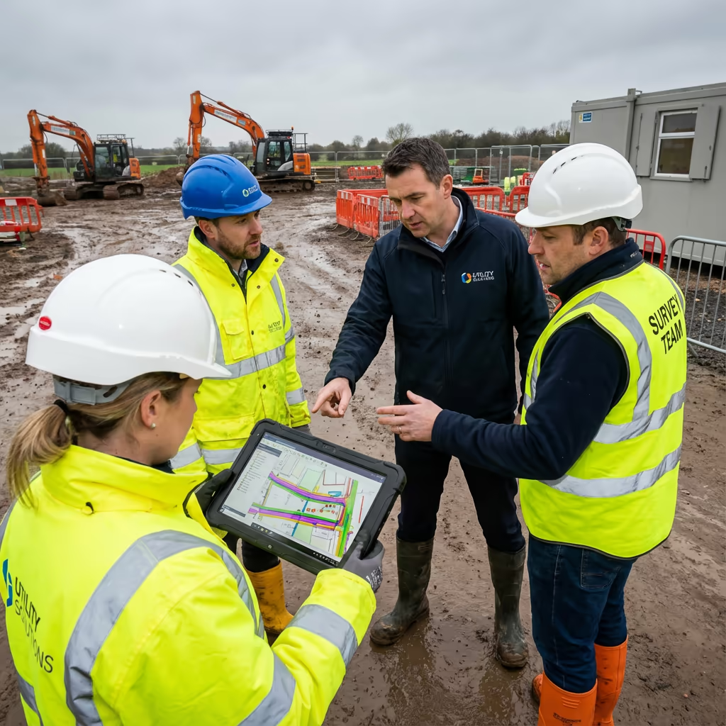
How Do I Choose a Drone Corridor Mapping Provider?
Corridor mapping requires specialist expertise beyond standard drone surveys. When evaluating providers, we recommend checking these key factors:
- CAA authorisation – Ensure they hold valid GVC permissions for commercial operations, ideally with extended BVLOS capabilities
- Infrastructure experience – Ask for examples of similar corridor projects they've completed for utilities, rail, or highways
- Professional insurance – Public liability and professional indemnity cover appropriate to infrastructure projects
- Processing capability – Ask about their software for handling long corridor datasets and generating cross-sections
- Airspace management – Long corridors often cross multiple airspace zones requiring careful planning
At Drone Survey Services, we tick every box. We're CAA approved, fully insured, and have delivered corridor mapping projects for utilities, rail, and highway clients across the UK.
Ready to work with a trusted corridor mapping provider?
Is Drone Corridor Mapping Cheaper Than Traditional Methods?
Significantly. Traditional corridor surveys require teams of surveyors walking the entire route, setting up equipment at each station, and often spending weeks in the field. Access issues, health and safety requirements, and difficult terrain all add to costs and delays.
Our drone corridor mapping captures equivalent or better data in a fraction of the time. A 20km corridor that might take a ground team three weeks can be flown and processed in under two weeks. The cost savings typically range from 50-70% compared to traditional methods, while delivering faster turnaround, higher data density, and often safer operations with minimal ground access required.
Ready to Discuss Your Corridor Project?
Expert advice • Tailored pricing • Response within 2 hours
James Leslie
Owner, Engineer & Drone Pilot
With extensive experience in infrastructure surveying and UAV operations, James personally oversees every corridor mapping project to ensure survey-grade accuracy and professional delivery.
TLDR: Drone Corridor Mapping Explained
Corridor Deliverables
- Corridor orthomosaic
- Cross-sections at intervals
- Longitudinal profiles
- Clearance analysis
- CAD files (DWG/DXF)
- 3D surface models
Discuss Your Corridor Project
Get expert advice and tailored pricing.
Enterprise Equipment
Survey-Grade Drone Fleet
We don't use consumer mini drones like other providers. Our fleet consists of industrial, survey-grade aircraft purpose-built for capturing detailed, accurate datasets.

AgEagle eBee X
Professional fixed-wing for rapid terrain coverage

DJI Matrice 400
Engineered for excellence, designed for versatility

WingtraOne GEN II
Best-in-class surveying efficiency for large projects

DJI Matrice 350 RTK
Professional multi-payload platform for precision surveying

DJI Mavic 4E
Portable surveying powerhouse with RTK precision
DJI Matrice 300 RTK
Industry-leading inspection and mapping platform

DJI Matrice 4E
Precision survey drone with oblique capture
1 of 7
← Swipe to explore fleet →
Sensor Technology
Specialised Sensors for All Aerial Surveys
Our aircraft carry professional-grade sensors matched to your project requirements, from high-resolution photogrammetry to terrain-penetrating LiDAR.
LiDAR Sensors
Penetrate vegetation and capture precise terrain data with laser scanning technology.
Applications
- Forestry & vegetation mapping
- Terrain modelling under canopy
- Flood risk assessment
- Archaeological surveys
- Power line corridor mapping
Thermal Imaging
Detect heat signatures for building diagnostics, energy audits, and industrial inspections.
Applications
- Building thermal surveys
- Solar panel inspections
- Electrical fault detection
- Search and rescue
- Livestock monitoring
RGB & Photogrammetry
High-resolution imagery for detailed 3D models, orthomosaics, and visual inspections.
Applications
- Topographic surveys
- 3D model generation
- Progress monitoring
- Asset inspection
- Marketing photography
Need a specific sensor or payload?
Client Testimonials
Why Clients Rate Our Drone Survey Service 5 Stars
Don't just take our word for it. Here's what industry professionals say about working with us.
“By far the best drone surveying company I've used. Responsive, helpful and report quality is spot on. Extremely diligent in highlighting defects outside of scope. 10+ projects completed and never disappointed.”
Mark Reynolds
Building Surveyor
“DSS's drone roof survey was brilliant. James showed me everything wrong with my roof in about 30 minutes. Quick, professional and easy to understand.”
Helen Parker
Homeowner
“Fantastic company to do business with. Been working with the DSS team since 2021 and it's been an absolute pleasure. Highly recommended.”
Robert Hughes
Property Developer
Related Services
LiDAR Mapping
Precision LiDAR scanning for detailed terrain models and vegetation analysis through tree canopy.
Drone Topographic Survey
Detailed topographic surveys for planning, design and construction projects.
Volumetric Analysis
Accurate stockpile measurements and cut/fill calculations from aerial data.