Environmental & Ecology
Drone Environmental Survey Services
Comprehensive aerial surveys for habitat mapping, vegetation classification, and environmental baseline assessments across sensitive ecological sites.
Response within 2 hours • Or call 020 4634 0456
What Is a Drone Environmental Survey?
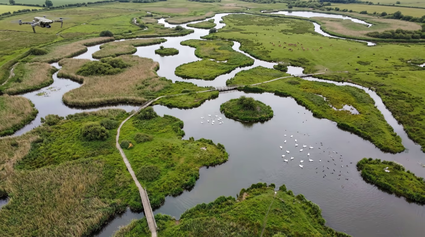
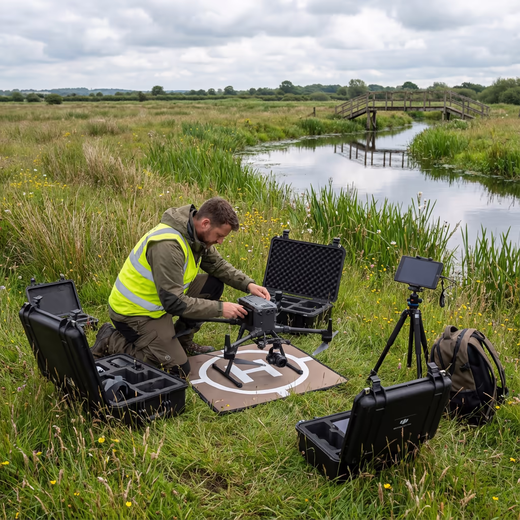
A drone environmental survey uses aerial technology to capture detailed imagery and data for ecological assessments, habitat mapping, and environmental monitoring. Our UAVs equipped with high-resolution cameras and multispectral sensors provide comprehensive coverage of sensitive sites without the disturbance caused by traditional ground-based surveys.
At Drone Survey Services, we support ecologists, environmental consultants, and conservation organisations with precise aerial data that reveals habitat boundaries, vegetation health, and ecological features across sites of all sizes. From SSSI assessments to biodiversity net gain calculations, our drone environmental surveys deliver the spatial data you need.

James Leslie
Owner, Engineer & Drone Pilot
"Got questions? Call me directly - I'm happy to talk through your project."
Call NowEcological Survey Data,Captured Safely
What You'll Receive
- Habitat classification maps (Phase 1/UKHab)
- Vegetation health indices (NDVI)
- High-resolution orthomosaics
- Environmental baseline data
Delivered in 5-7 working days
Why Choose Us
- CAA approved & fully insured
- Minimal site disturbance
- Multispectral sensor capability
- UK-wide coverage
Trusted by ecologists, conservation bodies & environmental consultants across the UK.
Trusted by leading organisations
How Much Does a Drone Environmental Survey Cost?
Pricing depends on your project scope and deliverables required. Here's a guide to help you budget:
| Project Size | Guide Price |
|---|---|
| SmallUnder 5 ha | £600+ |
| Medium5-20 ha | £1,200+ |
| Large20-50 ha | £2,200+ |
| Major50+ ha | POA |
| Seasonal MonitoringRepeat surveys | POA |
*Guide prices include standard deliverables. Final quote based on site complexity, access, and specific requirements.
What affects your quote?
- Site size & habitat complexity
- Required classification level
- Sensor requirements
- Seasonal timing constraints
Our drone-based approach typically saves 40-60% compared to traditional ground-based habitat surveys while minimising disturbance to sensitive wildlife. Contact us with your project details and we'll provide a tailored quote within 24 hours.
Ready to get a quote for your project?
Free, no-obligation quotes within 24 hours
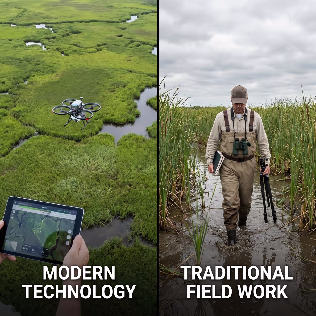
What Is the Difference Between Drone Environmental Survey and Traditional Methods?
Traditional habitat surveys require ecologists to walk transects across sites, manually recording habitat types and features. While this ground-truthing remains valuable, it's time-consuming, expensive for large sites, and can cause significant disturbance—particularly during sensitive nesting or breeding seasons.
Drone environmental surveys capture the entire site in a fraction of the time with zero ground disturbance. Our aerial imagery provides complete coverage that's impossible to achieve on foot, while multispectral sensors reveal vegetation health patterns invisible to the human eye. The result is faster, more comprehensive data that complements traditional ecological expertise.
When to Choose Each Approach
Choose Drone Environmental Survey
Low-disturbance coverage
Choose Traditional Survey
Detailed ground-truthing
Not sure which approach suits your project?
What Accuracy Can a Drone Environmental Survey Achieve?
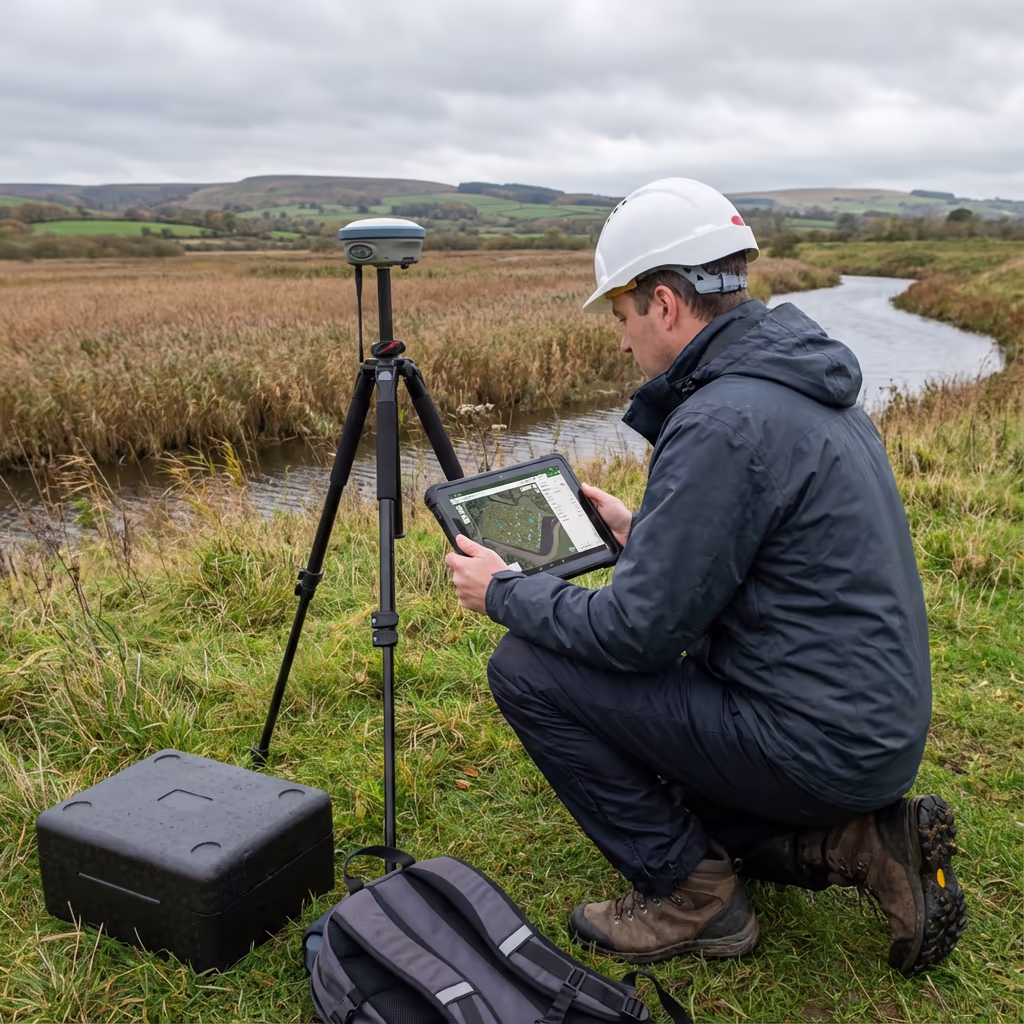
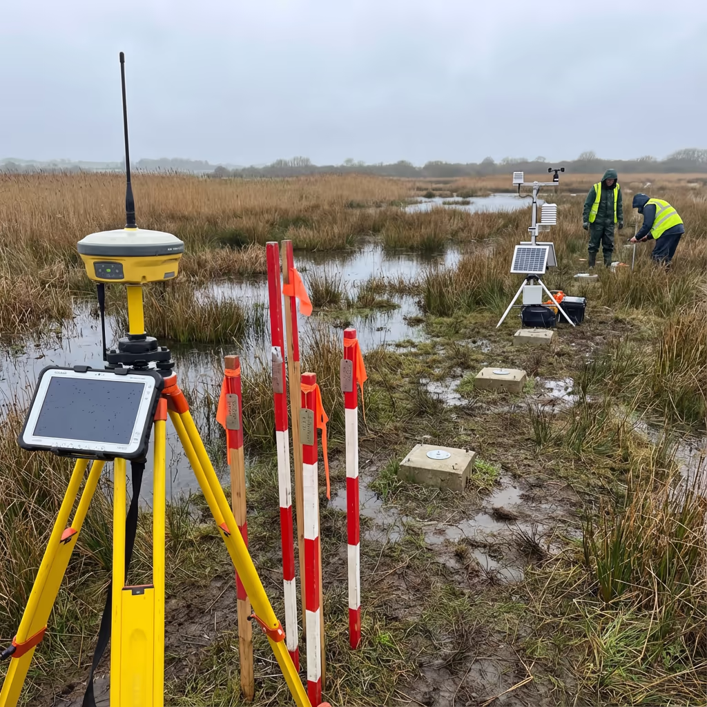
Our drone environmental surveys deliver ground sampling distances (GSD) as fine as 1-2cm per pixel, allowing identification of individual plants and precise habitat boundary delineation. Using RTK/PPK positioning, we achieve horizontal accuracy of ±2-5cm—essential for repeatable monitoring and change detection over time.
For vegetation classification, our multispectral sensors capture spectral signatures that distinguish between habitat types with high confidence. When combined with strategic ground-truthing points, our habitat maps meet or exceed the accuracy requirements for Phase 1 habitat surveys, UKHab classification, and biodiversity net gain assessments.
What Are the Applications of Drone Environmental Survey?
Drone environmental surveys support a wide range of ecological and conservation applications. Here are the key use cases where our clients see the greatest value:
Biodiversity Net Gain (BNG)
Accurate habitat baseline mapping for metric calculations, pre- and post-development monitoring, and long-term stewardship reporting.
SSSI & Protected Site Monitoring
Condition assessments for Sites of Special Scientific Interest, SACs, SPAs, and local wildlife sites without disturbance.
Habitat Restoration Projects
Track vegetation establishment, invasive species spread, and restoration success over seasonal and annual cycles.
Environmental Impact Assessment
Rapid baseline surveys for EIA, identifying ecological constraints and opportunities for development projects.
Wetland & Coastal Surveys
Map fragile wetland habitats, saltmarsh extent, and coastal vegetation without trampling sensitive areas.
Agricultural & Estate Management
Identify field margins, hedgerow condition, and habitat features for environmental stewardship schemes.
Have an environmental project that needs aerial survey?
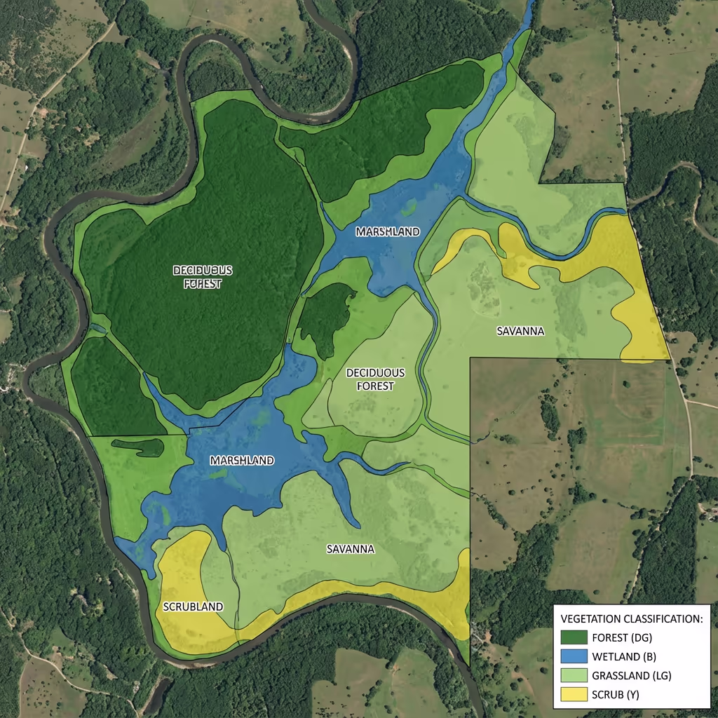
Can Drones Map Habitats and Vegetation?
Absolutely—this is where drone environmental surveys truly excel. Using high-resolution RGB imagery combined with multispectral sensors, we capture detailed spectral signatures that distinguish between grassland types, scrub, woodland, wetland, and other habitat categories with remarkable precision.
Our vegetation classification workflows produce habitat maps aligned with Phase 1, UKHab, or NVC classification systems as required. We calculate vegetation indices like NDVI to reveal plant health patterns invisible to standard photography—essential for identifying stressed vegetation, invasive species spread, or areas of poor establishment in restoration projects.
For long-term monitoring, our georeferenced datasets enable precise change detection between survey dates. You can track habitat loss or gain, vegetation succession, and the effectiveness of management interventions with quantified metrics rather than subjective observation.
What Deliverables Do You Get From a Drone Environmental Survey?
We tailor deliverables to your project requirements and the ecological frameworks you're working within. Our standard environmental survey outputs include:
Habitat Classification Maps
Georeferenced habitat maps aligned with Phase 1, UKHab, or NVC classification systems with habitat areas calculated.
Vegetation Health Indices (NDVI)
Normalised Difference Vegetation Index maps revealing plant vigour, stress patterns, and biomass distribution across your site.
High-Resolution Orthomosaic
Georeferenced aerial imagery at 1-2cm per pixel resolution, suitable for detailed ecological interpretation and reporting.
Environmental Baseline Report
Summary report with habitat areas, key ecological features, and recommendations for further survey or management.
CAD & GIS Files
Habitat polygons and survey data in DWG, DXF, Shapefile, and GeoPackage formats for integration with your CAD and GIS systems.
3D Site Models
Digital Surface Models and terrain data for visualisation, drainage analysis, and landscape planning applications.
Need specific deliverables for your project?
How Long Does a Drone Environmental Survey Take?
On-site data capture is remarkably efficient. We can survey 20-50 hectares per day depending on habitat complexity and weather conditions. A typical 10-hectare nature reserve takes just 1-2 hours of flight time, causing minimal disturbance to wildlife compared to days of ground-based survey.
Processing and analysis depends on your required outputs. Standard habitat maps and orthomosaics are typically delivered within 5-7 working days. For urgent projects, we offer expedited processing with 48-72 hour turnaround available at additional cost. Seasonal timing may affect scheduling—we'll discuss optimal survey windows when we quote your project.
| Phase | Duration |
|---|---|
| Planning & Permissions | 1-3 days |
| On-Site Data Capture | ½-1 day |
| Image Processing | 1-2 days |
| Habitat Classification | 2-3 days |
| Deliverable Generation | 1-2 days |
| Total (Standard) | 5-7 working days |
Express Processing Available
Need it faster? 48-72 hour turnaround available for urgent projects.
How Do I Choose a Drone Environmental Survey Provider?
Not all drone survey providers understand the specific requirements of ecological work. When evaluating providers, we recommend checking these key factors:
- CAA authorisation – Ensure they hold valid GVC or legacy PfCO permissions for commercial operations
- Ecological awareness – Experience working on sensitive sites with wildlife disturbance protocols
- Appropriate sensors – Multispectral capability for vegetation analysis, not just standard cameras
- Classification expertise – Understanding of Phase 1, UKHab, and ecological frameworks
- Relevant case studies – Request examples of similar ecological projects they've completed
At Drone Survey Services, we tick every box. We're CAA approved, fully insured, and have delivered environmental surveys for nature reserves, rewilding projects, BNG assessments, and conservation organisations throughout the UK.
Ready to work with a trusted environmental survey provider?
Is Drone Environmental Survey Cheaper Than Traditional Methods?
In most scenarios, yes—significantly. Traditional habitat surveys require teams of ecologists walking transects for days, which quickly becomes expensive for large or complex sites. Access difficulties in wetlands, dense vegetation, or steep terrain add further time and cost.
Our drone environmental surveys capture equivalent or better spatial data in a fraction of the time. A site that might take a ground team a week to survey can be flown in hours. The cost savings typically range from 40-60% compared to traditional methods, while providing more complete coverage and consistent documentation. For repeat monitoring surveys, the economics become even more favourable—your baseline data enables rapid comparison without starting from scratch.
Ready to Discuss Your Environmental Project?
Expert advice • Tailored pricing • Response within 2 hours
James Leslie
Owner, Engineer & Drone Pilot
With extensive experience in surveying and UAV operations, James personally oversees every environmental survey project to ensure accurate data capture with minimal ecological disturbance.
TLDR: Drone Environmental Surveys Explained
Environmental Deliverables
- Habitat classification maps
- Vegetation indices (NDVI)
- Species identification data
- Environmental baseline report
- CAD & GIS files
- 3D site models
Discuss Your Project
Get expert advice and tailored pricing.
Enterprise Equipment
Survey-Grade Drone Fleet
We don't use consumer mini drones like other providers. Our fleet consists of industrial, survey-grade aircraft purpose-built for capturing detailed, accurate datasets.

AgEagle eBee X
Professional fixed-wing for rapid terrain coverage

DJI Matrice 400
Engineered for excellence, designed for versatility

WingtraOne GEN II
Best-in-class surveying efficiency for large projects

DJI Matrice 350 RTK
Professional multi-payload platform for precision surveying

DJI Mavic 4E
Portable surveying powerhouse with RTK precision
DJI Matrice 300 RTK
Industry-leading inspection and mapping platform

DJI Matrice 4E
Precision survey drone with oblique capture
1 of 7
← Swipe to explore fleet →
Sensor Technology
Specialised Sensors for All Aerial Surveys
Our aircraft carry professional-grade sensors matched to your project requirements, from high-resolution photogrammetry to terrain-penetrating LiDAR.
LiDAR Sensors
Penetrate vegetation and capture precise terrain data with laser scanning technology.
Applications
- Forestry & vegetation mapping
- Terrain modelling under canopy
- Flood risk assessment
- Archaeological surveys
- Power line corridor mapping
Thermal Imaging
Detect heat signatures for building diagnostics, energy audits, and industrial inspections.
Applications
- Building thermal surveys
- Solar panel inspections
- Electrical fault detection
- Search and rescue
- Livestock monitoring
RGB & Photogrammetry
High-resolution imagery for detailed 3D models, orthomosaics, and visual inspections.
Applications
- Topographic surveys
- 3D model generation
- Progress monitoring
- Asset inspection
- Marketing photography
Need a specific sensor or payload?
Client Testimonials
Why Clients Rate Our Drone Survey Service 5 Stars
Don't just take our word for it. Here's what industry professionals say about working with us.
“By far the best drone surveying company I've used. Responsive, helpful and report quality is spot on. Extremely diligent in highlighting defects outside of scope. 10+ projects completed and never disappointed.”
Mark Reynolds
Building Surveyor
“DSS's drone roof survey was brilliant. James showed me everything wrong with my roof in about 30 minutes. Quick, professional and easy to understand.”
Helen Parker
Homeowner
“Fantastic company to do business with. Been working with the DSS team since 2021 and it's been an absolute pleasure. Highly recommended.”
Robert Hughes
Property Developer
Related Services
LiDAR Mapping
Penetrate vegetation canopy to map ground terrain for ecological baseline and habitat assessment.
Topographic Survey
Detailed terrain mapping for environmental planning, flood modelling, and site assessment.
Drone Survey
Comprehensive aerial surveys delivering precise data and 3D models for any application.