Surveying & Mapping
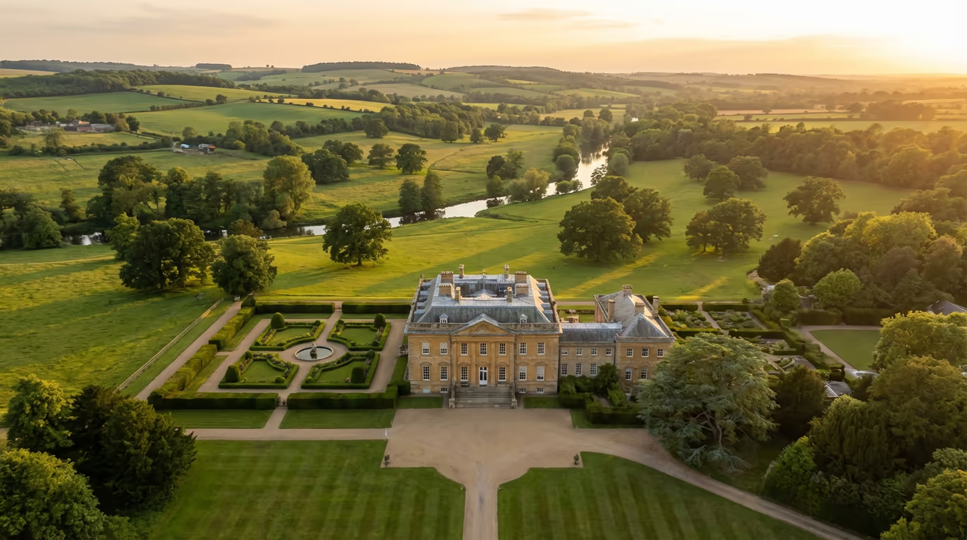
Drone Estate Survey Services
Comprehensive aerial surveys for country estates, manor houses, and landed properties. Map boundaries, buildings, woodland, and every feature of your estate.
Response within 2 hours • Or call 020 4634 0456
What Is a Drone Estate Survey?
A drone estate survey provides comprehensive aerial documentation of country estates, manor houses, and large landed properties. Using professional-grade UAVs equipped with high-resolution cameras, we capture detailed imagery of every aspect of your estate—from the principal residence and outbuildings to parkland, woodland, and boundary features.
At Drone Survey Services, we understand that estates are complex properties requiring careful, thorough documentation. Our surveys deliver accurate boundary mapping, detailed building surveys, woodland assessments, and comprehensive orthomosaic imagery that gives you a complete picture of your landholding. Whether you're planning improvements, managing succession, or simply need an up-to-date record of your estate, our drone surveys deliver the data you need.

James Leslie
Owner, Engineer & Drone Pilot
"Got questions? Call me directly - I'm happy to talk through your project."
Call NowComplete Estate Documentation,Delivered Fast
What You'll Receive
- Estate orthomosaic & aerial imagery
- Boundary mapping & verification
- Building condition surveys
- Woodland & landscape assessment
Delivered in 5-10 working days
Why Choose Us
- CAA approved & fully insured
- Experience with historic estates
- Latest DJI drone technology
- UK-wide coverage
Trusted by estate owners, land agents & surveyors across the UK.
Trusted by leading organisations
How Much Does a Drone Estate Survey Cost?
Estate survey pricing depends on the size and complexity of your property. Here's a guide to help you budget:
| Estate Size | Guide Price |
|---|---|
| SmallUnder 10 ha | £800+ |
| Medium10–50 ha | £1,500+ |
| Large50–100 ha | £2,800+ |
| Major100+ ha | POA |
| Building SurveysAdd-on | +£400 |
*Guide prices include standard deliverables. Final quote based on site complexity, number of buildings, and specific requirements.
What affects your quote?
- Estate size & terrain
- Number of buildings
- Woodland coverage
- Required deliverables
Our drone-based approach typically saves 40–60% compared to traditional ground surveys, while delivering far more comprehensive documentation. Contact us with your estate details and we'll provide a tailored quote within 24 hours.
Ready to get a quote for your estate?
Free, no-obligation quotes within 24 hours
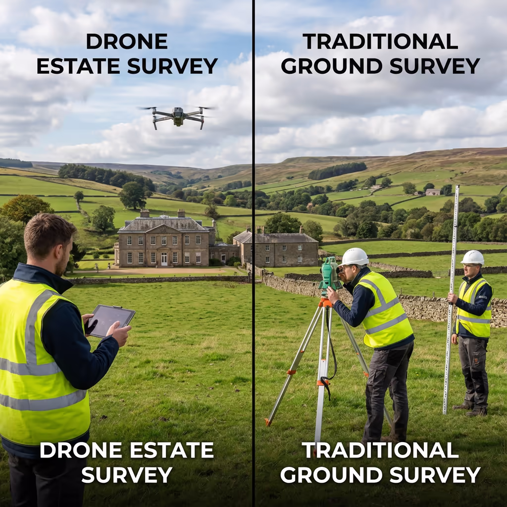
What Is the Difference Between Drone Estate Survey and Traditional Methods?
Traditional estate surveys typically involve ground-based surveying teams walking the entire property over multiple days, supplemented by limited aerial photography from manned aircraft. While thorough, this approach is time-consuming, expensive, and often misses features that are only visible from above.
A drone estate survey transforms this process. We can capture comprehensive aerial coverage of even the largest estates in a single day, producing detailed orthomosaic imagery that reveals every feature of your land. From hidden drainage patterns and archaeological features to boundary anomalies and building defects—drone surveys capture details that ground teams simply cannot see.
When to Choose Each Approach
Choose Drone Estate Survey
Comprehensive coverage
Choose Traditional Survey
Ground-level detail
Not sure which approach suits your estate?
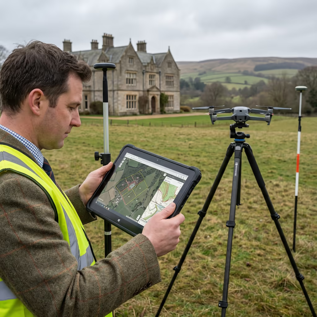
What Accuracy Can a Drone Estate Survey Achieve?
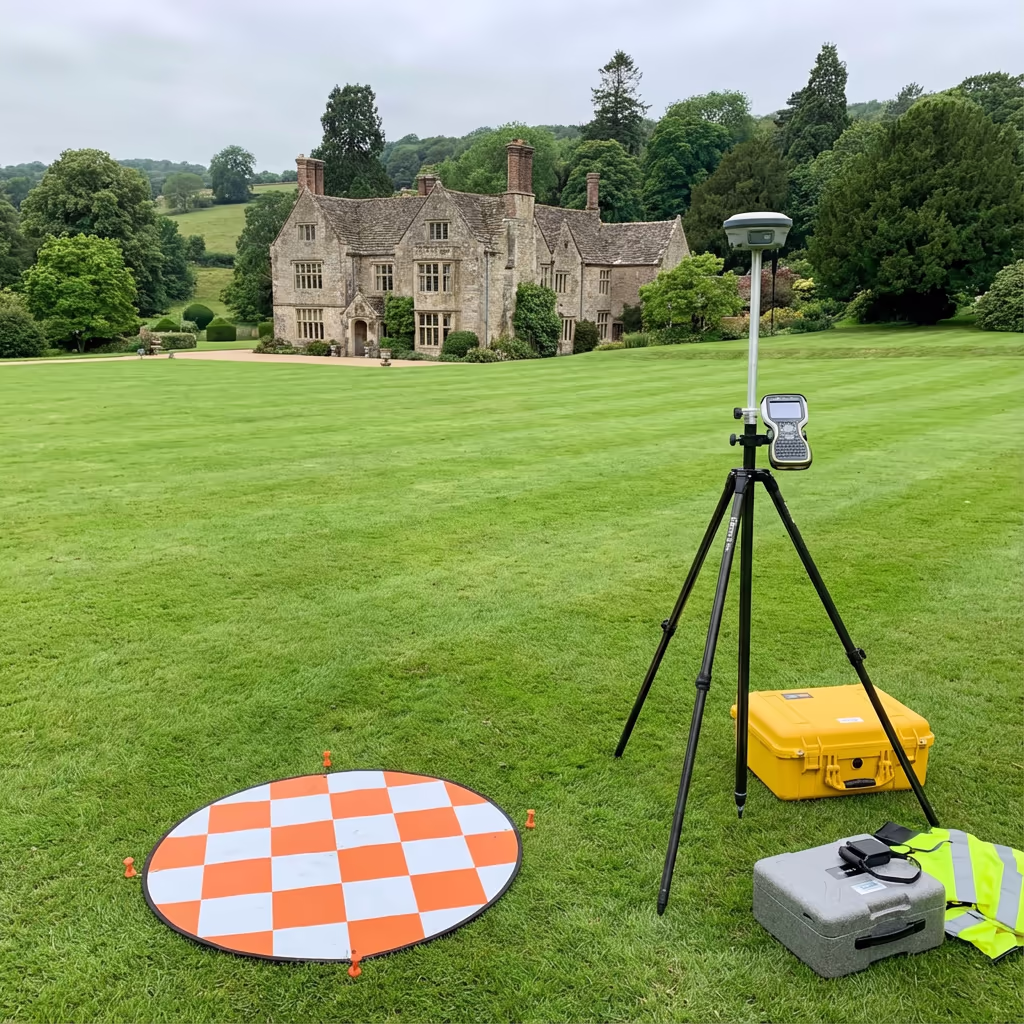
Our drone estate surveys routinely achieve horizontal accuracy of 2-5cm and vertical accuracy of 3-8cm when using ground control points. This exceeds the requirements for most estate management, planning, and documentation purposes.
We use RTK/PPK-enabled drones with professional-grade cameras to ensure precise positioning of all imagery. For boundary verification and planning applications, we establish ground control networks across your estate. The result is survey-grade data that land agents, solicitors, and planning authorities can rely on with confidence.
What Are the Applications of Drone Estate Survey?
Drone estate surveys serve estate owners, land agents, solicitors, and property professionals across a wide range of applications:
Estate Management
Comprehensive documentation for day-to-day management, maintenance planning, and long-term stewardship of your property.
Succession Planning
Detailed records for inheritance tax planning, estate division, and wealth transfer between generations.
Property Sales
High-quality aerial imagery and accurate mapping for marketing materials and due diligence documentation.
Planning Applications
Supporting documentation for development proposals, change of use applications, and Listed Building consents.
Insurance Documentation
Comprehensive visual records of buildings, structures, and land for insurance valuations and claims.
Environmental Stewardship
Baseline surveys for environmental schemes, woodland management plans, and habitat documentation.
Have an estate that needs surveying?
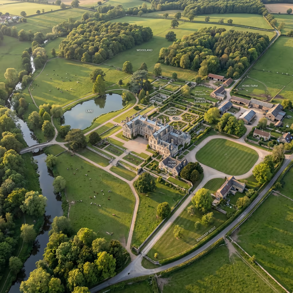
What Can a Drone Estate Survey Capture?
A comprehensive drone estate survey captures every aspect of your property, providing documentation that would take weeks to compile using traditional methods. Our surveys typically include:
Buildings & Structures
- • Principal residence & wings
- • Estate cottages & lodges
- • Farm buildings & barns
- • Walled gardens & glasshouses
- • Stables & outbuildings
Land & Landscape
- • Parkland & formal gardens
- • Woodland blocks & plantations
- • Agricultural land & fields
- • Water features & lakes
- • Boundaries & hedgerows
Infrastructure
- • Driveways & access roads
- • Gates, walls & fencing
- • Drainage & water courses
- • Utilities & services
- • Rights of way & paths
Special Features
- • Historic features & monuments
- • Archaeological remains
- • Tree preservation orders
- • Wildlife habitats
- • Views & vistas
Every feature is captured in high-resolution imagery and mapped to precise coordinates, creating a complete digital record of your estate that can be used for years to come.

What Deliverables Do You Get From a Drone Estate Survey?
We tailor deliverables to your estate's requirements, but our standard survey outputs include:
Estate Orthomosaic
High-resolution, georeferenced aerial imagery of your entire estate, stitched into a single seamless map. Perfect for estate records and management planning.
Boundary Mapping
Accurate mapping of all estate boundaries, including hedgerows, walls, fences, and watercourses. Cross-referenced to title plans where available.
Building Surveys
Detailed aerial photography of all buildings from multiple angles, including roof condition assessment and facade documentation.
Woodland Assessment
Aerial mapping of woodland areas with tree canopy coverage analysis. Useful for forestry management and environmental scheme applications.
CAD Plans & 3D Models
Professional CAD drawings in DWG/DXF format, plus 3D terrain models for design and visualization purposes.
Need specific deliverables for your estate?
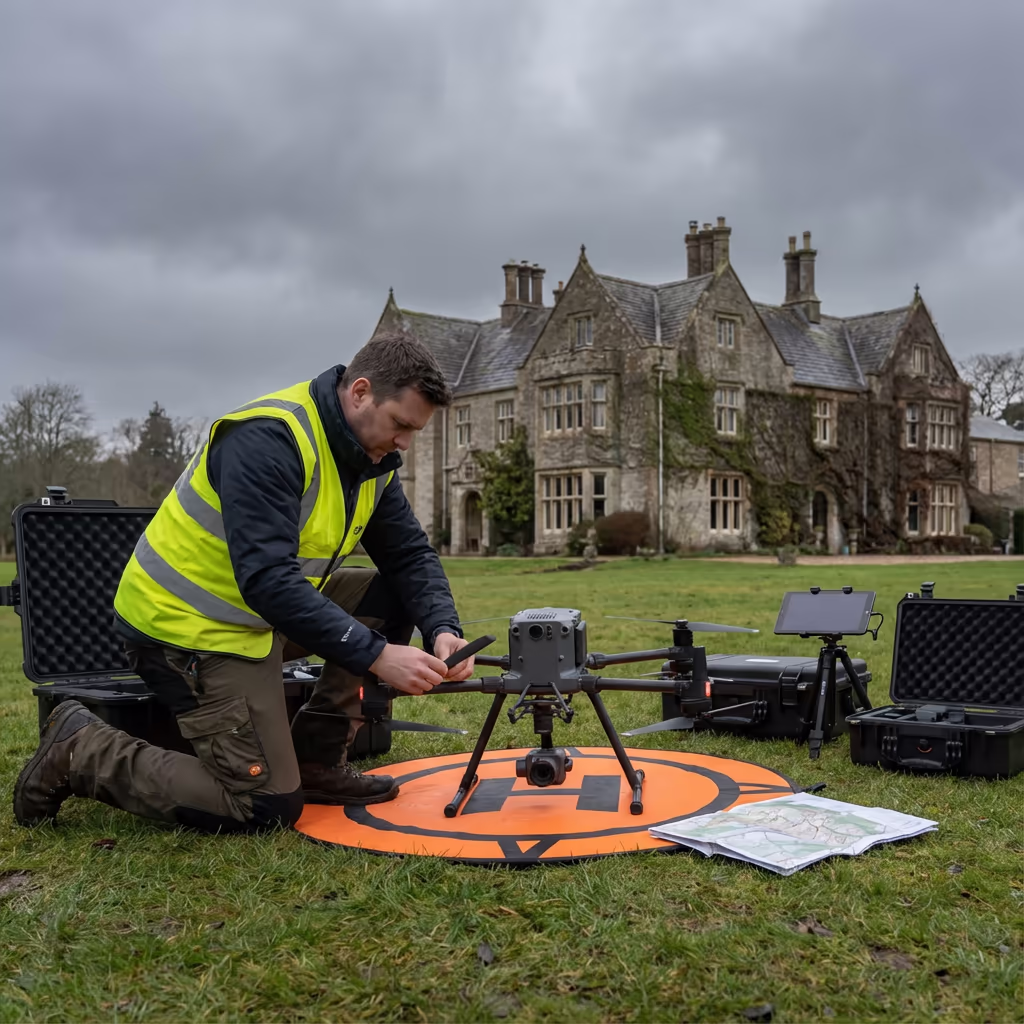
How Long Does a Drone Estate Survey Take?
On-site data capture is remarkably efficient. A typical 50-hectare estate can be surveyed in a single day, including all buildings and landscape features. Larger estates may require 2-3 days of flying, depending on the level of detail required.
Processing and delivery depends on estate size and your required outputs. Standard deliverables are typically ready within 5-10 working days. For urgent projects, we offer expedited processing with faster turnaround available at additional cost.
| Phase | Duration |
|---|---|
| Planning & Permissions | 1-3 days |
| On-Site Survey | 1-3 days |
| Data Processing | 3-5 days |
| Deliverable Production | 2-4 days |
| Total (Standard) | 5-10 working days |
Express Processing Available
Need it faster? Expedited delivery available for time-sensitive projects.
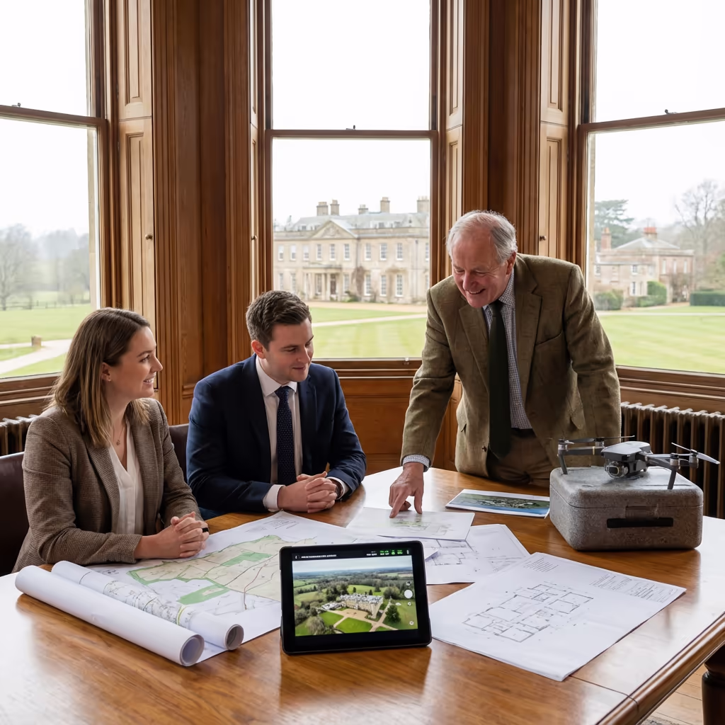
How Do I Choose a Drone Estate Survey Provider?
When selecting a provider to survey your estate, we recommend checking these key factors:
- CAA authorisation – Ensure they hold valid GVC or legacy PfCO permissions for commercial operations
- Professional insurance – Public liability and professional indemnity cover appropriate to working on private estates
- Estate experience – Look for evidence of previous work on similar properties and understanding of estate management needs
- Discretion – Estates are private properties; ensure your provider understands confidentiality requirements
- Professional deliverables – Ask to see examples of their mapping and documentation quality
At Drone Survey Services, we tick every box. We're CAA approved, fully insured, and have delivered surveys for estates ranging from small manor houses to major landed properties throughout the UK.
Ready to work with a trusted estate survey provider?
Is Drone Estate Survey Cheaper Than Traditional Surveying?
In almost every case, yes—substantially. Traditional estate surveys require teams of surveyors working over multiple days or weeks, often supplemented by expensive manned aircraft photography. The costs accumulate quickly, particularly for larger estates with extensive woodland or multiple buildings.
Our drone estate surveys capture equivalent or better data in a fraction of the time. An estate that might take a ground team two weeks can be flown in 1-3 days. The cost savings typically range from 40-60% compared to traditional methods, while delivering more comprehensive aerial coverage and often higher quality imagery. For estates of any significant size, drone surveys offer compelling value.
Ready to Discuss Your Estate Survey?
Expert advice • Tailored pricing • Response within 2 hours
James Leslie
Owner, Engineer & Drone Pilot
With extensive experience surveying estates across the UK, James personally oversees every project to ensure comprehensive documentation and professional delivery.
TLDR: Drone Estate Surveys Explained
Estate Deliverables
- Estate orthomosaic imagery
- Boundary mapping & plans
- Building surveys & photography
- Woodland assessment
- CAD plans (DWG/DXF)
- 3D terrain models
Discuss Your Estate
Get expert advice and tailored pricing.
Enterprise Equipment
Survey-Grade Drone Fleet
We don't use consumer mini drones like other providers. Our fleet consists of industrial, survey-grade aircraft purpose-built for capturing detailed, accurate datasets.

AgEagle eBee X
Professional fixed-wing for rapid terrain coverage

DJI Matrice 400
Engineered for excellence, designed for versatility

WingtraOne GEN II
Best-in-class surveying efficiency for large projects

DJI Matrice 350 RTK
Professional multi-payload platform for precision surveying

DJI Mavic 4E
Portable surveying powerhouse with RTK precision
DJI Matrice 300 RTK
Industry-leading inspection and mapping platform

DJI Matrice 4E
Precision survey drone with oblique capture
1 of 7
← Swipe to explore fleet →
Sensor Technology
Specialised Sensors for All Aerial Surveys
Our aircraft carry professional-grade sensors matched to your project requirements, from high-resolution photogrammetry to terrain-penetrating LiDAR.
LiDAR Sensors
Penetrate vegetation and capture precise terrain data with laser scanning technology.
Applications
- Forestry & vegetation mapping
- Terrain modelling under canopy
- Flood risk assessment
- Archaeological surveys
- Power line corridor mapping
Thermal Imaging
Detect heat signatures for building diagnostics, energy audits, and industrial inspections.
Applications
- Building thermal surveys
- Solar panel inspections
- Electrical fault detection
- Search and rescue
- Livestock monitoring
RGB & Photogrammetry
High-resolution imagery for detailed 3D models, orthomosaics, and visual inspections.
Applications
- Topographic surveys
- 3D model generation
- Progress monitoring
- Asset inspection
- Marketing photography
Need a specific sensor or payload?
Client Testimonials
Why Clients Rate Our Drone Survey Service 5 Stars
Don't just take our word for it. Here's what industry professionals say about working with us.
“By far the best drone surveying company I've used. Responsive, helpful and report quality is spot on. Extremely diligent in highlighting defects outside of scope. 10+ projects completed and never disappointed.”
Mark Reynolds
Building Surveyor
“DSS's drone roof survey was brilliant. James showed me everything wrong with my roof in about 30 minutes. Quick, professional and easy to understand.”
Helen Parker
Homeowner
“Fantastic company to do business with. Been working with the DSS team since 2021 and it's been an absolute pleasure. Highly recommended.”
Robert Hughes
Property Developer