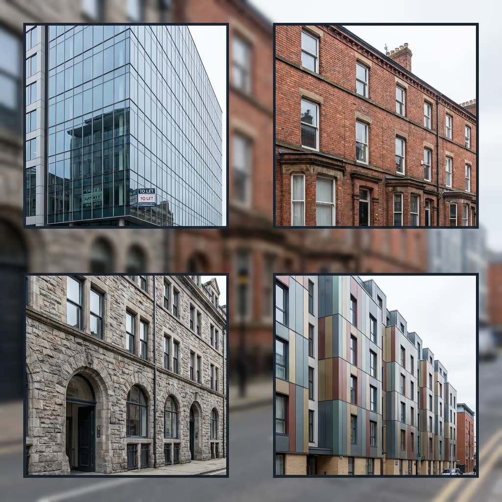
Building Inspection
Drone Facade Survey Services
Safe, cost-effective building facade inspections without scaffolding, rope access, or elevated platforms. Detailed defect identification for buildings of any height.
Response within 2 hours • Or call 020 4634 0456
What Is a Drone Facade Survey?
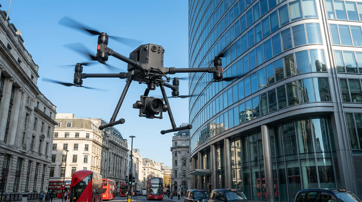
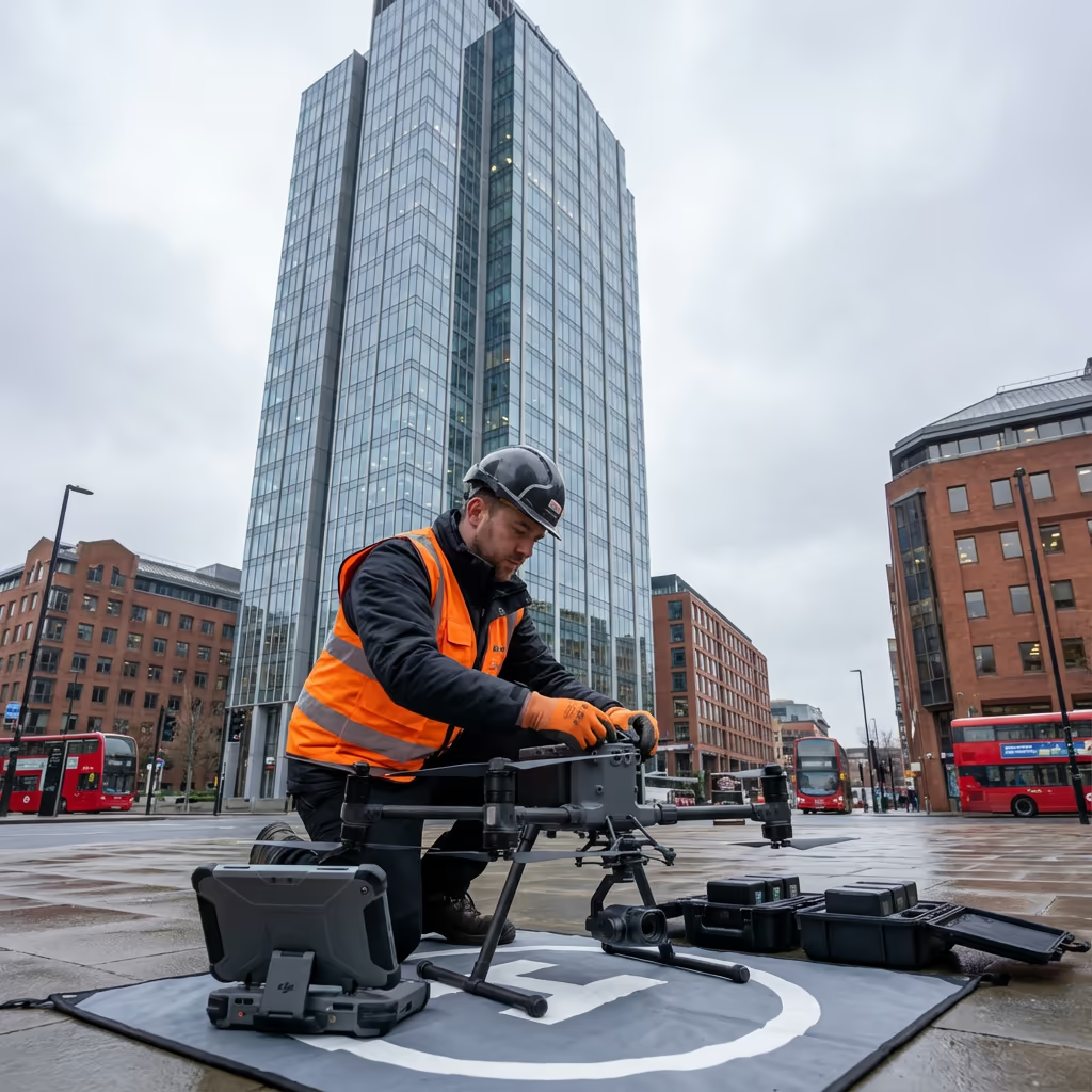
A drone facade survey uses high-resolution cameras and thermal imaging sensors mounted on our UAVs to capture detailed imagery of building exteriors. This allows us to identify defects, damage, and deterioration across the entire facade without the need for scaffolding, cherry pickers, or rope access teams.
At Drone Survey Services, we deploy the latest drone technology capable of capturing sub-millimetre detail from safe operating distances. Our surveys reveal cracks, water ingress, failed sealants, loose cladding, and structural issues that would otherwise require expensive access equipment to inspect.

James Leslie
Owner, Engineer & Drone Pilot
"Got questions? Call me directly - I'm happy to talk through your project."
Call NowComprehensive Facade Inspections,No Scaffolding Required
What You'll Receive
- High-resolution facade imagery
- Detailed defect report
- Condition mapping & grading
- Thermal anomaly identification
Delivered in 5-7 working days
Why Choose Us
- CAA approved & fully insured
- Zero working at height risk
- Latest drone & camera technology
- UK-wide coverage
Trusted by property managers, surveyors & building owners across the UK.
Trusted by leading organisations
How Much Does a Drone Facade Survey Cost?
Pricing depends on building height, facade complexity, and required deliverables. Here's a guide to help you budget:
| Building Type | Guide Price |
|---|---|
| Low-rise1-3 storeys | £400+ |
| Medium-rise4-8 storeys | £700+ |
| High-rise9-15 storeys | £1,200+ |
| Tall Building15+ storeys | £2,000+ |
| Multi-buildingCampus | POA |
*Guide prices include standard deliverables. Final quote based on building complexity, access requirements, and specific needs.
What affects your quote?
- Building height & complexity
- Number of facades
- Required deliverables
- Thermal imaging needs
Our drone-based approach typically saves 60-80% compared to scaffolding or rope access inspections. Contact us with your building details and we'll provide a tailored quote within 24 hours.
Ready to get a quote for your building?
Free, no-obligation quotes within 24 hours
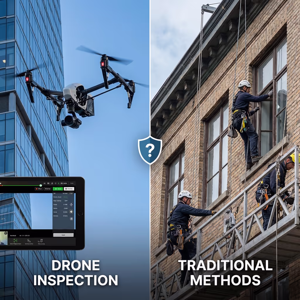
What Is the Difference Between Drone Facade Survey and Rope Access?
Traditional facade inspections require either scaffolding, cherry pickers, or rope access teams. These methods are expensive, time-consuming, and carry significant health and safety risks. Working at height remains one of the leading causes of workplace fatalities in the UK construction industry.
Drone facade surveys eliminate all working at height risks by keeping personnel safely on the ground. Our drones capture imagery that's often more detailed than visual inspection, and can access areas that would be difficult or impossible to reach with traditional methods—such as the underside of balconies or areas near obstacles.
When to Choose Each Method
Choose Drone Facade Survey
Safe & cost-effective
Consider Rope Access
Physical intervention needed
Not sure which method suits your project?
What Accuracy Can a Drone Facade Survey Achieve?
Our drone facade surveys capture imagery at resolutions of 2-5mm per pixel, allowing us to identify hairline cracks, minor deterioration, and early-stage defects that might be missed during traditional visual inspections. This level of detail exceeds what's achievable by the human eye from scaffolding or rope access.
For thermal imaging surveys, we use radiometric cameras that detect temperature variations as small as 0.05 degrees Celsius. This allows us to identify moisture ingress, insulation failures, and thermal bridging with pinpoint accuracy. All imagery is geotagged and can be overlaid onto building elevations for precise defect location mapping.
What Are the Applications of Drone Facade Survey?
Drone facade surveys serve a wide range of building inspection and asset management needs. Here are the key applications where our clients see the greatest value:
Cladding Inspections
Post-Grenfell compliance checks, ACM identification, cladding condition assessments for building safety cases and EWS1 forms.
Planned Maintenance
Scheduled facade condition surveys for maintenance planning, budgeting, and lifecycle cost analysis.
Pre-Acquisition Surveys
Due diligence inspections for property purchases, identifying potential remediation costs before acquisition.
Insurance Claims
Documenting storm damage, impact damage, or defects for insurance claims with timestamped evidence.
Heritage Buildings
Non-invasive inspection of listed buildings, churches, and historic structures where access is restricted.
Defect Investigation
Investigating reported defects, water ingress, cracking, or structural concerns without access equipment.
Have a building that needs inspection?
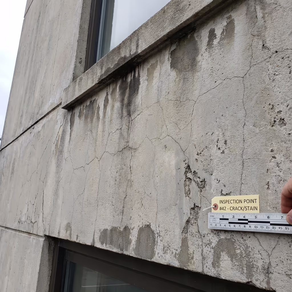
What Defects Can Drone Facade Surveys Identify?
Our high-resolution cameras and thermal sensors can identify a comprehensive range of facade defects and deterioration:
Visual Defects
- Hairline and structural cracking
- Spalling and surface deterioration
- Failed or missing sealants
- Loose or damaged cladding panels
- Corrosion and rust staining
- Vegetation growth and biological staining
- Impact damage and vandalism
- Missing or damaged fixings
Thermal Defects
- Moisture ingress and damp
- Insulation failures and voids
- Thermal bridging
- Air leakage paths
- Hidden water damage
- Delamination beneath render
- Failed cavity barriers
- HVAC performance issues
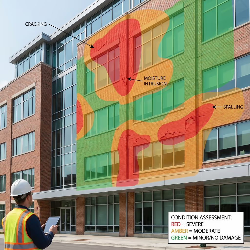
Each defect is documented with high-resolution imagery, precise location mapping, and severity grading to support maintenance planning and remediation prioritisation.
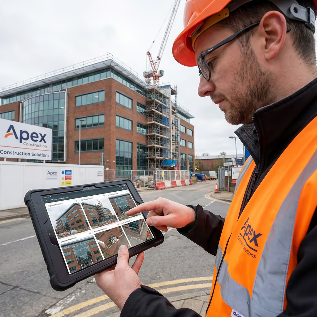
What Deliverables Do You Get From a Drone Facade Survey?
We tailor deliverables to your project requirements, but our standard drone facade survey outputs include:
High-Resolution Facade Imagery
Complete photographic record of all facades at 2-5mm resolution, organised by elevation with metadata.
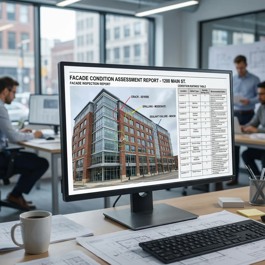
Defect Report
Comprehensive report detailing all identified defects with severity ratings, locations, and recommended actions.
Condition Mapping
Elevation drawings with defects plotted and colour-coded by severity (red/amber/green) for visual assessment.
3D Models (Optional)
Photogrammetric 3D model of building facades for measurement, visualisation, and BIM integration.
CAD Drawings (Optional)
Scaled elevation drawings in DWG/DXF format with defect annotations for use in remediation planning.
Need specific deliverables for your project?
How Long Does a Drone Facade Survey Take?
On-site data capture is remarkably fast compared to traditional methods. A typical medium-rise building (4-8 storeys) can be surveyed in 2-4 hours, including all four elevations. High-rise buildings take longer but still complete in a single day in most cases.
Processing and report delivery depends on building complexity and required outputs. Standard deliverables are typically ready within 5-7 working days. For urgent projects, we offer expedited processing with 48-72 hour turnaround available at additional cost.
| Phase | Duration |
|---|---|
| Planning & Permissions | 1-3 days |
| On-Site Data Capture | 2-6 hours |
| Image Processing | 1-2 days |
| Defect Analysis | 2-3 days |
| Report & Deliverables | 1-2 days |
| Total (Standard) | 5-7 working days |
Express Processing Available
Need it faster? 48-72 hour turnaround available for urgent projects.

How Do I Choose a Drone Facade Survey Provider?
Not all drone facade survey providers are equal. When evaluating providers, we recommend checking these key factors:
- CAA authorisation – Ensure they hold valid GVC permissions for commercial operations near buildings
- Professional insurance – Public liability and professional indemnity cover appropriate to building surveys
- Building survey experience – Facade surveys require specific expertise beyond general drone photography
- Thermal imaging capability – Ask about their thermal cameras and analysis experience
- Report quality – Request sample reports to assess their analysis and presentation standards
At Drone Survey Services, we tick every box. We're CAA approved, fully insured, and have delivered facade inspections for residential blocks, commercial offices, heritage buildings, and industrial facilities throughout the UK.
Ready to work with a trusted facade survey provider?
Is Drone Facade Survey Cheaper Than Traditional Methods?
In virtually every scenario, yes—significantly. Traditional facade inspections require either scaffolding (expensive to erect and dismantle), cherry pickers (limited reach, requires road closures), or rope access teams (skilled labour, safety equipment, permits). These methods easily run into tens of thousands of pounds for high-rise buildings.
Our drone facade surveys capture equivalent or better data at a fraction of the cost. A building that might cost £15,000-£20,000 to scaffold for inspection can be surveyed by drone for £1,500-£3,000. The cost savings typically range from 60-80% compared to traditional methods, while delivering faster turnaround and often more comprehensive coverage.
Scaffolding
£15,000+
2-3 weeks setup
Rope Access
£5,000+
3-5 days on-site
Drone Facade Survey
£1,200+
Same day capture
Ready to Discuss Your Facade Inspection?
Expert advice • Tailored pricing • Response within 2 hours
James Leslie
Owner, Engineer & Drone Pilot
With extensive experience in building surveys and UAV operations, James personally oversees every facade inspection to ensure comprehensive coverage and professional delivery.
TLDR: Drone Facade Surveys Explained
Facade Survey Deliverables
- High-resolution facade imagery
- Defect reports with severity ratings
- Condition mapping (RAG)
- 3D models & measurements
- CAD drawings (DWG/DXF)
- Thermal anomaly analysis
Discuss Your Project
Get expert advice and tailored pricing.
Enterprise Equipment
Survey-Grade Drone Fleet
We don't use consumer mini drones like other providers. Our fleet consists of industrial, survey-grade aircraft purpose-built for capturing detailed, accurate datasets.

AgEagle eBee X
Professional fixed-wing for rapid terrain coverage

DJI Matrice 400
Engineered for excellence, designed for versatility

WingtraOne GEN II
Best-in-class surveying efficiency for large projects

DJI Matrice 350 RTK
Professional multi-payload platform for precision surveying

DJI Mavic 4E
Portable surveying powerhouse with RTK precision
DJI Matrice 300 RTK
Industry-leading inspection and mapping platform

DJI Matrice 4E
Precision survey drone with oblique capture
1 of 7
← Swipe to explore fleet →
Sensor Technology
Specialised Sensors for All Aerial Surveys
Our aircraft carry professional-grade sensors matched to your project requirements, from high-resolution photogrammetry to terrain-penetrating LiDAR.
LiDAR Sensors
Penetrate vegetation and capture precise terrain data with laser scanning technology.
Applications
- Forestry & vegetation mapping
- Terrain modelling under canopy
- Flood risk assessment
- Archaeological surveys
- Power line corridor mapping
Thermal Imaging
Detect heat signatures for building diagnostics, energy audits, and industrial inspections.
Applications
- Building thermal surveys
- Solar panel inspections
- Electrical fault detection
- Search and rescue
- Livestock monitoring
RGB & Photogrammetry
High-resolution imagery for detailed 3D models, orthomosaics, and visual inspections.
Applications
- Topographic surveys
- 3D model generation
- Progress monitoring
- Asset inspection
- Marketing photography
Need a specific sensor or payload?
Client Testimonials
Why Clients Rate Our Drone Survey Service 5 Stars
Don't just take our word for it. Here's what industry professionals say about working with us.
“By far the best drone surveying company I've used. Responsive, helpful and report quality is spot on. Extremely diligent in highlighting defects outside of scope. 10+ projects completed and never disappointed.”
Mark Reynolds
Building Surveyor
“DSS's drone roof survey was brilliant. James showed me everything wrong with my roof in about 30 minutes. Quick, professional and easy to understand.”
Helen Parker
Homeowner
“Fantastic company to do business with. Been working with the DSS team since 2021 and it's been an absolute pleasure. Highly recommended.”
Robert Hughes
Property Developer
Related Services
Drone Roof Inspection
Safe, detailed roof surveys without the need for scaffolding or access equipment.
Thermal Imaging
Identify heat loss, moisture ingress, and insulation defects with aerial thermal surveys.
Drone Survey
Comprehensive aerial surveys for land, construction sites, and infrastructure projects.