Flood Risk & Environmental
Drone Flood Risk Survey Services
Accurate elevation data for flood risk assessments, catchment mapping, and Environment Agency submissions. Survey-grade terrain models delivered fast.
Response within 2 hours • Or call 020 4634 0456
What Is a Drone Flood Risk Survey?
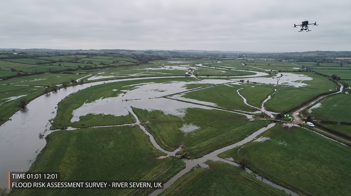
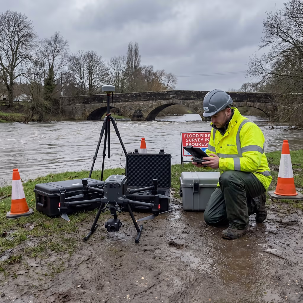
A drone flood risk survey uses UAV technology to capture highly accurate elevation data of land, rivers, and floodplains. This data forms the foundation of Flood Risk Assessments (FRAs) required for planning applications, insurance evaluations, and environmental impact studies across the UK.
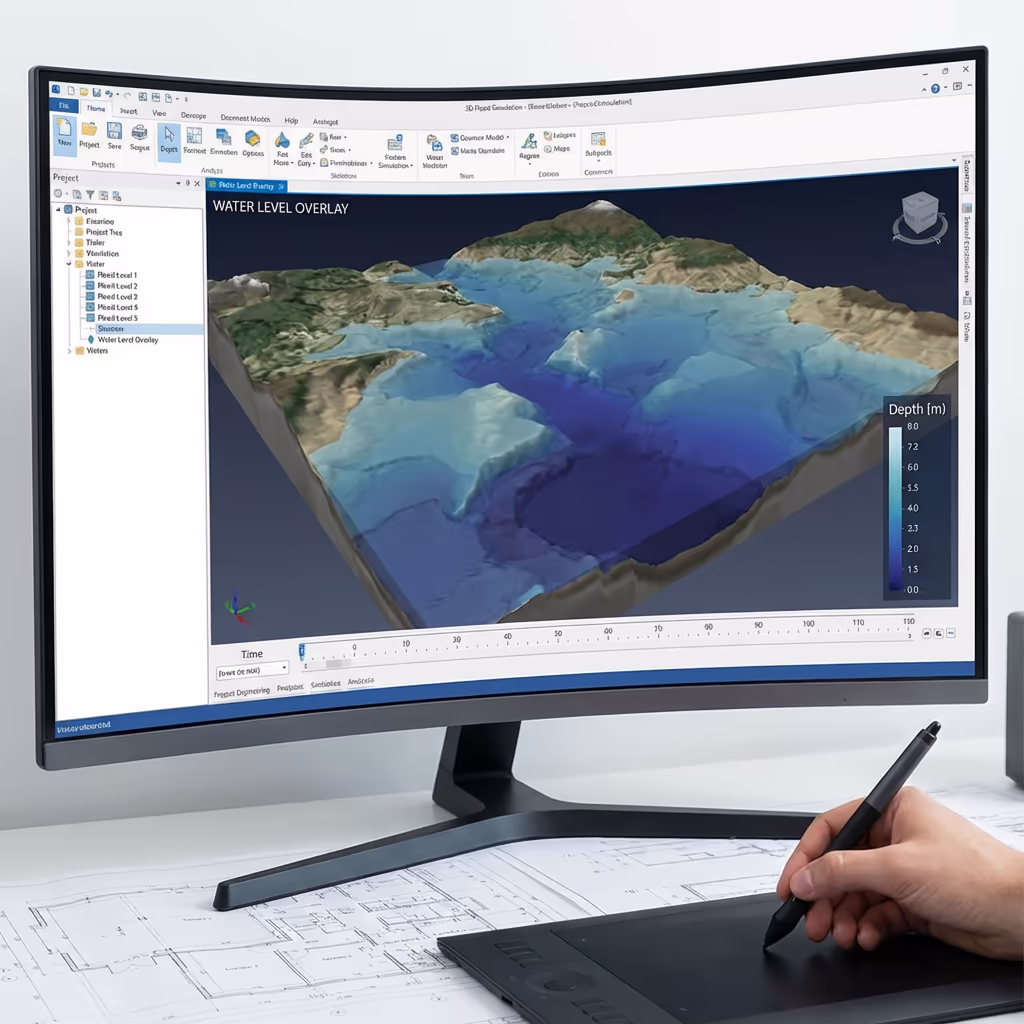
At Drone Survey Services, we deploy survey-grade drones with RTK positioning to capture centimetre-accurate terrain models. Our data supports flood modelling software, helping engineers and planners understand how water will behave during storm events and identify areas at risk of flooding.

James Leslie
Owner, Engineer & Drone Pilot
"Got questions about flood risk surveys? Call me directly - I'm happy to talk through your project."
Call NowFRA-Ready Survey Data,Delivered Fast
What You'll Receive
- Digital Terrain Model (DTM)
- Catchment boundary mapping
- Contours at specified intervals
- FRA-ready elevation data
Delivered in 5-7 working days
Why Choose Us
- CAA approved & fully insured
- Environment Agency compatible data
- Survey-grade accuracy (±2-5cm)
- UK-wide coverage
Trusted by environmental consultants, planners, and developers across the UK.
Trusted by leading organisations
How Much Does a Drone Flood Risk Survey Cost?
Pricing depends on catchment size, site complexity, and required deliverables. Here's a guide to help you budget:
| Catchment Size | Guide Price |
|---|---|
| Small CatchmentUnder 5 ha | £700+ |
| Medium Catchment5–20 ha | £1,400+ |
| Large Catchment20–50 ha | £2,500+ |
| Major Catchment50+ ha | POA |
| Post-Flood AssessmentAny size | POA |
*Guide prices include standard deliverables. Final quote based on site complexity, access, and specific requirements.
What affects your quote?
- Catchment area & terrain
- Required deliverables
- Turnaround time
- Access requirements
Our drone-based approach typically saves 40–60% compared to traditional ground surveys of flood-prone areas. Contact us with your project details and we'll provide a tailored quote within 24 hours.
Ready to get a quote for your flood risk project?
Free, no-obligation quotes within 24 hours
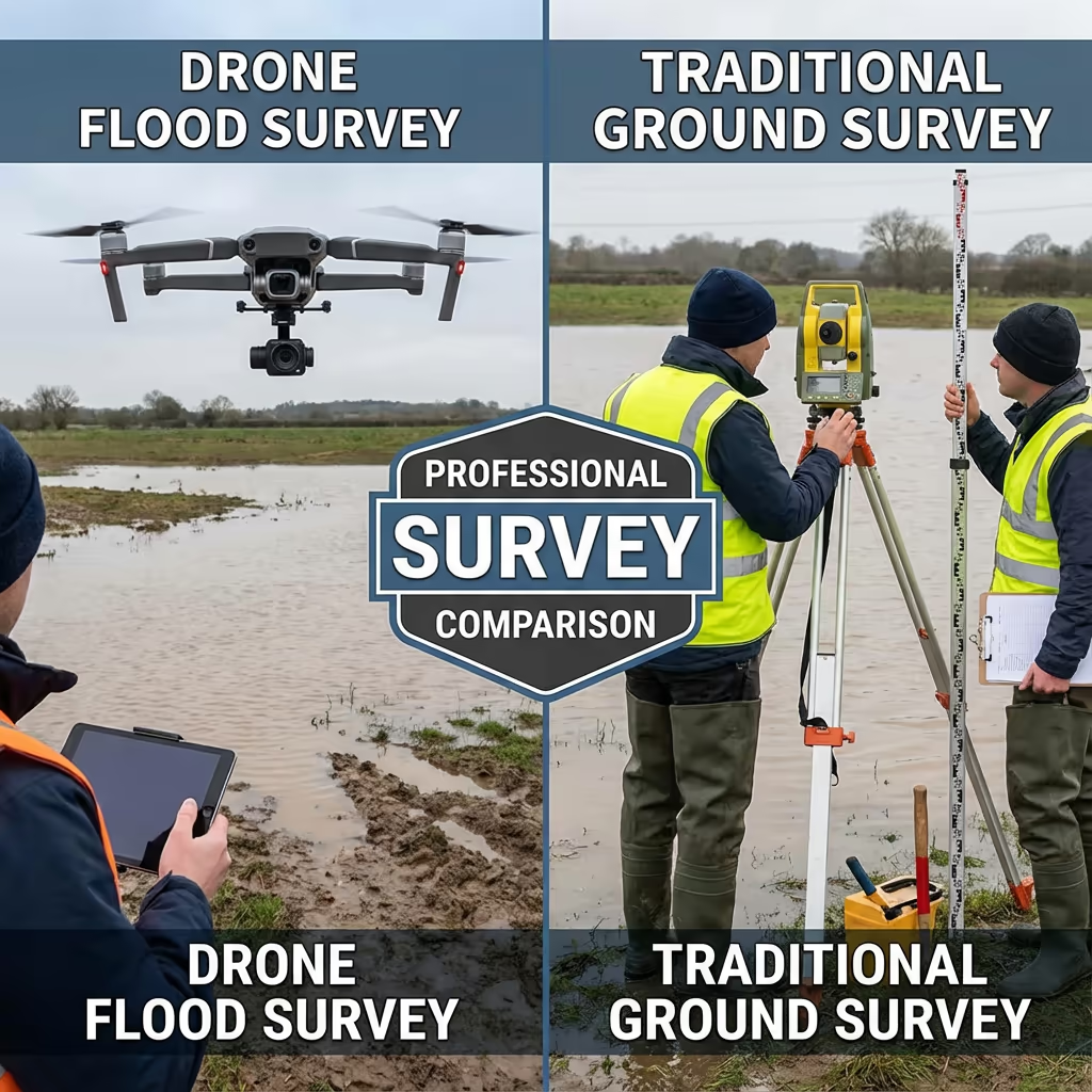
What Is the Difference Between Drone Flood Risk Survey and Traditional Methods?
Traditional flood risk surveys rely on ground-based survey teams manually collecting spot heights across floodplains. This approach is time-consuming, expensive, and often produces sparse data points that miss critical terrain features affecting water flow.
Drone flood risk surveys capture millions of elevation points in a fraction of the time, creating detailed terrain models that show every undulation, drainage channel, and flow path. This density of data produces more accurate flood models and identifies risks that traditional surveys might miss.
When to Choose Each Method
Choose Drone Survey
Faster & more detailed
Traditional Survey
When you might still need it
Not sure which approach suits your flood risk project?
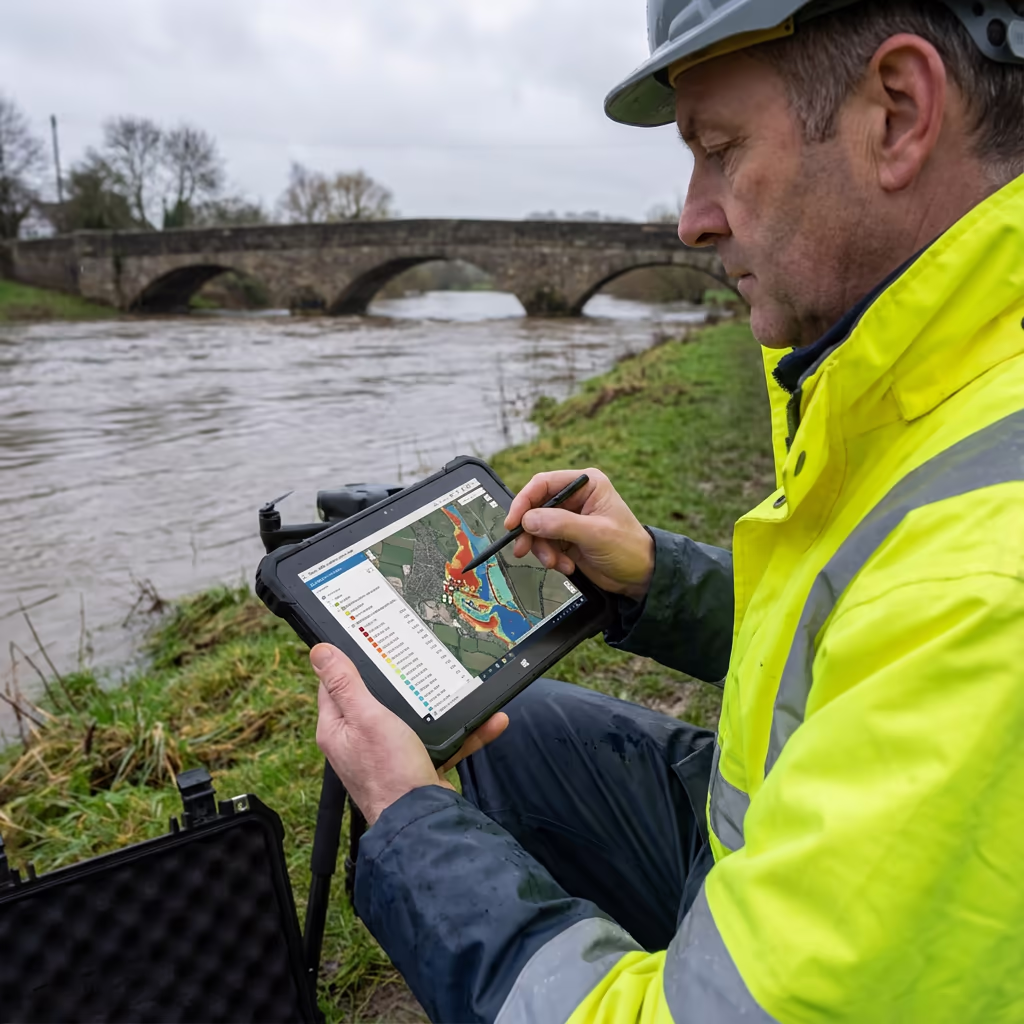
What Accuracy Can a Drone Flood Risk Survey Achieve?
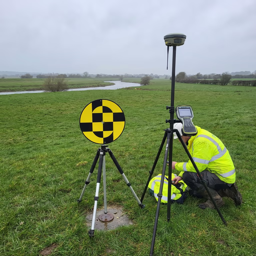
Our drone flood risk surveys achieve vertical accuracy of ±2-5cm and horizontal accuracy of ±5-10cm when using ground control points. This precision is critical for flood modelling, where even small elevation changes can significantly affect predicted water depths and flow patterns.
We use RTK/PPK-enabled drones with high-resolution sensors to capture dense point clouds. For Environment Agency submissions and planning applications, we establish surveyed ground control networks and provide full accuracy reports with every project. The resulting data exceeds the requirements for most Flood Risk Assessments and hydraulic modelling applications.
What Are the Applications of Drone Flood Risk Survey?
Drone flood risk surveys provide essential data across numerous applications where accurate elevation information determines project success:
Flood Risk Assessments (FRAs)
Planning application support with accurate terrain data for sequential and exception test submissions.
Drainage Design
SuDS design, surface water management, and drainage infrastructure planning with precise ground levels.
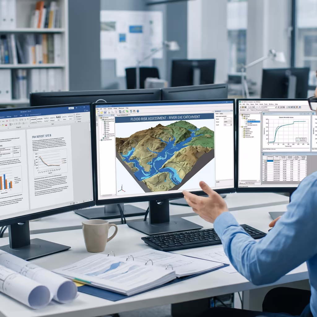
Hydraulic Modelling
DTM data for flood modelling software including TUFLOW, MIKE, and HEC-RAS applications.
Insurance Assessments
Property-level flood risk evaluation for insurance underwriting and risk management.
Natural Flood Management
Catchment analysis for NFM schemes, attenuation features, and environmental flood mitigation.
Post-Flood Assessment
Emergency response surveys to document flood extents, damage assessment, and recovery planning.
Have a flood risk project that needs survey data?
Can Drone Surveys Support Environment Agency Flood Assessments?
Yes—our drone flood risk survey data is specifically formatted to meet Environment Agency requirements. We understand the technical specifications needed for FRA submissions, pre-application discussions, and formal planning consultations with Lead Local Flood Authorities.
Our deliverables integrate directly with Environment Agency flood mapping data and modelling software. We provide data in standard formats (GeoTIFF, ASCII grid, LAS/LAZ) that hydraulic engineers can import directly into their flood models. We also supply accuracy statements and methodology reports required for regulatory submissions.
Whether you're working on a strategic flood risk assessment, site-specific FRA, or providing evidence for a planning appeal, our data provides the foundation for defensible conclusions about flood risk.
What Deliverables Do You Get From a Drone Flood Risk Survey?
We tailor deliverables to your specific flood risk application. Our standard outputs include:
Digital Terrain Model (DTM)
Bare-earth elevation model with vegetation removed. Essential for flood modelling and FRA submissions.
Digital Surface Model (DSM)
Top surface including buildings and vegetation. Useful for surface water flow analysis and visualisation.
Catchment Mapping
Watershed boundaries, flow accumulation analysis, and drainage catchment delineation.
Contours & Cross-Sections
Contour lines at your specified interval, plus river and channel cross-sections for hydraulic modelling.
CAD Files & GIS Data
DWG/DXF files for design software and georeferenced GIS formats (GeoTIFF, Shapefile, ASCII Grid).
FRA Support Data
Accuracy statements, methodology reports, and survey metadata for regulatory submissions.
Need specific deliverables for your FRA?
How Long Does a Drone Flood Risk Survey Take?
On-site data capture is remarkably efficient. A typical 10-hectare catchment survey takes just 2-3 hours of flight time, plus setup and ground control establishment. Larger catchments can be surveyed in a single day visit.
Processing and delivery depends on the complexity of deliverables required. Standard DTM and contour outputs are typically ready within 5-7 working days. For urgent FRA deadlines, we offer expedited processing with 48-72 hour turnaround available.
| Phase | Duration |
|---|---|
| Planning & Permissions | 1-3 days |
| On-Site Data Capture | ½-1 day |
| Data Processing | 2-3 days |
| Quality Control | 1-2 days |
| Total (Standard) | 5-7 working days |
Express Processing Available
Need data urgently for an FRA deadline? 48-72 hour turnaround available.
How Do I Choose a Drone Flood Risk Survey Provider?
Flood risk surveys require specific expertise beyond standard drone photography. When evaluating providers, check these key factors:
- CAA authorisation – Ensure they hold valid GVC or legacy PfCO permissions for commercial operations
- Flood risk expertise – Ask about their experience with FRAs and Environment Agency requirements
- Survey-grade accuracy – Confirm they use RTK/PPK positioning and ground control for precision work
- Compatible formats – Ensure they can deliver data in formats your hydraulic engineers need
- Professional insurance – Public liability and professional indemnity cover appropriate to your project
At Drone Survey Services, we tick every box. We're CAA approved, fully insured, and have delivered flood risk survey data for planning applications, major developments, and environmental projects throughout the UK.
Ready to work with a trusted flood risk survey provider?
Is Drone Flood Risk Survey Cheaper Than Traditional Methods?
In most scenarios, yes—significantly. Traditional ground surveys of floodplains require teams working in difficult terrain, often near water and in wet conditions. The time required to manually capture sufficient elevation points makes traditional surveys expensive, especially for larger catchments.
Our drone flood risk surveys capture equivalent or superior data in a fraction of the time. A catchment that might take a ground team several days can be surveyed in hours, with far denser data coverage. The cost savings typically range from 40-60% compared to traditional methods, while delivering faster turnaround and better data for flood modelling.
Ready to Discuss Your Flood Risk Project?
Expert advice • Tailored pricing • Response within 2 hours
James Leslie
Owner, Engineer & Drone Pilot
With extensive experience in surveying and UAV operations, James personally oversees every flood risk project to ensure survey-grade accuracy and professional delivery.
TLDR: Drone Flood Risk Surveys Explained
Flood Risk Deliverables
- Digital Terrain Model (DTM)
- Digital Surface Model (DSM)
- Catchment boundary mapping
- Contours & cross-sections
- CAD files (DWG/DXF)
- FRA support documentation
Discuss Your Project
Get expert advice and tailored pricing for your flood risk survey.
Enterprise Equipment
Survey-Grade Drone Fleet
We don't use consumer mini drones like other providers. Our fleet consists of industrial, survey-grade aircraft purpose-built for capturing detailed, accurate datasets.

AgEagle eBee X
Professional fixed-wing for rapid terrain coverage

DJI Matrice 400
Engineered for excellence, designed for versatility

WingtraOne GEN II
Best-in-class surveying efficiency for large projects

DJI Matrice 350 RTK
Professional multi-payload platform for precision surveying

DJI Mavic 4E
Portable surveying powerhouse with RTK precision
DJI Matrice 300 RTK
Industry-leading inspection and mapping platform

DJI Matrice 4E
Precision survey drone with oblique capture
1 of 7
← Swipe to explore fleet →
Sensor Technology
Specialised Sensors for All Aerial Surveys
Our aircraft carry professional-grade sensors matched to your project requirements, from high-resolution photogrammetry to terrain-penetrating LiDAR.
LiDAR Sensors
Penetrate vegetation and capture precise terrain data with laser scanning technology.
Applications
- Forestry & vegetation mapping
- Terrain modelling under canopy
- Flood risk assessment
- Archaeological surveys
- Power line corridor mapping
Thermal Imaging
Detect heat signatures for building diagnostics, energy audits, and industrial inspections.
Applications
- Building thermal surveys
- Solar panel inspections
- Electrical fault detection
- Search and rescue
- Livestock monitoring
RGB & Photogrammetry
High-resolution imagery for detailed 3D models, orthomosaics, and visual inspections.
Applications
- Topographic surveys
- 3D model generation
- Progress monitoring
- Asset inspection
- Marketing photography
Need a specific sensor or payload?
Client Testimonials
Why Clients Rate Our Drone Survey Service 5 Stars
Don't just take our word for it. Here's what industry professionals say about working with us.
“By far the best drone surveying company I've used. Responsive, helpful and report quality is spot on. Extremely diligent in highlighting defects outside of scope. 10+ projects completed and never disappointed.”
Mark Reynolds
Building Surveyor
“DSS's drone roof survey was brilliant. James showed me everything wrong with my roof in about 30 minutes. Quick, professional and easy to understand.”
Helen Parker
Homeowner
“Fantastic company to do business with. Been working with the DSS team since 2021 and it's been an absolute pleasure. Highly recommended.”
Robert Hughes
Property Developer