Forestry & Woodland
Drone Forestry Survey Services
Comprehensive aerial surveys for woodland management, timber inventory, and forest health assessment using advanced drone technology.
Response within 2 hours • Or call 020 4634 0456
What Is a Drone Forestry Survey?
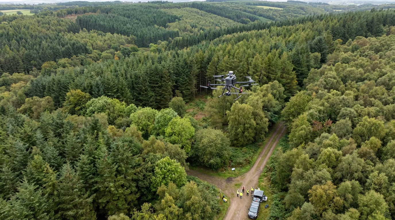
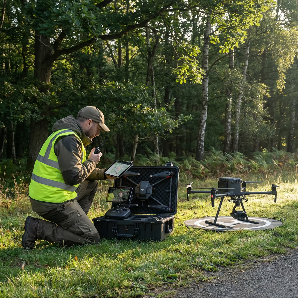
A drone forestry survey uses UAV-mounted sensors to capture detailed aerial data about woodland areas, individual trees, and forest health. Unlike traditional ground-based methods, our drones can cover vast areas quickly while collecting high-resolution imagery and precise elevation data.
At Drone Survey Services, we combine photogrammetry and LiDAR technology to deliver comprehensive forest inventories. Our surveys measure tree heights, canopy density, species distribution, and timber volume—giving forestry managers the data they need for informed decision-making.

James Leslie
Owner, Engineer & Drone Pilot
"Got questions? Call me directly - I'm happy to talk through your project."
Call NowProfessional Forestry Data,Delivered Fast
What You'll Receive
- Detailed canopy height mapping
- Tree count and species analysis
- Timber volume estimates
- Health assessment reports
Delivered in 5-10 working days
Why Choose Us
- CAA approved & fully insured
- Forestry survey specialists
- LiDAR & photogrammetry capability
- UK-wide coverage
Trusted by estate managers, forestry companies & environmental consultants across the UK.
Trusted by leading organisations
How Much Does a Drone Forestry Survey Cost?
Pricing depends on your woodland size and required deliverables. Here's a guide to help you budget:
| Woodland Size | Guide Price |
|---|---|
| Small WoodlandUnder 10 ha | £600+ |
| Medium Woodland10–50 ha | £1,400+ |
| Large Forest50–200 ha | £3,000+ |
| Major Forest200+ ha | POA |
| Annual MonitoringRepeat surveys | POA |
*Guide prices include standard deliverables. Final quote based on site access, terrain complexity, and specific requirements.
What affects your quote?
- Woodland area & terrain
- Required deliverables
- Tree density & species
- Access requirements
Our drone-based approach typically saves 50–70% compared to traditional ground-based forest inventory. Contact us with your project details and we'll provide a tailored quote within 24 hours.
Ready to get a quote for your woodland?
Free, no-obligation quotes within 24 hours
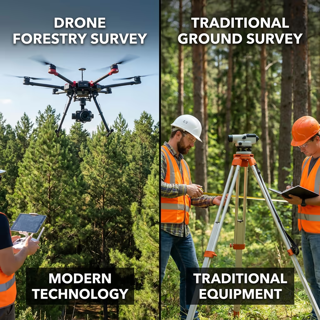
What Is the Difference Between Drone Forestry Survey and Traditional Methods?
Traditional forest inventory relies on sample plots—surveyors walk through the woodland measuring a fraction of trees and extrapolating results. While this method has served forestry for decades, it's time-consuming, labour-intensive, and limited in coverage.
Drone forestry surveys capture the entire woodland from above, measuring every tree rather than just sample plots. Our UAVs collect thousands of data points per hectare, creating complete canopy height models and enabling individual tree detection. This means better accuracy, faster results, and no disturbance to wildlife or sensitive habitats.
When to Choose Each Method
Choose Drone Survey
Complete woodland coverage
Traditional Methods
Sample-based estimates
Not sure which approach suits your woodland?
What Accuracy Can a Drone Forestry Survey Achieve?
Our drone forestry surveys achieve tree height accuracy of ±0.5-1.5 metres using photogrammetry, improving to ±0.2-0.5 metres with LiDAR. For individual tree detection, we consistently identify 85-95% of trees in the upper canopy, with detection rates depending on species mix and stand density.
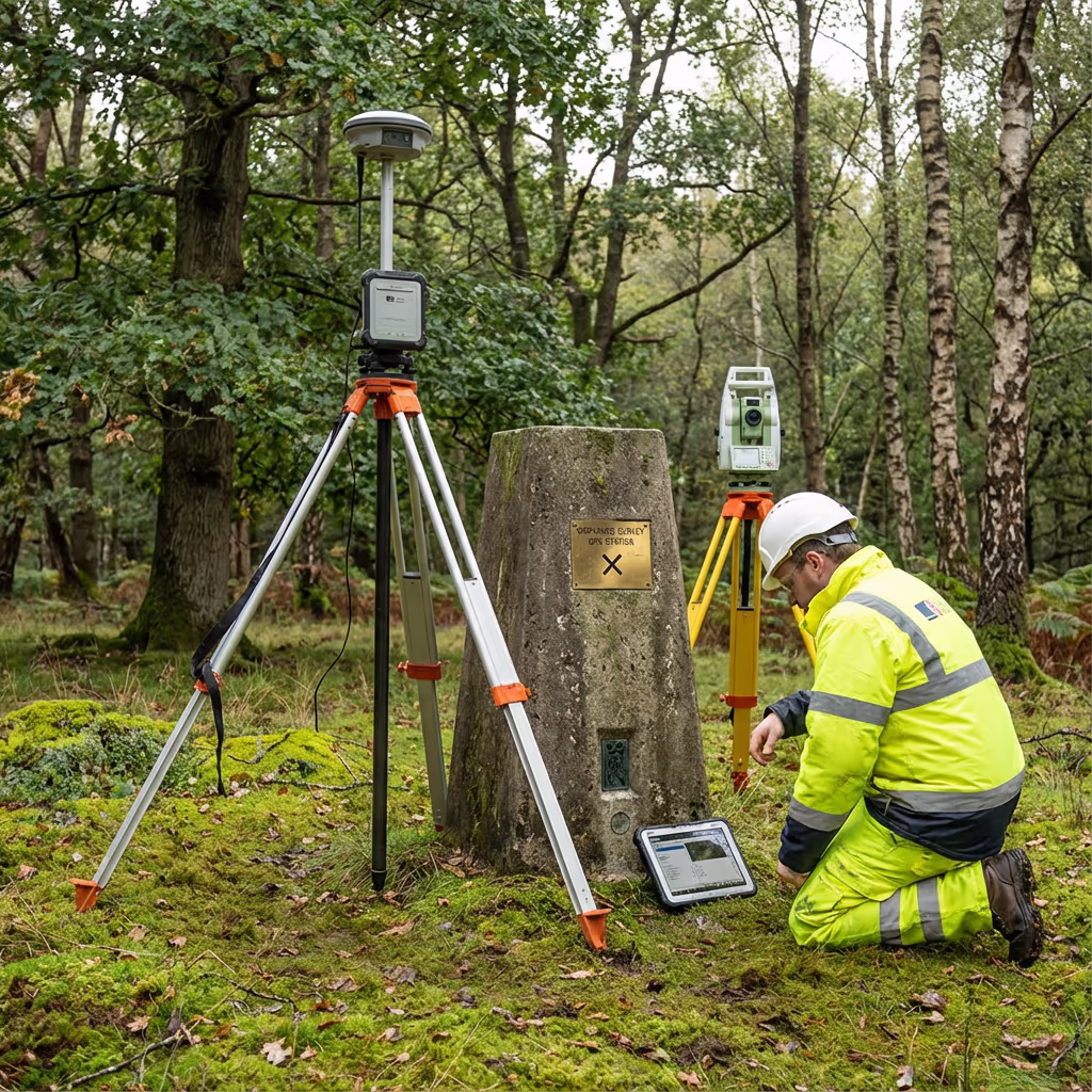
Positional accuracy depends on ground control. With RTK/PPK positioning and surveyed ground control points, we achieve horizontal accuracy of ±5cm and vertical accuracy of ±10cm. This level of precision supports timber volume calculations, carbon stock assessments, and detailed management planning.

What Are the Applications of Drone Forestry Survey?
Drone forestry surveys support the full lifecycle of woodland management. Here are the key applications where our clients see the greatest value:
Timber Inventory
Complete tree counts, height measurements, and volume estimates for harvest planning and timber sales.
Carbon Assessment
Accurate biomass estimation for carbon credit schemes, woodland carbon code projects, and environmental reporting.
Health Monitoring
Early detection of pest damage, disease spread, windthrow, and drought stress using multispectral analysis.
Woodland Creation
Baseline surveys for new planting schemes, survival assessments, and grant compliance monitoring.
Estate Management
Complete woodland mapping for estate valuations, management plans, and long-term strategic planning.
Conservation & Ecology
Habitat assessment, ancient woodland surveys, and biodiversity monitoring for environmental projects.
Have a woodland project that needs surveying?
Can Drones Measure Tree Heights and Timber Volume?
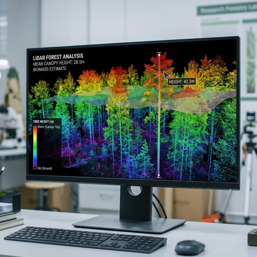
Yes—this is one of our core capabilities. Using photogrammetry and LiDAR, we create detailed Canopy Height Models (CHMs) that measure the height of every tree in your woodland. Combined with species information and diameter estimates, we calculate standing timber volume with commercial accuracy.
Our LiDAR surveys penetrate the canopy to map the ground surface beneath, giving us true tree heights rather than estimates. For conifer plantations, we achieve volume accuracy within 10-15% of traditional ground surveys—but covering 100% of trees rather than sample plots.
We can also track changes over time, comparing surveys to measure growth rates, monitor thinning operations, and assess storm damage. This data supports harvest scheduling, timber valuations, and long-term yield planning.

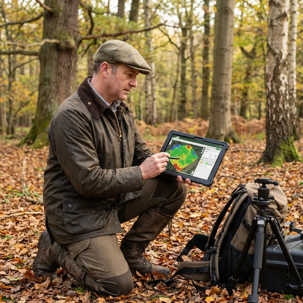
What Deliverables Do You Get From a Drone Forestry Survey?
We tailor deliverables to your project requirements, but our standard forestry survey outputs include:
Canopy Height Model (CHM)
Detailed height mapping showing tree heights across your entire woodland. Essential for volume calculations and growth monitoring.
Tree Height Analysis
Individual tree heights extracted from CHM data, with statistical summaries including mean, max, and distribution analysis.
Timber Volume Estimates
Standing volume calculations using allometric equations calibrated to UK forestry standards. Broken down by compartment or custom zones.
Health Assessment
Canopy density analysis, stress indicators, and identification of areas requiring attention. Optional multispectral analysis available.
CAD Files & 3D Models
Boundary mapping, access routes, and compartment data in AutoCAD format. Plus textured 3D models for visualisation and planning.
Need specific deliverables for your project?
How Long Does a Drone Forestry Survey Take?
On-site data capture is remarkably efficient. We can survey 30-80 hectares per day depending on terrain and flight conditions. A typical 20-hectare woodland takes half a day of flight time, plus setup and ground control establishment.
Processing and delivery depends on the complexity of analysis required. Standard canopy mapping and height analysis is typically ready within 5-7 working days. Full timber volume analysis with detailed reporting takes 7-10 working days. We'll confirm realistic timescales when we quote your project.
| Phase | Duration |
|---|---|
| Planning & Permissions | 1-3 days |
| On-Site Data Capture | ½-1 day |
| Data Processing | 2-3 days |
| Analysis & QC | 2-4 days |
| Report Generation | 1-2 days |
| Total (Standard) | 5-10 working days |
Express Processing Available
Need it faster? Priority processing available for urgent projects.

How Do I Choose a Drone Forestry Survey Provider?
Not all drone survey companies understand forestry. When evaluating providers, we recommend checking these key factors:
- Forestry experience – Ask for examples of woodland surveys they've completed and references from forestry clients
- CAA authorisation – Ensure they hold valid GVC or legacy PfCO permissions for commercial operations
- LiDAR capability – For accurate ground surface mapping under canopy, LiDAR is essential
- Processing expertise – Tree detection and volume estimation require specialist software and knowledge
- Professional insurance – Public liability and professional indemnity cover appropriate to your project
At Drone Survey Services, we tick every box. We're CAA approved, fully insured, and have delivered forestry surveys for private estates, forestry companies, and environmental consultancies throughout the UK.
Ready to work with a trusted forestry survey provider?
Is Drone Forestry Survey Cheaper Than Traditional Methods?
In most cases, yes—substantially. Traditional forest inventory requires teams of surveyors walking through woodland measuring sample plots. For a 50-hectare site, this might take a ground team 5-7 days of fieldwork, plus office time for analysis and reporting.
Our drone surveys capture equivalent or better data in a fraction of the time. That same 50-hectare woodland can be flown in a single day, with complete coverage rather than sample-based estimates. The cost savings typically range from 50-70% compared to traditional methods, while delivering faster turnaround and more comprehensive data.
Ready to Discuss Your Forestry Project?
Expert advice • Tailored pricing • Response within 2 hours
James Leslie
Owner, Engineer & Drone Pilot
With extensive experience in surveying and UAV operations, James personally oversees every forestry project to ensure accurate data and professional delivery.
TLDR: Drone Forestry Surveys Explained
Forestry Deliverables
- Canopy height mapping
- Tree height analysis
- Timber volume estimates
- Health assessment reports
- CAD files & boundaries
- 3D models & visualisation
Discuss Your Project
Get expert advice and tailored pricing.
Enterprise Equipment
Survey-Grade Drone Fleet
We don't use consumer mini drones like other providers. Our fleet consists of industrial, survey-grade aircraft purpose-built for capturing detailed, accurate datasets.

AgEagle eBee X
Professional fixed-wing for rapid terrain coverage

DJI Matrice 400
Engineered for excellence, designed for versatility

WingtraOne GEN II
Best-in-class surveying efficiency for large projects

DJI Matrice 350 RTK
Professional multi-payload platform for precision surveying

DJI Mavic 4E
Portable surveying powerhouse with RTK precision
DJI Matrice 300 RTK
Industry-leading inspection and mapping platform

DJI Matrice 4E
Precision survey drone with oblique capture
1 of 7
← Swipe to explore fleet →
Sensor Technology
Specialised Sensors for All Aerial Surveys
Our aircraft carry professional-grade sensors matched to your project requirements, from high-resolution photogrammetry to terrain-penetrating LiDAR.
LiDAR Sensors
Penetrate vegetation and capture precise terrain data with laser scanning technology.
Applications
- Forestry & vegetation mapping
- Terrain modelling under canopy
- Flood risk assessment
- Archaeological surveys
- Power line corridor mapping
Thermal Imaging
Detect heat signatures for building diagnostics, energy audits, and industrial inspections.
Applications
- Building thermal surveys
- Solar panel inspections
- Electrical fault detection
- Search and rescue
- Livestock monitoring
RGB & Photogrammetry
High-resolution imagery for detailed 3D models, orthomosaics, and visual inspections.
Applications
- Topographic surveys
- 3D model generation
- Progress monitoring
- Asset inspection
- Marketing photography
Need a specific sensor or payload?
Client Testimonials
Why Clients Rate Our Drone Survey Service 5 Stars
Don't just take our word for it. Here's what industry professionals say about working with us.
“By far the best drone surveying company I've used. Responsive, helpful and report quality is spot on. Extremely diligent in highlighting defects outside of scope. 10+ projects completed and never disappointed.”
Mark Reynolds
Building Surveyor
“DSS's drone roof survey was brilliant. James showed me everything wrong with my roof in about 30 minutes. Quick, professional and easy to understand.”
Helen Parker
Homeowner
“Fantastic company to do business with. Been working with the DSS team since 2021 and it's been an absolute pleasure. Highly recommended.”
Robert Hughes
Property Developer