Surveying & Mapping
Drone Industrial Survey Services
Comprehensive aerial surveys for industrial facilities, factories, warehouses, and manufacturing sites. Minimise downtime with rapid data capture.
Response within 2 hours • Or call 020 4634 0456
What Is a Drone Industrial Survey?
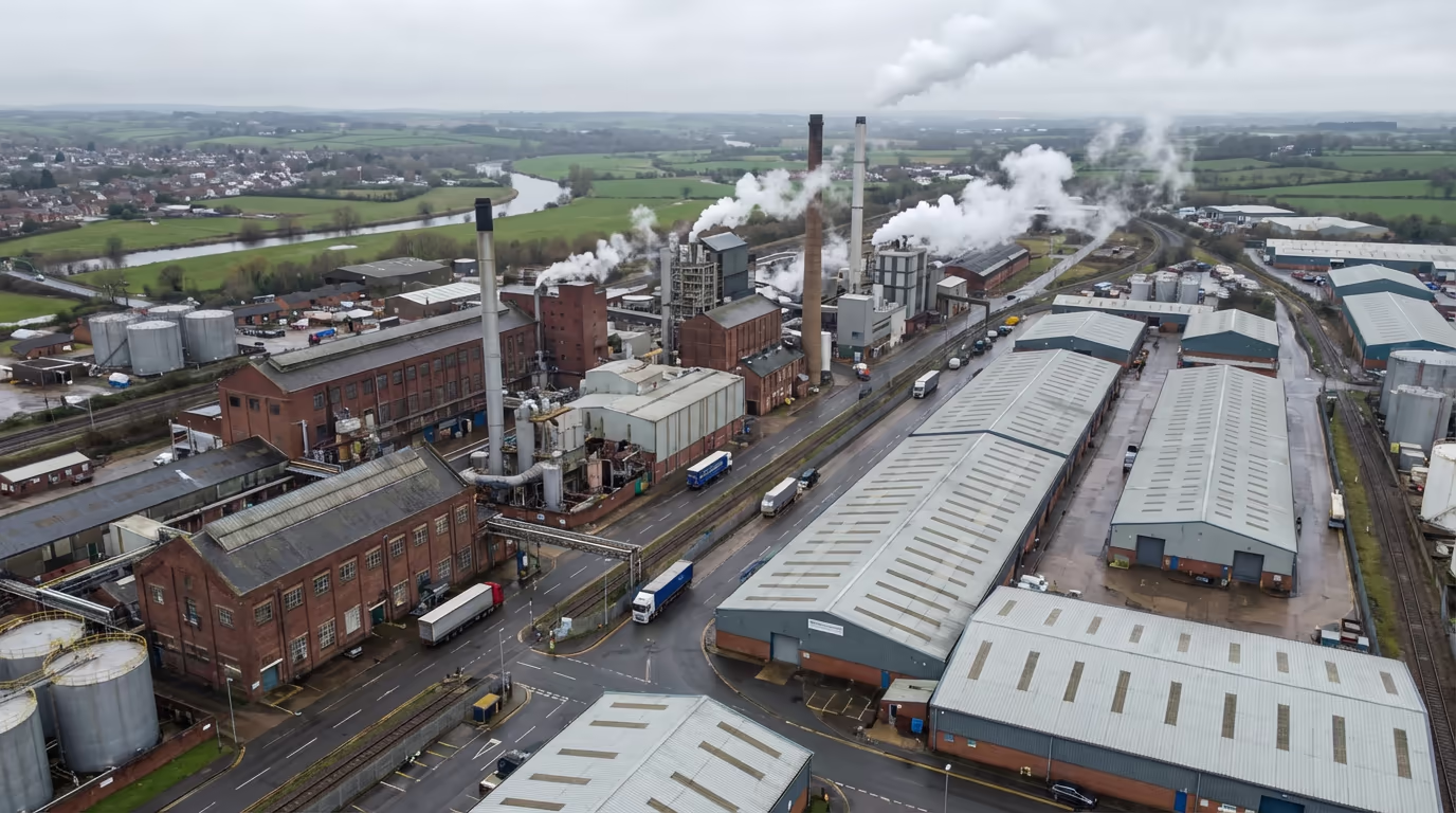
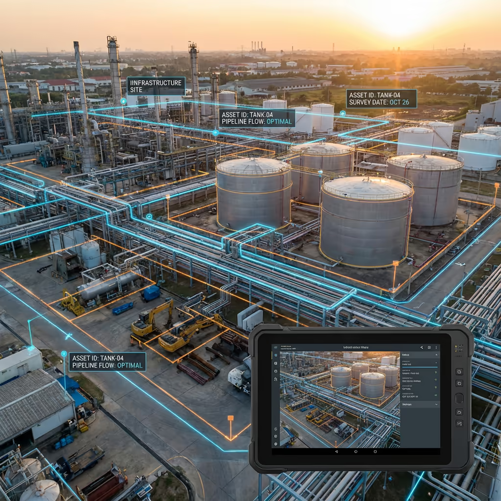
A drone industrial survey uses UAV technology to capture comprehensive aerial data of industrial facilities, manufacturing plants, warehouses, and production sites. Our drones equipped with high-resolution cameras and sensors can map entire facilities, inspect rooftops and infrastructure, and create detailed records of your industrial assets.
At Drone Survey Services, we specialise in surveys of active industrial sites across the UK. Our approach minimises operational disruption while delivering the accurate spatial data you need for facility management, maintenance planning, insurance documentation, and regulatory compliance.

James Leslie
Owner, Engineer & Drone Pilot
"Got questions? Call me directly - I'm happy to talk through your project."
Call NowIndustrial Survey Data,Minimal Downtime
What You'll Receive
- High-resolution site orthomosaic
- Detailed asset mapping
- Building & roof surveys
- CAD-ready drawings & 3D models
Delivered in 5-7 working days
Why Choose Us
- CAA approved & fully insured
- Active site experience
- Latest DJI enterprise drones
- UK-wide coverage
Trusted by facility managers, engineers & industrial operators across the UK.
Trusted by leading organisations
How Much Does a Drone Industrial Survey Cost?
Pricing depends on your facility size and requirements. Here's a guide to help you budget:
| Facility Size | Guide Price |
|---|---|
| SmallUnder 2 ha | £600+ |
| Medium2–10 ha | £1,200+ |
| Large10–25 ha | £2,200+ |
| Major Complex25+ ha | POA |
| With ThermalAny size | +£300 |
*Guide prices include standard deliverables. Final quote based on site complexity, access, and specific requirements.
What affects your quote?
- Site size & complexity
- Required deliverables
- Active operations
- Access & safety requirements
Our drone-based approach typically saves 40–60% compared to traditional ground surveys and scaffolding-based inspections. Contact us with your project details and we'll provide a tailored quote within 24 hours.
Ready to get a quote for your facility?
Free, no-obligation quotes within 24 hours
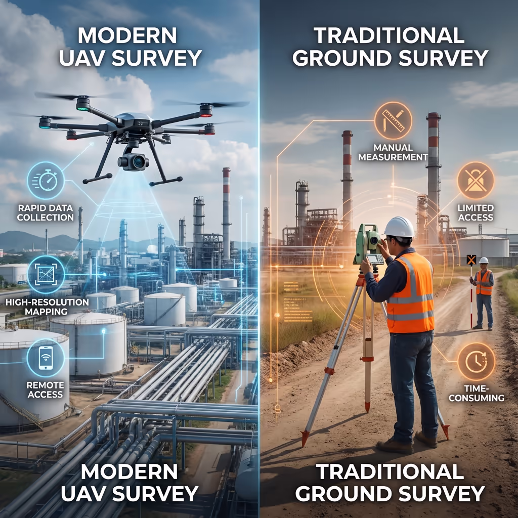
What Is the Difference Between Drone Industrial Survey and Traditional Methods?
Traditional industrial surveys typically require ground teams, scaffolding, cherry pickers, or rope access to inspect and measure facilities. This approach is time-consuming, expensive, and often requires shutting down operations for safety.
Drone industrial surveys capture the same data—and often more—from the air in a fraction of the time. Our UAVs can survey rooftops, facades, pipework, and storage tanks without scaffolding, reach areas inaccessible to ground teams, and capture data while your facility continues normal operations.
When to Choose Each Approach
Choose Drone Survey
Fast & non-disruptive
Choose Traditional
Detail & close access
Not sure which approach suits your facility?
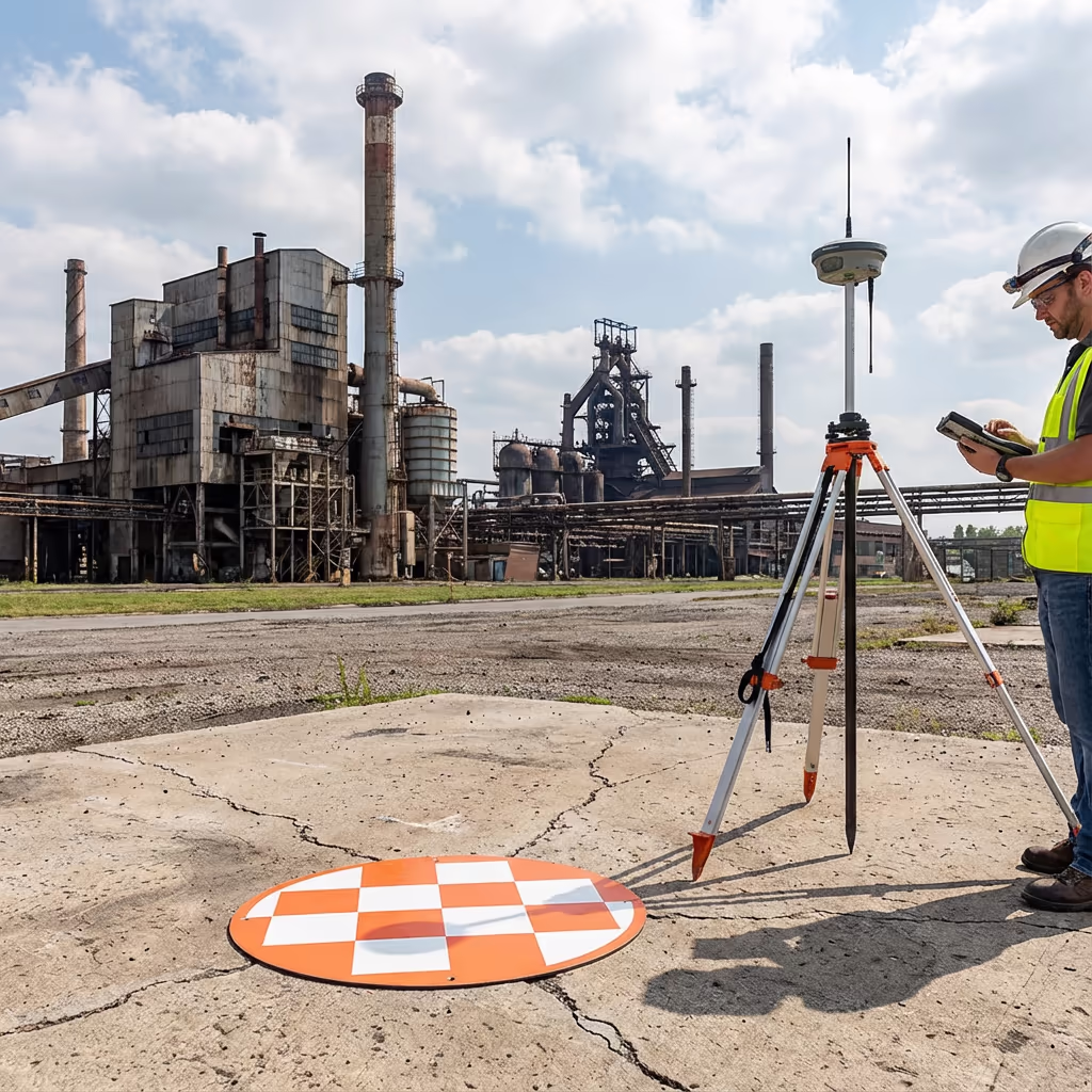
What Accuracy Can a Drone Industrial Survey Achieve?
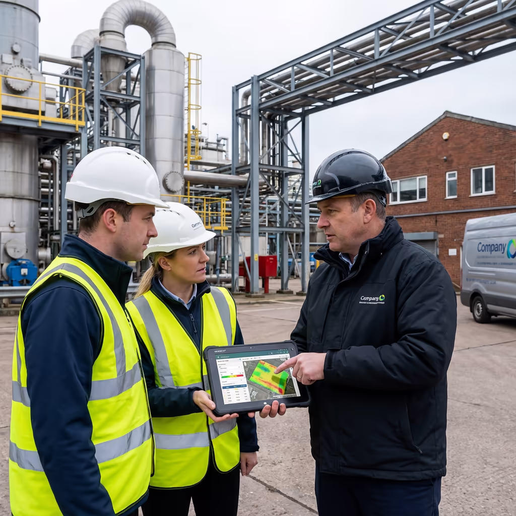
Our drone industrial surveys routinely achieve positional accuracy of ±2-3cm when using ground control points and RTK-enabled drones. This level of precision is suitable for asset management, facilities planning, insurance documentation, and most engineering applications.
For projects requiring higher accuracy, we can increase GCP density and employ specialist processing workflows. Our orthomosaics typically achieve ground sample distances (GSD) of 1-2cm per pixel, capturing detail down to individual bolts, joints, and surface defects visible from above.
What Are the Applications of Drone Industrial Survey?
Drone industrial surveys serve a wide range of industries and purposes. Here are the key applications where our clients see the greatest value:
Facility Management
Complete site mapping for asset registers, space planning, and facilities management systems integration.
Roof & Building Surveys
Condition assessments of roofs, cladding, and building fabric without scaffolding or disruption to operations.
Insurance & Compliance
Detailed visual records for insurance valuations, claims documentation, and regulatory compliance.
Infrastructure Mapping
Pipework, storage tanks, conveyors, and utility runs captured in precise 3D for maintenance planning.
Progress Monitoring
Regular survey flights to track construction, expansion, or remediation projects over time.
Site Security
Perimeter mapping, fence line surveys, and security assessments from comprehensive aerial imagery.
Have a facility that needs surveying?
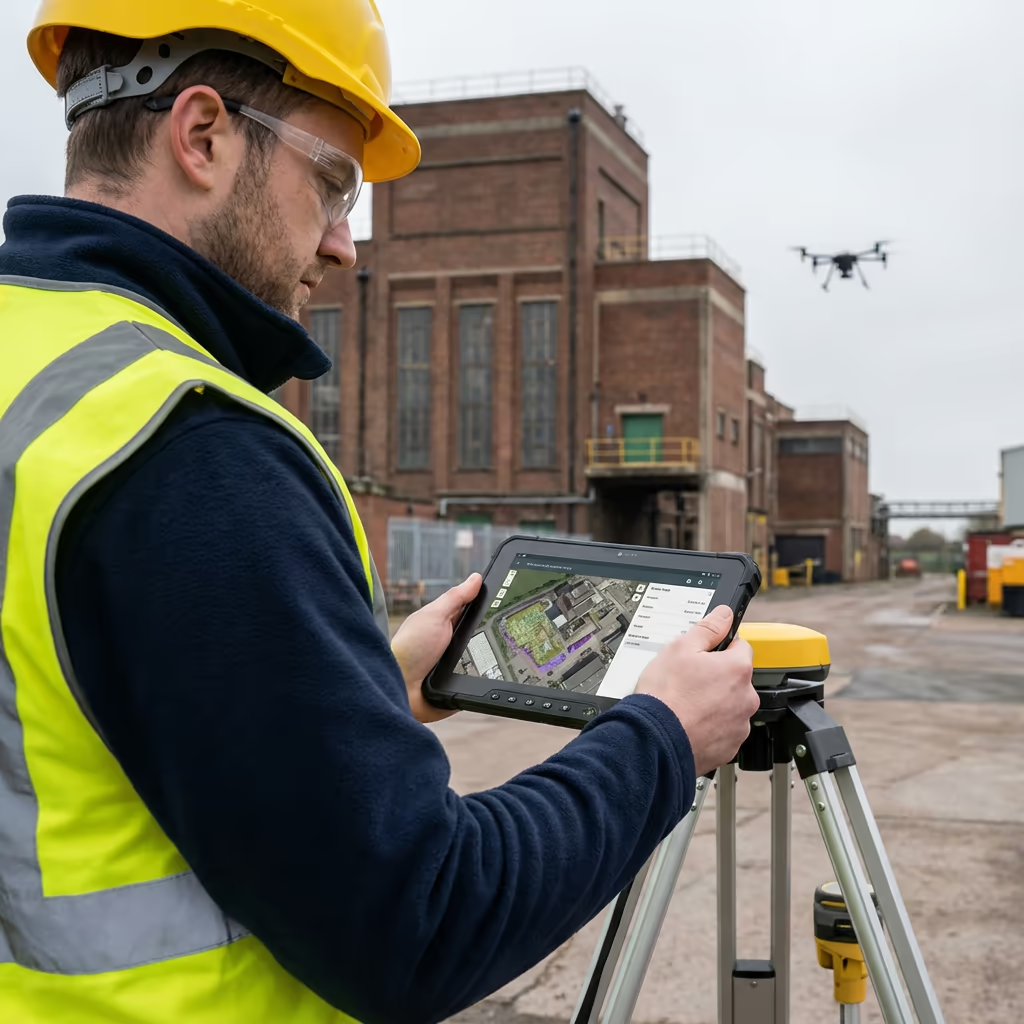
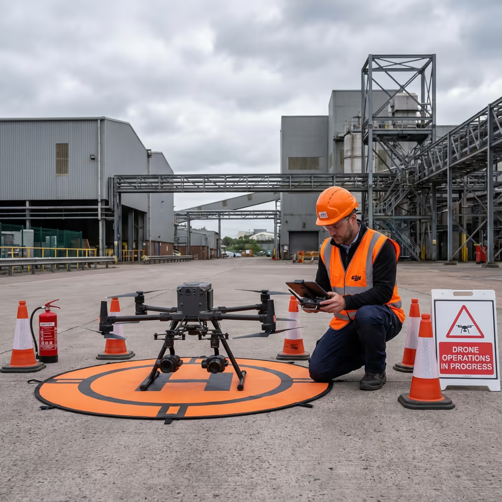
Can Drones Survey Active Industrial Sites?
Yes—this is one of the key advantages of drone surveys. Our pilots are trained in industrial safety protocols and hold relevant certifications for working on operational sites. We conduct thorough risk assessments before every flight and coordinate closely with your site management team.
We can operate around:
- Active production lines and manufacturing processes
- Vehicle and forklift movements
- Loading and unloading operations
- Ongoing maintenance activities
- Shift changes and personnel movements
For sites with specific hazards (chemical plants, refineries, etc.), we hold ATEX-rated equipment and can obtain additional permits as required. We work with your HSE team to ensure full compliance with site-specific safety requirements.

What Deliverables Do You Get From a Drone Industrial Survey?
We tailor deliverables to your specific requirements, but our standard industrial survey outputs include:
Site Orthomosaic
High-resolution, georeferenced aerial map of your entire facility. Perfect for GIS integration and as-built documentation.
Asset Mapping
Detailed inventory of visible assets including buildings, tanks, pipework, and infrastructure with precise locations.
Building Surveys
Roof condition reports, elevation imagery, and facade documentation for maintenance and insurance purposes.
Infrastructure Plans
Traced drawings of visible infrastructure including road layouts, drainage, and utility runs.
CAD Files & 3D Models
DWG/DXF files compatible with AutoCAD, plus 3D mesh models for visualisation and BIM integration.
Need specific deliverables for your facility?
How Long Does a Drone Industrial Survey Take?
On-site data capture is remarkably fast. We can survey most industrial facilities in half a day to a full day depending on size and complexity. A typical 10-hectare site takes 3-4 hours of flight time, plus setup, safety briefings, and ground control establishment.
Processing and delivery depends on your required outputs. Standard deliverables are typically ready within 5-7 working days. For urgent projects, we offer expedited processing with 48-72 hour turnaround available at additional cost.
| Phase | Duration |
|---|---|
| Planning & Coordination | 1-2 days |
| On-Site Data Capture | ½-1 day |
| Data Processing | 2-3 days |
| Deliverable Production | 2-3 days |
| Total (Standard) | 5-7 working days |
Express Processing Available
Need it faster? 48-72 hour turnaround available for urgent projects.
How Do I Choose a Drone Industrial Survey Provider?
Not all drone operators have the experience and credentials needed for industrial sites. When evaluating providers, we recommend checking these key factors:
- CAA authorisation – Ensure they hold valid GVC or legacy PfCO permissions for commercial operations
- Industrial site experience – Ask about previous work on operational facilities similar to yours
- Appropriate insurance – Public liability (£5M+) and professional indemnity cover
- Safety credentials – CSCS cards, site safety training, risk assessment capability
- Processing capability – In-house data processing and CAD production
At Drone Survey Services, we tick every box. We're CAA approved, carry £10M public liability insurance, and have delivered industrial surveys across manufacturing, logistics, energy, and chemical sectors throughout the UK.
Ready to work with an experienced industrial survey provider?
Is Drone Industrial Survey Cheaper Than Traditional Methods?
In most cases, significantly cheaper. Traditional roof surveys requiring scaffolding can cost £10,000+ just for access. Cherry pickers and MEWPs add hire costs, operator fees, and extended site time. Ground-based surveys of large facilities require multiple days of surveyor time.
Our drone surveys capture equivalent or better data in a fraction of the time and cost. A complete facility survey that might take a ground team a week can be flown in hours. The cost savings typically range from 40-70% compared to traditional methods, with the added benefit of minimal operational disruption.
Ready to Discuss Your Industrial Survey?
Expert advice • Tailored pricing • Response within 2 hours
James Leslie
Owner, Engineer & Drone Pilot
With extensive experience surveying operational industrial sites, James personally oversees every project to ensure accurate data capture and professional delivery.
TLDR: Drone Industrial Surveys Explained
Industrial Survey Deliverables
- Site orthomosaic
- Asset mapping
- Building surveys
- Infrastructure plans
- CAD files (DWG/DXF)
- 3D models
Discuss Your Facility
Get expert advice and tailored pricing.
Enterprise Equipment
Survey-Grade Drone Fleet
We don't use consumer mini drones like other providers. Our fleet consists of industrial, survey-grade aircraft purpose-built for capturing detailed, accurate datasets.

AgEagle eBee X
Professional fixed-wing for rapid terrain coverage

DJI Matrice 400
Engineered for excellence, designed for versatility

WingtraOne GEN II
Best-in-class surveying efficiency for large projects

DJI Matrice 350 RTK
Professional multi-payload platform for precision surveying

DJI Mavic 4E
Portable surveying powerhouse with RTK precision
DJI Matrice 300 RTK
Industry-leading inspection and mapping platform

DJI Matrice 4E
Precision survey drone with oblique capture
1 of 7
← Swipe to explore fleet →
Sensor Technology
Specialised Sensors for All Aerial Surveys
Our aircraft carry professional-grade sensors matched to your project requirements, from high-resolution photogrammetry to terrain-penetrating LiDAR.
LiDAR Sensors
Penetrate vegetation and capture precise terrain data with laser scanning technology.
Applications
- Forestry & vegetation mapping
- Terrain modelling under canopy
- Flood risk assessment
- Archaeological surveys
- Power line corridor mapping
Thermal Imaging
Detect heat signatures for building diagnostics, energy audits, and industrial inspections.
Applications
- Building thermal surveys
- Solar panel inspections
- Electrical fault detection
- Search and rescue
- Livestock monitoring
RGB & Photogrammetry
High-resolution imagery for detailed 3D models, orthomosaics, and visual inspections.
Applications
- Topographic surveys
- 3D model generation
- Progress monitoring
- Asset inspection
- Marketing photography
Need a specific sensor or payload?
Client Testimonials
Why Clients Rate Our Drone Survey Service 5 Stars
Don't just take our word for it. Here's what industry professionals say about working with us.
“By far the best drone surveying company I've used. Responsive, helpful and report quality is spot on. Extremely diligent in highlighting defects outside of scope. 10+ projects completed and never disappointed.”
Mark Reynolds
Building Surveyor
“DSS's drone roof survey was brilliant. James showed me everything wrong with my roof in about 30 minutes. Quick, professional and easy to understand.”
Helen Parker
Homeowner
“Fantastic company to do business with. Been working with the DSS team since 2021 and it's been an absolute pleasure. Highly recommended.”
Robert Hughes
Property Developer