Land & Property
Drone Land Survey Services
Fast, accurate aerial surveys for boundary mapping, area calculations, and detailed land assessment across the UK.
Response within 2 hours • Or call 020 4634 0456
What Is a Drone Land Survey?
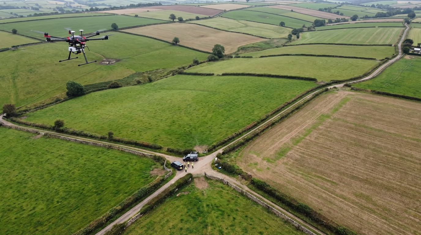
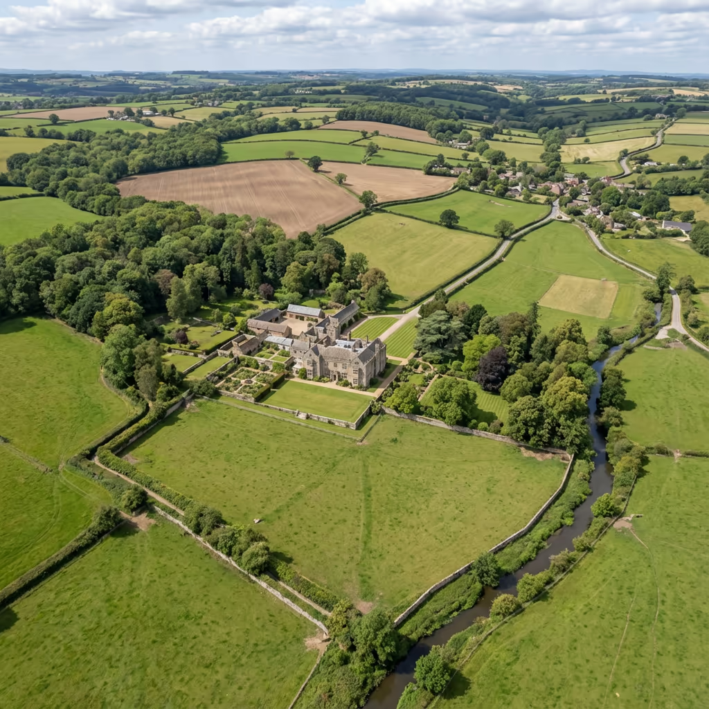
A drone land survey uses aerial photography and photogrammetry to create precise maps and measurements of land parcels, boundaries, and terrain features. Our UAVs capture thousands of overlapping images which are processed to produce survey-grade orthomosaics, digital elevation models, and accurate area calculations.
At Drone Survey Services, we deploy the latest RTK-enabled drones to deliver centimetre-level accuracy across sites of any size. Whether you need to map a single field or survey an entire estate, our drone land surveys provide the detailed, georeferenced data you need for planning, management, and legal purposes.

James Leslie
Owner, Engineer & Drone Pilot
"Got questions? Call me directly - I'm happy to talk through your project."
Call NowProfessional Drone Land Survey Data,Delivered Fast
What You'll Receive
- High-resolution orthomosaic
- Digital Terrain Model (DTM)
- Accurate boundary mapping
- Survey-grade accuracy (±2-5cm)
Delivered in 3-5 working days
Why Choose Us
- CAA approved & fully insured
- RTK precision surveying
- Latest DJI drone technology
- UK-wide coverage
Trusted by landowners, farmers, and property professionals across the UK.
Trusted by leading organisations
How Much Does a Drone Land Survey Cost?
Pricing depends on your site size and requirements. Here's a guide to help you budget:
| Site Size | Guide Price |
|---|---|
| SmallUnder 5 ha | £600+ |
| Medium5–20 ha | £1,000+ |
| Large20–50 ha | £1,800+ |
| Estate50–100 ha | £3,000+ |
| Major100+ ha | POA |
*Guide prices include standard deliverables. Final quote based on site complexity, access, and specific requirements.
What affects your quote?
- Site size & complexity
- Required deliverables
- Turnaround time
- Access & location
Our drone-based approach typically saves 50–70% compared to traditional land surveys. Contact us with your project details and we'll provide a tailored quote within 24 hours.
Ready to get a quote for your land survey?
Free, no-obligation quotes within 24 hours
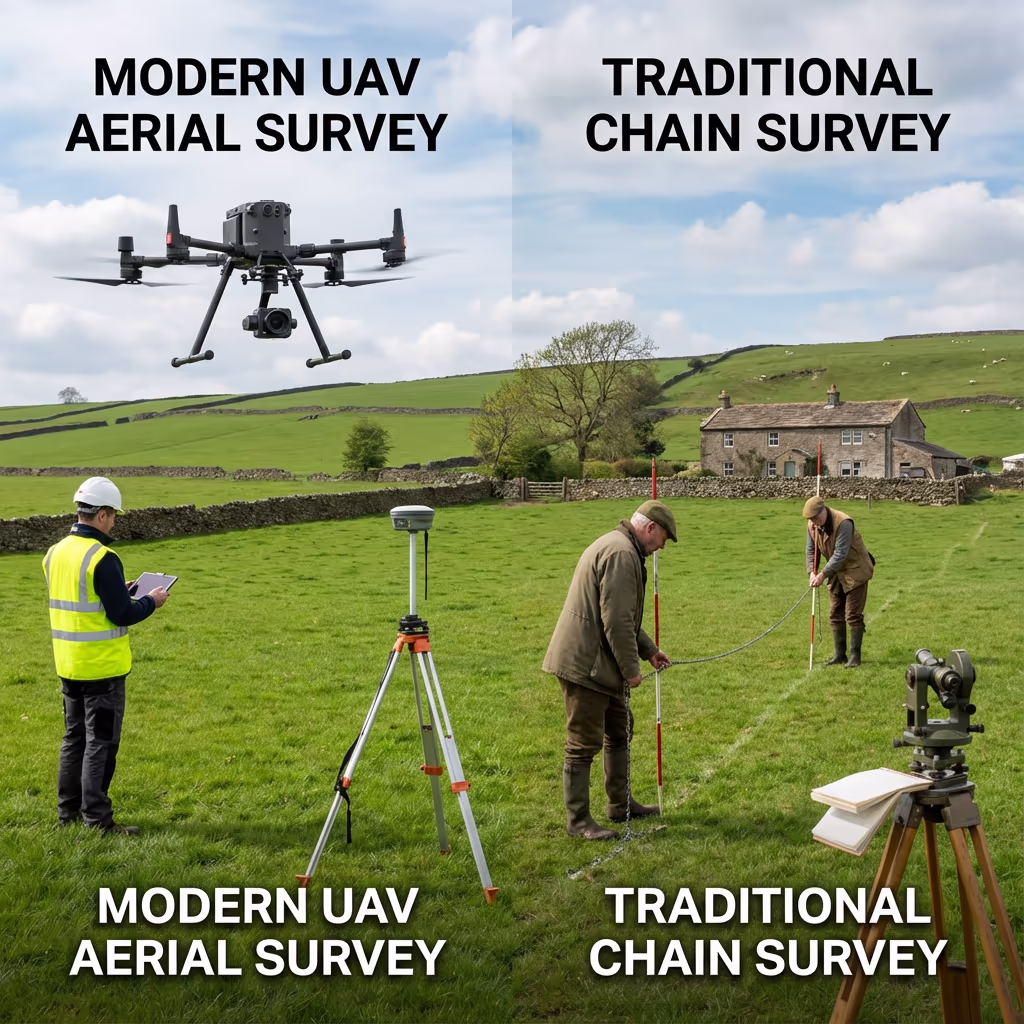
What Is the Difference Between Drone Land Survey and Traditional Methods?
Traditional land surveys rely on surveyors walking the site with total stations, GPS rovers, or even chain measurements. While accurate, these methods are time-consuming—especially on large sites—and can take days or weeks to complete.
Drone land surveys capture the same data in a fraction of the time. Our UAVs photograph the entire site from above, creating thousands of data points that we process into accurate maps and measurements. The result is comprehensive coverage that would be impractical to achieve on foot, delivered in days rather than weeks.
When to Choose Each Approach
Choose Drone Land Survey
Fast & comprehensive
Choose Traditional Survey
Detailed & precise
Not sure which approach suits your project?
What Accuracy Can a Drone Land Survey Achieve?
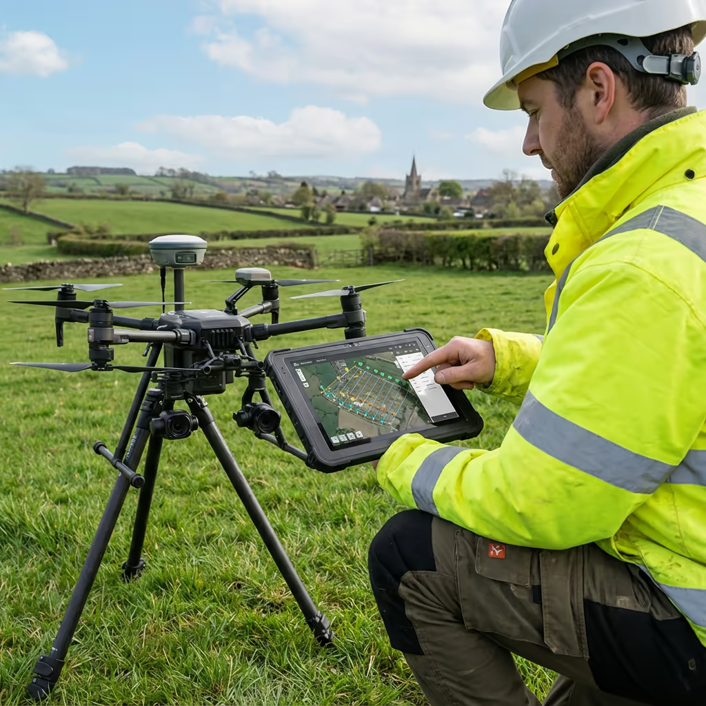
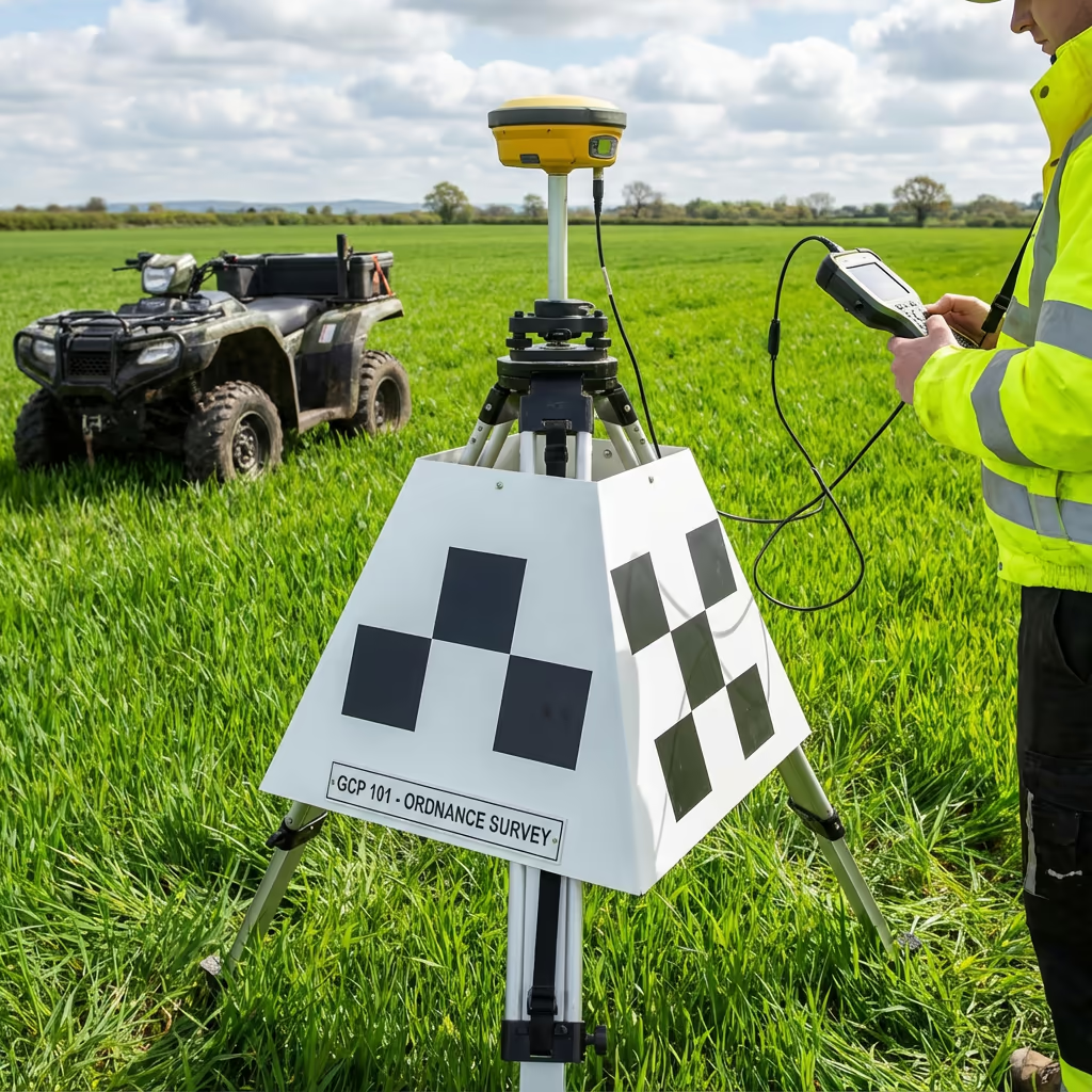
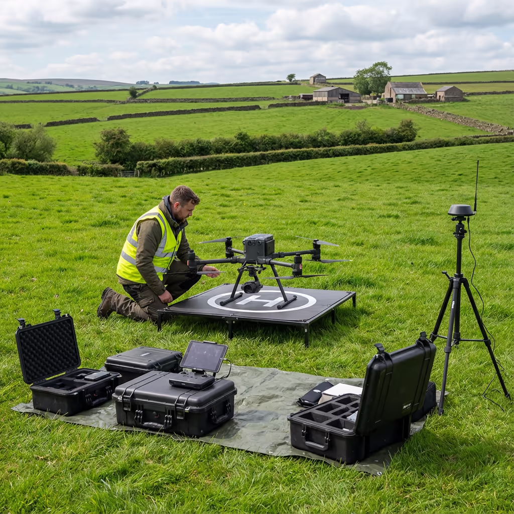
Our drone land surveys routinely achieve horizontal accuracy of ±2-3cm and vertical accuracy of ±3-5cm when using RTK positioning and ground control points. This level of precision meets the requirements for most planning, agricultural, and property management applications.
We use RTK-enabled drones that receive real-time corrections from base stations, ensuring every image is precisely georeferenced. For projects requiring the highest accuracy, we establish ground control networks and verify results against known survey points. The result is reliable, survey-grade data you can use with confidence.
What Are the Applications of Drone Land Survey?
Drone land surveys serve a wide range of purposes across agriculture, property, and development sectors. Here are the key applications where our clients see the greatest value:
Agricultural Land
Farm boundary mapping, field area calculations, crop planning, and agricultural subsidy applications (BPS/SFI).
Property Sales & Purchase
Accurate land area verification for property transactions, estate agent marketing, and due diligence requirements.
Planning Applications
Site surveys for planning submissions, existing site plans, and red line boundary mapping for development proposals.
Estate Management
Comprehensive estate mapping, tenant boundary verification, woodland and amenity area calculations.
Boundary Disputes
Evidence gathering for boundary disagreements, historical feature identification, and comparison with title plans.
Land Registry Updates
Accurate surveys for first registration, boundary amendments, and subdivision of land parcels.
Have a land survey project in mind?
How Much Land Can a Drone Survey in a Day?
Our drones can survey remarkably large areas in a single day. For standard land mapping at 2-3cm resolution, we typically cover 100-200 hectares per day depending on terrain complexity and flight conditions. This represents a significant efficiency gain over traditional methods.
For higher resolution surveys (1cm or better), coverage reduces to around 50-80 hectares per day. Multiple battery sets and efficient flight planning allow us to maximise productive time on site. Even the largest estates can typically be surveyed within 2-3 days, with processed deliverables following within a week.
200ha
Max daily coverage
2-3cm
Standard resolution
45min
Per battery flight
1000+
Images per flight
What Deliverables Do You Get From a Drone Land Survey?
We tailor deliverables to your project requirements, but our standard drone land survey outputs include:
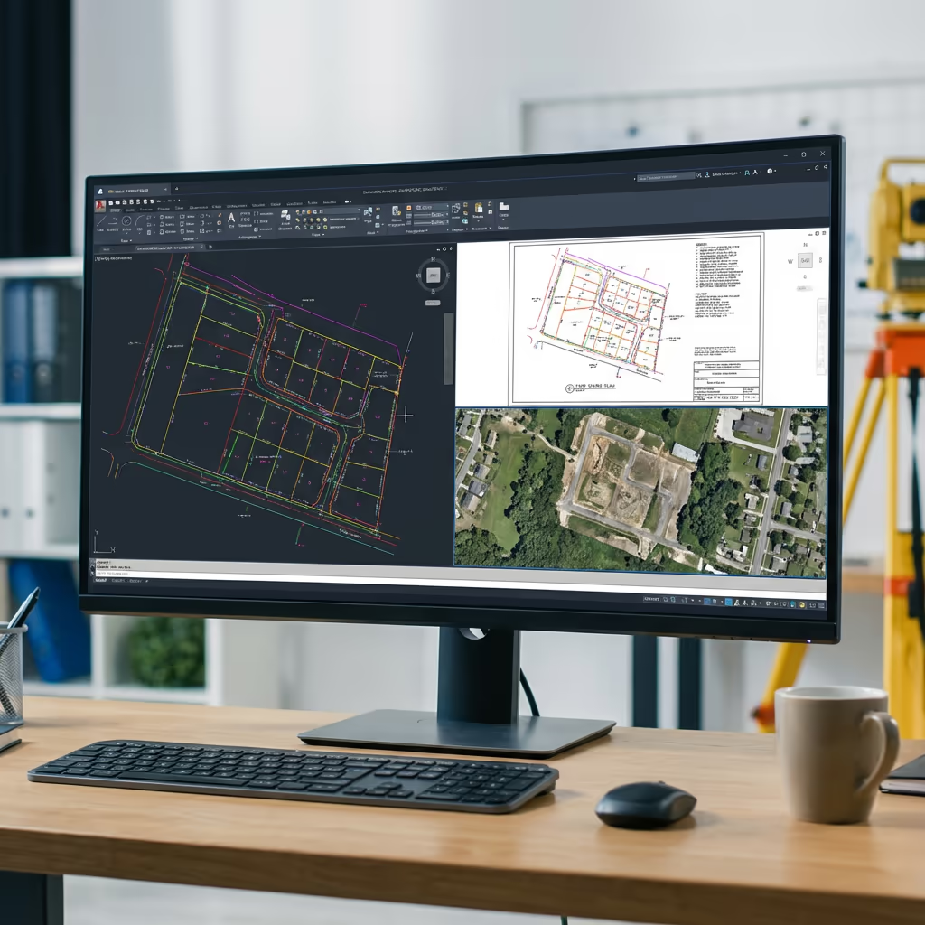
High-Resolution Orthomosaic
Georeferenced aerial imagery of your entire site, stitched into a single accurate map. Perfect for visual reference and GIS integration.
Digital Terrain Model (DTM)
Bare-earth surface model showing ground elevation. Essential for drainage planning, earthworks, and level analysis.
Digital Surface Model (DSM)
Top surface including vegetation, buildings, and features. Used for visibility analysis and feature mapping.
Boundary Mapping
Clear delineation of land boundaries, hedgerows, fences, and other boundary features with accurate measurements.
Area Calculations & CAD Files
Precise area measurements in hectares/acres, plus DWG/DXF files compatible with AutoCAD and other CAD software.
Need specific deliverables for your project?
How Long Does a Drone Land Survey Take?
On-site data capture is remarkably fast. A typical 20-hectare site takes just 2-3 hours to survey, including setup and ground control point establishment. Larger sites of 50-100 hectares can usually be completed within a single day.
Processing and delivery depends on site size and your required outputs. Standard deliverables are typically ready within 3-5 working days. For urgent projects, we offer expedited processing with 24-48 hour turnaround available at additional cost.
| Phase | Duration |
|---|---|
| Planning & Permissions | 1-2 days |
| On-Site Data Capture | 2-6 hours |
| Image Processing | 1-2 days |
| Deliverable Production | 1-2 days |
| Total (Standard) | 3-5 working days |
Express Processing Available
Need it faster? 24-48 hour turnaround available for urgent projects.
How Do I Choose a Drone Land Survey Provider?
Not all drone survey services are equal. When evaluating providers for your land survey, we recommend checking these key factors:
- CAA authorisation – Ensure they hold valid GVC or legacy PfCO permissions for commercial operations
- Professional insurance – Public liability and professional indemnity cover appropriate to your project
- RTK/PPK capability – Essential for survey-grade accuracy on land measurement projects
- Processing expertise – Ask about their photogrammetry software and quality control workflows
- Relevant experience – Request examples of similar land survey projects they've completed
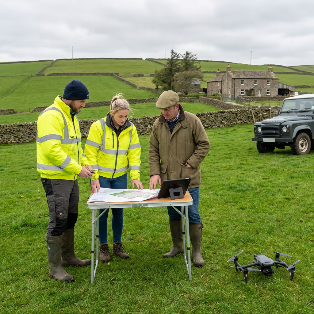
At Drone Survey Services, we tick every box. We're CAA approved, fully insured, and have delivered land surveys for farmers, estates, solicitors, and land agents throughout the UK.
Ready to work with a trusted land survey provider?
Is Drone Land Survey Cheaper Than Traditional Surveying?
In most scenarios, significantly cheaper. Traditional land surveys require surveyors to physically walk every boundary and feature, taking measurements point by point. For a 50-hectare site, this could take a week or more of field work, plus additional office time for drawing production.
Our drone land surveys capture the same—or more—information in a single day. The cost savings typically range from 50-70% compared to traditional methods, while delivering faster turnaround and comprehensive visual documentation. For large rural sites, the economics become even more favourable, making drone surveys the obvious choice for cost-conscious landowners and professionals.
Ready to Discuss Your Land Survey Project?
Expert advice • Competitive pricing • Response within 2 hours
James Leslie
Owner, Engineer & Drone Pilot
With extensive experience in surveying and UAV operations, James personally oversees every land survey project to ensure accuracy and professional delivery.
TLDR: Drone Land Surveys Explained
Land Survey Deliverables
- High-resolution orthomosaic
- Digital Terrain Model (DTM)
- Digital Surface Model (DSM)
- Boundary mapping
- Area calculations
- CAD files (DWG/DXF)
Discuss Your Project
Get expert advice and tailored pricing.
Enterprise Equipment
Survey-Grade Drone Fleet
We don't use consumer mini drones like other providers. Our fleet consists of industrial, survey-grade aircraft purpose-built for capturing detailed, accurate datasets.

AgEagle eBee X
Professional fixed-wing for rapid terrain coverage

DJI Matrice 400
Engineered for excellence, designed for versatility

WingtraOne GEN II
Best-in-class surveying efficiency for large projects

DJI Matrice 350 RTK
Professional multi-payload platform for precision surveying

DJI Mavic 4E
Portable surveying powerhouse with RTK precision
DJI Matrice 300 RTK
Industry-leading inspection and mapping platform

DJI Matrice 4E
Precision survey drone with oblique capture
1 of 7
← Swipe to explore fleet →
Sensor Technology
Specialised Sensors for All Aerial Surveys
Our aircraft carry professional-grade sensors matched to your project requirements, from high-resolution photogrammetry to terrain-penetrating LiDAR.
LiDAR Sensors
Penetrate vegetation and capture precise terrain data with laser scanning technology.
Applications
- Forestry & vegetation mapping
- Terrain modelling under canopy
- Flood risk assessment
- Archaeological surveys
- Power line corridor mapping
Thermal Imaging
Detect heat signatures for building diagnostics, energy audits, and industrial inspections.
Applications
- Building thermal surveys
- Solar panel inspections
- Electrical fault detection
- Search and rescue
- Livestock monitoring
RGB & Photogrammetry
High-resolution imagery for detailed 3D models, orthomosaics, and visual inspections.
Applications
- Topographic surveys
- 3D model generation
- Progress monitoring
- Asset inspection
- Marketing photography
Need a specific sensor or payload?
Client Testimonials
Why Clients Rate Our Drone Survey Service 5 Stars
Don't just take our word for it. Here's what industry professionals say about working with us.
“By far the best drone surveying company I've used. Responsive, helpful and report quality is spot on. Extremely diligent in highlighting defects outside of scope. 10+ projects completed and never disappointed.”
Mark Reynolds
Building Surveyor
“DSS's drone roof survey was brilliant. James showed me everything wrong with my roof in about 30 minutes. Quick, professional and easy to understand.”
Helen Parker
Homeowner
“Fantastic company to do business with. Been working with the DSS team since 2021 and it's been an absolute pleasure. Highly recommended.”
Robert Hughes
Property Developer