Surveying & Mapping
Drone Measured Building Survey Services
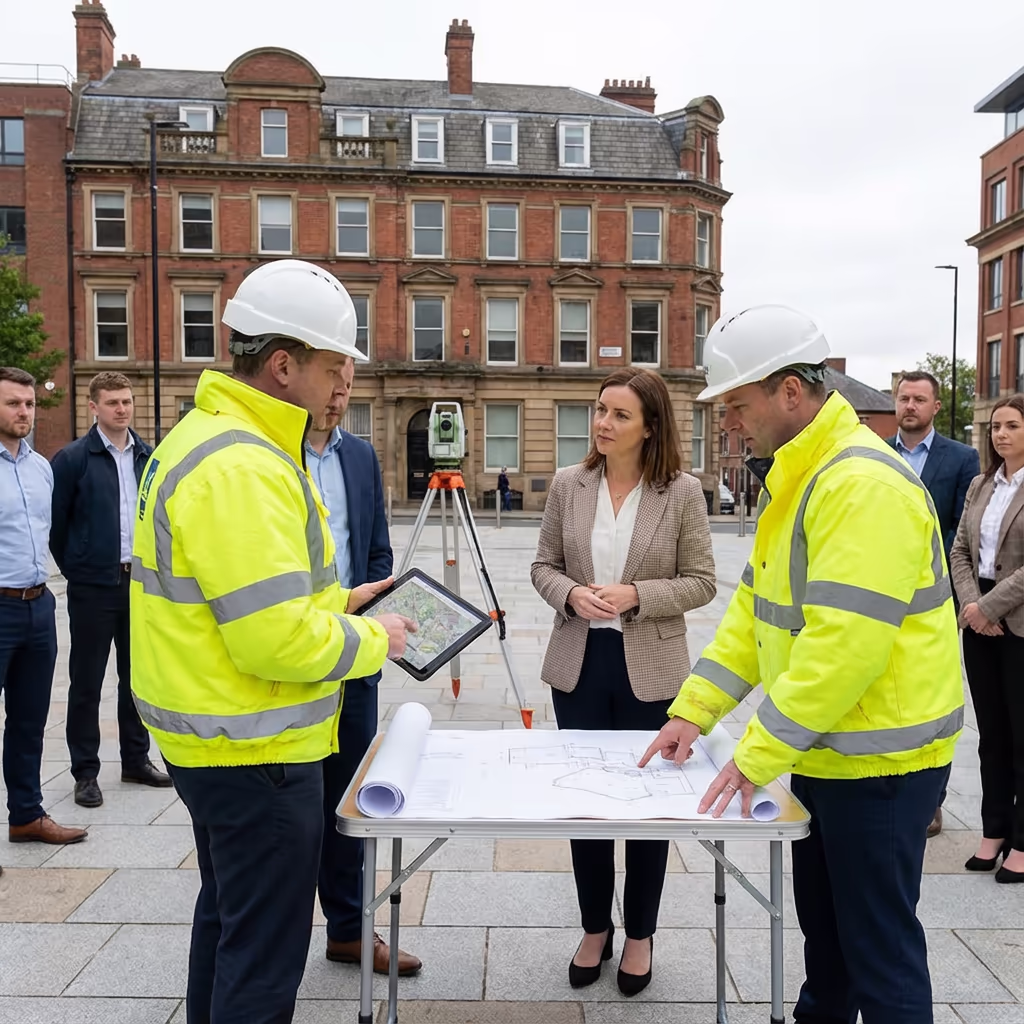
Precise external building measurements from aerial data. Elevation drawings, 3D models, and comprehensive dimensional data for architects and property professionals.
Response within 2 hours • Or call 020 4634 0456
What Is a Drone Measured Building Survey?
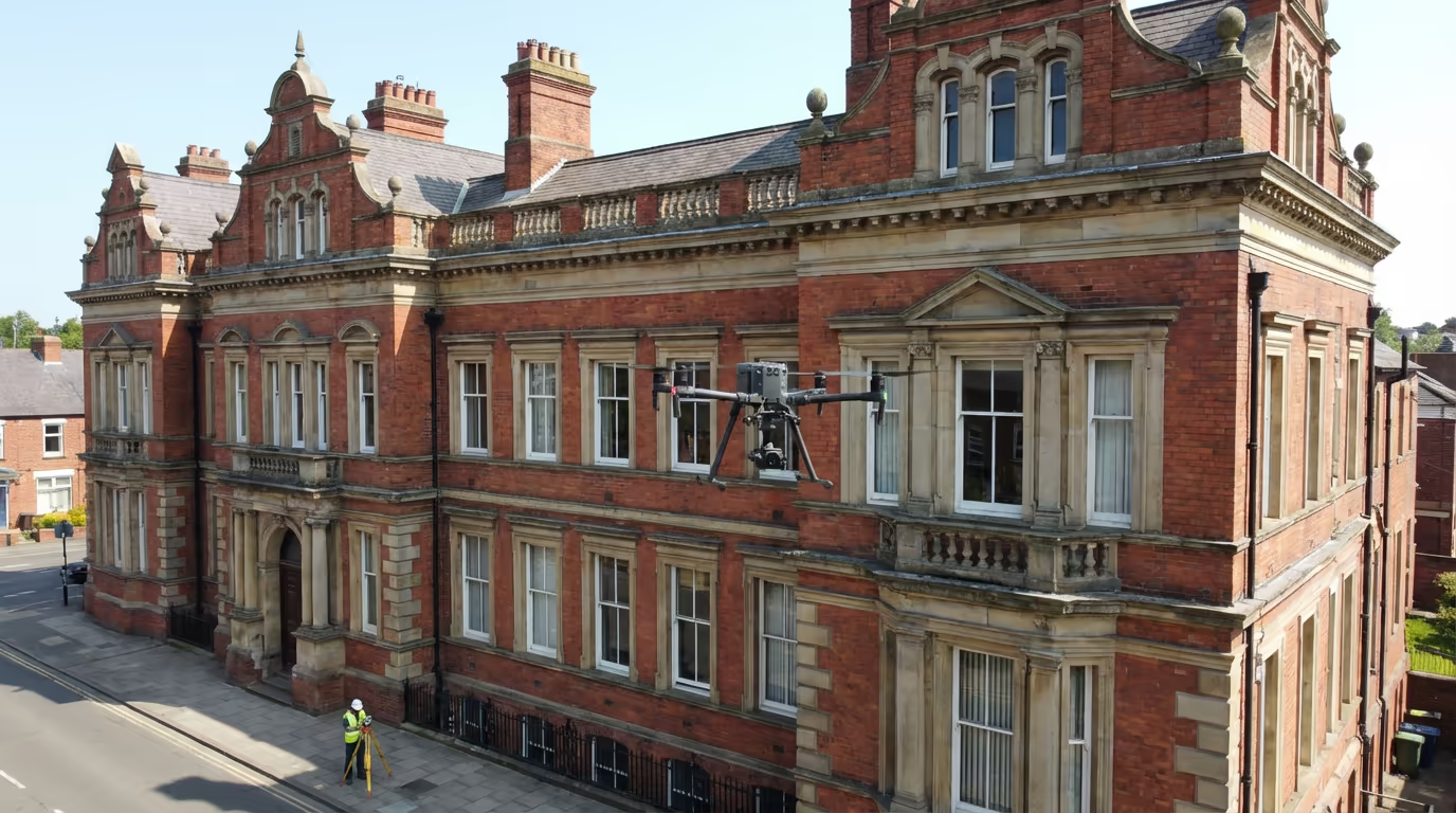
A drone measured building survey captures precise external dimensions of buildings using aerial photogrammetry. Our UAVs photograph every facade, roof plane, and architectural feature, creating accurate 3D models from which we extract comprehensive measurement data.
At Drone Survey Services, we combine high-resolution aerial imagery with advanced processing to deliver elevation drawings, facade measurements, and 3D building models. This approach is particularly valuable for buildings where traditional access is difficult, dangerous, or would require expensive scaffolding.

James Leslie
Owner, Engineer & Drone Pilot
"Got questions? Call me directly - I'm happy to talk through your project."
Call NowAccurate Building Dimensions,No Scaffolding Required
What You'll Receive
- Scaled elevation drawings
- 3D building model
- Facade measurements
- CAD-ready files (DXF/DWG)
Delivered in 3-5 working days
Why Choose Us
- CAA approved & fully insured
- No scaffolding or access equipment
- Architect-ready deliverables
- UK-wide coverage
Trusted by architects, surveyors & property developers across the UK.
Trusted by leading organisations
How Much Does a Drone Measured Building Survey Cost?
Pricing depends on building size, complexity, and required deliverables. Here's a guide to help you budget:
| Building Type | Guide Price |
|---|---|
| Small BuildingUnder 200m² footprint | £400+ |
| Medium Building200-500m² footprint | £700+ |
| Large Building500-1000m² footprint | £1,200+ |
| Complex BuildingIntricate architecture | £2,000+ |
| Multi-BuildingEstate or campus | POA |
*Guide prices include standard deliverables. Final quote based on building complexity, access, and specific requirements.
What affects your quote?
- Building size & height
- Architectural complexity
- Required deliverables
- Access & location
Our drone approach eliminates scaffolding and cherry picker hire, often saving 30-50% compared to traditional measured building surveys. Contact us with your project details for a tailored quote within 24 hours.
Ready to get a quote for your building?
Free, no-obligation quotes within 24 hours
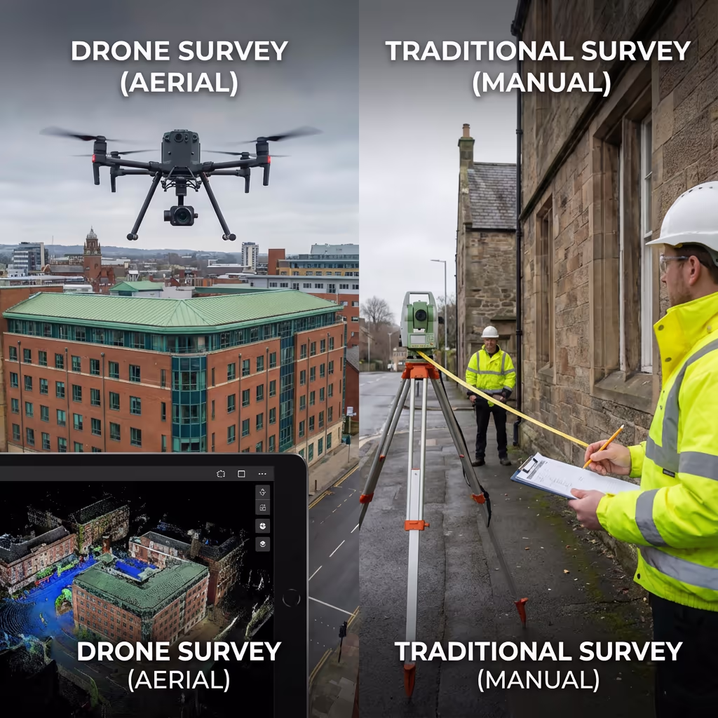
What Is the Difference Between Drone Measured Building Survey and Traditional Methods?
Traditional measured building surveys require surveyors to physically access every part of a building—often using scaffolding, cherry pickers, or rope access for upper levels and roofs. This is time-consuming, expensive, and sometimes impossible for certain buildings.
Drone measured building surveys capture the entire exterior from the air in a fraction of the time. Our UAVs photograph all facades, roof areas, and architectural details without scaffolding or working at height. The result is comprehensive coverage that often exceeds what traditional methods can achieve—particularly for complex rooflines and inaccessible areas.
Method Comparison
Drone Measured Building Survey
Modern approach
Traditional Methods
Manual measurement
Not sure which approach suits your project?
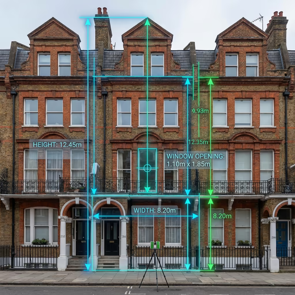
What Accuracy Can a Drone Measured Building Survey Achieve?
Our drone measured building surveys routinely achieve accuracy of ±10-20mm on facade dimensions when using ground control points. For most architectural and planning applications, this exceeds the tolerances required by RICS guidelines.
We establish survey control using RTK GPS and place coded targets on the building where accessible. Our processing workflow uses photogrammetric adjustment to ensure consistent accuracy across all facades. For projects requiring higher precision, we can combine drone capture with terrestrial survey checks to achieve ±5mm or better.
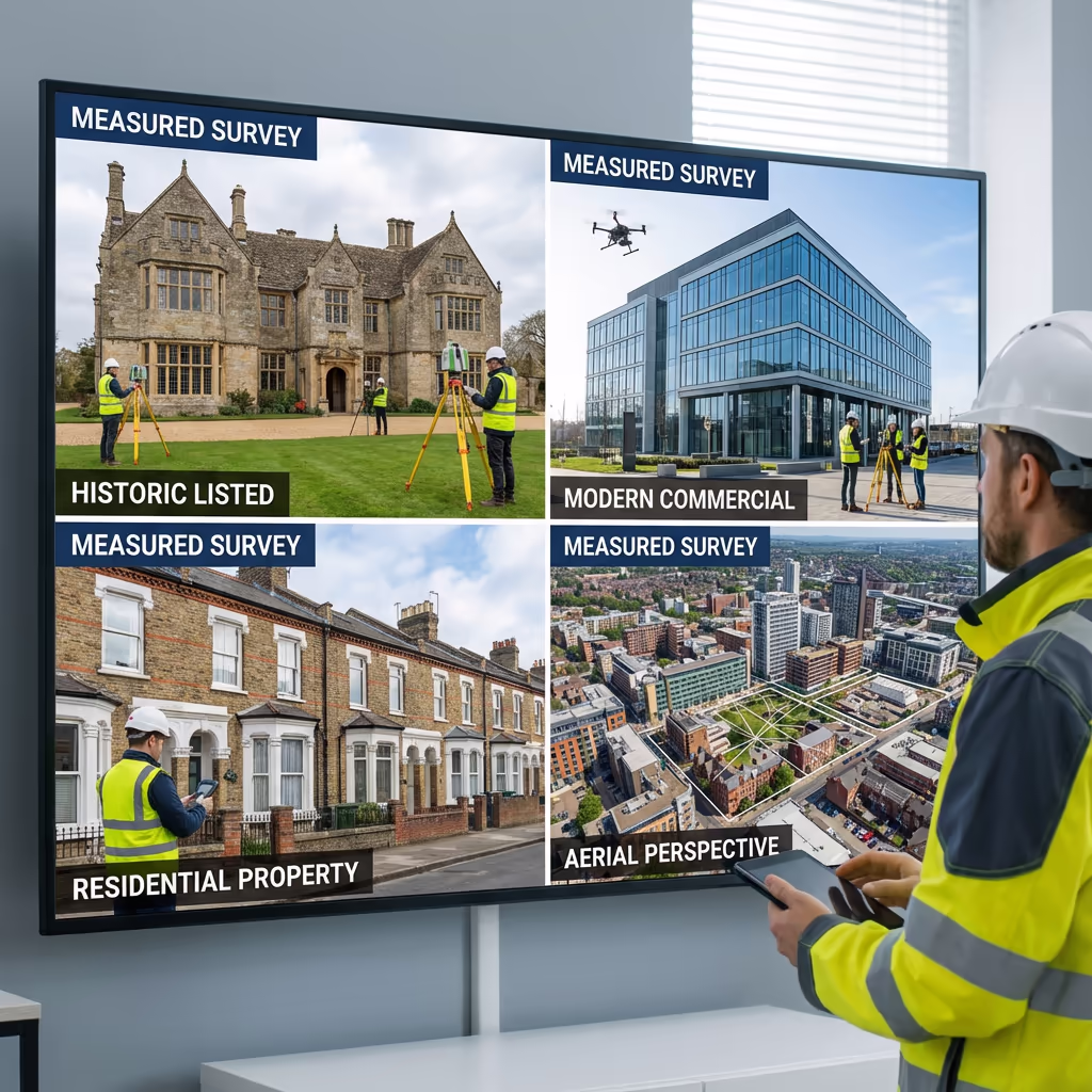
What Are the Applications of Drone Measured Building Survey?
Drone measured building surveys serve a wide range of property and construction professionals. Here are the key applications where our clients see the greatest value:
Architectural Design
Accurate as-built drawings for extensions, alterations, and refurbishment projects where original drawings don't exist or are unreliable.
Planning Applications
Precise elevation drawings and site context for planning submissions, change of use applications, and conservation area proposals.
Heritage & Conservation
Detailed recording of listed buildings, historic structures, and conservation assets for heritage statements and repair specifications.
Property Transactions
Due diligence surveys for acquisitions, lease negotiations, and portfolio management requiring accurate floor areas and dimensions.
Facade Restoration
Detailed facade surveys for window replacement, cladding projects, and restoration schemes requiring precise opening dimensions.
BIM & Digital Twins
Creating accurate 3D models as the foundation for BIM workflows and digital twin applications in facilities management.
Have a building that needs measuring?
Can Drones Capture Building Interiors?
Standard outdoor drones are designed for exterior surveys only. Flying inside buildings presents significant challenges—GPS doesn't work indoors, there's no room for safe manoeuvring, and the risk of collision is high. Our drone measured building surveys focus on external facades, roofs, and building envelopes.
For interior surveys, we offer complementary terrestrial laser scanning and handheld SLAM scanning services. These can be combined with drone exterior surveys to create comprehensive whole-building models. If you need internal floor plans alongside external elevations, we can provide an integrated package.
Need Interior + Exterior?
We offer combined packages integrating drone exterior surveys with terrestrial interior scanning for complete building documentation.
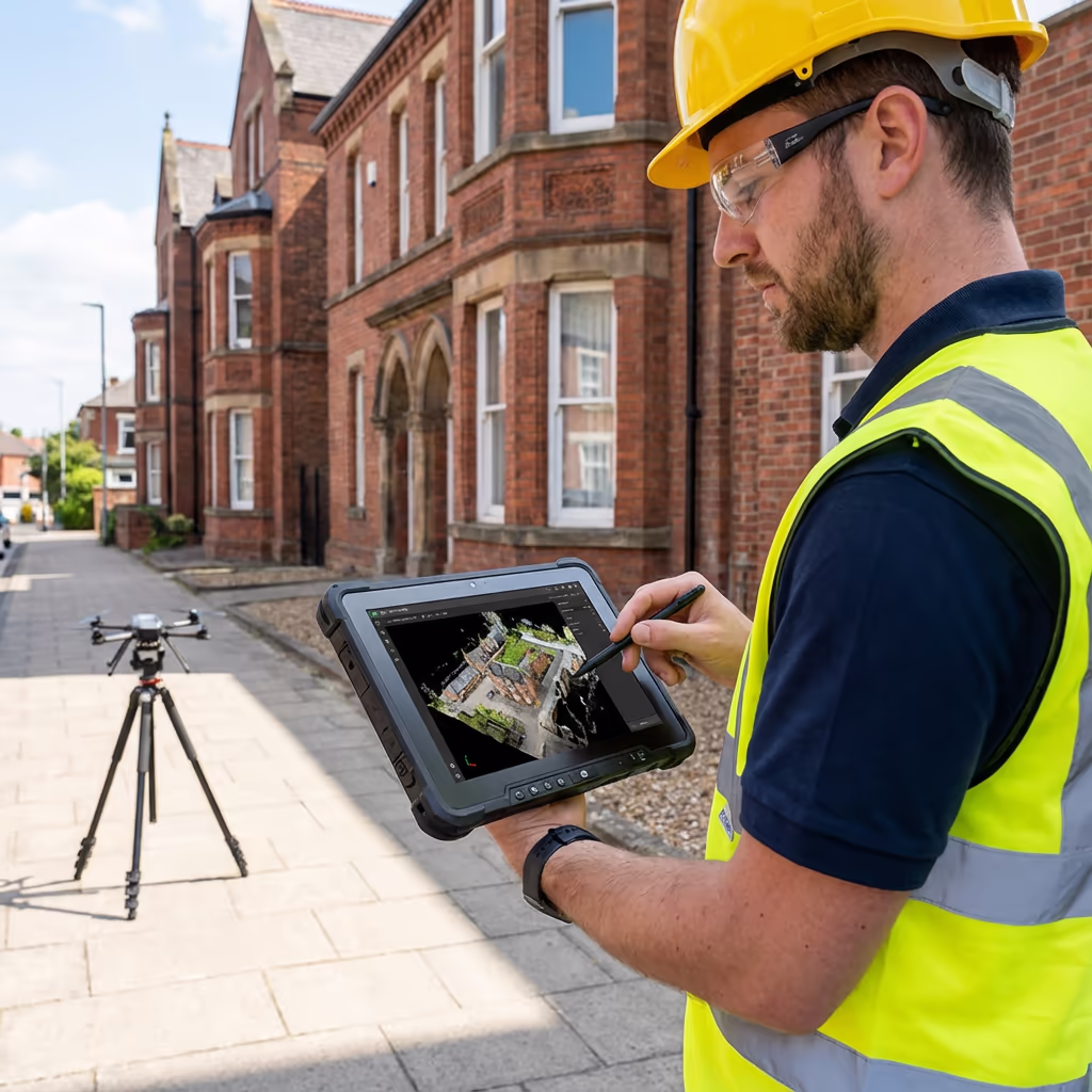
What Deliverables Do You Get From a Drone Measured Building Survey?
We tailor deliverables to your project requirements, but our standard measured building survey outputs include:
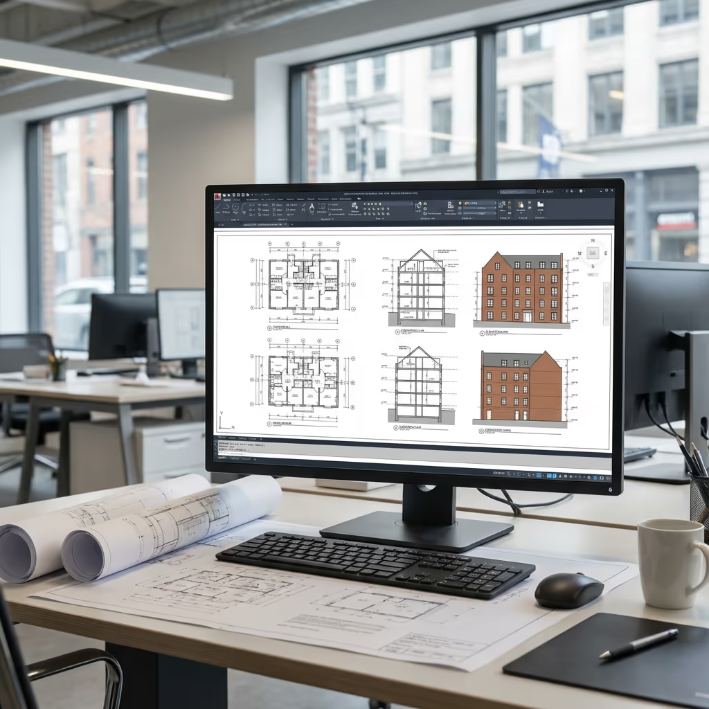
Elevation Drawings
Scaled elevation drawings of all facades with key dimensions annotated. Supplied as PDF and DWG/DXF files.
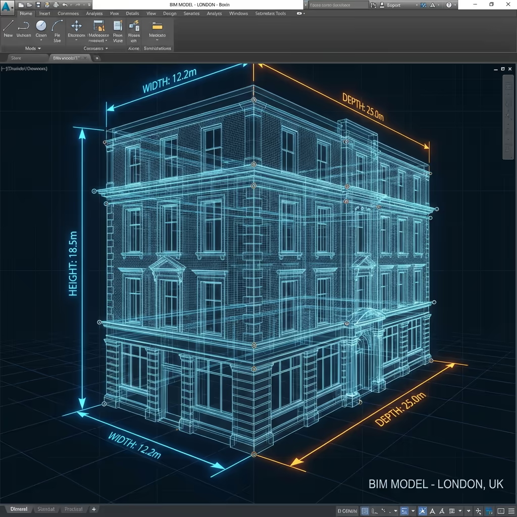
3D Building Model
Textured 3D mesh model of the complete building exterior. Available in OBJ, FBX, or other common formats.
Orthomosaic Facades
True-to-scale photographic images of each facade, corrected for perspective distortion and suitable for condition recording.
Roof Plan
Plan view of the roof showing all planes, features, and key dimensions. Essential for roofing specifications and drainage design.
CAD Files
All drawings supplied in DWG and DXF formats, ready for import into AutoCAD, Revit, or other design software.
High-Resolution Imagery
Full set of aerial photographs capturing all building details. Invaluable for condition assessment and defect identification.
Need specific deliverables for your project?
How Long Does a Drone Measured Building Survey Take?
On-site data capture is remarkably fast. A typical residential or small commercial building takes 1-2 hours to survey completely—including all facades and roof areas. Larger or more complex buildings may take half a day.
Processing and deliverable production typically takes 3-5 working days for standard projects. Complex buildings with detailed architectural features may require additional processing time. For urgent projects, we offer expedited turnaround options.
| Phase | Duration |
|---|---|
| Booking & Planning | 1-2 days |
| On-Site Survey | 1-4 hours |
| 3D Model Creation | 1-2 days |
| Drawing Production | 1-2 days |
| Total (Standard) | 3-5 working days |
Express Processing Available
Need it faster? 24-48 hour turnaround available for urgent projects.
How Do I Choose a Drone Measured Building Survey Provider?
Not all drone survey providers offer the same quality of measured building work. When evaluating providers, we recommend checking these key factors:
- CAA authorisation – Ensure they hold valid GVC or legacy PfCO permissions for commercial operations
- Professional insurance – Public liability and professional indemnity cover appropriate to your project
- Survey experience – Drone photography is different from measured surveys—check they understand dimensional accuracy
- CAD capability – Ask about their drawing production workflow and output formats
- Relevant examples – Request case studies of similar building surveys they've completed
At Drone Survey Services, we tick every box. We're CAA approved, fully insured, and have delivered measured building surveys for architects, heritage consultants, and property professionals throughout the UK.
Ready to work with a trusted survey provider?
Is Drone Measured Building Survey Cheaper Than Traditional Methods?
In most cases, yes—often significantly. Traditional measured building surveys of multi-storey buildings typically require scaffolding hire, cherry picker rental, or specialist rope access. These access costs alone can exceed the entire price of a drone survey.
Our drone approach captures all exterior surfaces in hours rather than days, with no access equipment needed. Typical savings range from 30-50% compared to traditional methods, while often delivering more comprehensive data—particularly for roof areas that would otherwise require expensive access solutions.
Typical Cost Comparison (3-Storey Building)
Ready to Discuss Your Building Survey?
Expert advice • Tailored pricing • Response within 2 hours
James Leslie
Owner, Engineer & Drone Pilot
With extensive experience in surveying and UAV operations, James personally oversees every measured building project to ensure accurate dimensions and professional delivery.
TLDR: Drone Measured Building Surveys Explained
Survey Deliverables
- Elevation drawings (PDF/DWG)
- 3D building model
- Orthomosaic facades
- Roof plan
- CAD files (DXF/DWG)
- High-resolution imagery
Discuss Your Project
Get expert advice and tailored pricing.
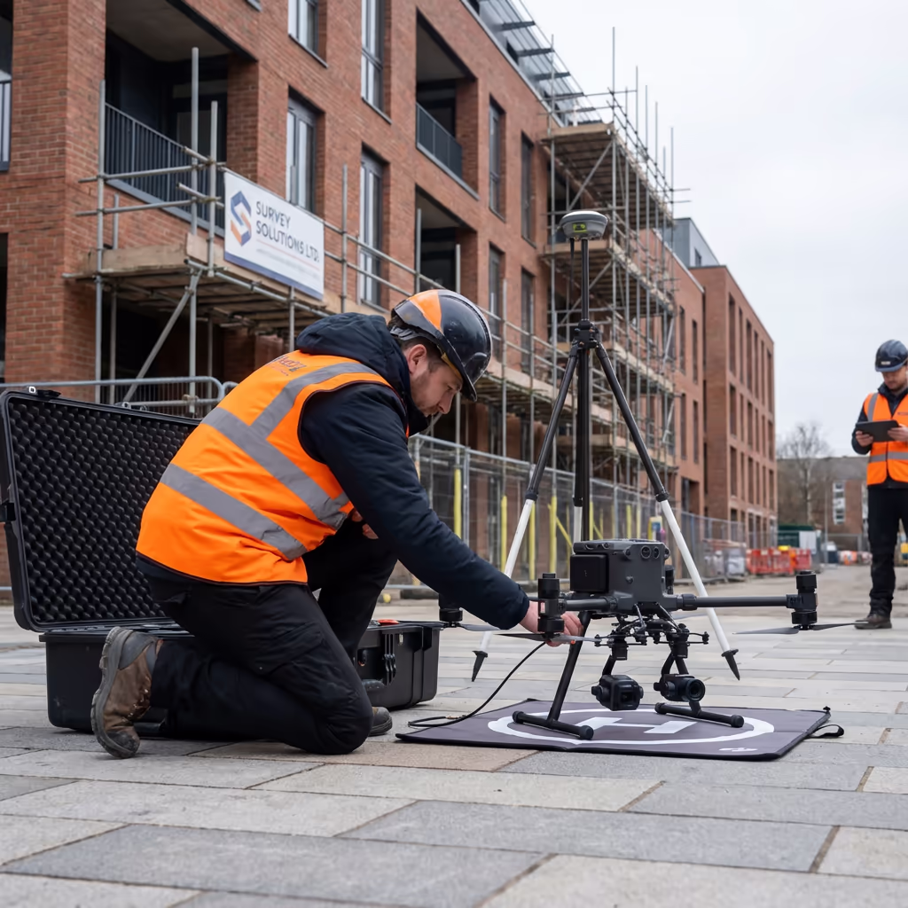
Enterprise Equipment
Survey-Grade Drone Fleet
We don't use consumer mini drones like other providers. Our fleet consists of industrial, survey-grade aircraft purpose-built for capturing detailed, accurate datasets.

AgEagle eBee X
Professional fixed-wing for rapid terrain coverage

DJI Matrice 400
Engineered for excellence, designed for versatility

WingtraOne GEN II
Best-in-class surveying efficiency for large projects

DJI Matrice 350 RTK
Professional multi-payload platform for precision surveying

DJI Mavic 4E
Portable surveying powerhouse with RTK precision
DJI Matrice 300 RTK
Industry-leading inspection and mapping platform

DJI Matrice 4E
Precision survey drone with oblique capture
1 of 7
← Swipe to explore fleet →
Sensor Technology
Specialised Sensors for All Aerial Surveys
Our aircraft carry professional-grade sensors matched to your project requirements, from high-resolution photogrammetry to terrain-penetrating LiDAR.
LiDAR Sensors
Penetrate vegetation and capture precise terrain data with laser scanning technology.
Applications
- Forestry & vegetation mapping
- Terrain modelling under canopy
- Flood risk assessment
- Archaeological surveys
- Power line corridor mapping
Thermal Imaging
Detect heat signatures for building diagnostics, energy audits, and industrial inspections.
Applications
- Building thermal surveys
- Solar panel inspections
- Electrical fault detection
- Search and rescue
- Livestock monitoring
RGB & Photogrammetry
High-resolution imagery for detailed 3D models, orthomosaics, and visual inspections.
Applications
- Topographic surveys
- 3D model generation
- Progress monitoring
- Asset inspection
- Marketing photography
Need a specific sensor or payload?
Client Testimonials
Why Clients Rate Our Drone Survey Service 5 Stars
Don't just take our word for it. Here's what industry professionals say about working with us.
“By far the best drone surveying company I've used. Responsive, helpful and report quality is spot on. Extremely diligent in highlighting defects outside of scope. 10+ projects completed and never disappointed.”
Mark Reynolds
Building Surveyor
“DSS's drone roof survey was brilliant. James showed me everything wrong with my roof in about 30 minutes. Quick, professional and easy to understand.”
Helen Parker
Homeowner
“Fantastic company to do business with. Been working with the DSS team since 2021 and it's been an absolute pleasure. Highly recommended.”
Robert Hughes
Property Developer
Related Services
Drone Topographic Survey
Comprehensive site surveys delivering precise topographic data and 3D terrain models.
LiDAR Mapping
Precision laser scanning for detailed terrain models and vegetation penetration surveys.
Drone Roof Inspection
Detailed roof surveys and condition assessments without scaffolding or access equipment.