
Mining & Quarry Surveying
Drone Mining Survey Services
Precision aerial surveys for mining operations, quarries, and aggregate sites. Accurate stockpile volumes, pit mapping, and progress monitoring delivered safely and efficiently.
Response within 2 hours • Or call 020 4634 0456
What Is a Drone Mining Survey?
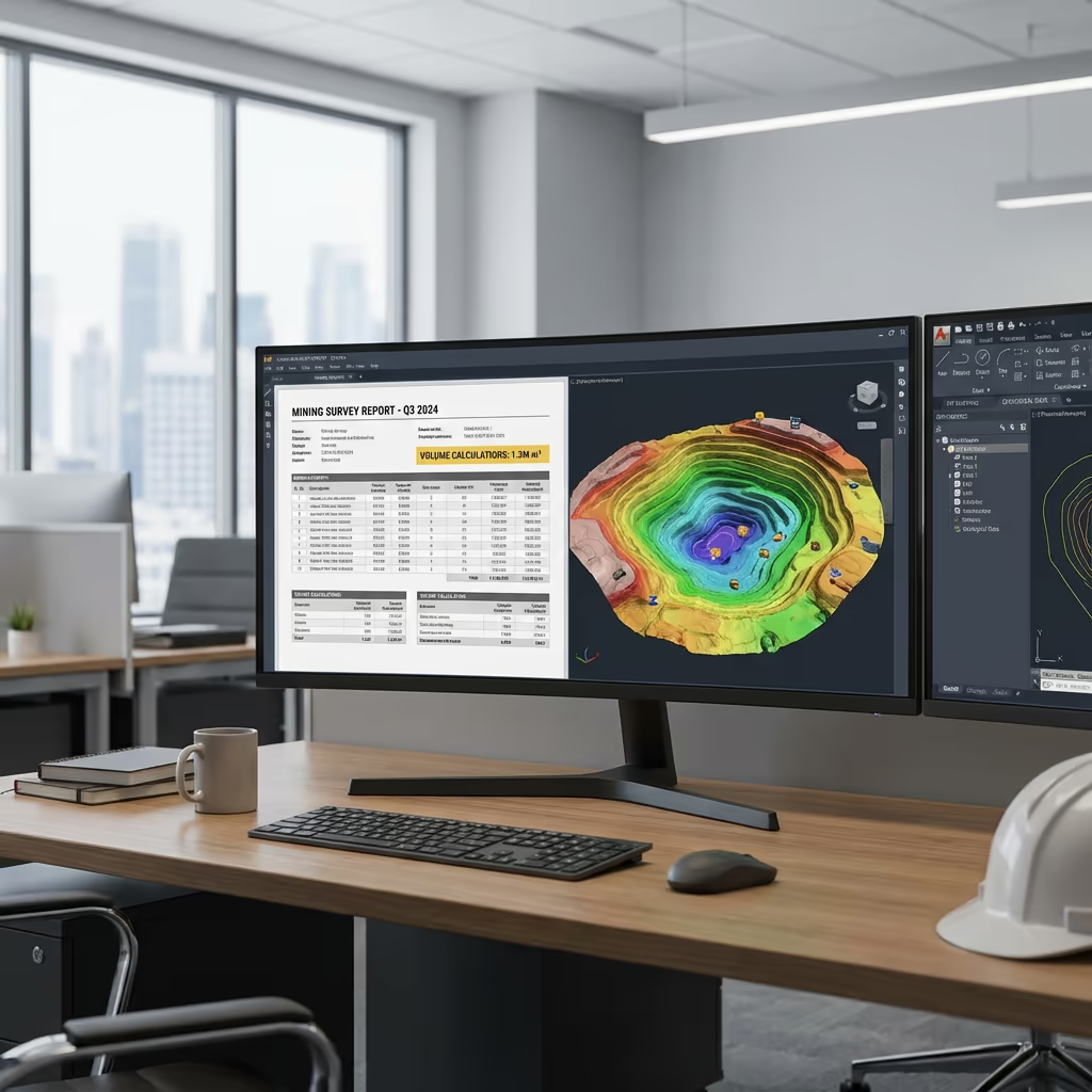
A drone mining survey uses UAV technology to capture detailed aerial data of mining operations, quarries, and aggregate sites. Our drones equipped with high-resolution cameras and RTK GPS systems fly over your site, capturing thousands of images that we process into accurate 3D models, orthomosaics, and volume calculations.
At Drone Survey Services, we specialise in helping mining and quarrying operations across the UK track progress, manage stockpiles, and maintain accurate site records. Our surveys provide the data you need for inventory management, compliance reporting, and operational planning—all captured without disrupting your operations.

James Leslie
Owner, Engineer & Drone Pilot
"Got questions? Call me directly - I'm happy to talk through your project."
Call NowAccurate Mining Survey Data,Delivered Fast
What You'll Receive
- Accurate stockpile volumes
- Pit mapping & progress tracking
- CAD-ready survey data
- Survey-grade accuracy (±2-5cm)
Delivered in 5-7 working days
Why Choose Us
- CAA approved & fully insured
- Mining & quarry specialists
- Latest DJI survey technology
- UK-wide coverage
Trusted by quarry operators and mining companies across the UK.
Trusted by leading organisations

How Much Does a Drone Mining Survey Cost?
Pricing depends on your site size and survey requirements. Here's a guide to help you budget:
| Site Size | Guide Price |
|---|---|
| Small SiteUnder 10 ha | £800+ |
| Medium Site10–50 ha | £1,800+ |
| Large Site50–100 ha | £3,500+ |
| Major Operation100+ ha | POA |
| Recurring MonthlyAny size | POA |
*Guide prices include standard deliverables. Final quote based on site complexity, access, and specific requirements.
What affects your quote?
- Site size & terrain
- Number of stockpiles
- Survey frequency
- Required deliverables
Our drone mining surveys typically save 50–70% compared to traditional ground surveys, with the added benefit of zero operational disruption. Contact us for a tailored quote.
Ready to get a quote for your site?
Free, no-obligation quotes within 24 hours

What Is the Difference Between Drone Mining Survey and Traditional Methods?
Traditional mining surveys require surveyors to physically traverse the site with total stations or GPS equipment. This means stopping operations, ensuring safe access to active faces, and spending days on site to capture comprehensive data. The result is often limited point density and significant operational disruption.
Our drone mining surveys capture the entire site from above in hours, not days. We fly safely over active areas, unstable ground, and inaccessible faces without putting anyone at risk. The result is millions of survey points, complete site coverage, and data delivered while your operations continue uninterrupted.
Choose the Right Approach
Drone Mining Survey
Fast, safe & comprehensive
Traditional Survey
Ground-based methods
Not sure which approach suits your operation?

What Accuracy Can a Drone Mining Survey Achieve?
Our drone mining surveys routinely achieve vertical accuracy of ±2-5cm and horizontal accuracy of ±2-3cm when using ground control points and RTK positioning. This level of precision meets the requirements for stockpile volume calculations, regulatory compliance, and operational planning.
For stockpile volumes, this accuracy translates to measurement precision within 1-2% of actual volumes—often more accurate than traditional methods. We verify every survey against known control points and provide accuracy reports with all deliverables so you can be confident in the data you're using for critical business decisions.
What Are the Applications of Drone Mining Survey?
Drone surveys have transformed how mining and quarrying operations manage their sites. Here are the key applications where our clients see the greatest value:
Stockpile Volume Measurement
Accurate monthly or quarterly stockpile volumes for inventory management, reconciliation, and financial reporting.
Pit Progress Monitoring
Track excavation progress, compare to plans, and calculate cut/fill volumes for contractor payments and planning.
Compliance & Reporting
Evidence for planning conditions, environmental monitoring, and regulatory compliance with accurate dated records.
Restoration Monitoring
Track restoration progress against approved schemes, verify fill volumes, and document compliance with restoration conditions.
Site Planning & Design
Accurate topographic data for expansion planning, haul road design, and operational optimisation.
Asset Inspection
Inspect conveyors, crushers, buildings, and infrastructure from above without scaffolding or rope access.
Have a mining or quarry project that needs surveying?

How Do Drones Improve Mining Safety?
Mining and quarrying are inherently hazardous environments. Traditional surveys require personnel to work near active faces, unstable slopes, and moving machinery. Every minute someone spends on the pit floor is a minute of exposure to risk.
Our drone surveys eliminate this exposure entirely. We capture complete site data from the safety of the air, surveying areas that would be too dangerous or impractical to access on foot. Steep bench faces, unstable stockpiles, active haul roads—we survey them all without putting anyone at risk.
Beyond survey safety, our aerial imagery helps identify potential hazards: slope failures, water accumulation, bench instability, and access issues can all be spotted from above before they become incidents. Regular drone surveys become part of your proactive safety management.
What Deliverables Do You Get From a Drone Mining Survey?
We tailor deliverables to your operational requirements, but our standard mining survey outputs include:
Pit Mapping & Surface Models
Complete 3D models of your pit or quarry showing benches, faces, haul roads, and all surface features at survey-grade accuracy.
Volume Calculations
Accurate stockpile volumes with detailed breakdowns. Compare against previous surveys for stock movement analysis.
Progress Tracking Reports
Cut/fill analysis showing extraction progress, restoration volumes, and comparison to approved plans.
Safety & Compliance Reports
Documentation for regulatory compliance, planning conditions, and safety records with dated imagery evidence.
CAD Files & 3D Models
Survey data in DWG, DXF, and other CAD formats. 3D mesh models for visualisation and planning software integration.
Need specific deliverables for your operation?

How Long Does a Drone Mining Survey Take?
On-site data capture is remarkably fast compared to traditional methods. We can survey most quarry sites in a single day, with larger operations taking 1-2 days. A typical 20-hectare site with multiple stockpiles takes 3-4 hours of flight time.
Processing and delivery depends on project complexity. Standard deliverables are typically ready within 5-7 working days. For operations requiring regular monthly surveys, we can establish streamlined workflows with faster turnaround. We'll confirm realistic timescales when we quote your project.
| Phase | Duration |
|---|---|
| Planning & Coordination | 1-2 days |
| On-Site Data Capture | ½-1 day |
| Data Processing | 2-3 days |
| Analysis & Reporting | 2-3 days |
| Total (Standard) | 5-7 working days |
Regular Survey Programmes Available
Monthly or quarterly surveys with streamlined processing and priority scheduling.

How Do I Choose a Drone Mining Survey Provider?
Not all drone survey providers understand the specific requirements of mining and quarrying operations. When evaluating providers, we recommend checking these key factors:
- Mining sector experience – Ask for examples of quarry and mining surveys they've completed
- CAA authorisation – Ensure they hold valid GVC permissions for commercial operations
- Volume accuracy track record – Ask about their accuracy on stockpile measurements
- Site safety awareness – They should understand quarry safety requirements and RAMS
- Professional insurance – Public liability and professional indemnity appropriate for mining sites
At Drone Survey Services, we tick every box. We're CAA approved, fully insured, and have delivered surveys for quarries and mining operations across the UK. We understand your operational requirements and work around your schedule.
Ready to work with a trusted mining survey provider?
Is Drone Mining Survey Cheaper Than Traditional Methods?
In virtually every scenario, yes—significantly cheaper. Traditional ground surveys of active mining sites require surveyors to spend days on site, often working in difficult conditions and requiring operations to pause for safe access. The cost of downtime alone often exceeds the entire cost of a drone survey.
Our drone surveys capture comprehensive site data in hours rather than days, with zero operational disruption. The cost savings typically range from 50-70% compared to traditional methods. For regular monthly surveys, the economics become even more favourable—we can offer programmed survey packages that deliver significant ongoing savings.
Ready to Discuss Your Mining Survey?
Expert advice • Tailored pricing • Response within 2 hours
James Leslie
Owner, Engineer & Drone Pilot
With extensive experience in surveying and UAV operations, James personally oversees every mining survey project to ensure accuracy and professional delivery.
TLDR: Drone Mining Surveys Explained
Mining Survey Deliverables
- Pit mapping & surface models
- Volume calculations
- Progress tracking reports
- Safety & compliance reports
- CAD files (DWG/DXF)
- 3D mesh models
Discuss Your Project
Get expert advice and tailored pricing.
Enterprise Equipment
Survey-Grade Drone Fleet
We don't use consumer mini drones like other providers. Our fleet consists of industrial, survey-grade aircraft purpose-built for capturing detailed, accurate datasets.

AgEagle eBee X
Professional fixed-wing for rapid terrain coverage

DJI Matrice 400
Engineered for excellence, designed for versatility

WingtraOne GEN II
Best-in-class surveying efficiency for large projects

DJI Matrice 350 RTK
Professional multi-payload platform for precision surveying

DJI Mavic 4E
Portable surveying powerhouse with RTK precision
DJI Matrice 300 RTK
Industry-leading inspection and mapping platform

DJI Matrice 4E
Precision survey drone with oblique capture
1 of 7
← Swipe to explore fleet →
Sensor Technology
Specialised Sensors for All Aerial Surveys
Our aircraft carry professional-grade sensors matched to your project requirements, from high-resolution photogrammetry to terrain-penetrating LiDAR.
LiDAR Sensors
Penetrate vegetation and capture precise terrain data with laser scanning technology.
Applications
- Forestry & vegetation mapping
- Terrain modelling under canopy
- Flood risk assessment
- Archaeological surveys
- Power line corridor mapping
Thermal Imaging
Detect heat signatures for building diagnostics, energy audits, and industrial inspections.
Applications
- Building thermal surveys
- Solar panel inspections
- Electrical fault detection
- Search and rescue
- Livestock monitoring
RGB & Photogrammetry
High-resolution imagery for detailed 3D models, orthomosaics, and visual inspections.
Applications
- Topographic surveys
- 3D model generation
- Progress monitoring
- Asset inspection
- Marketing photography
Need a specific sensor or payload?
Client Testimonials
Why Clients Rate Our Drone Survey Service 5 Stars
Don't just take our word for it. Here's what industry professionals say about working with us.
“By far the best drone surveying company I've used. Responsive, helpful and report quality is spot on. Extremely diligent in highlighting defects outside of scope. 10+ projects completed and never disappointed.”
Mark Reynolds
Building Surveyor
“DSS's drone roof survey was brilliant. James showed me everything wrong with my roof in about 30 minutes. Quick, professional and easy to understand.”
Helen Parker
Homeowner
“Fantastic company to do business with. Been working with the DSS team since 2021 and it's been an absolute pleasure. Highly recommended.”
Robert Hughes
Property Developer