Surveying & Mapping
Drone Photogrammetry Survey Services
High-resolution aerial imagery transformed into precise orthomosaics, 3D models, and detailed terrain data for construction, planning, and engineering projects.
Response within 2 hours • Or call 020 4634 0456
What Is a Drone Photogrammetry Survey?
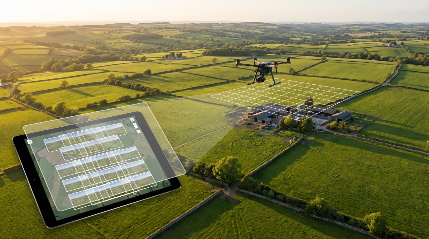
A drone photogrammetry survey uses overlapping aerial photographs captured by our UAVs to create highly accurate 2D and 3D representations of land, buildings, and infrastructure. Specialised software analyses hundreds or thousands of images, identifying common points to reconstruct precise geometry and surface detail.
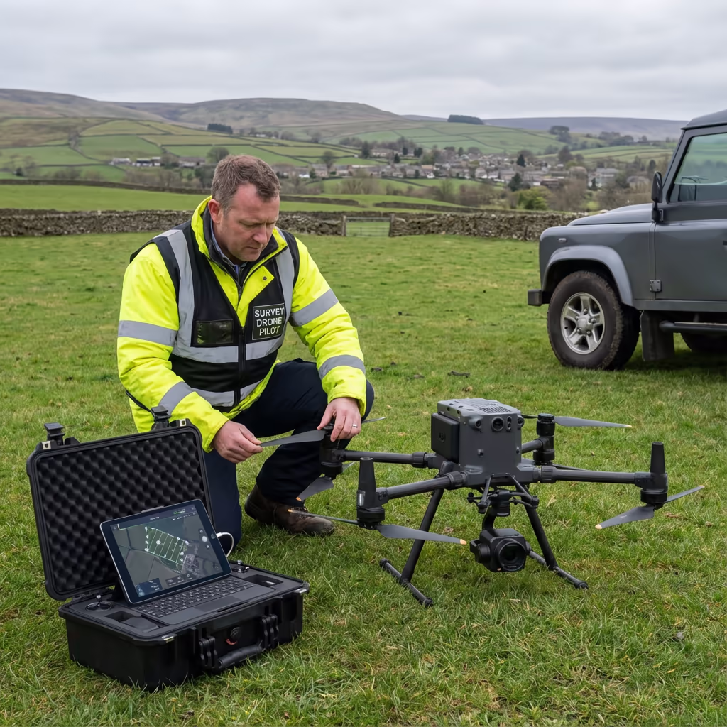
At Drone Survey Services, we deploy high-resolution cameras on professional drones capable of capturing centimetre-level detail. The result is survey-grade orthomosaics, digital elevation models, and textured 3D meshes that serve architects, engineers, planners, and construction teams across the UK.

James Leslie
Owner, Engineer & Drone Pilot
"Got questions? Call me directly - I'm happy to talk through your project."
Call NowSurvey-Grade Photogrammetry,Delivered Fast
What You'll Receive
- High-resolution orthomosaic maps
- 3D point cloud & textured mesh
- Digital Surface & Terrain Models
- Survey-grade accuracy (±2-5cm)
Delivered in 3-5 working days
Why Choose Us
- CAA approved & fully insured
- Professional photogrammetry processing
- Latest DJI camera technology
- UK-wide coverage
Trusted by architects, developers & civil engineers across the UK.
Trusted by leading organisations
How Much Does a Drone Photogrammetry Survey Cost?
Pricing depends on your project scope. Here's a guide to help you budget:
| Project Size | Guide Price |
|---|---|
| MicroUnder 1 ha | £600+ |
| Small1-5 ha | £900+ |
| Medium5-20 ha | £1,500+ |
| Large20-50 ha | £2,800+ |
| Enterprise50-100 ha | £5,000+ |
| Major Projects100+ ha | POA |
*Guide prices include standard deliverables. Final quote based on site complexity, access, and specific requirements.
What affects your quote?
- Site size & terrain
- Required deliverables
- Turnaround time
- Access requirements
Our drone-based approach typically saves 50-70% compared to traditional ground surveys. Contact us with your project details and we'll provide a tailored quote within 24 hours.
Ready to get a quote for your project?
Free, no-obligation quotes within 24 hours
What Is the Difference Between Drone Photogrammetry and LiDAR?
Both technologies create 3D models, but they work in fundamentally different ways. Drone photogrammetry uses overlapping photographs to calculate surface positions—it excels at capturing visual detail, textures, and colours, making it ideal for construction sites, building inspections, and marketing imagery.
LiDAR fires laser pulses that can penetrate vegetation to reach the ground below. This makes it essential for forestry surveys and sites with dense tree cover. However, for most open sites, construction monitoring, and projects requiring visual documentation, photogrammetry delivers excellent results at a lower cost.
When to Choose Each Technology
Choose Photogrammetry
Visual detail & texture
Choose LiDAR
Penetrates vegetation
Not sure which technology suits your project?
What Accuracy Can a Drone Photogrammetry Survey Achieve?
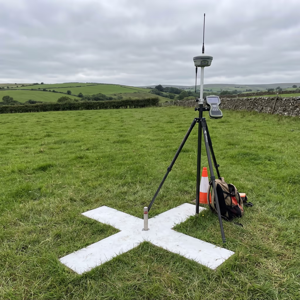
Our drone photogrammetry surveys routinely achieve horizontal accuracy of ±2-3cm and vertical accuracy of ±3-5cm when using ground control points. This level of precision meets or exceeds the requirements for most construction, planning, and engineering applications.
We use RTK/PPK-enabled drones combined with strategically placed ground control points (GCPs) to ensure sub-centimetre precision. The camera captures thousands of overlapping images with 75-85% overlap, allowing our photogrammetry software to triangulate each point with exceptional accuracy. For projects requiring the highest precision, we can achieve ±1-2cm with additional GCPs.
What Are the Applications of Drone Photogrammetry Survey?
Drone photogrammetry has revolutionised how we capture site data across numerous industries. Here are the key applications where our clients see the greatest value:
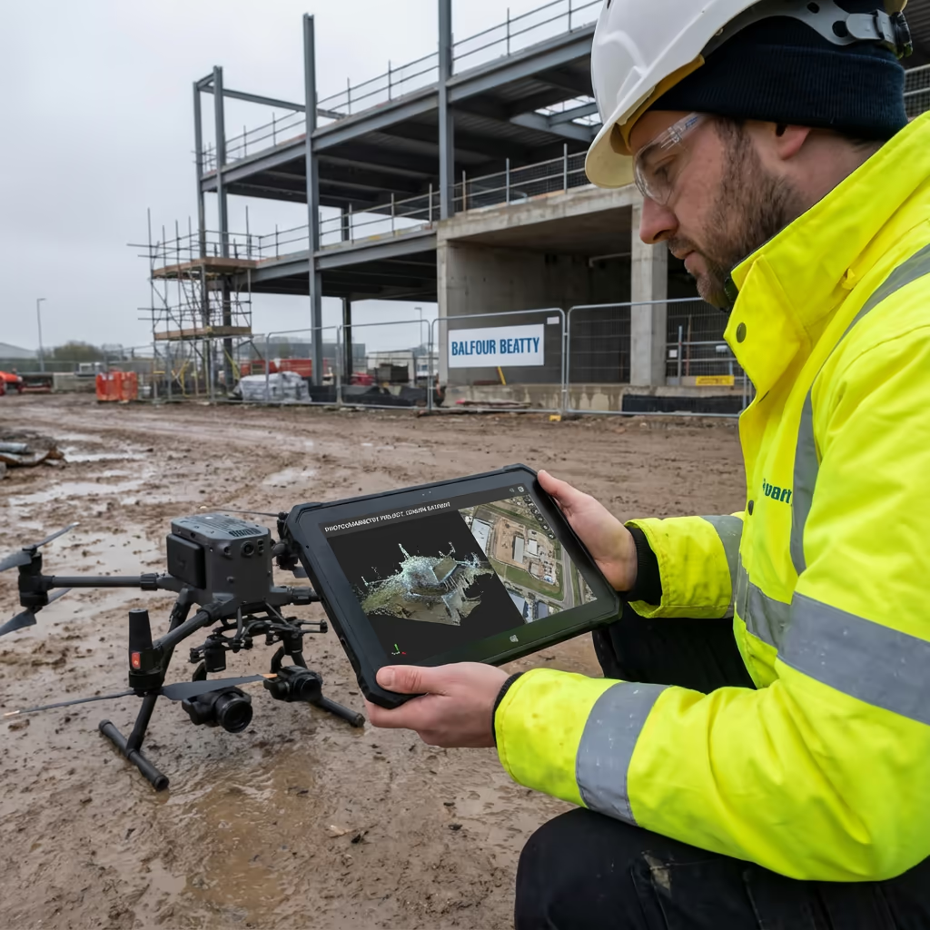
Construction Monitoring
Regular site surveys to track progress, verify earthworks, and create visual documentation for stakeholders and project records.
Planning Applications
Accurate site surveys and visual documentation to support planning submissions, including topographic data and 3D context models.
Volumetric Analysis
Precise stockpile measurements, cut and fill calculations, and material quantity surveys for quarries, construction, and waste management.
Building & Roof Surveys
Detailed 3D models of structures for condition assessments, heritage documentation, and BIM integration projects.
Agricultural Mapping
Crop health monitoring, drainage planning, and land assessment using high-resolution aerial imagery and elevation data.
Marketing & Visualisation
Stunning aerial imagery and 3D models for property marketing, development proposals, and stakeholder presentations.
Have a project that needs photogrammetry?
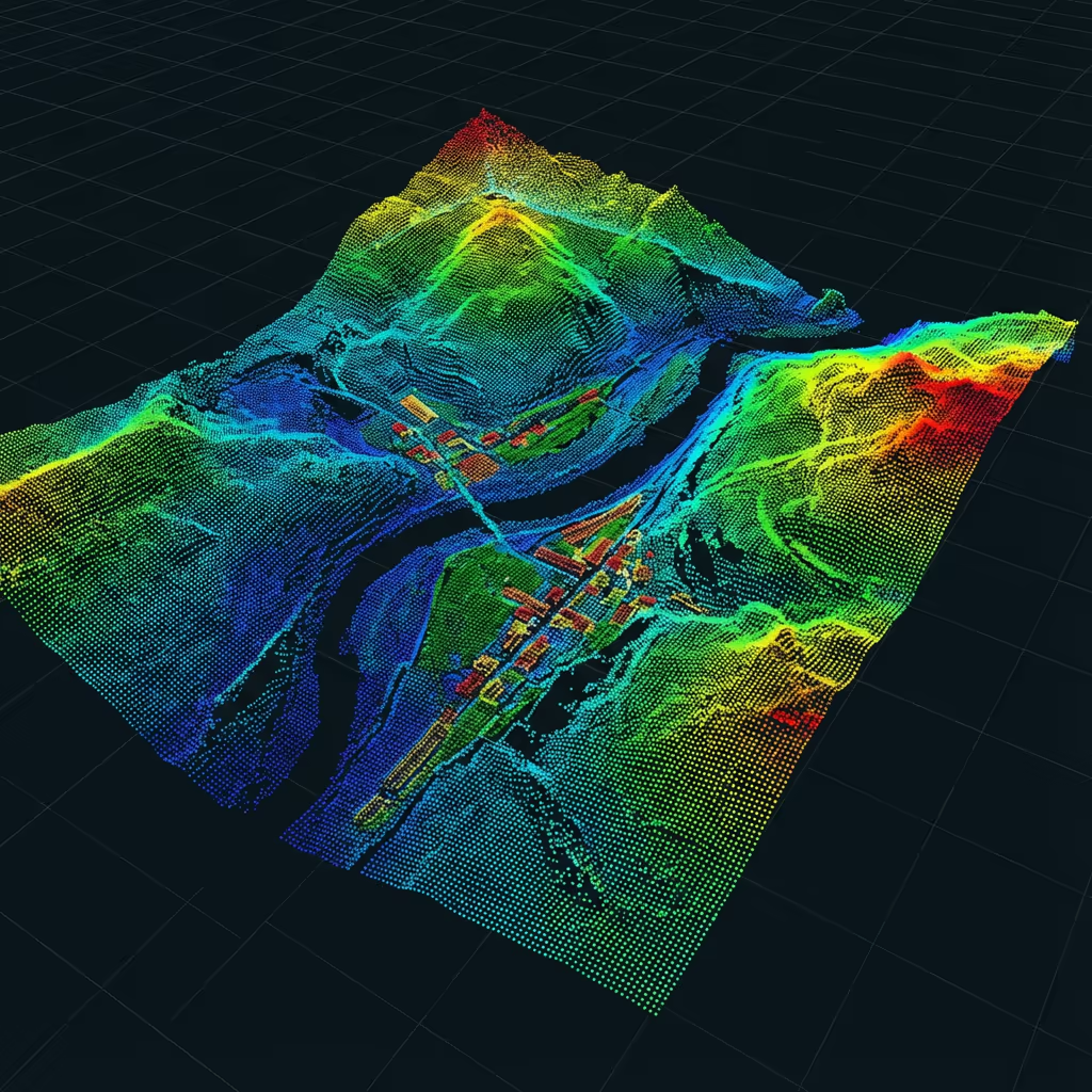
How Does Drone Photogrammetry Create 3D Models?
The magic of photogrammetry lies in capturing the same features from multiple angles. Our drone flies a pre-programmed grid pattern, typically capturing images with 75-85% overlap. This means each ground point appears in dozens of photographs taken from different positions.
Sophisticated software analyses these images, identifying millions of matching points using advanced algorithms. By calculating where each camera was when it took each photo, the software triangulates the precise 3D position of every matched point—creating a dense point cloud that accurately represents the terrain and structures.
From this point cloud, we generate surface models, contours, and textured 3D meshes. The photographic imagery also produces geo-referenced orthomosaics—seamless, distortion-free aerial maps that combine the visual detail of photographs with the geometric accuracy of traditional survey plans.
What Deliverables Do You Get From a Drone Photogrammetry Survey?
We tailor deliverables to your project requirements, but our standard photogrammetry survey outputs include:
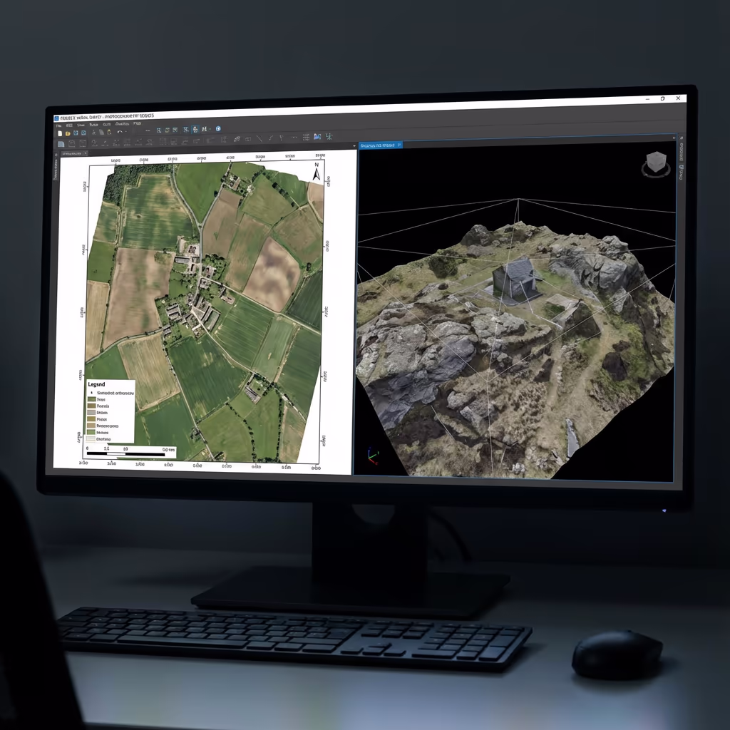
Orthomosaic Maps
High-resolution, geo-referenced aerial imagery stitched into a seamless, distortion-free map. Perfect for site plans, progress records, and GIS integration.
3D Point Cloud
Dense point cloud data with RGB colour values. Millions of precisely positioned points for analysis, measurement, and CAD integration.
Digital Surface Model (DSM)
Elevation model showing all surface features including buildings, vegetation, and structures. Essential for visibility analysis and 3D visualisation.
Digital Terrain Model (DTM)
Bare-earth elevation model on open sites. Used for earthworks design, drainage planning, and volume calculations.
Contours & CAD Files
Contour lines at your specified interval, plus DXF/DWG exports ready for direct import into AutoCAD, Civil 3D, and other design software.
Need specific deliverables for your project?
How Long Does a Drone Photogrammetry Survey Take?
On-site data capture is remarkably fast. We can survey 20-50 hectares per day depending on required resolution and flight conditions. A typical 5-hectare construction site takes just 1-2 hours of flight time, plus setup and ground control establishment.
Processing and delivery depends on project complexity and your required outputs. Standard deliverables are typically ready within 3-5 working days. For urgent projects, we offer expedited processing with 24-48 hour turnaround available at additional cost.
| Phase | Duration |
|---|---|
| Planning & Permissions | 1-2 days |
| On-Site Data Capture | 2-4 hours |
| Image Processing | 1-2 days |
| Product Generation | 1-2 days |
| Quality Control & Delivery | 1 day |
| Total (Standard) | 3-5 working days |
Express Processing Available
Need it faster? 24-48 hour turnaround available for urgent projects.

How Do I Choose a Drone Photogrammetry Survey Provider?
Not all drone survey services are equal. When evaluating providers, we recommend checking these key factors:
- CAA authorisation – Ensure they hold valid GVC or legacy PfCO permissions for commercial operations
- Professional insurance – Public liability and professional indemnity cover appropriate to your project
- Survey experience – Photogrammetry requires specialist knowledge of survey accuracy and deliverables
- Processing capability – Ask about their software and workflows for generating accurate outputs
- Relevant case studies – Request examples of similar projects they've completed
At Drone Survey Services, we tick every box. We're CAA approved, fully insured, and have delivered photogrammetry projects across construction, planning, infrastructure, and property sectors throughout the UK.
Ready to work with a trusted survey provider?
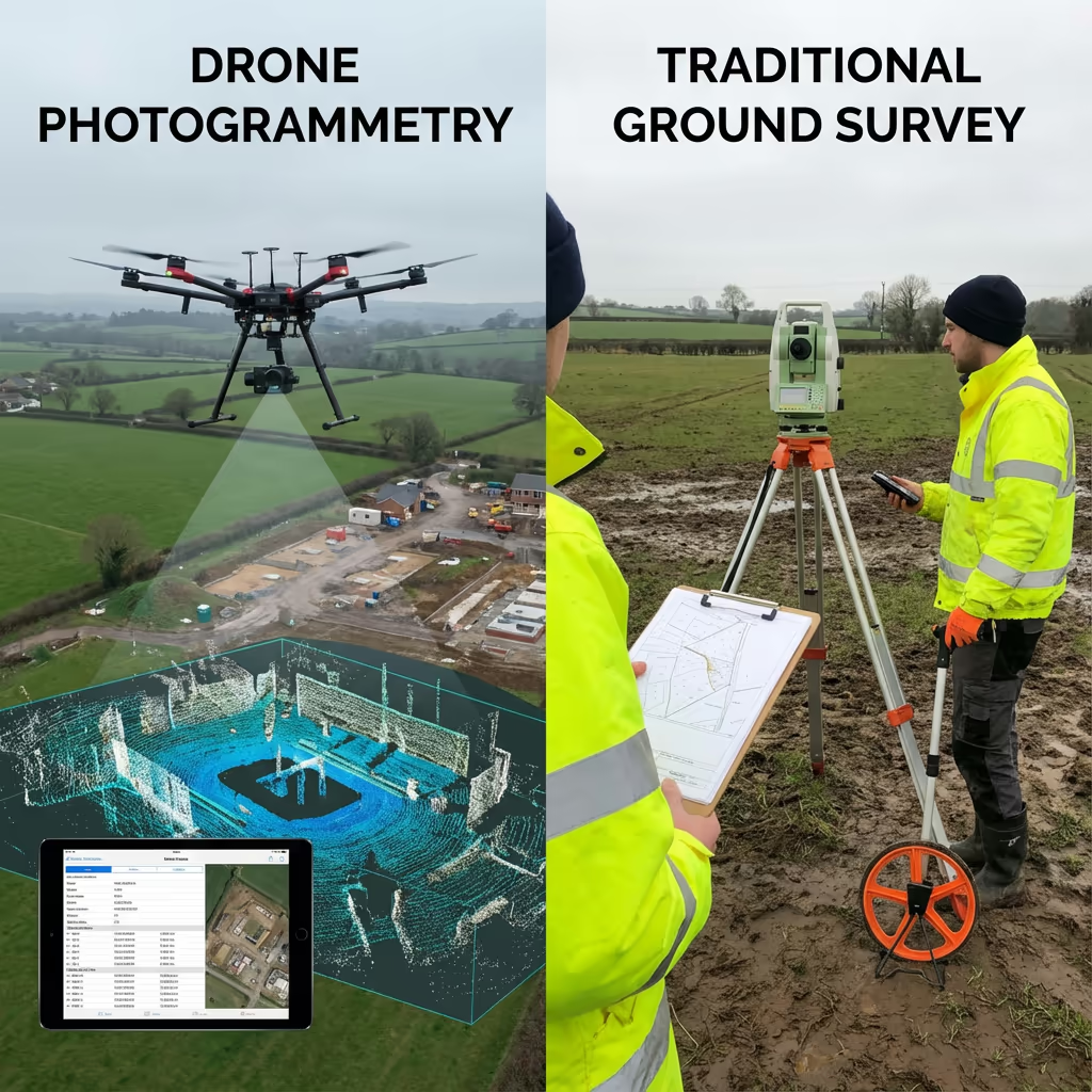
Is Drone Photogrammetry Survey Cheaper Than Traditional Surveying?
In most scenarios, yes—significantly. Traditional ground-based surveys require teams of surveyors spending days or weeks walking sites with total stations and GPS equipment. For large areas, the labour costs quickly add up.
Our drone photogrammetry captures equivalent or better data in a fraction of the time. A site that might take a ground team a week can be flown in hours. The cost savings typically range from 50-70% compared to traditional methods, while delivering faster turnaround and more comprehensive visual documentation. For large or complex sites, the economics become even more favourable.
Ready to Discuss Your Photogrammetry Project?
Expert advice • Tailored pricing • Response within 2 hours
James Leslie
Owner, Engineer & Drone Pilot
With extensive experience in surveying and UAV operations, James personally oversees every photogrammetry project to ensure survey-grade accuracy and professional delivery.
TLDR: Photogrammetry Drone Surveys Explained
Photogrammetry Deliverables
- High-resolution orthomosaic maps
- 3D point cloud (LAS/LAZ)
- Digital Surface Model (DSM)
- Digital Terrain Model (DTM)
- Contours at specified intervals
- CAD files (DXF/DWG)
Discuss Your Project
Get expert advice and tailored pricing.
Enterprise Equipment
Survey-Grade Drone Fleet
We don't use consumer mini drones like other providers. Our fleet consists of industrial, survey-grade aircraft purpose-built for capturing detailed, accurate datasets.

AgEagle eBee X
Professional fixed-wing for rapid terrain coverage

DJI Matrice 400
Engineered for excellence, designed for versatility

WingtraOne GEN II
Best-in-class surveying efficiency for large projects

DJI Matrice 350 RTK
Professional multi-payload platform for precision surveying

DJI Mavic 4E
Portable surveying powerhouse with RTK precision
DJI Matrice 300 RTK
Industry-leading inspection and mapping platform

DJI Matrice 4E
Precision survey drone with oblique capture
1 of 7
← Swipe to explore fleet →
Sensor Technology
Specialised Sensors for All Aerial Surveys
Our aircraft carry professional-grade sensors matched to your project requirements, from high-resolution photogrammetry to terrain-penetrating LiDAR.
LiDAR Sensors
Penetrate vegetation and capture precise terrain data with laser scanning technology.
Applications
- Forestry & vegetation mapping
- Terrain modelling under canopy
- Flood risk assessment
- Archaeological surveys
- Power line corridor mapping
Thermal Imaging
Detect heat signatures for building diagnostics, energy audits, and industrial inspections.
Applications
- Building thermal surveys
- Solar panel inspections
- Electrical fault detection
- Search and rescue
- Livestock monitoring
RGB & Photogrammetry
High-resolution imagery for detailed 3D models, orthomosaics, and visual inspections.
Applications
- Topographic surveys
- 3D model generation
- Progress monitoring
- Asset inspection
- Marketing photography
Need a specific sensor or payload?
Client Testimonials
Why Clients Rate Our Drone Survey Service 5 Stars
Don't just take our word for it. Here's what industry professionals say about working with us.
“By far the best drone surveying company I've used. Responsive, helpful and report quality is spot on. Extremely diligent in highlighting defects outside of scope. 10+ projects completed and never disappointed.”
Mark Reynolds
Building Surveyor
“DSS's drone roof survey was brilliant. James showed me everything wrong with my roof in about 30 minutes. Quick, professional and easy to understand.”
Helen Parker
Homeowner
“Fantastic company to do business with. Been working with the DSS team since 2021 and it's been an absolute pleasure. Highly recommended.”
Robert Hughes
Property Developer