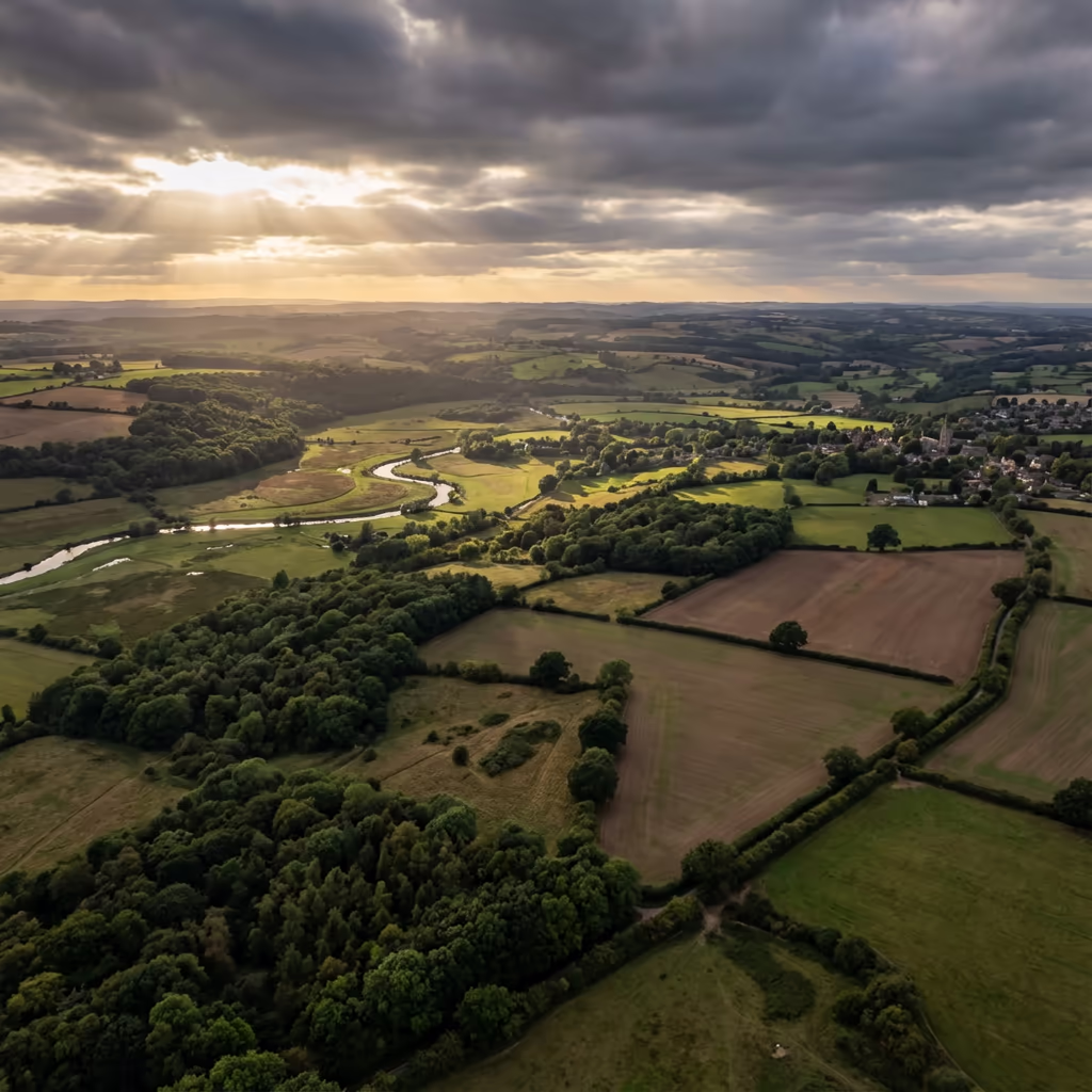
Rail Infrastructure
Drone Railway Survey Services
Precision rail corridor mapping, clearance analysis, and structure gauging—all without costly track possessions or access requirements.
Response within 2 hours • Or call 020 4634 0456
What Is a Drone Railway Survey?
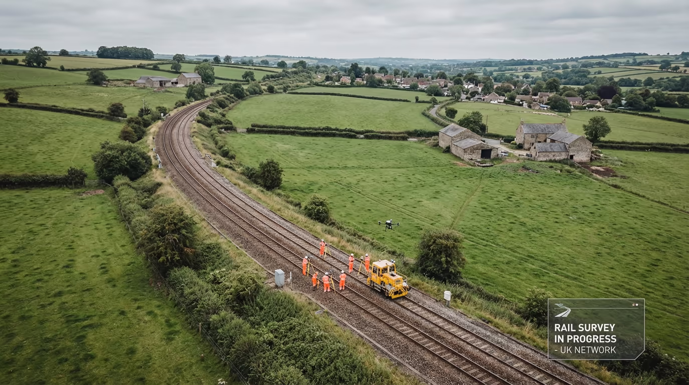
A drone railway survey uses unmanned aerial vehicles to capture detailed data along rail corridors without requiring track access or possessions. Our UAVs fly parallel to the track, capturing high-resolution imagery and precise measurements of the permanent way, structures, vegetation, and lineside assets.
At Drone Survey Services, we specialise in rail infrastructure surveys for Network Rail projects, heritage railways, and private freight operators. Our drone-based approach delivers survey-grade accuracy while eliminating the safety risks and operational disruption of traditional track-based methods.

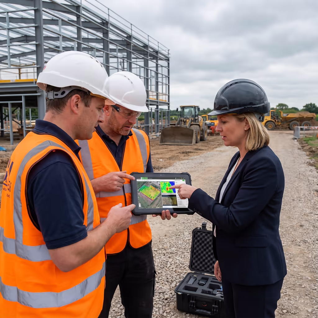
James Leslie
Owner, Engineer & Drone Pilot
"Got questions? Call me directly - I'm happy to talk through your project."
Call NowRail Corridor Data,No Track Access Needed
What You'll Receive
- Corridor orthomosaic imagery
- Cross-sections at specified intervals
- Clearance analysis reports
- Structure gauging data
Delivered in 5-10 working days
Why Choose Us
- CAA approved & fully insured
- No track possessions required
- Network Rail project experience
- UK-wide coverage
Trusted by rail infrastructure managers, TOCs, and engineering consultancies.
Trusted by leading organisations
How Much Does a Drone Railway Survey Cost?
Pricing depends on corridor length, deliverable requirements, and site complexity. Here's a guide to help you budget:
| Corridor Length | Guide Price |
|---|---|
| Short SectionUnder 2km | £1,000+ |
| Medium2–10km | £2,500+ |
| Long Corridor10–25km | £5,000+ |
| Major Route25+km | POA |
| Network Rail ProjectsAll sizes | POA |
*Guide prices include standard deliverables. Final quote based on corridor complexity, vegetation, structures, and specific requirements.
What affects your quote?
- Corridor length & complexity
- Number of structures
- Vegetation density
- Deliverable requirements
By eliminating the need for track possessions, our drone railway surveys save significant costs compared to traditional rail surveying methods. Contact us with your project details for a tailored quote within 24 hours.
Ready to get a quote for your rail project?
Free, no-obligation quotes within 24 hours
What Is the Difference Between Drone Railway Survey and Traditional Methods?
Traditional rail surveys require track possessions—blocking the line to allow survey teams safe access. This means service disruption, significant possession costs, and complex safety planning including Controller of Site Safety (COSS) and Personal Track Safety (PTS) requirements.
Drone railway surveys eliminate these requirements entirely. Our UAVs fly from positions adjacent to the track, capturing comprehensive data without ever needing to step on the ballast. This transforms project timelines and budgets while actually improving data coverage—we can survey areas that would be difficult or dangerous to access on foot.
When to Choose Each Approach
Drone Railway Survey
No track access required
Traditional Rail Survey
Track possession required
Not sure which approach suits your project?
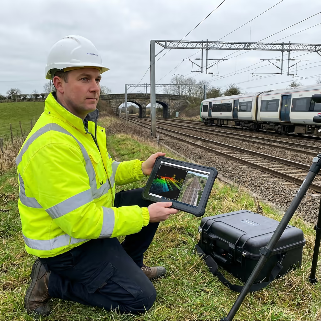
What Accuracy Can a Drone Railway Survey Achieve?
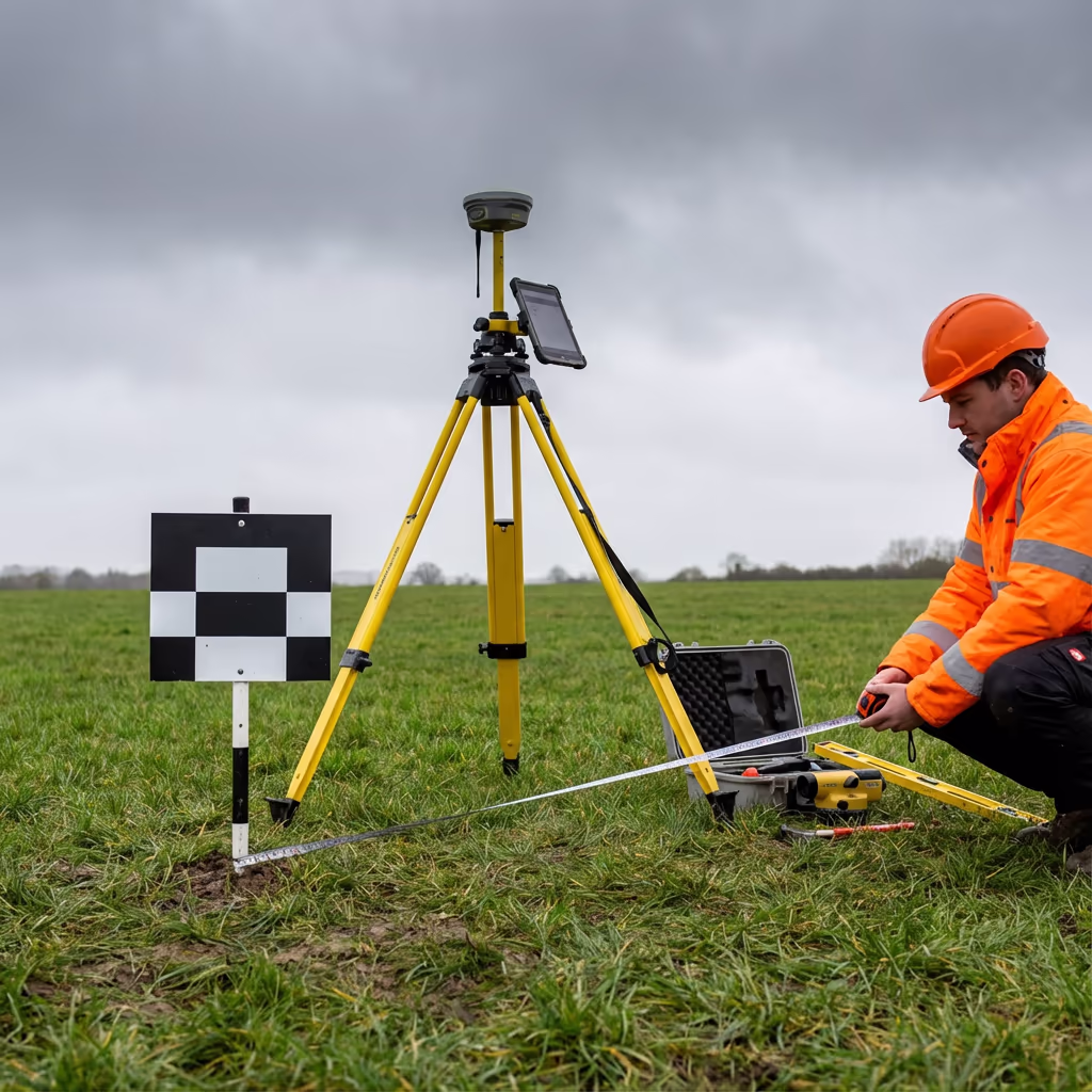
Our drone railway surveys achieve accuracies of ±2-5cm horizontally and ±3-5cm vertically when using RTK/PPK positioning and ground control points. This meets the requirements for most rail infrastructure applications including clearance analysis, structure gauging, and asset condition assessment.
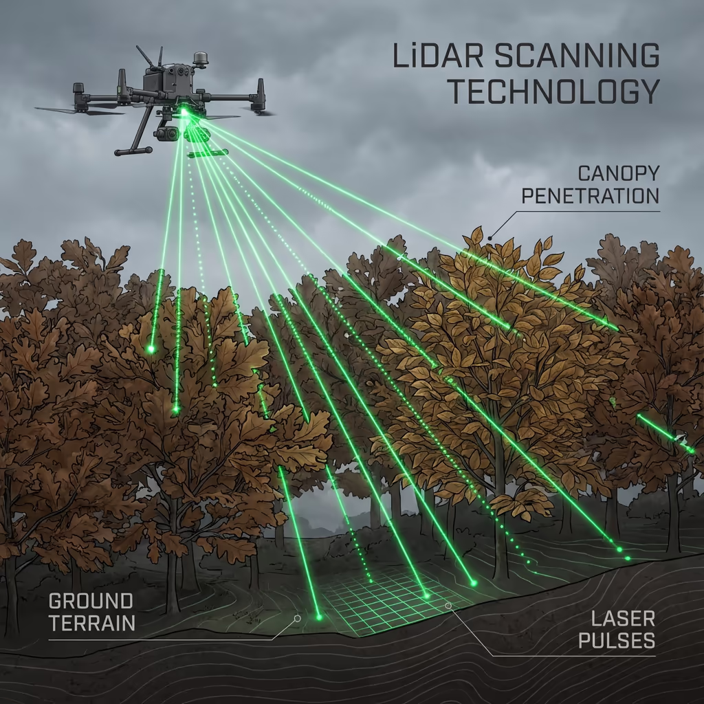
For projects requiring enhanced precision, we can combine drone photogrammetry with LiDAR scanning to achieve even tighter tolerances. Our survey methodology is designed to complement Network Rail standards and GRIP stage requirements, ensuring data is fit for purpose from initial feasibility through detailed design.
What Are the Applications of Drone Railway Survey?
Drone railway surveys support a wide range of rail infrastructure projects. Here are the key applications where our clients see the greatest value:
Clearance Analysis
Structure gauge verification, platform clearances, and overhead line equipment surveys for electrification and freight gauge enhancement projects.
Vegetation Management
Lineside vegetation mapping, encroachment assessment, and leaf-fall risk analysis to support maintenance planning.
Asset Condition
Bridge inspections, retaining wall surveys, culvert assessments, and lineside structure monitoring without scaffolding or access equipment.
Enhancement Schemes
Baseline surveys for line upgrades, platform extensions, new stations, and capacity enhancement projects.
Heritage Railways
Track condition surveys, level crossing assessments, and infrastructure documentation for preserved lines.
Incident Response
Rapid deployment for earthworks failures, landslips, bridge strikes, and emergency condition assessments.
Have a rail project that needs surveying?
Can Drones Survey Rail Corridors Without Track Access?
Yes—and this is where drone railway surveys deliver transformational benefits. Our UAVs operate from positions outside the railway boundary, typically from adjacent land, roads, or Network Rail access points. We never need to step on the track or require a possession.
For open track sections, we fly parallel to the corridor at appropriate standoff distances. For bridges, tunnels, and confined areas, we use oblique photography and LiDAR to capture data from accessible positions. This approach enables surveys during normal traffic operations—even on busy main lines.
The result is faster project timelines, dramatically reduced costs, and zero impact on train services. For Network Rail projects, this means no possession planning, no COSS coordination, and no track access forms—just high-quality survey data delivered efficiently.
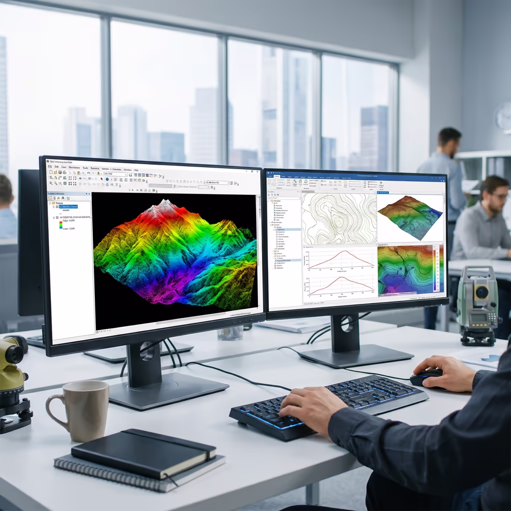
What Deliverables Do You Get From a Drone Railway Survey?
We tailor deliverables to your project requirements, but our standard drone railway survey outputs include:
Corridor Orthomosaic
High-resolution georeferenced imagery of the entire rail corridor, ideal for condition assessment, vegetation mapping, and desktop review.
Cross-Sections
Track cross-sections at your specified intervals showing rail level, ballast profile, cess, and lineside features.
Clearance Analysis
Structure gauge assessments, platform edge measurements, and overhead clearance data for gauge enhancement projects.
Structure Gauging
Bridge soffit levels, platform copings, tunnel profiles, and other structure dimensions against gauge requirements.
CAD Files & 3D Models
DWG/DXF drawings, 3D mesh models, and point cloud data compatible with major rail design software.
Need specific deliverables for your rail project?
How Long Does a Drone Railway Survey Take?
On-site data capture is remarkably fast. We typically survey 5-15km of corridor per day depending on complexity, vegetation, and the number of structures requiring detailed capture. A 10km branch line survey usually takes just one day of field work.
Processing and delivery depends on your required outputs. Standard corridor surveys are typically delivered within 5-10 working days. Complex projects with detailed clearance analysis may require 10-15 days. For urgent requirements, we offer expedited processing with faster turnaround available.
| Phase | Duration |
|---|---|
| Planning & Coordination | 2-5 days |
| On-Site Data Capture | 1-3 days |
| Data Processing | 3-5 days |
| Analysis & QC | 2-4 days |
| Deliverable Generation | 2-3 days |
| Total (Standard) | 5-10 working days |
Express Processing Available
Need it faster? Expedited delivery available for urgent rail projects.
How Do I Choose a Drone Railway Survey Provider?
Rail survey work requires specialist knowledge beyond standard drone operations. When evaluating providers, we recommend checking these key factors:
- CAA authorisation – Valid GVC permissions for commercial operations near rail infrastructure
- Rail sector experience – Understanding of Network Rail standards, GRIP stages, and rail-specific deliverables
- Professional insurance – Adequate liability cover for operations near critical infrastructure
- Clearance analysis capability – Software and expertise for gauge verification and structure assessment
- Proven track record – Case studies from similar rail corridor projects
At Drone Survey Services, we bring engineering expertise combined with advanced UAV technology to deliver rail surveys that meet the highest professional standards. We're CAA approved, fully insured, and experienced in working with Network Rail, TOCs, and rail engineering consultancies.
Ready to work with a trusted rail survey provider?
Is Drone Railway Survey Cheaper Than Track-Based Methods?
Significantly—often by 50-70% or more. Traditional rail surveys carry substantial costs beyond the survey work itself: track possession charges, safety personnel (COSS, lookouts), service disruption compensation, and the extended timescales required to secure possessions on busy routes.
Our drone-based approach eliminates all these costs. We can survey during normal traffic operations, require no track access, and typically complete projects in a fraction of the time. For a typical 10km corridor survey, the savings compared to traditional methods can easily exceed £10,000-£20,000—while actually delivering more comprehensive data coverage.
Ready to Discuss Your Rail Survey Project?
Expert advice • No possession costs • Response within 2 hours
James Leslie
Owner, Engineer & Drone Pilot
With engineering experience and specialist UAV expertise, James personally oversees every rail survey project to ensure professional standards and accurate deliverables.
TLDR: Drone Railway Surveys Explained
Railway Survey Deliverables
- Corridor orthomosaic
- Cross-sections
- Clearance analysis
- Structure gauging
- CAD files (DWG/DXF)
- 3D models & point clouds
Discuss Your Rail Project
Get expert advice and tailored pricing.
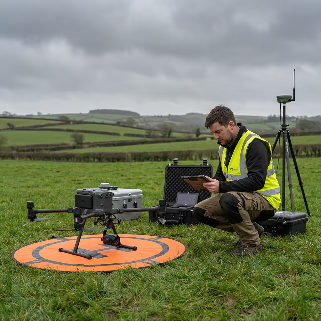
Enterprise Equipment
Survey-Grade Drone Fleet
We don't use consumer mini drones like other providers. Our fleet consists of industrial, survey-grade aircraft purpose-built for capturing detailed, accurate datasets.

AgEagle eBee X
Professional fixed-wing for rapid terrain coverage

DJI Matrice 400
Engineered for excellence, designed for versatility

WingtraOne GEN II
Best-in-class surveying efficiency for large projects

DJI Matrice 350 RTK
Professional multi-payload platform for precision surveying

DJI Mavic 4E
Portable surveying powerhouse with RTK precision
DJI Matrice 300 RTK
Industry-leading inspection and mapping platform

DJI Matrice 4E
Precision survey drone with oblique capture
1 of 7
← Swipe to explore fleet →
Sensor Technology
Specialised Sensors for All Aerial Surveys
Our aircraft carry professional-grade sensors matched to your project requirements, from high-resolution photogrammetry to terrain-penetrating LiDAR.
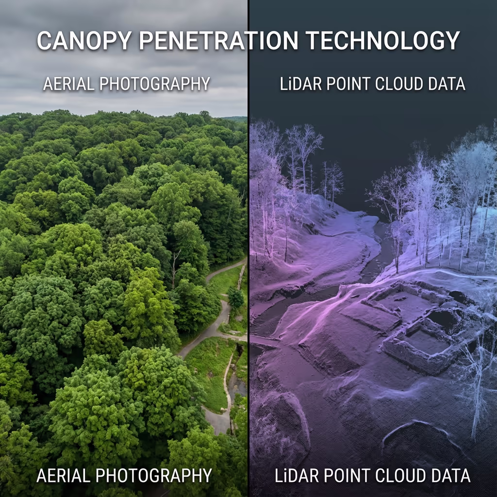
LiDAR Sensors
Penetrate vegetation and capture precise terrain data with laser scanning technology.
Applications
- Forestry & vegetation mapping
- Terrain modelling under canopy
- Flood risk assessment
- Archaeological surveys
- Power line corridor mapping
Thermal Imaging
Detect heat signatures for building diagnostics, energy audits, and industrial inspections.
Applications
- Building thermal surveys
- Solar panel inspections
- Electrical fault detection
- Search and rescue
- Livestock monitoring
RGB & Photogrammetry
High-resolution imagery for detailed 3D models, orthomosaics, and visual inspections.
Applications
- Topographic surveys
- 3D model generation
- Progress monitoring
- Asset inspection
- Marketing photography
Need a specific sensor or payload?
Client Testimonials
Why Clients Rate Our Drone Survey Service 5 Stars
Don't just take our word for it. Here's what industry professionals say about working with us.
“By far the best drone surveying company I've used. Responsive, helpful and report quality is spot on. Extremely diligent in highlighting defects outside of scope. 10+ projects completed and never disappointed.”
Mark Reynolds
Building Surveyor
“DSS's drone roof survey was brilliant. James showed me everything wrong with my roof in about 30 minutes. Quick, professional and easy to understand.”
Helen Parker
Homeowner
“Fantastic company to do business with. Been working with the DSS team since 2021 and it's been an absolute pleasure. Highly recommended.”
Robert Hughes
Property Developer