Surveying & Mapping
Drone Road Survey Services
Precision aerial surveys for roads, highways, and transport infrastructure. Accurate cross-sections, surface condition mapping, and CAD-ready deliverables.
Response within 2 hours • Or call 020 4634 0456
What Is a Drone Road Survey?
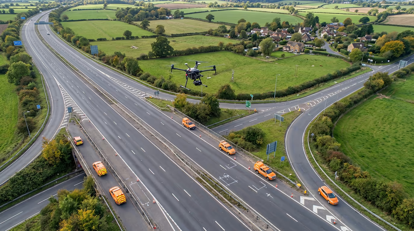
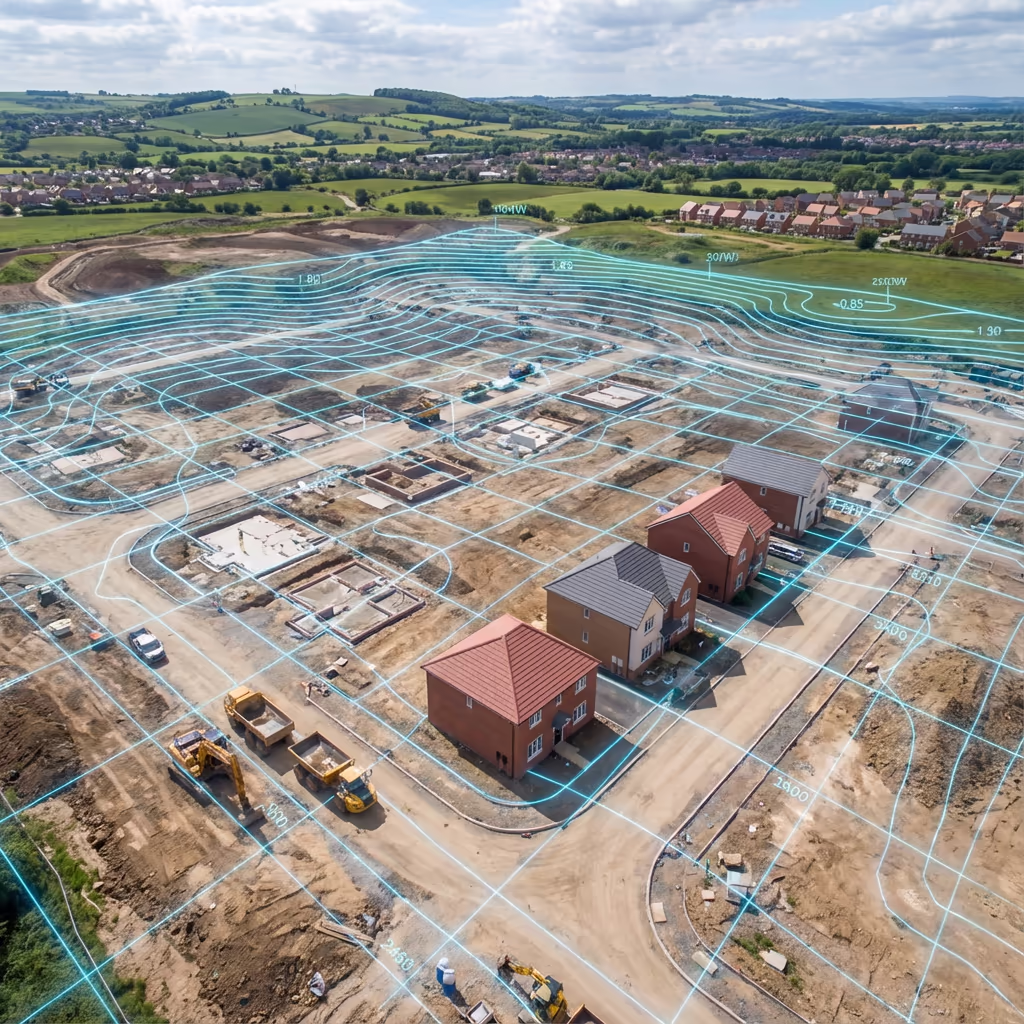
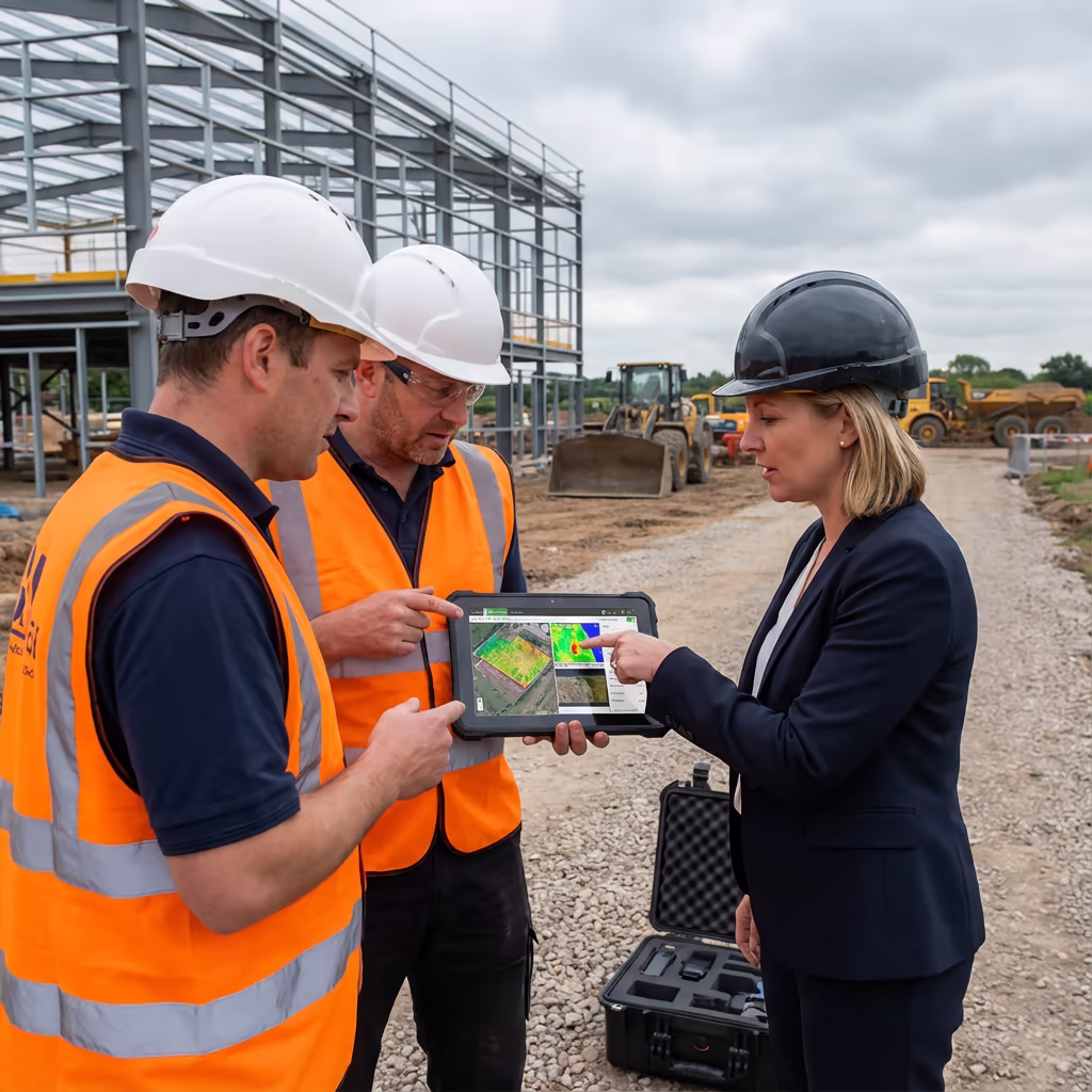
A drone road survey uses UAV-mounted cameras and sensors to capture highly accurate data of road corridors, highways, and transport infrastructure. Our drones fly systematic grid patterns along roads, capturing thousands of overlapping images that are processed into precise 3D models, orthomosaics, and cross-sections.
At Drone Survey Services, we deliver survey-grade road data for highway authorities, civil engineers, and transport planners. Whether you need cross-sections for resurfacing projects, surface condition assessments, or complete corridor mapping for new road schemes, our drone road surveys provide the accurate data you need—faster and more cost-effectively than traditional methods.

James Leslie
Owner, Engineer & Drone Pilot
"Got questions? Call me directly - I'm happy to talk through your project."
Call NowSurvey-Grade Road Data,Delivered Fast
What You'll Receive
- High-resolution orthomosaic
- Cross-sections at any interval
- Longitudinal profiles
- Survey-grade accuracy (±2-5cm)
Delivered in 5-7 working days
Why Choose Us
- CAA approved & fully insured
- Specialist road survey expertise
- Latest DJI & sensor technology
- UK-wide coverage
Trusted by highway authorities, engineers & transport planners across the UK.
Trusted by leading organisations
How Much Does a Drone Road Survey Cost?
Pricing depends on the length of road and complexity of your requirements. Here's a guide to help you budget:
| Road Length | Guide Price |
|---|---|
| Short StretchUnder 1km | £600+ |
| Medium1-5km | £1,200+ |
| Long5-10km | £2,000+ |
| Major Route10+ km | £3,500+ |
| Network SurveyMultiple routes | POA |
*Guide prices include standard deliverables. Final quote based on road width, traffic management requirements, and specific outputs needed.
What affects your quote?
- Road length & width
- Traffic management needs
- Required deliverables
- Turnaround time
Our drone-based approach typically saves 50-70% compared to traditional road survey methods—and dramatically reduces traffic disruption. Contact us with your project details and we'll provide a tailored quote within 24 hours.
Ready to get a quote for your road project?
Free, no-obligation quotes within 24 hours
What Is the Difference Between Drone Road Survey and Traditional Methods?
Traditional road surveys require teams of surveyors working on or beside live carriageways. This means traffic management, lane closures, and significant health and safety considerations. It's slow, expensive, and disruptive to road users.
Drone road surveys capture the same data—often more—from the air. Our UAVs fly above the road corridor, capturing thousands of images in a fraction of the time. We can survey 10km of road in a single day that might take a ground team weeks. Traffic disruption is minimal or eliminated entirely for many projects.
When to Choose Each Approach
Choose Drone Road Survey
Fast & minimal disruption
Choose Traditional Methods
When ground access is essential
Not sure which approach suits your project?
What Accuracy Can a Drone Road Survey Achieve?
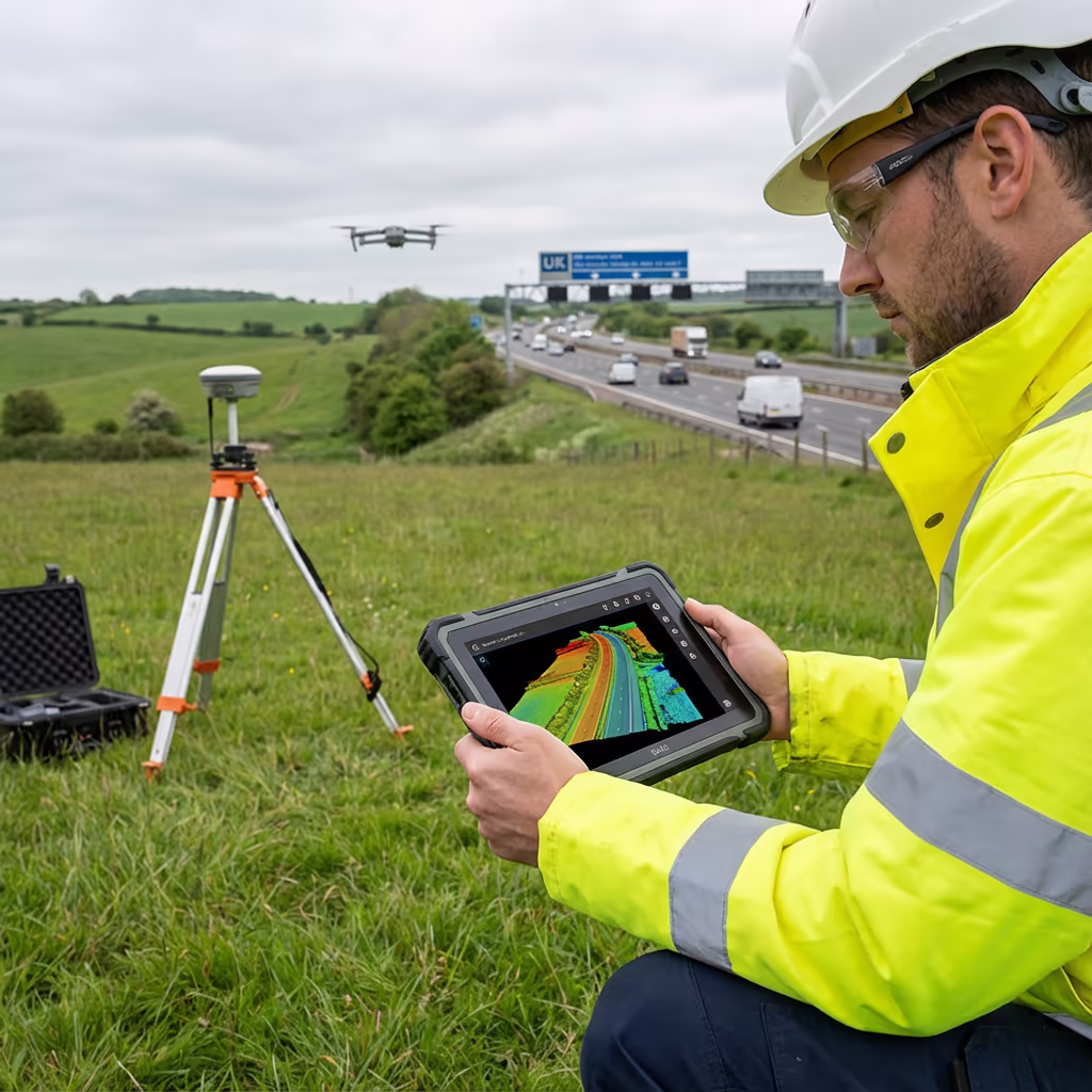
Our drone road surveys routinely achieve vertical accuracy of ±2-5cm and horizontal accuracy of ±3-5cm when using ground control points. This level of precision meets the requirements for highway design, resurfacing projects, and engineering applications.
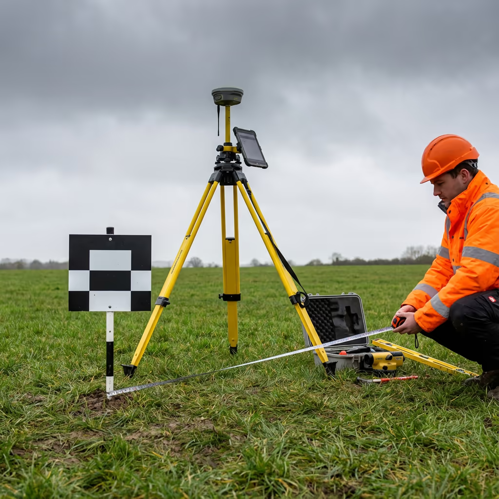
We use RTK/PPK-enabled drones with high-resolution cameras to ensure precise positioning. For projects requiring the highest accuracy, we establish ground control networks along the road corridor and process data using rigorous photogrammetric workflows. Cross-sections and profiles are extracted to engineering-grade standards suitable for CAD integration.
What Are the Applications of Drone Road Survey?
Drone road surveys serve a wide range of highway and transport infrastructure projects. Here are the key applications where our clients see the greatest value:
Road Design & Planning
Accurate terrain models and existing conditions surveys for new road schemes, junction improvements, and road widening projects.
Resurfacing Projects
Precise cross-sections and longitudinal profiles for surfacing quantity calculations and material specification.
Highway Asset Management
Network-wide condition surveys, asset inventories, and baseline data for highway authorities and maintenance contractors.
Drainage & Flooding
Accurate elevation data for drainage design, flood risk assessment, and surface water management along road corridors.
Active Travel Routes
Cycle paths, pedestrian routes, and multi-use trails—capturing existing conditions for upgrade and improvement schemes.
Construction Monitoring
Progress surveys during road construction, volume calculations for earthworks, and as-built verification.
Have a road project that needs surveying?
Can Drone Road Survey Capture Road Surface Condition?
Yes—our high-resolution drone imagery captures detailed road surface condition data. From centimetre-resolution orthomosaics, we can identify and map surface defects including cracking patterns, potholes, patching, rutting evidence, and deterioration of road markings.
For highway authorities and maintenance contractors, this provides a powerful tool for condition assessment and planned maintenance prioritisation. Combined with our 3D surface models, we can quantify rutting depth, identify drainage issues, and support asset management decisions. This visual condition data complements traditional machine-based surveys and provides context that automated systems often miss.
What Deliverables Do You Get From a Drone Road Survey?
We tailor deliverables to your project requirements. Our standard drone road survey outputs include:
High-Resolution Orthomosaic
Georeferenced aerial imagery of the entire road corridor at 1-2cm per pixel resolution. Perfect for condition assessment and visual documentation.
Cross-Sections
Accurate cross-sections at any interval you specify—typically 10m, 20m, or 50m depending on project requirements.
Longitudinal Profiles
Road centreline profiles showing vertical alignment, gradients, and level changes along the route.
Surface Condition Reports
Visual assessment of road surface condition with defect mapping and photographic evidence.
CAD Drawings
AutoCAD-compatible DWG files with road edge, kerb lines, markings, and survey data ready for design integration.
Digital Terrain Model (DTM)
Bare-earth surface model of the road corridor for drainage analysis, earthworks calculations, and design development.
Need specific deliverables for your road project?
How Long Does a Drone Road Survey Take?
On-site data capture is remarkably fast compared to traditional methods. We can survey 5-10km of road corridor per day depending on width, traffic conditions, and complexity. A typical 2km road scheme takes just 2-3 hours of flight time, plus setup and ground control establishment.
Processing and delivery depends on project complexity and your required outputs. Standard deliverables are typically ready within 5-7 working days. For urgent projects, we offer expedited processing with 48-72 hour turnaround available at additional cost.
| Phase | Duration |
|---|---|
| Planning & Permissions | 1-3 days |
| On-Site Data Capture | ½-1 day |
| Photogrammetric Processing | 2-3 days |
| Cross-Section Extraction | 1-2 days |
| QC & Delivery | 1 day |
| Total (Standard) | 5-7 working days |
Express Processing Available
Need it faster? 48-72 hour turnaround available for urgent road projects.
How Do I Choose a Drone Road Survey Provider?
Not all drone survey providers have experience with road and highway projects. When evaluating providers, we recommend checking these key factors:
- CAA authorisation – Ensure they hold valid GVC or legacy PfCO permissions for commercial operations
- Professional insurance – Public liability and professional indemnity cover appropriate to highway projects
- Road survey experience – Ask about their experience with linear corridor surveys and cross-section extraction
- CAD capability – Ensure they can deliver in your required formats (DWG, DXF, etc.)
- Relevant case studies – Request examples of similar road and highway projects they've completed
At Drone Survey Services, we tick every box. We're CAA approved, fully insured, and have delivered road survey projects for highway authorities, civil engineering consultants, and transport planners across the UK.
Ready to work with a trusted road survey provider?
Is Drone Road Survey Cheaper Than Traditional Methods?
In most scenarios, yes—often dramatically so. Traditional road surveys require teams of surveyors working on or beside live carriageways, with all the traffic management, health and safety, and time costs that entails. A ground survey of a 5km road corridor might take a team a week or more.
Our drone approach captures equivalent data in hours, not days. We fly above the road corridor, eliminating most traffic management requirements and dramatically reducing on-site time. The cost savings typically range from 50-70% compared to traditional methods—and you get faster turnaround with less disruption to road users. For busy roads and motorways, the indirect savings from reduced traffic disruption can be even greater.
Ready to Discuss Your Road Survey Project?
Expert advice • Tailored pricing • Response within 2 hours
James Leslie
Owner, Engineer & Drone Pilot
With extensive experience in surveying and UAV operations, James personally oversees every road survey project to ensure survey-grade accuracy and professional delivery.
TLDR: Drone Road Surveys Explained
Road Survey Deliverables
- High-resolution orthomosaic
- Cross-sections at any interval
- Longitudinal profiles
- Surface condition reports
- CAD drawings (DWG/DXF)
- Digital Terrain Model (DTM)
Discuss Your Project
Get expert advice and tailored pricing.
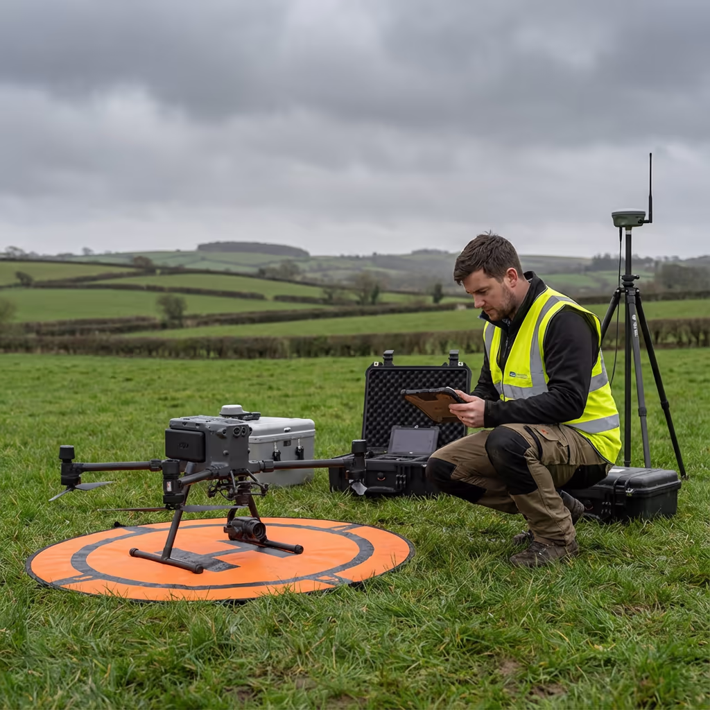
Enterprise Equipment
Survey-Grade Drone Fleet
We don't use consumer mini drones like other providers. Our fleet consists of industrial, survey-grade aircraft purpose-built for capturing detailed, accurate datasets.

AgEagle eBee X
Professional fixed-wing for rapid terrain coverage

DJI Matrice 400
Engineered for excellence, designed for versatility

WingtraOne GEN II
Best-in-class surveying efficiency for large projects

DJI Matrice 350 RTK
Professional multi-payload platform for precision surveying

DJI Mavic 4E
Portable surveying powerhouse with RTK precision
DJI Matrice 300 RTK
Industry-leading inspection and mapping platform

DJI Matrice 4E
Precision survey drone with oblique capture
1 of 7
← Swipe to explore fleet →
Sensor Technology
Specialised Sensors for All Aerial Surveys
Our aircraft carry professional-grade sensors matched to your project requirements, from high-resolution photogrammetry to terrain-penetrating LiDAR.
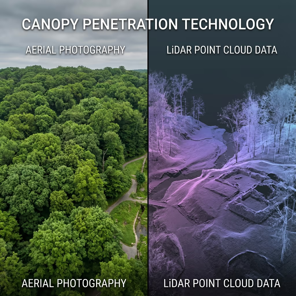
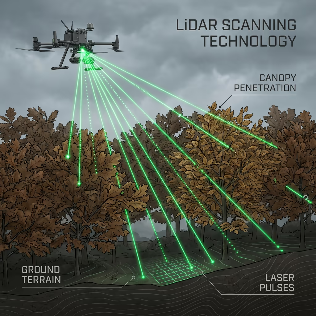
LiDAR Sensors
Penetrate vegetation and capture precise terrain data with laser scanning technology.
Applications
- Forestry & vegetation mapping
- Terrain modelling under canopy
- Flood risk assessment
- Archaeological surveys
- Power line corridor mapping
Thermal Imaging
Detect heat signatures for building diagnostics, energy audits, and industrial inspections.
Applications
- Building thermal surveys
- Solar panel inspections
- Electrical fault detection
- Search and rescue
- Livestock monitoring
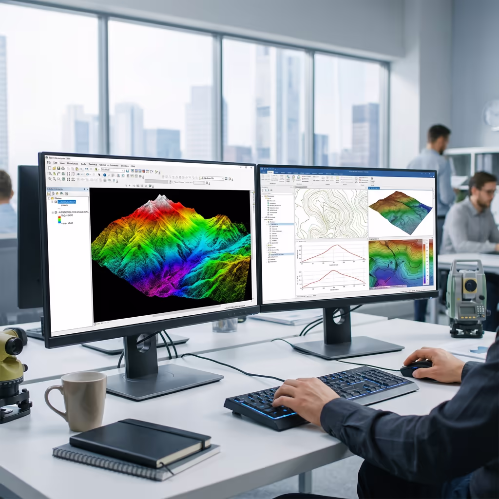
RGB & Photogrammetry
High-resolution imagery for detailed 3D models, orthomosaics, and visual inspections.
Applications
- Topographic surveys
- 3D model generation
- Progress monitoring
- Asset inspection
- Marketing photography
Need a specific sensor or payload?
Client Testimonials
Why Clients Rate Our Drone Survey Service 5 Stars
Don't just take our word for it. Here's what industry professionals say about working with us.
“By far the best drone surveying company I've used. Responsive, helpful and report quality is spot on. Extremely diligent in highlighting defects outside of scope. 10+ projects completed and never disappointed.”
Mark Reynolds
Building Surveyor
“DSS's drone roof survey was brilliant. James showed me everything wrong with my roof in about 30 minutes. Quick, professional and easy to understand.”
Helen Parker
Homeowner
“Fantastic company to do business with. Been working with the DSS team since 2021 and it's been an absolute pleasure. Highly recommended.”
Robert Hughes
Property Developer