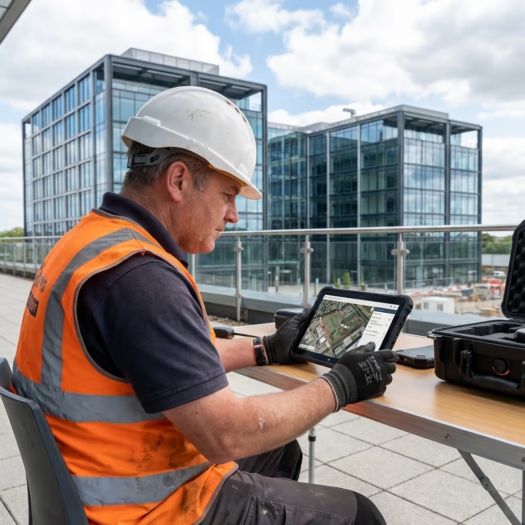
Inspection & Assessment
Drone Roof Survey Services
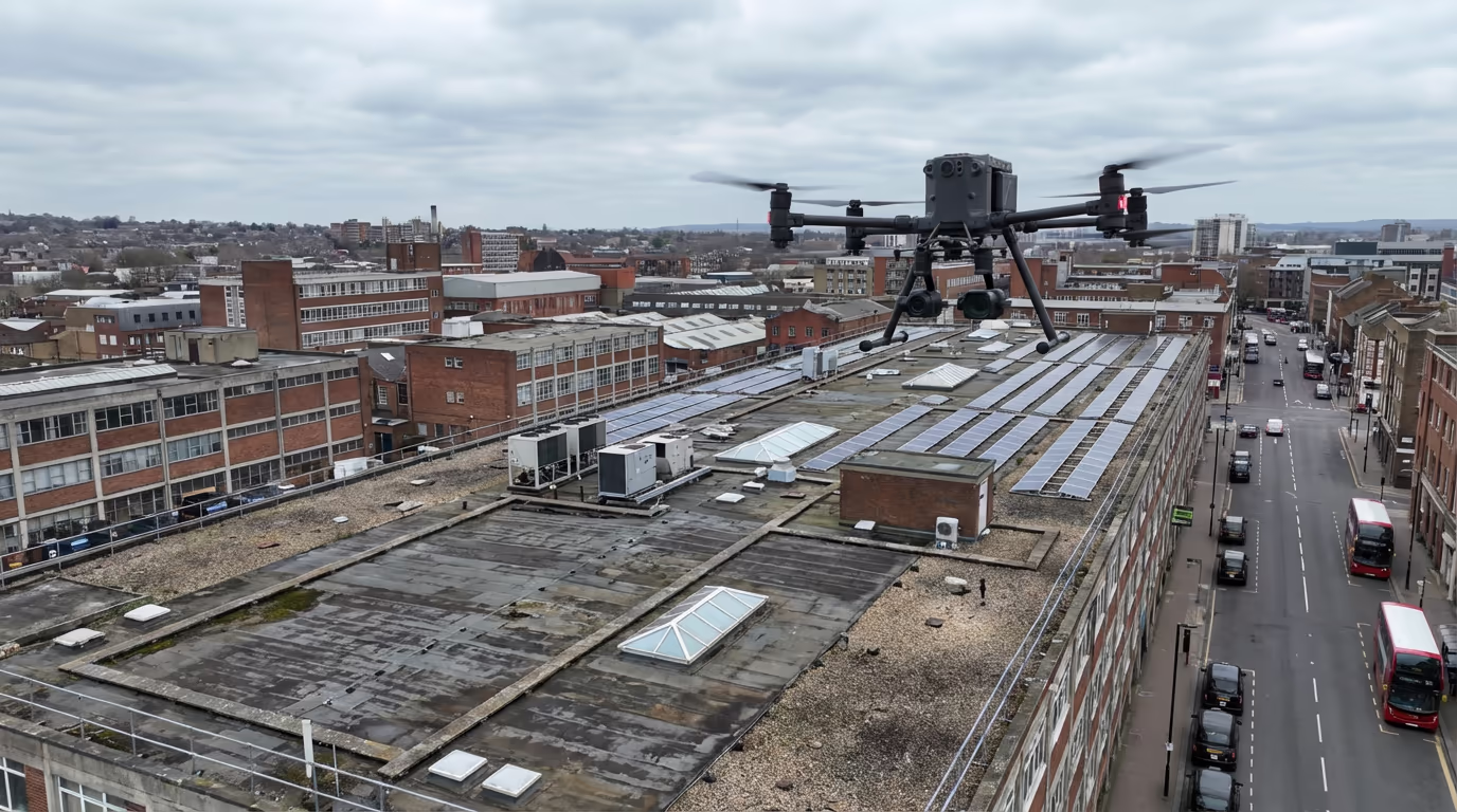
Safe, detailed aerial roof inspections without scaffolding or cherry pickers. High-resolution imagery and thermal analysis for accurate condition assessments.
Response within 2 hours • Or call 020 4634 0456
What Is a Drone Roof Survey?
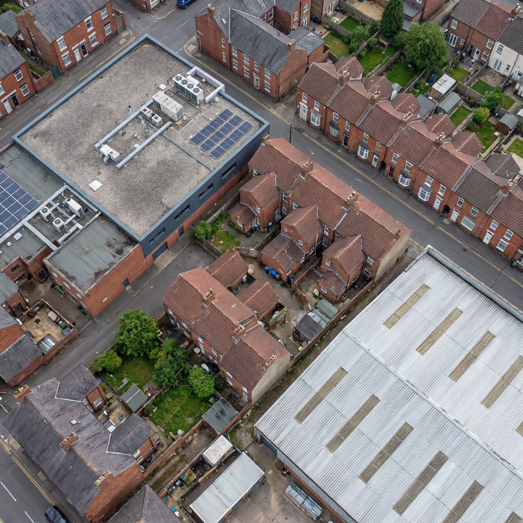
A drone roof survey uses professional UAV technology to capture detailed imagery of your roof from above, without the need for scaffolding, cherry pickers, or anyone climbing onto the roof itself. Our drones capture high-resolution photographs and video that reveal the true condition of your roofing materials.
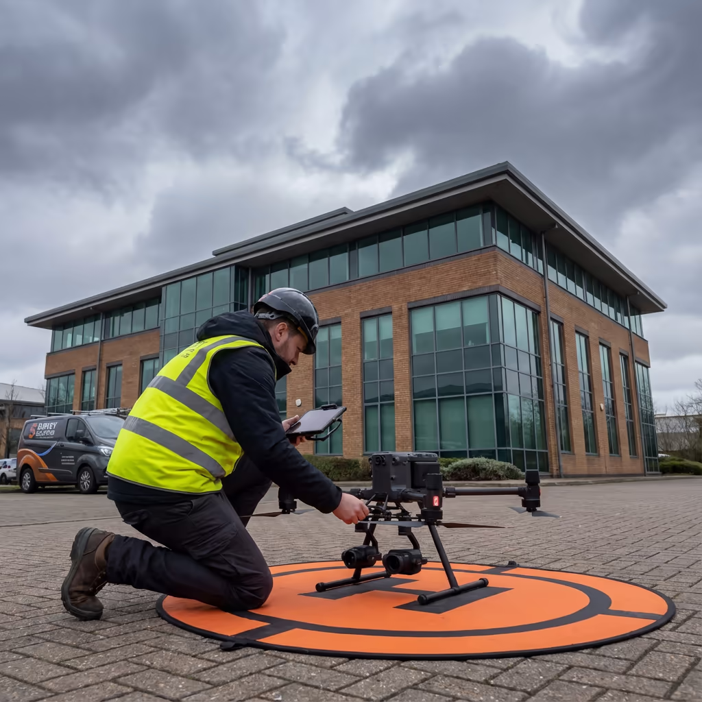
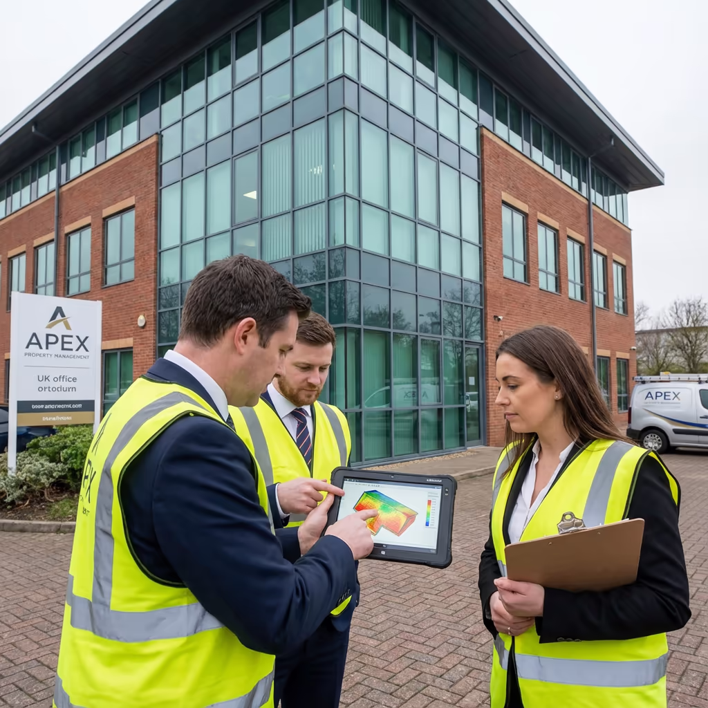
At Drone Survey Services, we deploy the latest camera drones equipped with high-resolution sensors and optional thermal imaging capabilities. This allows us to identify defects, damage, and potential problem areas that would be impossible to see from ground level—and often missed even by traditional on-roof inspections.

James Leslie
Owner, Engineer & Drone Pilot
"Got questions? Call me directly - I'm happy to talk through your project."
Call NowSafe Roof Inspections,No Scaffolding Required
What You'll Receive
- High-resolution aerial imagery
- Annotated defect report
- Thermal imaging (optional)
- Maintenance recommendations
Delivered in 3-5 working days
Why Choose Us
- CAA approved & fully insured
- No scaffolding costs
- Same-week availability
- UK-wide coverage
Trusted by property managers, surveyors & building owners across the UK.
Trusted by leading organisations
How Much Does a Drone Roof Survey Cost?
Drone roof survey pricing depends on the size and complexity of your property. Here's a guide to help you budget:
| Property Type | Guide Price |
|---|---|
| ResidentialSingle property | £250+ |
| Small CommercialUp to 500m² | £350+ |
| Medium Commercial500-2000m² | £500+ |
| Large Commercial2000m²+ | £750+ |
| Multi-BuildingPortfolio | POA |
| Thermal Add-on | +£150 |
*Guide prices include standard deliverables. Final quote based on site complexity, access, and specific requirements.
What affects your quote?
- Roof size & complexity
- Number of buildings
- Location & access
- Thermal imaging requirement
Compared to traditional roof inspections requiring scaffolding or access equipment, a drone roof survey typically saves 60-80% on access costs alone. Contact us with your property details and we'll provide a tailored quote within 24 hours.
Ready to get a quote for your roof survey?
Free, no-obligation quotes within 24 hours
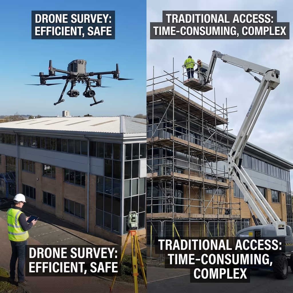
What Is the Difference Between Drone Roof Survey and Traditional Inspection?
Traditional roof inspections typically require scaffolding, cherry pickers, or surveyors physically climbing onto the roof. This brings significant costs, safety risks, and often takes days to organise. Weather delays can push timelines even further.
A drone roof survey eliminates these challenges. We can be on-site within days, complete the survey in hours, and capture imagery that's often more detailed than a visual inspection from roof level. Our drones access areas that would be dangerous or impossible to reach on foot, and the entire process carries zero risk of falls or accidents.
Why Choose Drone Over Traditional?
Drone Roof Survey
Fast, safe & cost-effective
Traditional Inspection
Scaffolding or access equipment
Not sure if a drone roof survey suits your property?
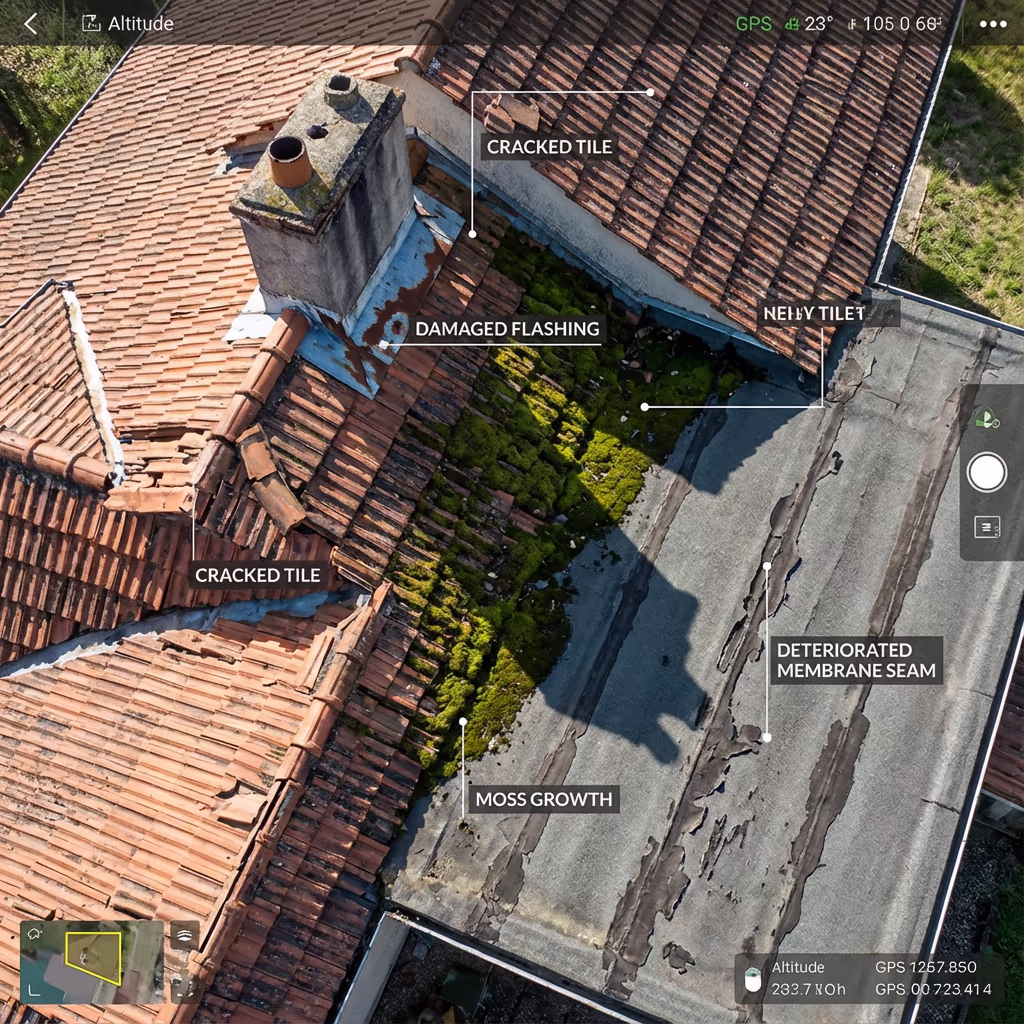
What Accuracy Can a Drone Roof Survey Achieve?
Our drone roof surveys capture imagery at resolutions of 1-2cm per pixel—detailed enough to identify individual cracked tiles, lifted flashings, blocked gutters, and even early-stage moss growth. This level of detail often exceeds what can be seen during a physical walk-over inspection.
When combined with orthomosaic processing, we can produce scaled, measurable roof plans that allow you to calculate areas, plan repairs, and specify materials with confidence. For structural assessments or insurance claims, this documentation provides clear, dated evidence of roof condition.
What Are the Applications of Drone Roof Survey?
Drone roof surveys are valuable across a wide range of property types and situations. Here are the key applications where our clients see the greatest value:
Residential Properties
Pre-purchase surveys, insurance claims, periodic maintenance checks, and storm damage assessment for houses and flats.
Commercial Buildings
Office blocks, retail units, and multi-storey buildings where traditional access is expensive and disruptive.
Industrial & Warehouses
Large flat roofs on distribution centres, factories, and logistics facilities—often too large for practical scaffold coverage.
Heritage & Listed Buildings
Churches, historic properties, and listed buildings where physical access could cause damage or is restricted.
Insurance & Claims
Storm damage documentation, condition reports for underwriters, and evidence gathering for insurance disputes.
Energy Audits
Thermal drone roof surveys to identify heat loss, insulation defects, and moisture ingress for energy efficiency improvements.
Have a roof that needs surveying?
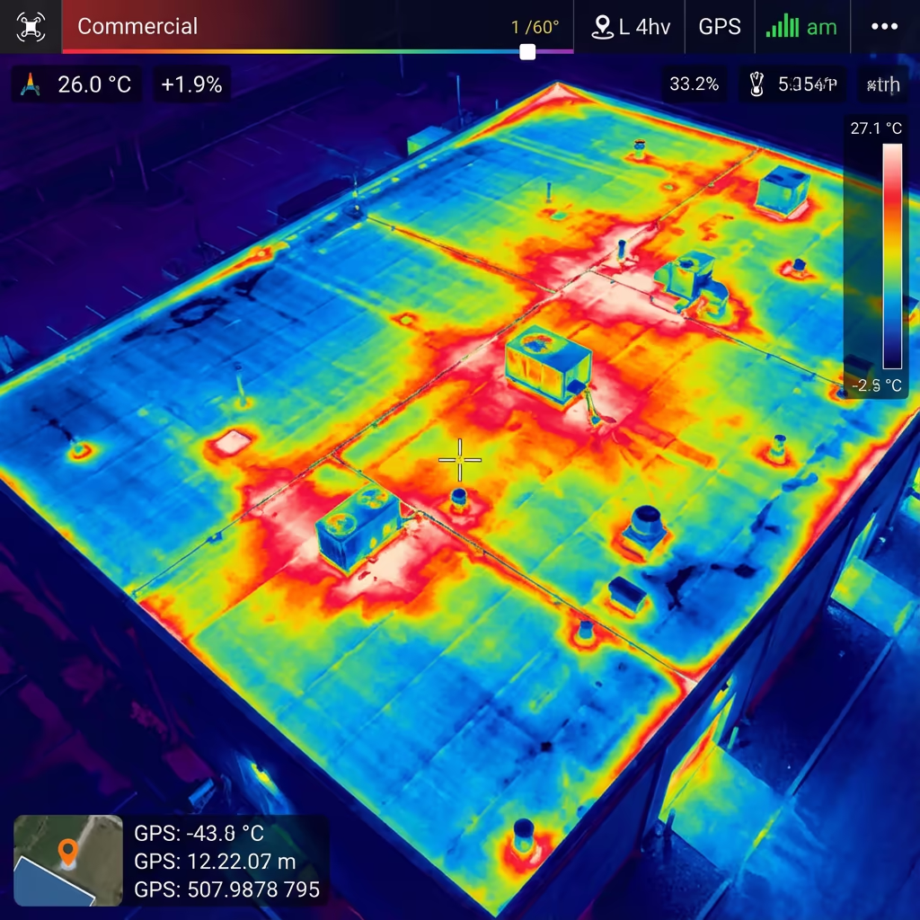
Can Drone Roof Surveys Detect Leaks?
Yes—with thermal imaging. Our drones can be equipped with radiometric thermal cameras that detect temperature variations across your roof surface. Trapped moisture retains heat differently than dry materials, making water ingress visible even when there's no obvious surface damage.
Thermal drone roof surveys are particularly effective for:
- Moisture detection – Finding water ingress before it causes interior damage
- Heat loss identification – Locating insulation gaps and thermal bridges
- Flat roof assessments – Identifying ponding and drainage issues
- Solar panel efficiency – Checking for faulty cells and connections
For the best results, thermal surveys are conducted in the early morning or evening when temperature differentials are most pronounced. We'll advise on optimal timing when you enquire.
Add Thermal Imaging to Any Survey
Just +£150 to add thermal analysis to your drone roof survey.
What Deliverables Do You Get From a Drone Roof Survey?
We tailor deliverables to your requirements, but our standard drone roof survey outputs include:
High-Resolution Aerial Imagery
Full coverage photography at 1-2cm/pixel resolution showing every detail of your roof surface, flashings, and drainage.
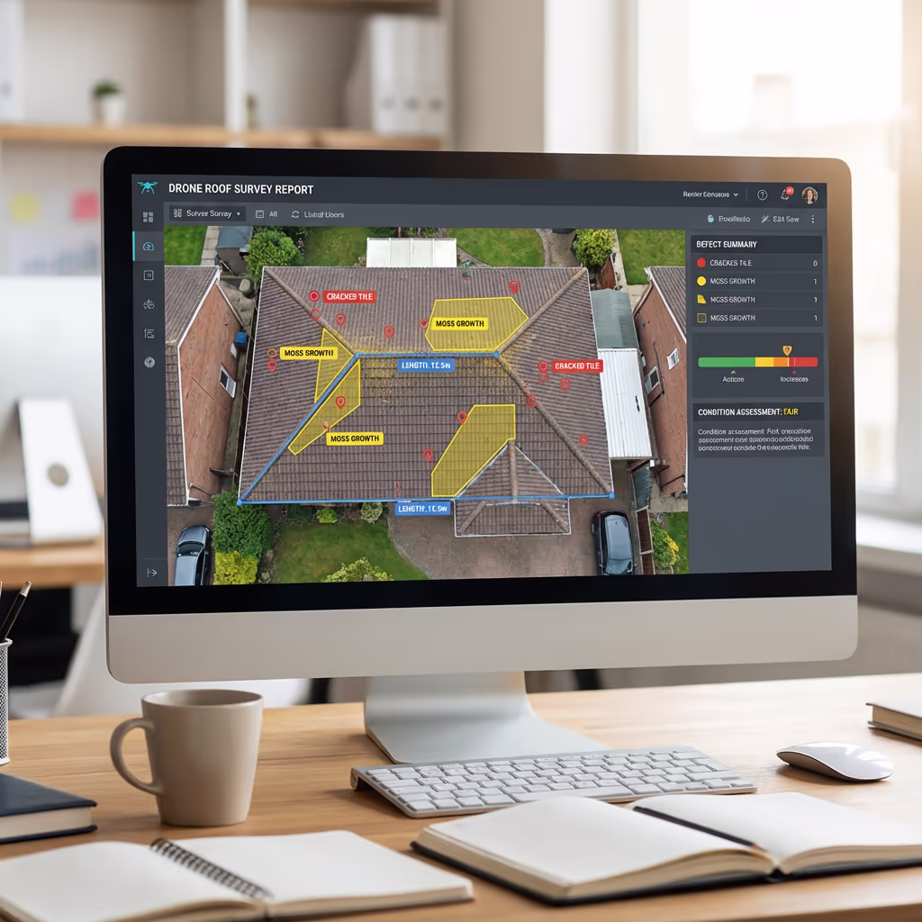
Annotated Defect Report
Professional PDF report with defects marked, photographed, and described. Includes location reference and severity assessment.
Orthomosaic Roof Plan
Scaled, measurable plan view of your entire roof, ideal for calculating areas and planning repairs.
Thermal Imagery (Optional)
Radiometric thermal images showing heat loss patterns, moisture detection, and insulation defects.
Condition Report & Recommendations
Executive summary of roof condition with prioritised maintenance recommendations and estimated repair areas.
Need specific deliverables for your project?
How Long Does a Drone Roof Survey Take?
On-site data capture is remarkably fast. A typical residential roof takes 20-30 minutes to survey. Medium commercial buildings take 1-2 hours. Even large industrial complexes can usually be completed within a half-day.
Report delivery depends on the scope of your survey. Standard photo reports are typically ready within 3-5 working days. Surveys requiring orthomosaic processing or detailed thermal analysis may take 5-7 days. We'll confirm realistic timescales when we quote your project.
| Phase | Duration |
|---|---|
| Booking & Planning | 1-3 days |
| On-Site Survey | 30 mins - 4 hrs |
| Image Processing | 1-2 days |
| Report Preparation | 1-3 days |
| Total (Standard) | 3-5 working days |
Express Service Available
Need it faster? Same-day or next-day reports available for urgent projects.
How Do I Choose a Drone Roof Survey Provider?
Not all drone roof survey services are equal. When evaluating providers, we recommend checking these key factors:
- CAA authorisation – Ensure they hold valid GVC or legacy PfCO permissions for commercial operations
- Professional insurance – Public liability (minimum £1M) and professional indemnity cover
- Roof survey experience – Ask for examples of previous roof inspection projects
- Report quality – Request sample reports to see the level of detail you'll receive
- Thermal capability – If you need leak detection, check they have proper thermal equipment
At Drone Survey Services, we tick every box. We're CAA approved, fully insured, and have delivered roof surveys for property managers, surveyors, and building owners across the UK.
Ready to work with a trusted roof survey provider?
Is Drone Roof Survey Cheaper Than Scaffolding?
Significantly cheaper—and faster too. Scaffolding hire for a typical commercial building can cost £2,000-£10,000+ depending on size, with additional costs for erection, dismantling, and hire periods. Cherry picker hire adds daily rates plus operator costs. Both require health & safety planning and often cause business disruption.
Our drone roof surveys deliver the same visual assessment—often with better coverage—at a fraction of the cost. A survey that might require £5,000 of scaffolding can typically be completed by drone for £350-£750. That's a saving of 80% or more, with results delivered in days rather than weeks.
Traditional Access Costs
- Scaffolding hire (2 weeks)£3,000-£8,000
- Erection & dismantling£500-£1,500
- Site safety management£300-£500
- Typical Total£4,000-£10,000
Drone Roof Survey
- Complete survey & report£350-£750
- Thermal imaging (optional)+£150
- No access equipment neededIncluded
- Typical Total£350-£900
James Leslie
Owner, Engineer & Drone Pilot
With extensive experience in drone surveying and building inspections, James personally oversees every roof survey to ensure detailed, accurate reporting you can rely on.
TLDR: Drone Roof Surveys Explained
Survey Deliverables
- High-resolution aerial imagery
- Annotated defect reports
- Orthomosaic roof plans
- Thermal imagery (optional)
- Condition assessment reports
- Maintenance recommendations
Discuss Your Project
Get expert advice and tailored pricing.
Enterprise Equipment
Survey-Grade Drone Fleet
We don't use consumer mini drones like other providers. Our fleet consists of industrial, survey-grade aircraft purpose-built for capturing detailed, accurate datasets.

AgEagle eBee X
Professional fixed-wing for rapid terrain coverage

DJI Matrice 400
Engineered for excellence, designed for versatility

WingtraOne GEN II
Best-in-class surveying efficiency for large projects

DJI Matrice 350 RTK
Professional multi-payload platform for precision surveying

DJI Mavic 4E
Portable surveying powerhouse with RTK precision
DJI Matrice 300 RTK
Industry-leading inspection and mapping platform

DJI Matrice 4E
Precision survey drone with oblique capture
1 of 7
← Swipe to explore fleet →
Sensor Technology
Specialised Sensors for All Aerial Surveys
Our aircraft carry professional-grade sensors matched to your project requirements, from high-resolution photogrammetry to terrain-penetrating LiDAR.
LiDAR Sensors
Penetrate vegetation and capture precise terrain data with laser scanning technology.
Applications
- Forestry & vegetation mapping
- Terrain modelling under canopy
- Flood risk assessment
- Archaeological surveys
- Power line corridor mapping
Thermal Imaging
Detect heat signatures for building diagnostics, energy audits, and industrial inspections.
Applications
- Building thermal surveys
- Solar panel inspections
- Electrical fault detection
- Search and rescue
- Livestock monitoring
RGB & Photogrammetry
High-resolution imagery for detailed 3D models, orthomosaics, and visual inspections.
Applications
- Topographic surveys
- 3D model generation
- Progress monitoring
- Asset inspection
- Marketing photography
Need a specific sensor or payload?
Client Testimonials
Why Clients Rate Our Drone Survey Service 5 Stars
Don't just take our word for it. Here's what industry professionals say about working with us.
“By far the best drone surveying company I've used. Responsive, helpful and report quality is spot on. Extremely diligent in highlighting defects outside of scope. 10+ projects completed and never disappointed.”
Mark Reynolds
Building Surveyor
“DSS's drone roof survey was brilliant. James showed me everything wrong with my roof in about 30 minutes. Quick, professional and easy to understand.”
Helen Parker
Homeowner
“Fantastic company to do business with. Been working with the DSS team since 2021 and it's been an absolute pleasure. Highly recommended.”
Robert Hughes
Property Developer