Surveying & Construction
Drone Setting Out Survey Services
Precision setting out with drone-assisted verification. Transfer design coordinates to site quickly and accurately with as-built confirmation.
Response within 2 hours - Or call 020 4634 0456
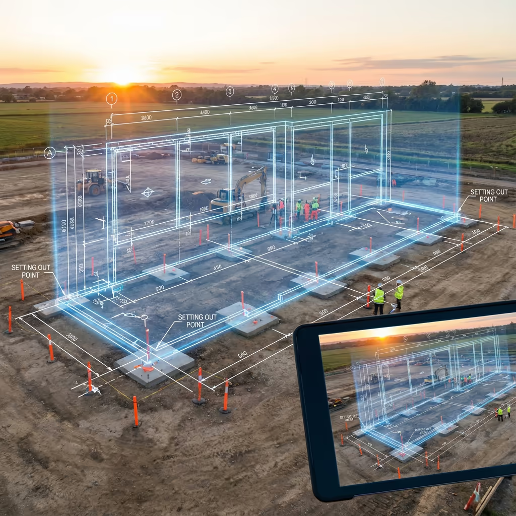
What Is a Drone Setting Out Survey?
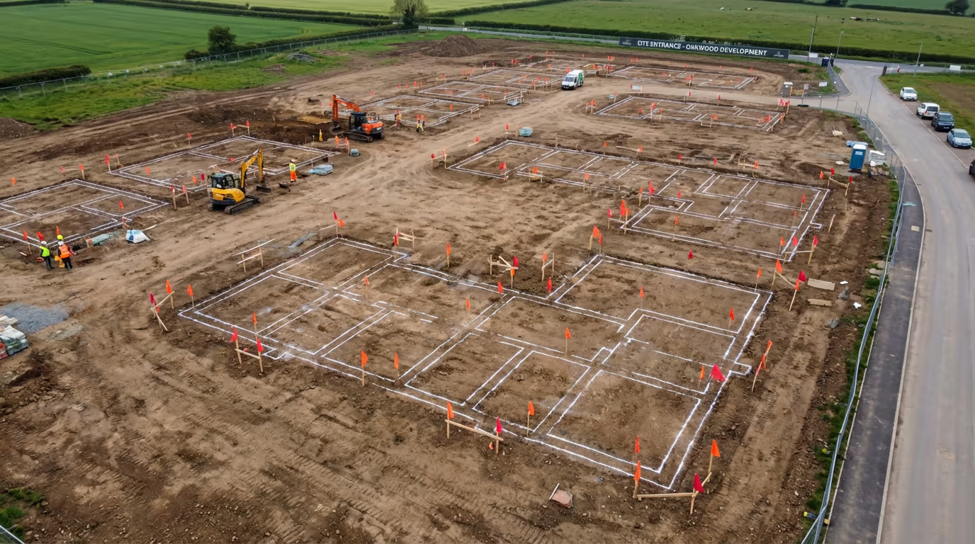
A drone setting out survey combines traditional setting out techniques with UAV technology to transfer design coordinates onto the ground with enhanced speed and verification. We mark the precise positions of building corners, foundation lines, road alignments, and infrastructure elements so construction can proceed accurately from design intent.
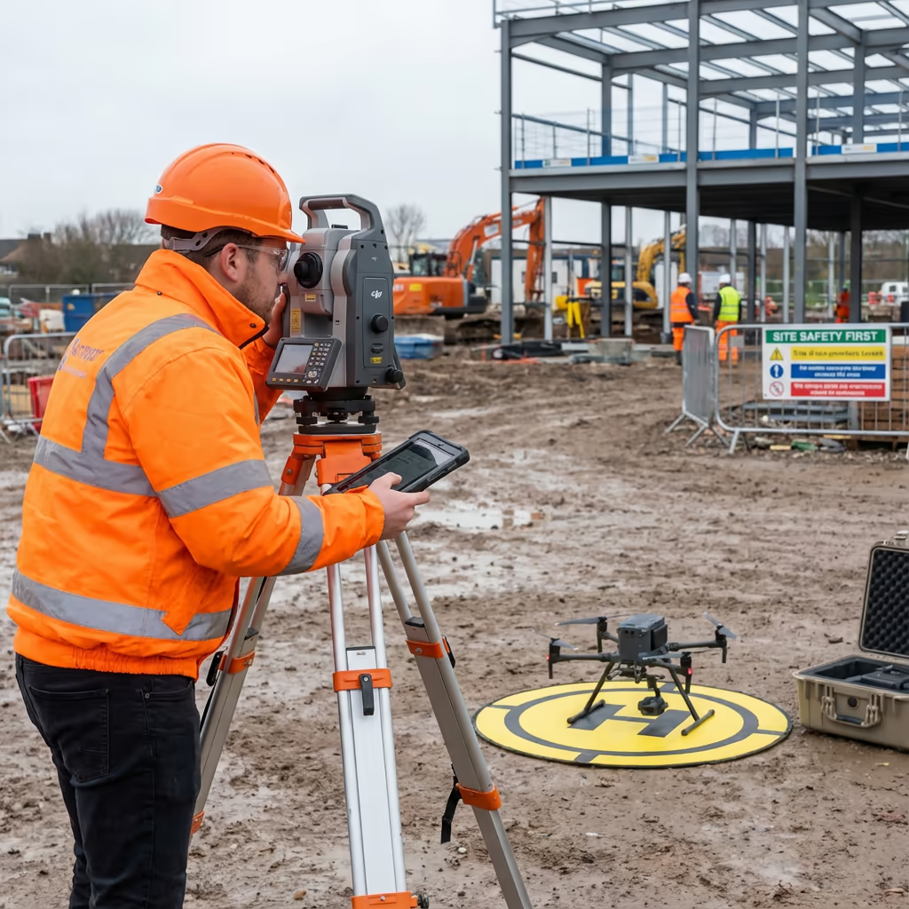
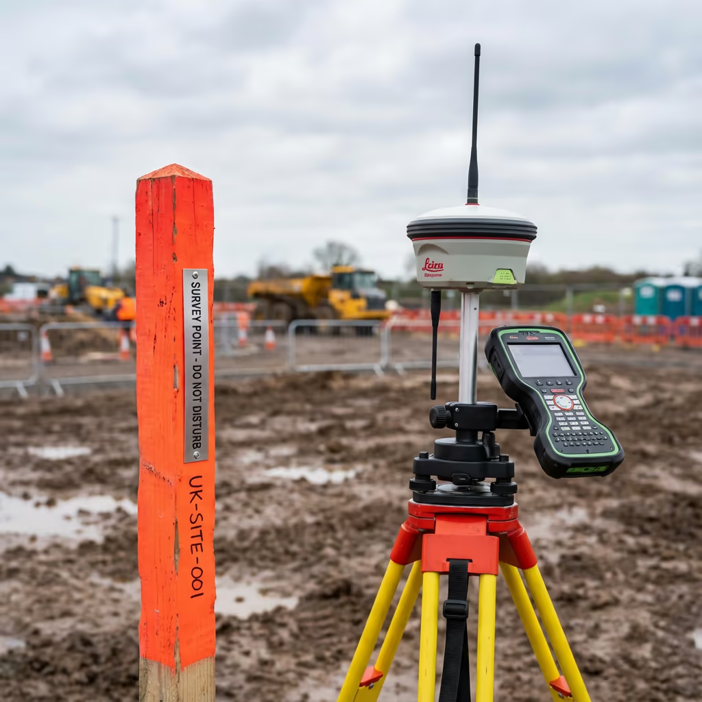
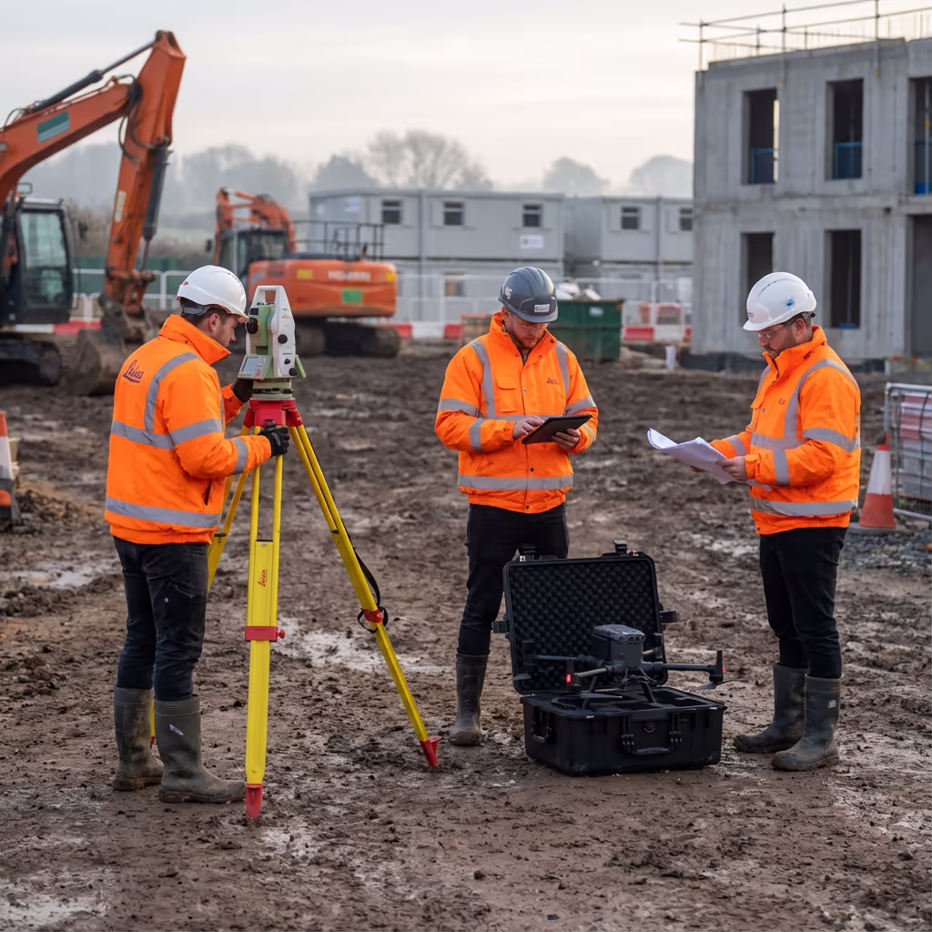
At Drone Survey Services, we use RTK-enabled drones alongside total stations and GNSS equipment to deliver survey-grade accuracy. The drone component allows instant as-built verification, creating aerial imagery and coordinates that confirm your setting out positions match design specifications before groundworks begin.

James Leslie
Owner, Engineer & Drone Pilot
"Got questions? Call me directly - I'm happy to talk through your project."
Call NowSurvey-Grade Setting Out,Verified By Drone
What You'll Receive
- Setting out coordinates & schedules
- As-built drone verification
- CAD overlay confirmation
- Survey-grade accuracy (10-20mm)
Delivered same day or next day
Why Choose Us
- CAA approved & fully insured
- Integrated drone + total station
- Instant visual verification
- UK-wide coverage
Trusted by contractors, developers & engineers across the UK.
Trusted by leading organisations
How Much Does a Drone Setting Out Survey Cost?
Pricing depends on site size, number of points to set out, and required deliverables. Here's a guide to help you budget:
| Project Type | Guide Price |
|---|---|
| Small SiteUp to 20 points | £500+ |
| Medium Site20-50 points | £800+ |
| Large Site50-100 points | £1,200+ |
| Complex Project100+ points | £1,800+ |
| Ongoing ContractRegular visits | POA |
*Guide prices include drone verification. Final quote based on point count, site access, and specific requirements.
What affects your quote?
- Number of set-out points
- Site complexity & access
- Verification requirements
- Turnaround urgency
Our drone-integrated approach reduces revisits and provides instant verification, typically saving 20-30% compared to traditional setting out with separate checking. Contact us with your project details for a tailored quote within 24 hours.
Ready to get a quote for your project?
Free, no-obligation quotes within 24 hours
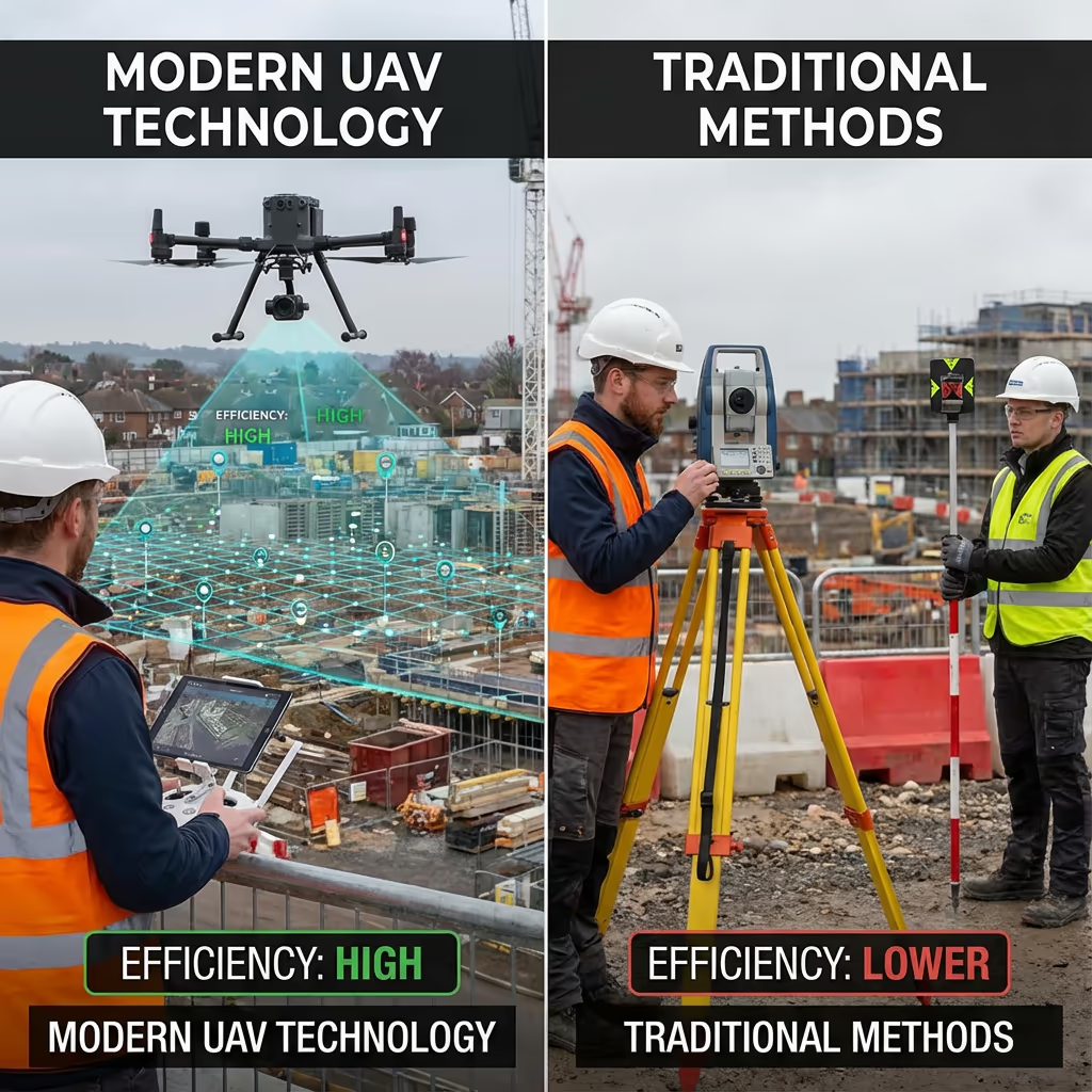
What Is the Difference Between Drone Setting Out and Traditional Methods?
Traditional setting out relies solely on total stations or GNSS rovers to mark positions on site. The surveyor works point-by-point, marking each location with pegs or spray paint. While accurate, this method provides no immediate visual context and errors may only be discovered during construction.
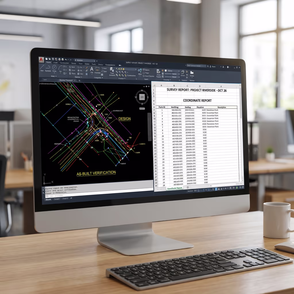
Drone setting out surveys add a powerful verification layer. After marking positions, we capture aerial imagery showing every point in spatial context. We overlay this against CAD designs to confirm alignment before construction begins. This catches errors immediately, reduces costly rework, and provides documented proof of accurate positioning.
When to Choose Each Approach
Choose Drone Setting Out
Verified accuracy
Traditional Setting Out
Simple positioning
Not sure which approach suits your project?
What Accuracy Can a Drone Setting Out Survey Achieve?
Our drone setting out surveys achieve positional accuracy of 10-20mm when using total station methods, meeting or exceeding construction tolerances for building corners, foundation lines, and infrastructure elements. This is the same accuracy as traditional setting out because we use the same survey-grade equipment.
The drone verification component adds a visual accuracy check using RTK-enabled positioning. We capture each marked position from the air and confirm coordinates against design data. This dual approach catches any errors in real-time, ensuring what's on the ground matches what's in the CAD drawing before expensive construction begins.
What Are the Applications of Drone Setting Out Survey?
Drone setting out surveys serve construction and infrastructure projects where precision positioning and verification matter. Here are the key applications where our clients see the greatest value:
Building Foundations
Marking building corners, pile positions, and foundation outlines with aerial verification against architectural drawings.
Housing Developments
Multi-plot layout with road alignments, service routes, and individual plot boundaries set out and verified from above.
Road & Highway Works
Centreline setting out, kerb lines, junction geometry, and drainage runs with comprehensive aerial documentation.
Utilities & Services
Pipeline routes, cable trenches, and service connection points marked with sub-surface coordination.
Industrial & Commercial
Warehouse footprints, car park layouts, and large-scale commercial building grids with verified accuracy.
Landscaping & Earthworks
Level pegs, cut/fill markers, retention features, and landscaping boundaries with before/after documentation.
Have a project that needs setting out?
How Does Drone Technology Improve Setting Out Accuracy?
Drone technology transforms setting out from a trust-based process into a verified one. Traditional methods rely entirely on the surveyor's field work being correct, with errors only discovered during construction. Our drone integration provides immediate visual confirmation that every point is in the right place.
After completing the ground-based setting out, we fly the site and capture high-resolution imagery with centimetre-accurate positioning. We then overlay your CAD design directly onto this imagery, creating a visual comparison between design intent and actual marker positions. Any discrepancies are immediately visible and can be corrected before work begins.
This verification process also creates permanent documentation. You receive timestamped imagery proving accurate setting out, protecting all parties if disputes arise later. For phased developments, we track progress across multiple visits, building a complete record of setting out accuracy throughout the project lifecycle.
What Deliverables Do You Get From a Drone Setting Out Survey?
We tailor deliverables to your project requirements, but our standard drone setting out survey outputs include:
Setting Out Coordinates
Complete coordinate schedule in your preferred format (CSV, DXF, or project-specific). Grid references, levels, and point descriptions for every marked position.
As-Built Verification
Georeferenced drone imagery with marked positions visible. Comparison report showing design vs actual positioning with deviation analysis.
CAD Overlays
Your design drawings overlaid on aerial imagery showing alignment of set-out points. Exportable to AutoCAD, Civil 3D, and other CAD platforms.
Progress Reports
For phased projects, comparative imagery and coordinate tracking across multiple setting out visits. Visual progress documentation for project records.
Point Schedules
Detailed point schedule with reference numbers, coordinates, descriptions, and verification status. Formatted for site use and project documentation.
Need specific deliverables for your project?
How Long Does a Drone Setting Out Survey Take?
On-site setting out is typically completed in a single day. A straightforward project with 20-30 points takes 3-4 hours including drone verification. Larger sites with 50+ points may require a full day or multiple visits depending on complexity.
Deliverables are often available same-day or next working day. Coordinate schedules and verification imagery are processed immediately after field work. For complex multi-phase projects, we agree delivery schedules at the outset to match your construction programme.
| Phase | Duration |
|---|---|
| Pre-Planning | 1-2 days |
| On-Site Setting Out | 3-8 hours |
| Drone Verification | 30-60 mins |
| Processing & QC | 2-4 hours |
| Deliverable Generation | 1-2 hours |
| Total (Standard) | Same day / Next day |
Urgent Response Available
Need setting out urgently? We offer same-day mobilisation for time-critical projects.
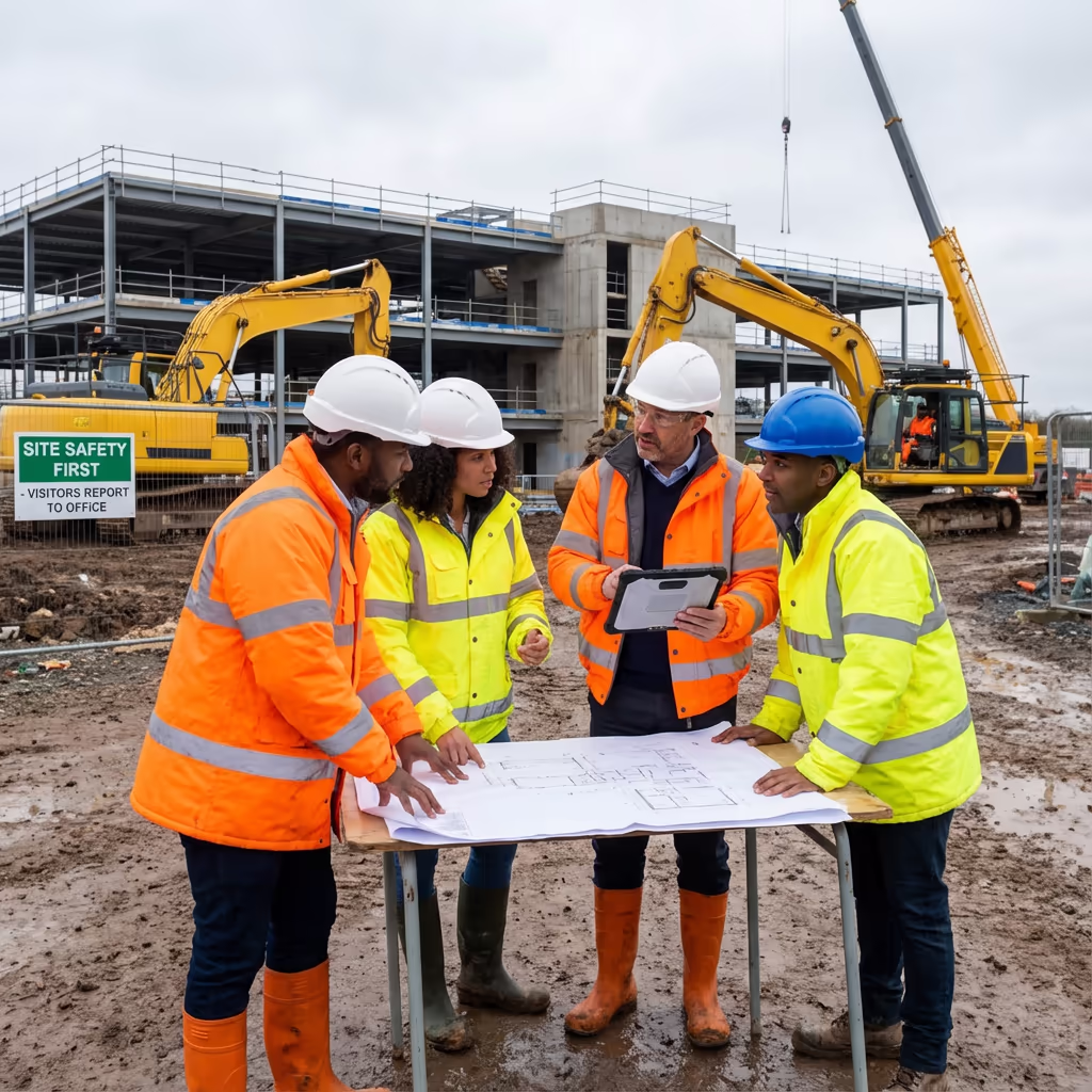
How Do I Choose a Drone Setting Out Survey Provider?
Not all setting out providers offer drone verification. When evaluating providers, we recommend checking these key factors:
- Survey qualifications - Ensure they have appropriate surveying credentials and construction experience
- CAA authorisation - Valid GVC or legacy PfCO permissions for commercial drone operations
- Professional insurance - Public liability and professional indemnity cover appropriate to construction work
- Integrated workflow - Ability to combine traditional survey with drone verification efficiently
- Construction experience - Ask about similar projects they've completed in your sector
At Drone Survey Services, we tick every box. We're CAA approved, fully insured, and have delivered drone setting out surveys for housing developments, commercial buildings, and infrastructure projects across the UK.
Ready to work with a trusted setting out provider?
Is Drone Setting Out Survey More Efficient Than Traditional?
The efficiency gains come primarily from reduced errors and instant verification rather than faster marking. Traditional setting out and drone setting out take similar time to mark positions on the ground since both use the same survey-grade equipment.
Where drone integration excels is in eliminating costly revisits and rework. Traditional methods may require separate checking visits and provide no visual documentation. Our drone verification catches errors immediately, provides permanent proof of accuracy, and enables confident sign-off before construction begins. For projects where accuracy matters, this verification typically pays for itself many times over.
Ready to Discuss Your Setting Out Project?
Expert advice - Tailored pricing - Response within 2 hours
James Leslie
Owner, Engineer & Drone Pilot
With extensive experience in surveying and UAV operations, James personally oversees every setting out project to ensure construction-grade accuracy and professional delivery.
TLDR: Drone Setting Out Explained
Setting Out Deliverables
- Setting out coordinates
- As-built verification
- CAD overlays
- Progress reports
- Point schedules
Discuss Your Project
Get expert advice and tailored pricing.
Enterprise Equipment
Survey-Grade Drone Fleet
We don't use consumer mini drones like other providers. Our fleet consists of industrial, survey-grade aircraft purpose-built for capturing detailed, accurate datasets.

AgEagle eBee X
Professional fixed-wing for rapid terrain coverage

DJI Matrice 400
Engineered for excellence, designed for versatility

WingtraOne GEN II
Best-in-class surveying efficiency for large projects

DJI Matrice 350 RTK
Professional multi-payload platform for precision surveying

DJI Mavic 4E
Portable surveying powerhouse with RTK precision
DJI Matrice 300 RTK
Industry-leading inspection and mapping platform

DJI Matrice 4E
Precision survey drone with oblique capture
1 of 7
← Swipe to explore fleet →
Sensor Technology
Specialised Sensors for All Aerial Surveys
Our aircraft carry professional-grade sensors matched to your project requirements, from high-resolution photogrammetry to terrain-penetrating LiDAR.
LiDAR Sensors
Penetrate vegetation and capture precise terrain data with laser scanning technology.
Applications
- Forestry & vegetation mapping
- Terrain modelling under canopy
- Flood risk assessment
- Archaeological surveys
- Power line corridor mapping
Thermal Imaging
Detect heat signatures for building diagnostics, energy audits, and industrial inspections.
Applications
- Building thermal surveys
- Solar panel inspections
- Electrical fault detection
- Search and rescue
- Livestock monitoring
RGB & Photogrammetry
High-resolution imagery for detailed 3D models, orthomosaics, and visual inspections.
Applications
- Topographic surveys
- 3D model generation
- Progress monitoring
- Asset inspection
- Marketing photography
Need a specific sensor or payload?
Client Testimonials
Why Clients Rate Our Drone Survey Service 5 Stars
Don't just take our word for it. Here's what industry professionals say about working with us.
“By far the best drone surveying company I've used. Responsive, helpful and report quality is spot on. Extremely diligent in highlighting defects outside of scope. 10+ projects completed and never disappointed.”
Mark Reynolds
Building Surveyor
“DSS's drone roof survey was brilliant. James showed me everything wrong with my roof in about 30 minutes. Quick, professional and easy to understand.”
Helen Parker
Homeowner
“Fantastic company to do business with. Been working with the DSS team since 2021 and it's been an absolute pleasure. Highly recommended.”
Robert Hughes
Property Developer
Related Services
Drone Topographic Survey
Detailed topographic surveys capturing existing site features before construction begins.
Drone Survey
Comprehensive aerial surveys delivering precise data and 3D models for construction projects.
Volumetric Analysis
Accurate stockpile measurements and cut/fill calculations from aerial data.