Surveying & Mapping
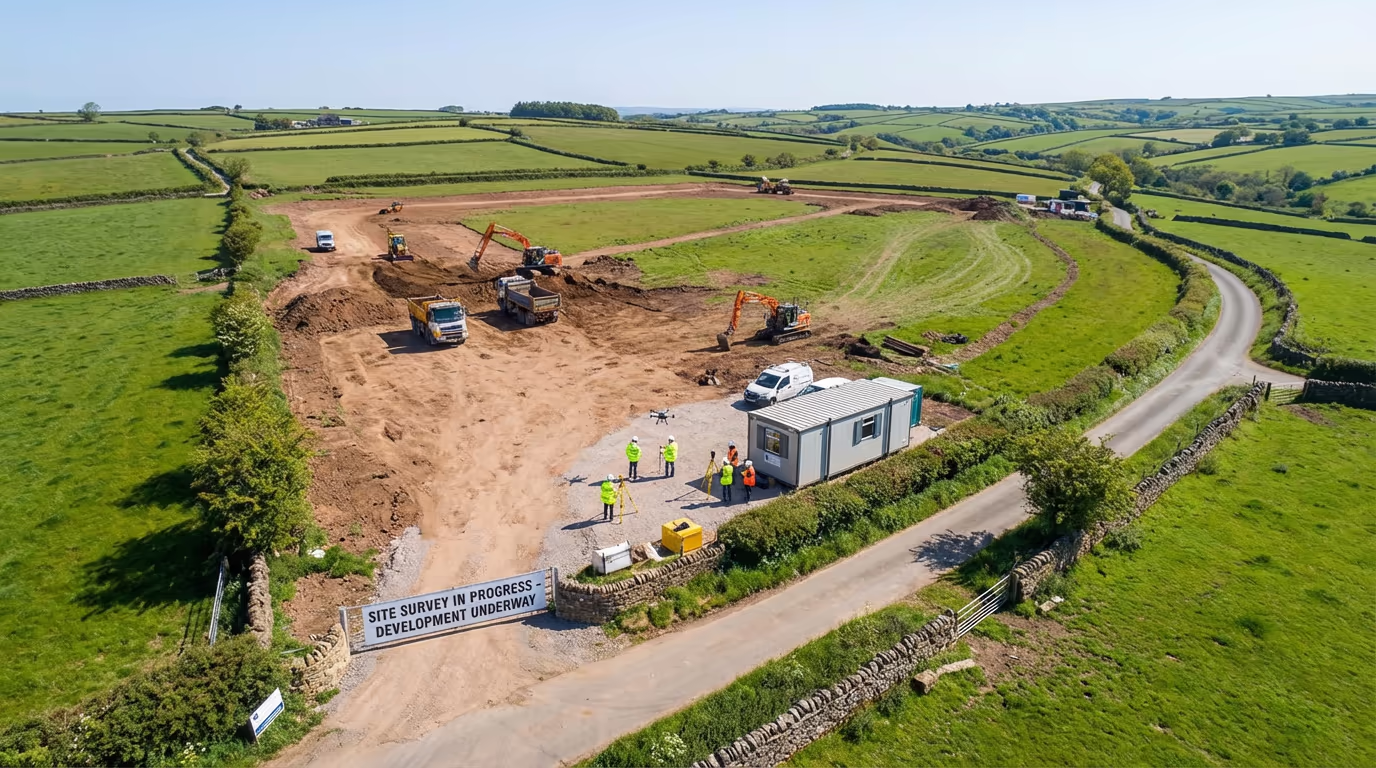
Drone Site Survey Services
Complete site documentation from the air. Capture boundaries, features, access routes, and existing conditions in a single visit.
Response within 2 hours • Or call 020 4634 0456
What Is a Drone Site Survey?
A drone site survey provides a comprehensive aerial assessment of your development site, capturing everything from boundaries and access routes to existing features and ground conditions. Unlike traditional ground surveys that can take days to complete, our drone-based approach captures the entire site in hours—delivering the complete picture you need for planning, design, and due diligence.
At Drone Survey Services, we combine high-resolution aerial photography with precision photogrammetry to create detailed orthomosaic maps, 3D models, and CAD-ready site plans. Whether you're acquiring a site, submitting a planning application, or briefing your design team, our drone site surveys give you accurate, current information about exactly what's on the ground.

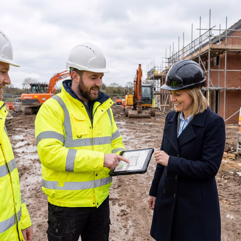
James Leslie
Owner, Engineer & Drone Pilot
"Got questions? Call me directly - I'm happy to talk through your project."
Call NowComplete Site Intelligence,Delivered Fast
What You'll Receive
- High-resolution site orthomosaic
- CAD-ready site plans (DWG/DXF)
- Boundary and feature mapping
- Survey-grade accuracy (±2-5cm)
Delivered in 3-5 working days
Why Choose Us
- CAA approved & fully insured
- Same-week availability
- Latest DJI survey equipment
- UK-wide coverage
Trusted by developers, architects & planning consultants across the UK.
Trusted by leading organisations
How Much Does a Drone Site Survey Cost?
Pricing depends on your site size and required deliverables. Here's a guide to help you budget:
| Site Size | Guide Price |
|---|---|
| MicroUnder 0.5 ha | £500+ |
| Small0.5–2 ha | £700+ |
| Medium2–5 ha | £1,000+ |
| Large5–10 ha | £1,500+ |
| Enterprise10+ ha | £2,500+ |
| Major ProjectsMulti-site | POA |
*Guide prices include standard deliverables. Final quote based on site complexity, access, and specific requirements.
What affects your quote?
- Site size & complexity
- Required deliverables
- Turnaround time
- Access arrangements
Our drone site surveys typically cost 50-70% less than traditional ground surveys while delivering more comprehensive data. Contact us with your site details and we'll provide a tailored quote within 24 hours.
Ready to get a quote for your site?
Free, no-obligation quotes within 24 hours
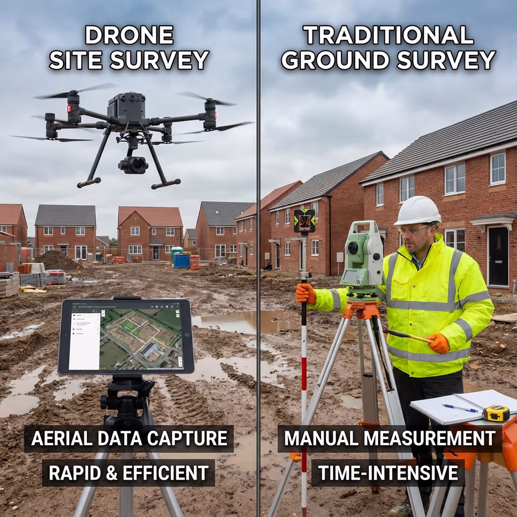
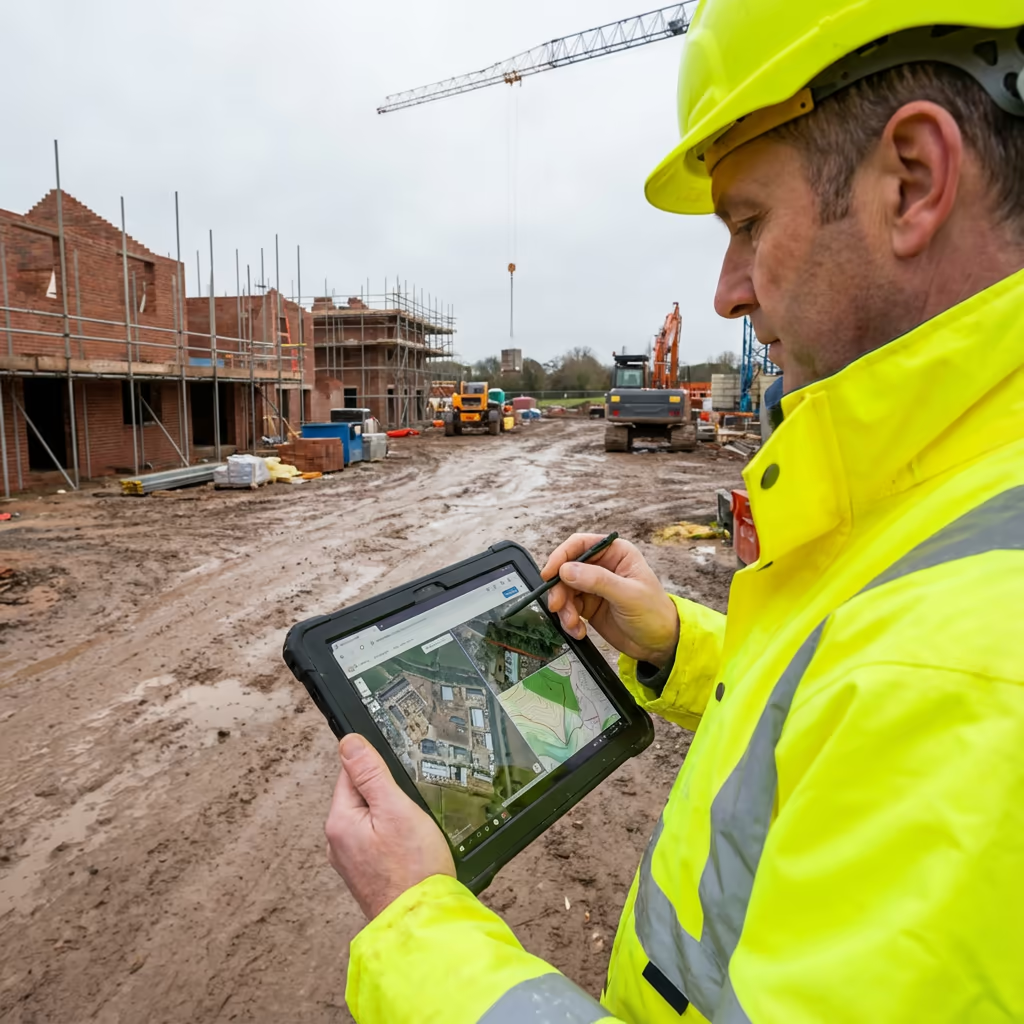
What Is the Difference Between Drone Site Survey and Traditional Survey?
Traditional site surveys require teams of surveyors walking the ground with total stations and GPS equipment, measuring each feature individually. This approach works well but takes time—a complex 5-hectare site might take several days to survey properly.
Drone site surveys capture the same information from the air in a fraction of the time. We photograph the entire site at high resolution, then process thousands of overlapping images into accurate maps, models, and plans. The result is often more comprehensive than traditional methods—we capture everything visible from above, not just the points a ground team chooses to measure.
Quick Comparison
Drone Site Survey
Fast & comprehensive
Traditional Survey
Ground-based approach
Not sure which approach suits your project?
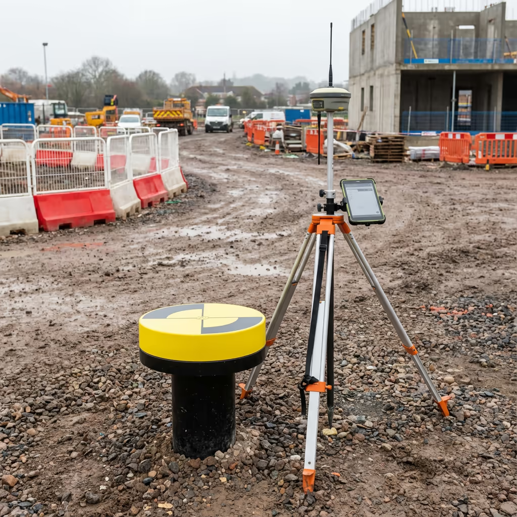
What Accuracy Can a Drone Site Survey Achieve?
Our drone site surveys routinely achieve horizontal accuracy of ±2-5cm and vertical accuracy of ±3-5cm when using ground control points. This level of precision is suitable for the vast majority of planning, design, and due diligence applications.
We use RTK-enabled drones with real-time positioning, combined with strategically placed ground control points surveyed to OSGB36 coordinates. This ensures your site data ties accurately into Ordnance Survey mapping and can be used alongside other survey data with confidence. For projects requiring higher accuracy, we can deploy additional ground control and enhanced processing workflows.
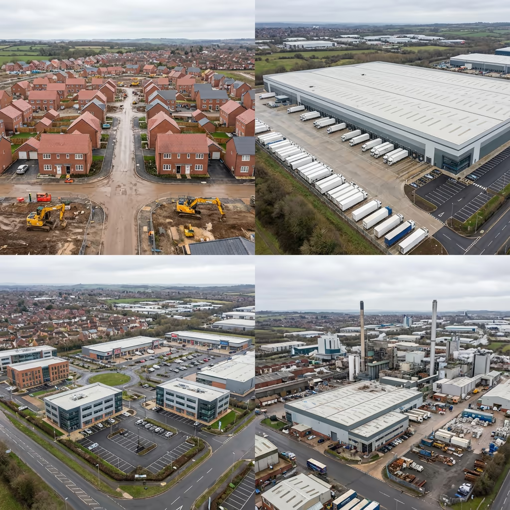
What Are the Applications of Drone Site Survey?
Drone site surveys support decisions at every stage of the development lifecycle. Here are the key applications where our clients see the greatest value:
Residential Development
Site appraisals, capacity studies, planning submissions, and progress monitoring throughout construction.
Commercial Sites
Retail parks, office developments, and mixed-use schemes requiring comprehensive site documentation.
Industrial Development
Factories, distribution centres, and manufacturing facilities—often with complex existing infrastructure.
Logistics & Warehousing
Large format buildings requiring accurate site levels and access route planning.
Land Acquisition
Due diligence surveys for land purchases, showing existing conditions and potential constraints.
Planning Applications
Accurate site plans and contextual imagery to support planning submissions and consultations.
Have a site that needs surveying?
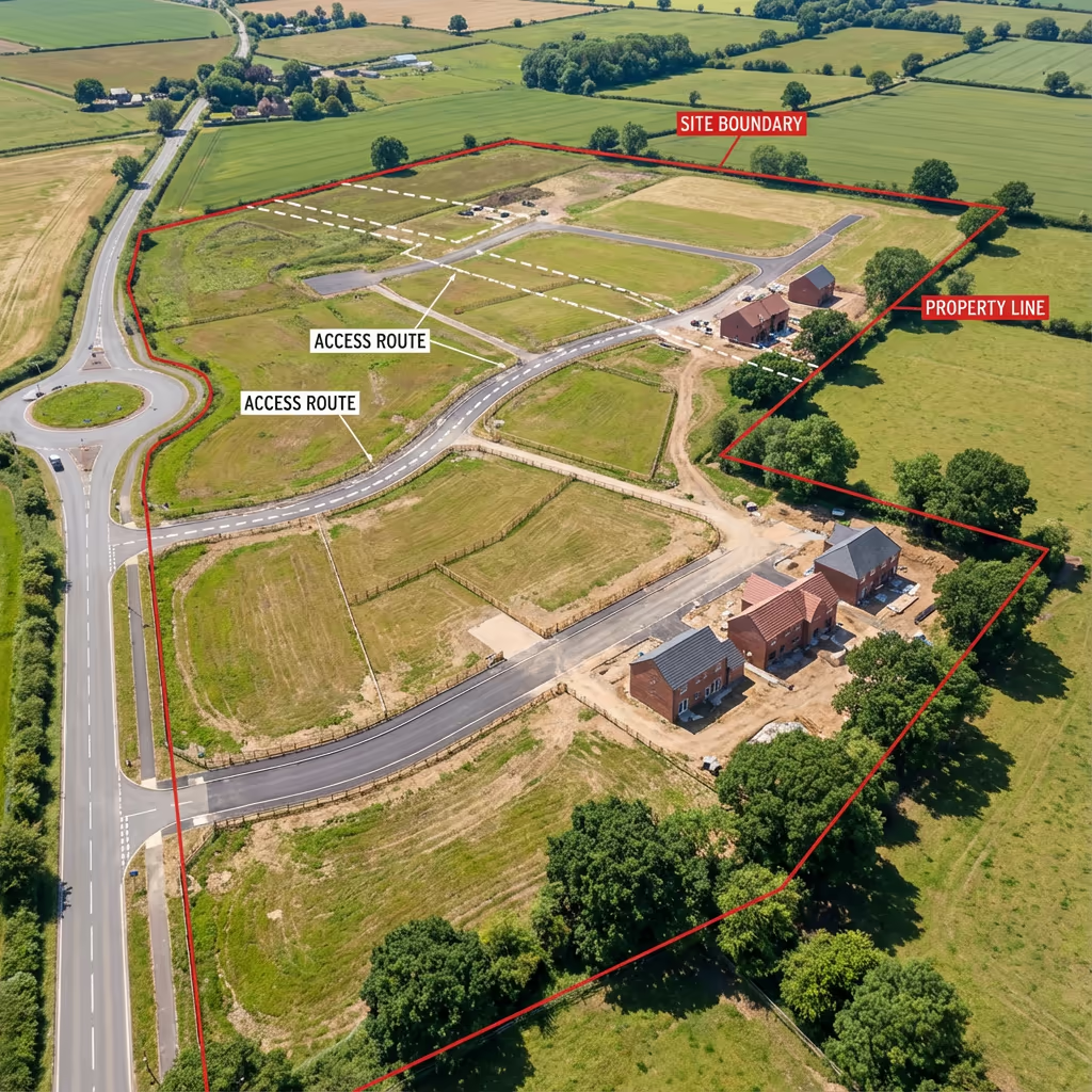
What Features Can a Drone Site Survey Capture?
A comprehensive drone site survey captures everything visible from above—and that's usually more than you'd expect. Our surveys document the complete picture of your site's existing conditions:
Boundaries & Fences
Property lines, fence positions, walls, and hedgerows
Buildings & Structures
Existing buildings, outbuildings, ruins, and foundations
Access & Circulation
Roads, paths, tracks, gates, and hardstanding areas
Vegetation
Trees (with heights), woodland, scrub, and hedges
Utilities & Services
Visible manholes, poles, substations, and infrastructure
Water Features
Ponds, streams, ditches, and drainage channels
Levels & Topography
Ground levels, slopes, banks, and level changes
Existing Uses
Parking areas, storage, waste, and site activities
The orthomosaic imagery we deliver acts as a permanent visual record of site conditions at survey date—invaluable for comparison with future surveys or resolving disputes about what was present before development began.
What Deliverables Do You Get From a Drone Site Survey?
We tailor deliverables to your project requirements, but our standard drone site survey outputs include:
Site Orthomosaic
High-resolution, georeferenced aerial imagery showing every detail of your site. Typically 2-3cm per pixel resolution.
Digital Terrain Model (DTM)
Bare-earth surface model showing ground levels across the site. Essential for level design and earthworks planning.
Digital Surface Model (DSM)
Top surface including vegetation and structures. Useful for visibility analysis and understanding site context.
Boundary Mapping
Accurate mapping of physical boundaries, fence lines, and property extents visible from aerial imagery.
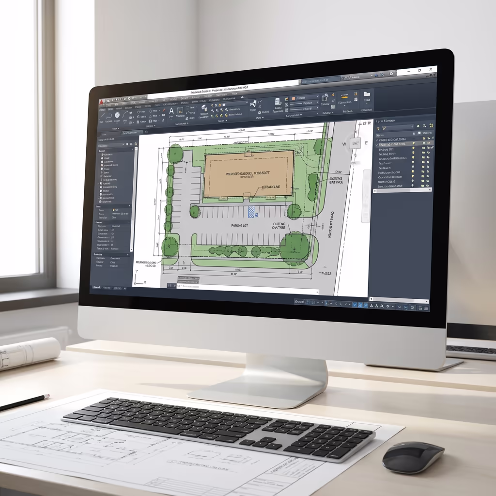
CAD Site Plans (DWG/DXF)
Professional CAD drawings ready for your design team. Layered format compatible with AutoCAD, Revit, and other software.
3D Site Model
Textured 3D mesh model for visualisation, design context, and stakeholder presentations.
Need specific deliverables for your project?
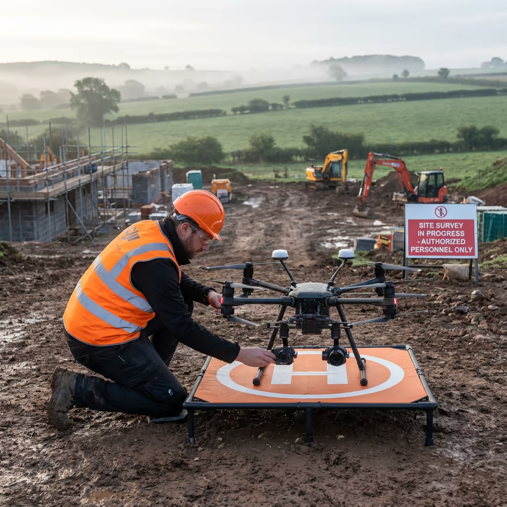
How Long Does a Drone Site Survey Take?
On-site data capture is fast. Most sites under 10 hectares can be surveyed in a single morning, including ground control setup. Larger sites may require a full day, but we can often complete what would take a ground team a week in just hours.
Processing and delivery depends on your required outputs. Standard deliverables are typically ready within 3-5 working days. For urgent projects, we offer express processing with next-day turnaround available at additional cost.
| Phase | Duration |
|---|---|
| Booking & Planning | 1-2 days |
| On-Site Survey | ½-1 day |
| Data Processing | 1-2 days |
| Feature Extraction | 1-2 days |
| Delivery & Handover | Same day |
| Total (Standard) | 3-5 working days |
Express Processing Available
Need it faster? Next-day turnaround available for urgent projects.
How Do I Choose a Drone Site Survey Provider?
The quality of drone survey providers varies significantly. When evaluating options, we recommend checking these key factors:
- CAA authorisation – Ensure they hold valid GVC permissions for commercial drone operations
- Professional insurance – Public liability and professional indemnity cover appropriate to your project value
- Survey experience – Understanding of accuracy requirements, coordinate systems, and deliverable formats
- Quality equipment – RTK-enabled drones and professional processing software
- Relevant portfolio – Examples of similar site survey projects they've delivered
At Drone Survey Services, we tick every box. We're CAA approved, fully insured, and have delivered site surveys for developers, architects, and planning consultants throughout the UK.
Ready to work with a trusted provider?
Is Drone Site Survey Cheaper Than Traditional Surveying?
In most cases, significantly so. Traditional ground surveys require surveyors to visit every point they need to measure, which takes time—especially on larger or more complex sites. Labour costs add up quickly when a team spends several days on site.
Our drone surveys capture everything in hours rather than days, dramatically reducing field time and costs. Typical savings range from 50-70% compared to equivalent traditional surveys. Beyond cost savings, you also get comprehensive visual documentation that traditional surveys simply cannot match—high-resolution imagery showing exactly what was on the ground at survey date.
Ready to Survey Your Site?
Expert advice • Same-week availability • Response within 2 hours
James Leslie
Owner, Engineer & Drone Pilot
With extensive experience in surveying and UAV operations, James personally oversees every site survey to ensure accurate, professional results you can rely on.
TLDR: Drone Site Surveys Explained
Site Survey Deliverables
- Site orthomosaic imagery
- Digital Terrain Model (DTM)
- Digital Surface Model (DSM)
- Boundary mapping
- Feature survey
- CAD site plans (DWG/DXF)
- 3D site models
Discuss Your Project
Get expert advice and tailored pricing.
Enterprise Equipment
Survey-Grade Drone Fleet
We don't use consumer mini drones like other providers. Our fleet consists of industrial, survey-grade aircraft purpose-built for capturing detailed, accurate datasets.

AgEagle eBee X
Professional fixed-wing for rapid terrain coverage

DJI Matrice 400
Engineered for excellence, designed for versatility

WingtraOne GEN II
Best-in-class surveying efficiency for large projects

DJI Matrice 350 RTK
Professional multi-payload platform for precision surveying

DJI Mavic 4E
Portable surveying powerhouse with RTK precision
DJI Matrice 300 RTK
Industry-leading inspection and mapping platform

DJI Matrice 4E
Precision survey drone with oblique capture
1 of 7
← Swipe to explore fleet →
Sensor Technology
Specialised Sensors for All Aerial Surveys
Our aircraft carry professional-grade sensors matched to your project requirements, from high-resolution photogrammetry to terrain-penetrating LiDAR.
LiDAR Sensors
Penetrate vegetation and capture precise terrain data with laser scanning technology.
Applications
- Forestry & vegetation mapping
- Terrain modelling under canopy
- Flood risk assessment
- Archaeological surveys
- Power line corridor mapping
Thermal Imaging
Detect heat signatures for building diagnostics, energy audits, and industrial inspections.
Applications
- Building thermal surveys
- Solar panel inspections
- Electrical fault detection
- Search and rescue
- Livestock monitoring
RGB & Photogrammetry
High-resolution imagery for detailed 3D models, orthomosaics, and visual inspections.
Applications
- Topographic surveys
- 3D model generation
- Progress monitoring
- Asset inspection
- Marketing photography
Need a specific sensor or payload?
Client Testimonials
Why Clients Rate Our Drone Survey Service 5 Stars
Don't just take our word for it. Here's what industry professionals say about working with us.
“By far the best drone surveying company I've used. Responsive, helpful and report quality is spot on. Extremely diligent in highlighting defects outside of scope. 10+ projects completed and never disappointed.”
Mark Reynolds
Building Surveyor
“DSS's drone roof survey was brilliant. James showed me everything wrong with my roof in about 30 minutes. Quick, professional and easy to understand.”
Helen Parker
Homeowner
“Fantastic company to do business with. Been working with the DSS team since 2021 and it's been an absolute pleasure. Highly recommended.”
Robert Hughes
Property Developer
Related Services
Drone Topographic Survey
Detailed topographic surveys with contours, spot heights, and elevation data for design and planning.
LiDAR Mapping
Precision laser scanning for vegetated sites where photogrammetry cannot see through tree cover.
Drone Survey
Comprehensive aerial surveys delivering precise data, 3D models, and orthomosaic imagery.