Surveying & Mapping
Drone Survey
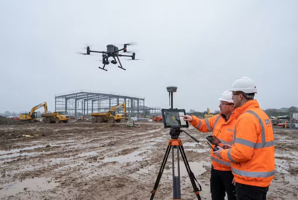
Comprehensive aerial surveys delivering precise topographic data and 3D models.
Overview
Our drone survey services combine cutting-edge UAV technology with professional surveying expertise to deliver accurate, detailed aerial data for your projects. Whether you need topographic surveys, site mapping, or volumetric analysis, our CAA-approved pilots and surveyors work together to provide comprehensive solutions that save time and reduce costs compared to traditional survey methods.
Key Features
- High-accuracy topographic data (±2-5cm)
- Photogrammetric processing
- RTK/PPK enabled drones for precision
- Ground control point surveys
- CAA-approved operations
Applications
- Construction site surveys
- Land development planning
- Volumetric stockpile analysis
- Environmental baseline surveys
- Infrastructure planning
Deliverables
- Orthomosaic maps
- Digital Elevation Models (DEM)
- Digital Surface Models (DSM)
- Contour maps
- 3D point clouds
- CAD-compatible files
Ready to get started?
Contact us for a free consultation and quote for your drone survey project.
Common Questions
Drone Survey FAQs
Our drone surveys typically achieve accuracies of ±2-5cm when using ground control points (GCPs). With RTK-enabled drones, we can achieve even higher precision for projects with stringent accuracy requirements.
On-site data capture typically takes a few hours to a full day depending on the site size. Processing and delivery of final deliverables usually takes 3-7 working days.
Client Feedback
What Our Clients Say
Client Testimonials
Why Clients Rate Our Drone Survey Service 5 Stars
Don't just take our word for it. Here's what industry professionals say about working with us.
“By far the best drone surveying company I've used. Responsive, helpful and report quality is spot on. Extremely diligent in highlighting defects outside of scope. 10+ projects completed and never disappointed.”
Mark Reynolds
Building Surveyor
“DSS's drone roof survey was brilliant. James showed me everything wrong with my roof in about 30 minutes. Quick, professional and easy to understand.”
Helen Parker
Homeowner
“Fantastic company to do business with. Been working with the DSS team since 2021 and it's been an absolute pleasure. Highly recommended.”
Robert Hughes
Property Developer
CAA Approved
Licensed commercial operators
Fully Insured
Public liability coverage
Professional Indemnity
PI insurance coverage
Get Started
Request a Drone Survey Quote
Complete the form and our team will provide a tailored quote for your drone survey requirements within 24 hours.
Get Your Free Drone Survey Quote
Get a free quote for your drone survey requirements