Surveying & Mapping
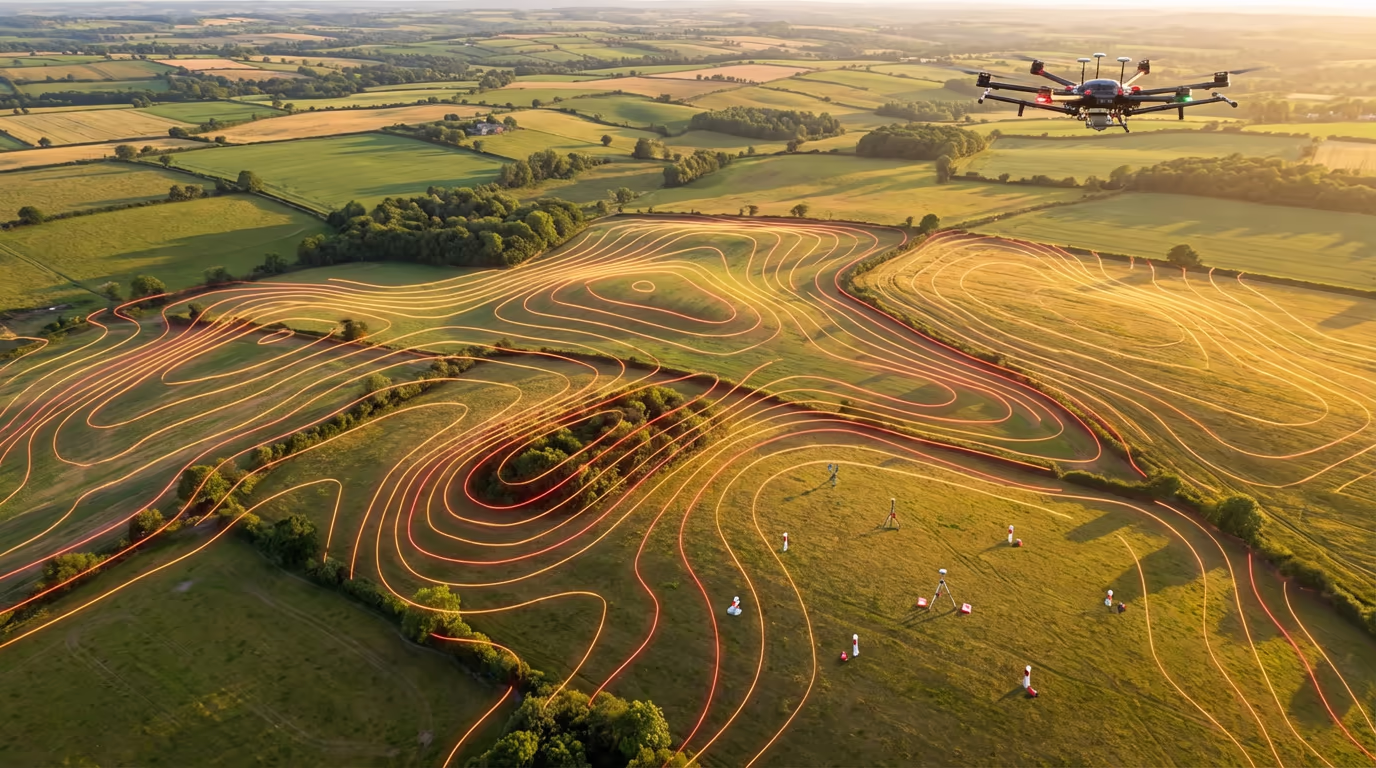
Drone Topographic Survey Services
Planning-grade topographic surveys using drone photogrammetry. Accurate contours, DTMs, and CAD-ready deliverables for development, planning, and engineering projects.
Response within 2 hours • Or call 020 4634 0456
What Is a Drone Topographic Survey?
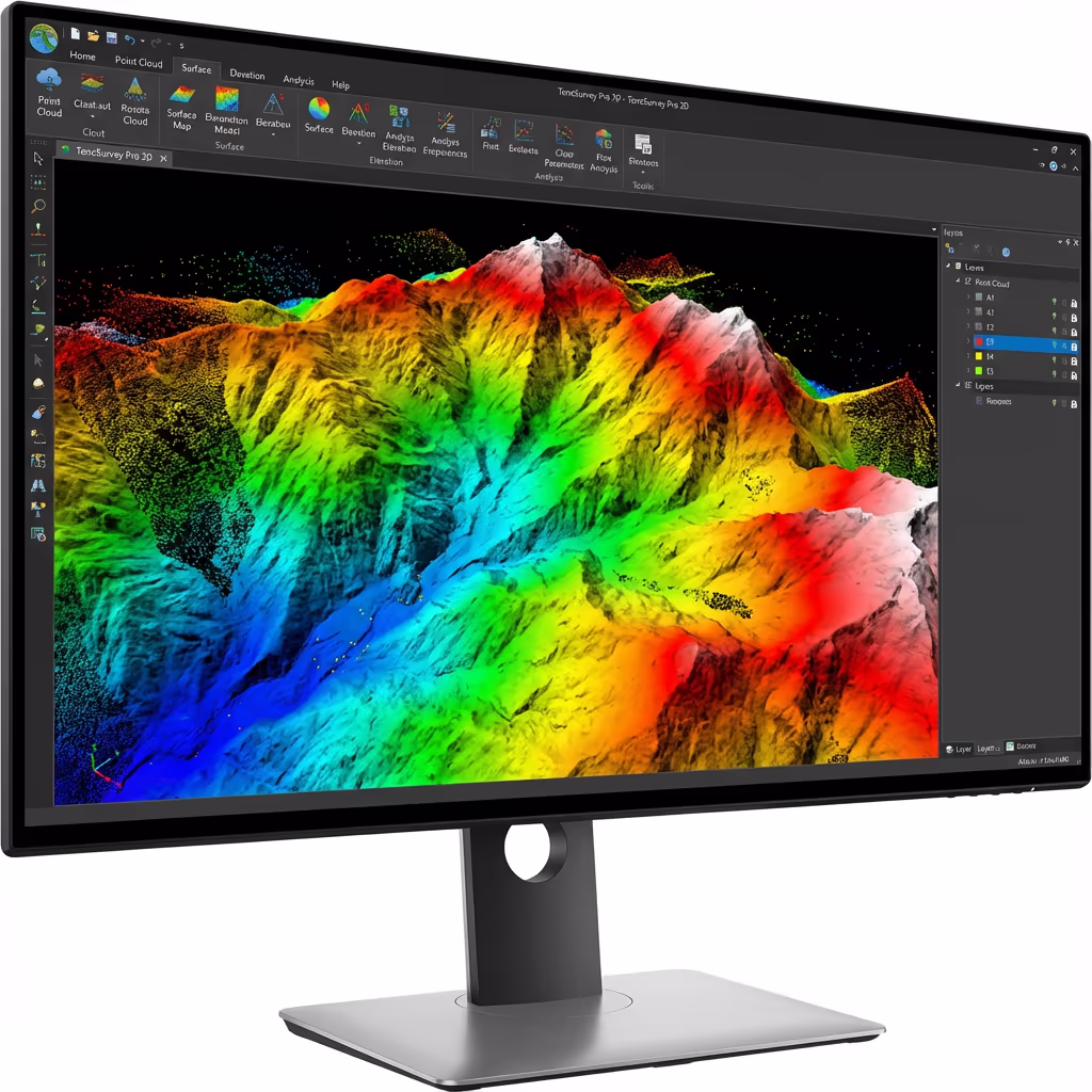
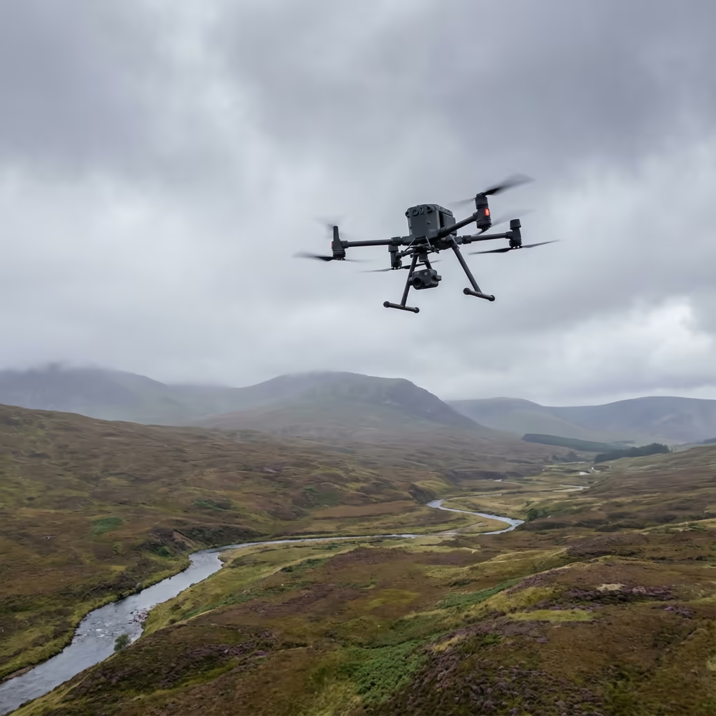
A drone topographic survey uses high-resolution aerial photography and photogrammetry to create detailed maps of terrain, features, and elevations. Our drones capture thousands of overlapping images which are processed into accurate 3D models, contour plans, and CAD drawings suitable for planning applications and engineering design.
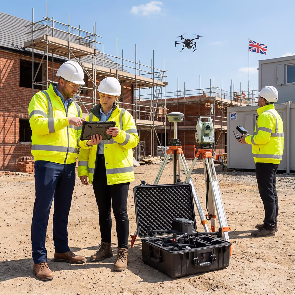
At Drone Survey Services, we deliver RICS-compliant topographic surveys that meet the requirements of local planning authorities, architects, and civil engineers. Our photogrammetry-based approach is ideal for open sites, construction projects, and development land where you need accurate ground levels, boundary positions, and feature locations.

James Leslie
Owner, Engineer & Drone Pilot
"Got questions? Call me directly - I'm happy to talk through your project."
Call NowPlanning-Grade Survey Data,Delivered Fast
What You'll Receive
- Orthomosaic map (GeoTIFF)
- Digital Terrain Model (DTM)
- Contours at your specified interval
- CAD files (DWG/DXF)
Delivered in 5-7 working days
Why Choose Us
- CAA approved & fully insured
- RICS-compliant deliverables
- Latest DJI drone technology
- UK-wide coverage
Trusted by architects, developers & local authorities across the UK.
Trusted by leading organisations
How Much Does a Drone Topographic Survey Cost?
Pricing depends on your project scope. Here's a guide to help you budget:
| Project Size | Guide Price |
|---|---|
| MicroUnder 1 ha | £800+ |
| Small1–5 ha | £1,200+ |
| Medium5–20 ha | £2,000+ |
| Large20–50 ha | £3,500+ |
| Enterprise50–100 ha | £6,000+ |
| Major Projects100+ ha | POA |
*Guide prices include standard deliverables. Final quote based on site complexity, access, and specific requirements.
What affects your quote?
- Site size & terrain
- Required deliverables
- Turnaround time
- Access requirements
Our drone-based approach typically saves 40–60% compared to traditional ground surveys. Contact us with your project details and we'll provide a tailored quote within 24 hours.
Ready to get a quote for your project?
Free, no-obligation quotes within 24 hours
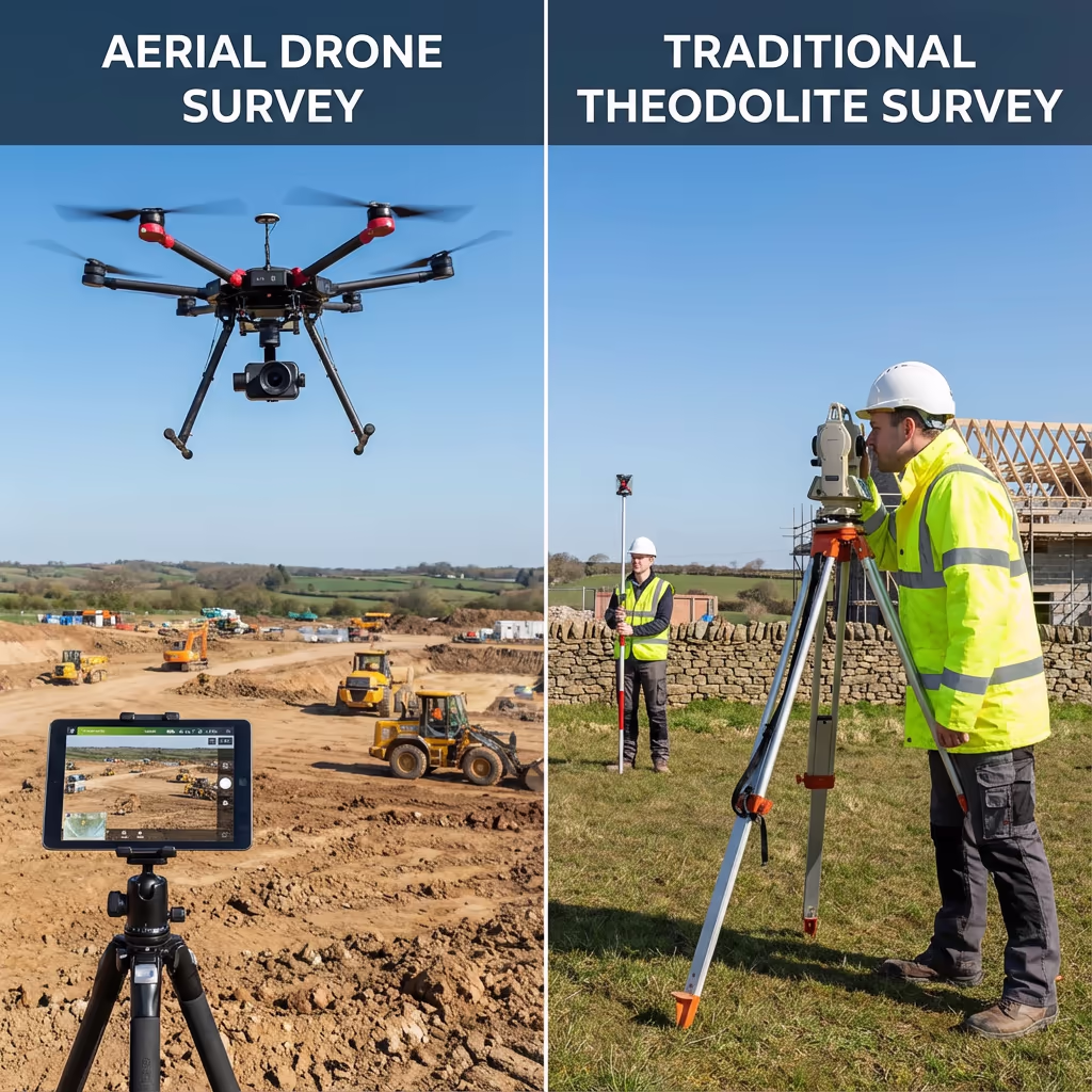
What Is the Difference Between Drone and Traditional Topographic Surveys?
Traditional topographic surveys use total stations and GPS equipment, with surveyors walking the site to capture individual points. This method is highly accurate but time-consuming, especially for larger sites. Each point must be measured individually, which can take days or even weeks for complex projects.
Drone topographic surveys capture thousands of measurements in a single flight, creating a complete digital model of your site. We achieve similar accuracy levels but in a fraction of the time, making drone surveys ideal for large areas, difficult terrain, or time-sensitive projects where traditional methods would be impractical or expensive.
When to Choose Each Method
Choose Drone Survey
Speed & coverage
Choose Traditional Survey
Detail & precision
Not sure which method suits your project?
What Accuracy Can a Drone Topographic Survey Achieve?
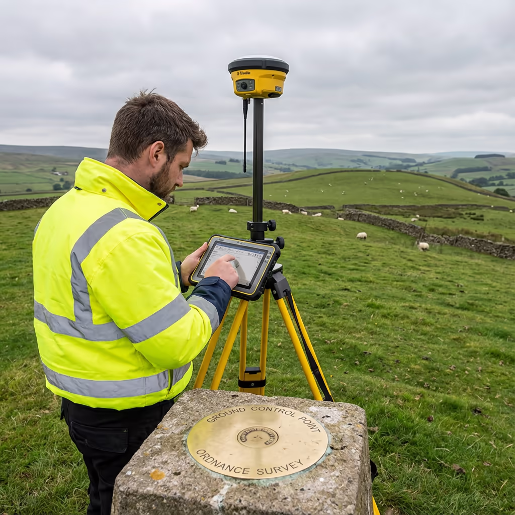
Our drone topographic surveys routinely achieve vertical accuracy of ±3-5cm and horizontal accuracy of ±2-5cm when using ground control points. This level of precision meets the requirements for planning applications, engineering design, and construction projects across the UK.
We use RTK-enabled drones with survey-grade GNSS receivers to ensure precise positioning of every image. Combined with accurately surveyed ground control points and rigorous photogrammetric processing, we deliver data that architects, engineers, and planning authorities can rely on for critical design decisions.
What Are the Applications of Drone Topographic Survey?
Drone topographic surveys support a wide range of planning, engineering, and development projects. Here are the key applications where our clients see the greatest value:
Planning Applications
Accurate site plans showing existing levels, features, and boundaries for outline and full planning submissions to local authorities.
Civil Engineering Design
Detailed terrain data for highway design, drainage calculations, earthworks planning, and infrastructure feasibility studies.
Construction & Development
As-built surveys, progress monitoring, and cut/fill calculations for residential, commercial, and industrial developments.
Land Registration
Boundary surveys and area calculations for land registration, sales, and legal documentation purposes.
Flood Risk Assessment
Accurate elevation data for flood modelling, drainage design, and Environment Agency flood risk assessments.
Infrastructure Projects
Route surveys for roads, railways, pipelines, and utility corridors requiring detailed terrain information.
Have a project that needs topographic survey?
What Features Can a Drone Topographic Survey Capture?
Our drone surveys capture a comprehensive range of site features visible from the air. The high-resolution imagery and 3D point clouds allow us to accurately map and measure everything on your site, providing the detail needed for planning and design work.
We can identify and map the following features from our aerial data:
For features that cannot be seen from the air—such as underground services, manholes covered by vegetation, or precise boundary markers—we recommend combining drone survey with targeted ground measurements to ensure complete coverage.
What Deliverables Do You Get From a Drone Topographic Survey?
We tailor deliverables to your project requirements, but our standard topographic survey outputs include:
Orthomosaic Maps
High-resolution georeferenced aerial imagery of your entire site. Perfect for planning drawings and visual documentation.
Digital Terrain Model (DTM)
Bare-earth surface model showing ground levels. Essential for drainage design, earthworks calculations, and flood modelling.
Digital Surface Model (DSM)
Top surface including buildings, vegetation, and structures. Used for visibility analysis and 3D visualisation.
Contour Plans
Contour lines at your specified interval (typically 0.25m, 0.5m, or 1m) showing site topography clearly.
CAD Files (DWG/DXF)
Industry-standard CAD drawings compatible with AutoCAD, Civil 3D, and other design software.
3D Point Clouds
Dense point cloud data for detailed analysis, measurement, and integration with BIM workflows.
Need specific deliverables for your project?
How Long Does a Drone Topographic Survey Take?
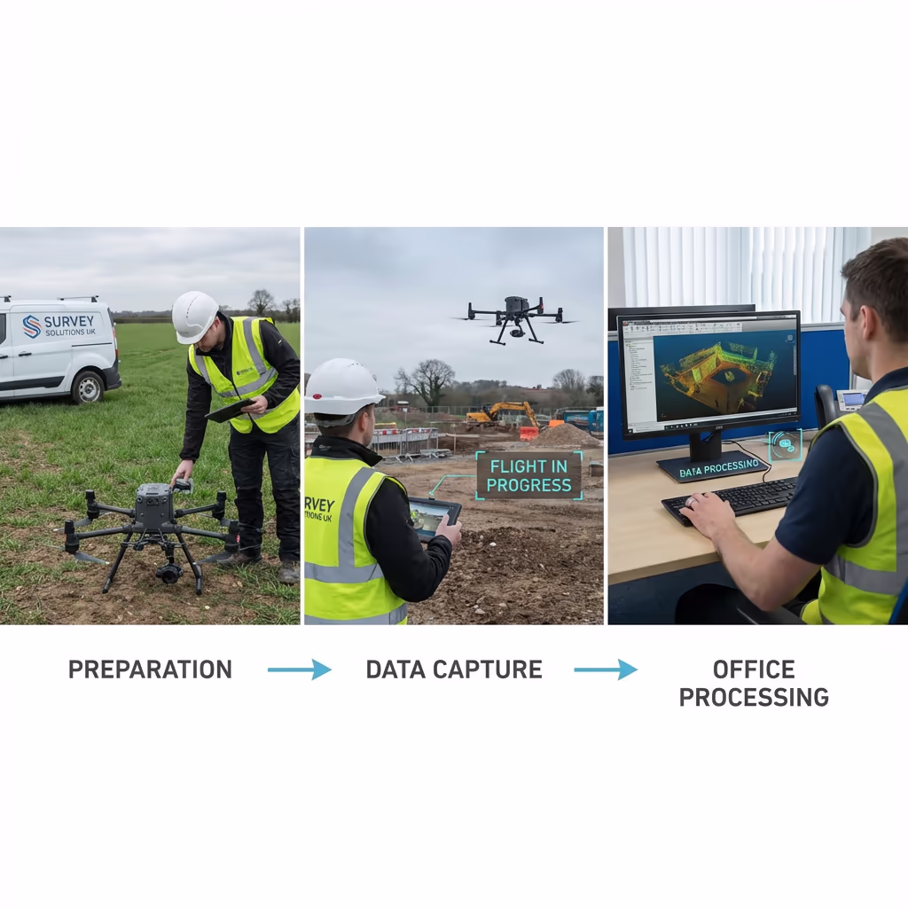
On-site data capture is remarkably fast. We can survey 20-50 hectares per day depending on terrain and flight conditions. A typical 5-hectare development site takes just 1-2 hours of flight time, plus setup and ground control establishment.
Processing and delivery depends on project complexity and your required outputs. Standard deliverables are typically ready within 5-7 working days. For urgent projects, we offer expedited processing with 48-72 hour turnaround available at additional cost. We'll confirm realistic timescales when we quote your project.
| Phase | Duration |
|---|---|
| Planning & Permissions | 1-3 days |
| On-Site Data Capture | ½-1 day |
| Photogrammetric Processing | 2-3 days |
| Surface Generation & QC | 1-2 days |
| Deliverable Generation | 1-2 days |
| Total (Standard) | 5-7 working days |
Express Processing Available
Need it faster? 48-72 hour turnaround available for urgent projects.
How Do I Choose a Drone Topographic Survey Provider?
Not all drone survey services are equal. When evaluating providers, we recommend checking these key factors:
- CAA authorisation – Ensure they hold valid GVC or legacy PfCO permissions for commercial operations
- Professional insurance – Public liability and professional indemnity cover appropriate to your project
- Survey experience – Topographic surveying requires specific knowledge beyond drone flying
- Processing capability – Ask about their software and quality control workflows
- RICS compliance – For planning applications, ensure deliverables meet RICS standards
At Drone Survey Services, we tick every box. We're CAA approved, fully insured, and have delivered topographic surveys for planning applications, engineering projects, and developments across the UK.
Ready to work with a trusted survey provider?
Is Drone Topographic Survey Cheaper Than Traditional Surveying?
In most scenarios, yes—significantly. Traditional ground surveys require surveyors to measure each point individually, walking across the entire site with GPS or total station equipment. For larger sites, this can take days and requires multiple staff on-site.
Our drone surveys capture equivalent data in a fraction of the time. A 10-hectare site that might take a ground team 3-4 days can be flown in 2-3 hours. The cost savings typically range from 40-60% compared to traditional methods, while delivering faster turnaround and complete site coverage rather than sample points. For large or complex sites, the economics become even more favourable.
Ready to Discuss Your Topographic Survey?
Expert advice • Tailored pricing • Response within 2 hours
James Leslie
Owner, Engineer & Drone Pilot
With extensive experience in surveying and UAV operations, James personally oversees every topographic survey to ensure planning-grade accuracy and professional delivery.
TLDR: Topographic Surveys Explained
Topographic Deliverables
- Orthomosaic maps (GeoTIFF)
- Digital Terrain Model (DTM)
- Digital Surface Model (DSM)
- Contour plans
- CAD files (DWG/DXF)
- 3D point clouds
Discuss Your Project
Get expert advice and tailored pricing.
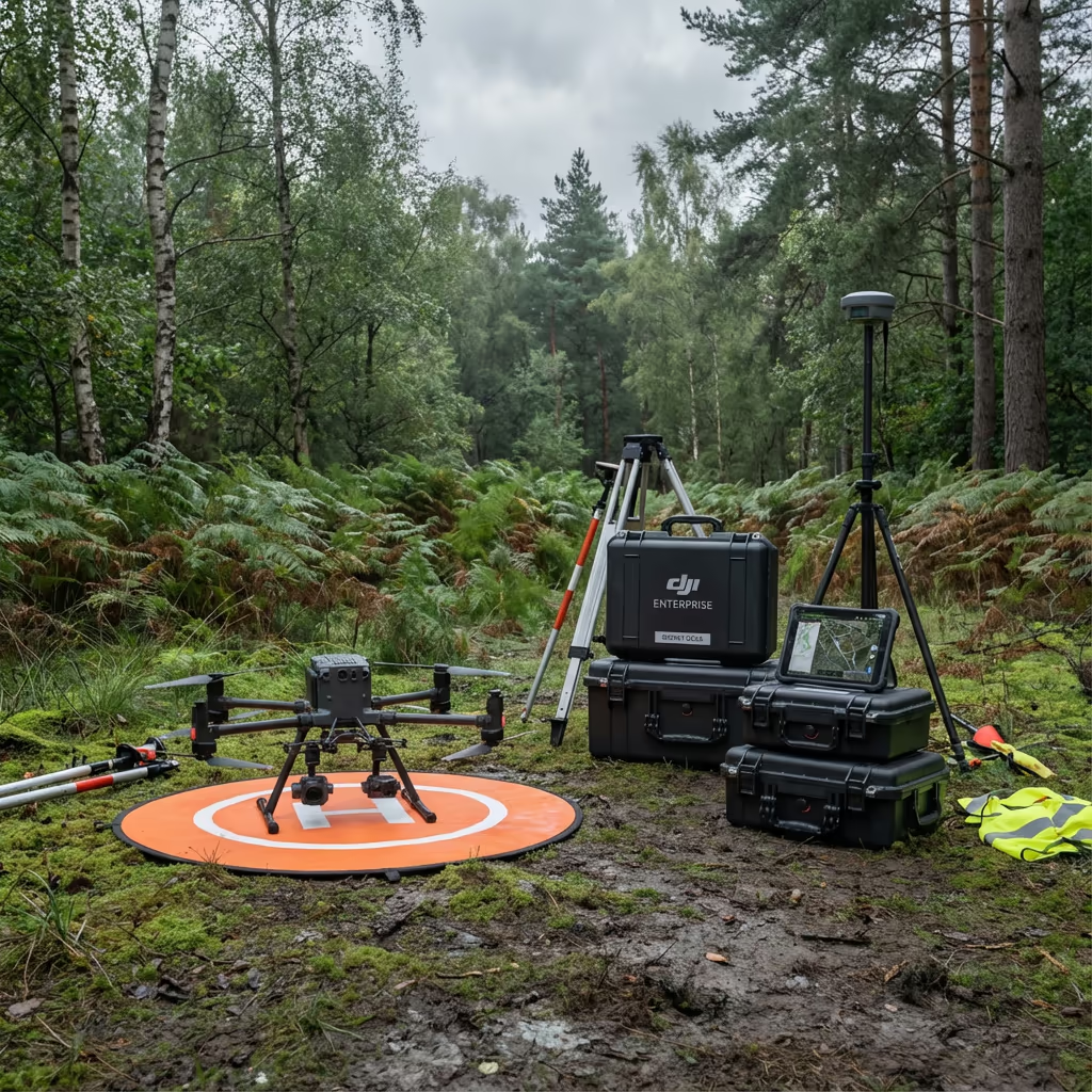
Enterprise Equipment
Survey-Grade Drone Fleet
We don't use consumer mini drones like other providers. Our fleet consists of industrial, survey-grade aircraft purpose-built for capturing detailed, accurate datasets.

AgEagle eBee X
Professional fixed-wing for rapid terrain coverage

DJI Matrice 400
Engineered for excellence, designed for versatility

WingtraOne GEN II
Best-in-class surveying efficiency for large projects

DJI Matrice 350 RTK
Professional multi-payload platform for precision surveying

DJI Mavic 4E
Portable surveying powerhouse with RTK precision
DJI Matrice 300 RTK
Industry-leading inspection and mapping platform

DJI Matrice 4E
Precision survey drone with oblique capture
1 of 7
← Swipe to explore fleet →
Sensor Technology
Specialised Sensors for All Aerial Surveys
Our aircraft carry professional-grade sensors matched to your project requirements, from high-resolution photogrammetry to terrain-penetrating LiDAR.
LiDAR Sensors
Penetrate vegetation and capture precise terrain data with laser scanning technology.
Applications
- Forestry & vegetation mapping
- Terrain modelling under canopy
- Flood risk assessment
- Archaeological surveys
- Power line corridor mapping
Thermal Imaging
Detect heat signatures for building diagnostics, energy audits, and industrial inspections.
Applications
- Building thermal surveys
- Solar panel inspections
- Electrical fault detection
- Search and rescue
- Livestock monitoring
RGB & Photogrammetry
High-resolution imagery for detailed 3D models, orthomosaics, and visual inspections.
Applications
- Topographic surveys
- 3D model generation
- Progress monitoring
- Asset inspection
- Marketing photography
Need a specific sensor or payload?
Client Testimonials
Why Clients Rate Our Drone Survey Service 5 Stars
Don't just take our word for it. Here's what industry professionals say about working with us.
“By far the best drone surveying company I've used. Responsive, helpful and report quality is spot on. Extremely diligent in highlighting defects outside of scope. 10+ projects completed and never disappointed.”
Mark Reynolds
Building Surveyor
“DSS's drone roof survey was brilliant. James showed me everything wrong with my roof in about 30 minutes. Quick, professional and easy to understand.”
Helen Parker
Homeowner
“Fantastic company to do business with. Been working with the DSS team since 2021 and it's been an absolute pleasure. Highly recommended.”
Robert Hughes
Property Developer