Surveying & Mapping
Drone LiDAR Survey Services
Precision LiDAR scanning for detailed terrain models, vegetation analysis, and ground surface mapping through tree canopy.
Response within 2 hours • Or call 020 4634 0456
What Is a Drone LiDAR Survey?
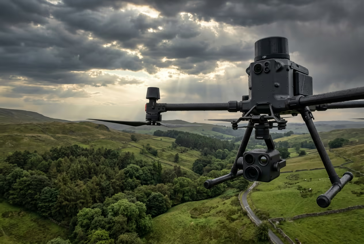
A drone LiDAR survey uses Light Detection and Ranging technology mounted on our UAVs to create incredibly detailed 3D maps of terrain, structures, and vegetation. Unlike traditional photography-based surveys, our LiDAR systems emit thousands of laser pulses per second, measuring the precise distance to every surface they hit.
At Drone Survey Services, we deploy the latest drone-mounted LiDAR sensors capable of capturing up to 300 points per square metre. This creates dense, accurate point clouds that reveal the true shape of the land—even beneath dense tree cover where photogrammetry simply cannot see.

James Leslie
Owner, Engineer & Drone Pilot
"Got questions? Call me directly - I'm happy to talk through your project."
Call NowSurvey-Grade Drone LiDAR Data,Delivered Fast
What You'll Receive
- Classified point cloud (LAS/LAZ)
- Digital Terrain Model (DTM)
- Contours at your specified interval
- Survey-grade accuracy (±2-5cm)
Delivered in 5-7 working days
Why Choose Us
- CAA approved & fully insured
- Specialist LiDAR processing team
- Latest DJI & sensor technology
- UK-wide coverage
Trusted by surveyors, engineers & environmental consultants across the UK.
Trusted by leading organisations
How Much Does a Drone LiDAR Survey Cost?
Pricing depends on your project scope. Here's a guide to help you budget:
| Project Size | Guide Price |
|---|---|
| MicroUnder 2 ha | £1,200+ |
| Small2–5 ha | £1,500+ |
| Medium5–20 ha | £2,500+ |
| Large20–50 ha | £4,000+ |
| Enterprise50–100 ha | £7,000+ |
| Major Projects100+ ha | POA |
*Guide prices include standard deliverables. Final quote based on site complexity, access, and specific requirements.
What affects your quote?
- Site size & terrain
- Required deliverables
- Turnaround time
- Access requirements
Our drone-based approach typically saves 40–60% compared to traditional ground surveys. Contact us with your project details and we'll provide a tailored quote within 24 hours.
Ready to get a quote for your project?
Free, no-obligation quotes within 24 hours
What Is the Difference Between Drone LiDAR and Photogrammetry?
Both technologies create 3D models, but they work in fundamentally different ways. Photogrammetry uses overlapping photographs to calculate surface positions—it's excellent for capturing visual detail and works brilliantly on open sites, construction projects, and buildings.
LiDAR, however, fires laser pulses that penetrate gaps in vegetation to reach the ground below. This makes it essential for forestry surveys, flood modelling, and archaeological prospection where you need to see through tree canopy. Our LiDAR systems also work in low-light conditions and on surfaces with poor visual contrast where photogrammetry struggles.
When to Choose Each Technology
Choose LiDAR
Penetrates vegetation
Choose Photogrammetry
Visual detail & texture
Not sure which technology suits your project?
What Accuracy Can a Drone LiDAR Survey Achieve?
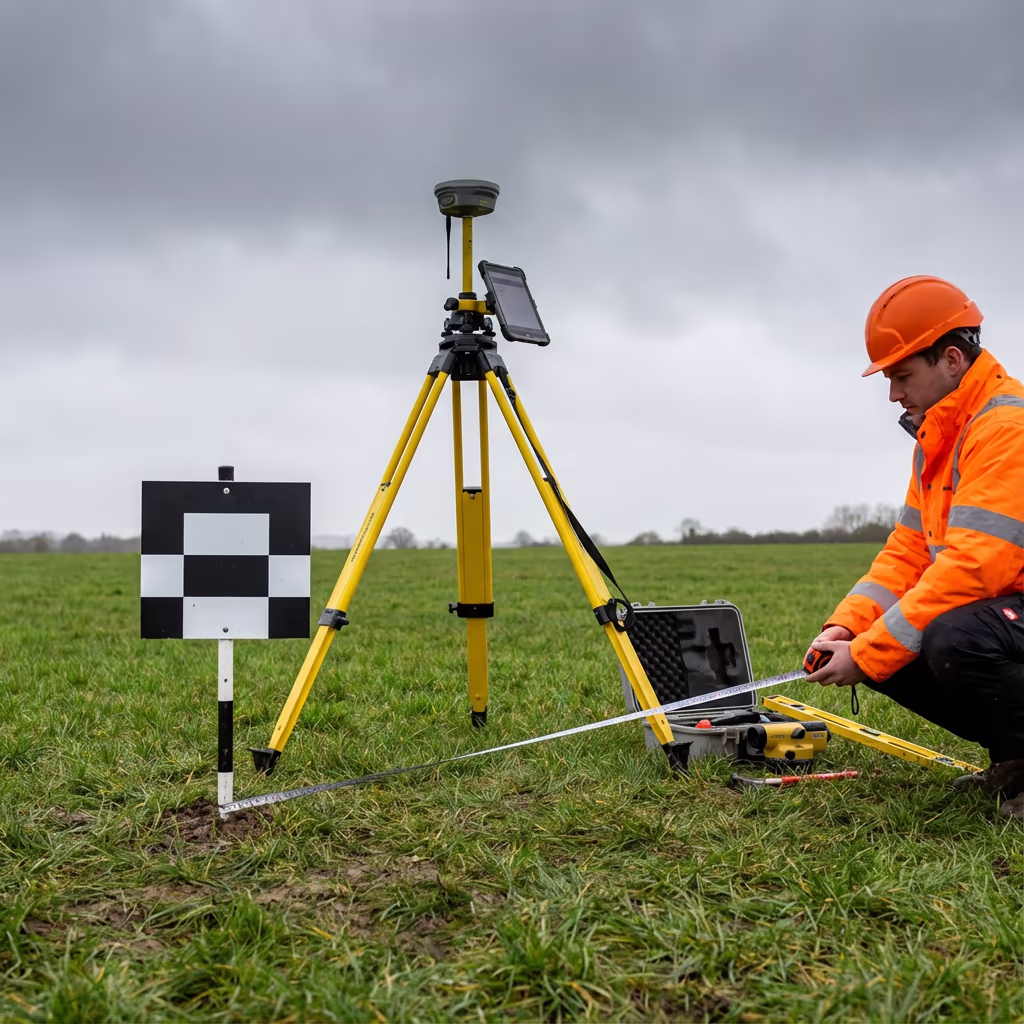
Our drone LiDAR surveys routinely achieve vertical accuracy of ±2-5cm and horizontal accuracy of ±5-10cm when using ground control points. This level of precision meets or exceeds the requirements for most engineering, environmental, and planning applications.
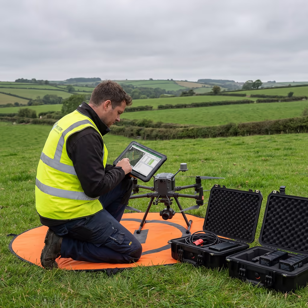
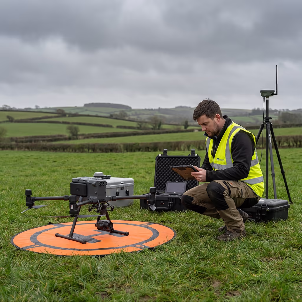
We use RTK/PPK-enabled drones with integrated GNSS and IMU systems to ensure precise positioning of every laser return. For projects requiring the highest accuracy, we establish ground control networks and process data using rigorous adjustment workflows. The result is survey-grade data you can rely on for critical decisions.
What Are the Applications of Drone LiDAR Survey?
Drone LiDAR has transformed how we capture terrain data across numerous industries. Here are the key applications where our clients see the greatest value:
Forestry & Woodland
Canopy height models, biomass estimation, tree inventory, and ground surface mapping beneath dense vegetation.
Flood Risk Assessment
Accurate DTMs for flood modelling, drainage design, and environmental impact assessments requiring true ground elevations.
Archaeological Surveys
Revealing hidden earthworks, field systems, and archaeological features beneath woodland that are invisible from the air.
Corridor Mapping
Power line surveys, pipeline routes, railway corridors, and road schemes requiring detailed terrain and vegetation data.
Coastal & Erosion
Cliff monitoring, coastal change detection, and erosion studies where vegetation often obscures the true ground surface.
Mining & Quarrying
Stockpile volumes, pit surveys, and restoration monitoring where dust or poor surface contrast challenges photogrammetry.
Have a project that needs LiDAR?
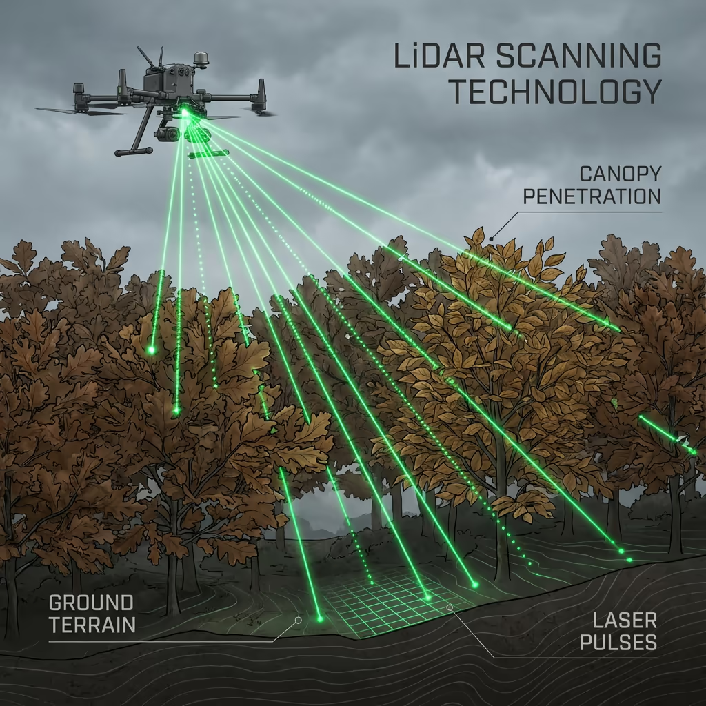
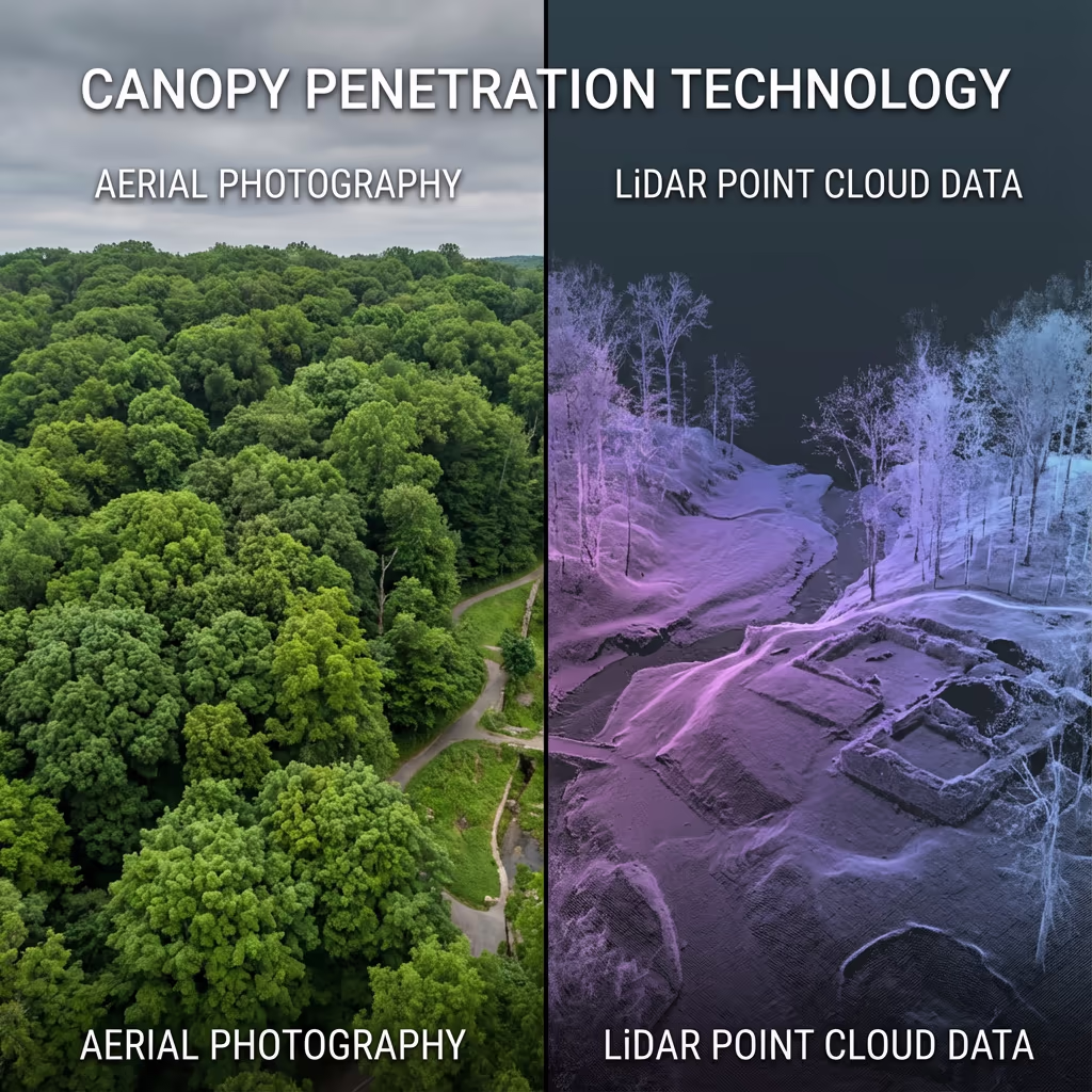
Can Drone LiDAR Survey Penetrate Tree Canopy?
Yes—this is LiDAR's superpower. Our systems fire thousands of laser pulses per second, and while some hit leaves and branches, others find gaps in the canopy and continue through to the ground below. We capture multiple returns from each pulse, allowing us to map both the canopy surface and the true terrain beneath.
In typical UK woodland, we achieve ground point densities of 5-20 points per square metre even under full leaf cover. During leaf-off conditions in winter, penetration rates improve further. This makes drone LiDAR the only practical technology for creating accurate ground models in vegetated areas—essential for forestry, flood modelling, and archaeological applications.
What Deliverables Do You Get From a Drone LiDAR Survey?
We tailor deliverables to your project requirements, but our standard LiDAR survey outputs include:
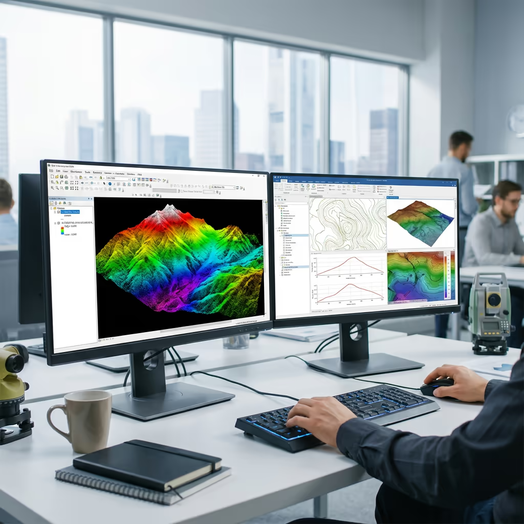
Classified Point Cloud (LAS/LAZ)
Full resolution point cloud with ground, vegetation, and structure classifications. Compatible with all major GIS and CAD software.
Digital Terrain Model (DTM)
Bare-earth surface model with vegetation removed. Essential for flood modelling, earthworks design, and volume calculations.
Digital Surface Model (DSM)
Top surface including vegetation and structures. Used for visibility analysis, canopy studies, and 3D visualisation.
Canopy Height Model (CHM)
Vegetation height above ground level. Invaluable for forestry inventory, biomass estimation, and habitat assessment.
Contours & Cross-Sections
Contour lines at your specified interval, plus cross-section profiles for engineering design and analysis.
Need specific deliverables for your project?
How Long Does a Drone LiDAR Survey Take?
On-site data capture is remarkably fast. We can survey 50-100 hectares per day depending on terrain and flight conditions. A typical 10-hectare woodland site takes just 2-3 hours of flight time, plus setup and ground control establishment.
Processing and delivery depends on project complexity and your required outputs. Standard deliverables are typically ready within 5-7 working days. For urgent projects, we offer expedited processing with 48-72 hour turnaround available at additional cost. We'll confirm realistic timescales when we quote your project.
| Phase | Duration |
|---|---|
| Planning & Permissions | 1-3 days |
| On-Site Data Capture | ½-1 day |
| Point Cloud Processing | 2-3 days |
| Classification & QC | 2-3 days |
| Deliverable Generation | 1-2 days |
| Total (Standard) | 5-7 working days |
Express Processing Available
Need it faster? 48-72 hour turnaround available for urgent projects.
How Do I Choose a Drone LiDAR Survey Provider?
Not all drone LiDAR services are equal. When evaluating providers, we recommend checking these key factors:
- CAA authorisation – Ensure they hold valid GVC or legacy PfCO permissions for commercial operations
- Professional insurance – Public liability and professional indemnity cover appropriate to your project
- LiDAR-specific experience – LiDAR requires specialist knowledge beyond standard drone surveys
- Processing capability – Ask about their software and workflows for point cloud classification
- Relevant case studies – Request examples of similar projects they've completed
At Drone Survey Services, we tick every box. We're CAA approved, fully insured, and have delivered LiDAR projects across forestry, archaeology, infrastructure, and environmental sectors throughout the UK.
Ready to work with a trusted LiDAR provider?
Is Drone LiDAR Survey Cheaper Than Traditional Surveying?
In most scenarios, yes—significantly. Traditional ground-based surveys of vegetated sites require teams of surveyors cutting sight lines through vegetation, working slowly and expensively through difficult terrain. Terrestrial LiDAR scanners are powerful but require multiple setup positions and significant field time.
Our drone LiDAR captures equivalent or better data in a fraction of the time. A woodland site that might take a ground team a week can be flown in hours. The cost savings typically range from 40-60% compared to traditional methods, while delivering faster turnaround and often higher point densities. For large or difficult sites, the economics become even more favourable.
Ready to Discuss Your LiDAR Project?
Expert advice • Tailored pricing • Response within 2 hours
James Leslie
Owner, Engineer & Drone Pilot
With extensive experience in surveying and UAV operations, James personally oversees every LiDAR project to ensure survey-grade accuracy and professional delivery.
TLDR: LiDAR Drone Surveys Explained
LiDAR Deliverables
- Classified point cloud (LAS/LAZ)
- Digital Terrain Model (DTM)
- Digital Surface Model (DSM)
- Canopy Height Model (CHM)
- Intensity images
- Contours & cross-sections
Discuss Your Project
Get expert advice and tailored pricing.
Enterprise Equipment
Survey-Grade Drone Fleet
We don't use consumer mini drones like other providers. Our fleet consists of industrial, survey-grade aircraft purpose-built for capturing detailed, accurate datasets.

AgEagle eBee X
Professional fixed-wing for rapid terrain coverage

DJI Matrice 400
Engineered for excellence, designed for versatility

WingtraOne GEN II
Best-in-class surveying efficiency for large projects

DJI Matrice 350 RTK
Professional multi-payload platform for precision surveying

DJI Mavic 4E
Portable surveying powerhouse with RTK precision
DJI Matrice 300 RTK
Industry-leading inspection and mapping platform

DJI Matrice 4E
Precision survey drone with oblique capture
1 of 7
← Swipe to explore fleet →
Sensor Technology
Specialised Sensors for All Aerial Surveys
Our aircraft carry professional-grade sensors matched to your project requirements, from high-resolution photogrammetry to terrain-penetrating LiDAR.
LiDAR Sensors
Penetrate vegetation and capture precise terrain data with laser scanning technology.
Applications
- Forestry & vegetation mapping
- Terrain modelling under canopy
- Flood risk assessment
- Archaeological surveys
- Power line corridor mapping
Thermal Imaging
Detect heat signatures for building diagnostics, energy audits, and industrial inspections.
Applications
- Building thermal surveys
- Solar panel inspections
- Electrical fault detection
- Search and rescue
- Livestock monitoring
RGB & Photogrammetry
High-resolution imagery for detailed 3D models, orthomosaics, and visual inspections.
Applications
- Topographic surveys
- 3D model generation
- Progress monitoring
- Asset inspection
- Marketing photography
Need a specific sensor or payload?
Client Testimonials
Why Clients Rate Our Drone Survey Service 5 Stars
Don't just take our word for it. Here's what industry professionals say about working with us.
“By far the best drone surveying company I've used. Responsive, helpful and report quality is spot on. Extremely diligent in highlighting defects outside of scope. 10+ projects completed and never disappointed.”
Mark Reynolds
Building Surveyor
“DSS's drone roof survey was brilliant. James showed me everything wrong with my roof in about 30 minutes. Quick, professional and easy to understand.”
Helen Parker
Homeowner
“Fantastic company to do business with. Been working with the DSS team since 2021 and it's been an absolute pleasure. Highly recommended.”
Robert Hughes
Property Developer